Plenty Of Sunshine, Afternoon Highs In The Upper 50s
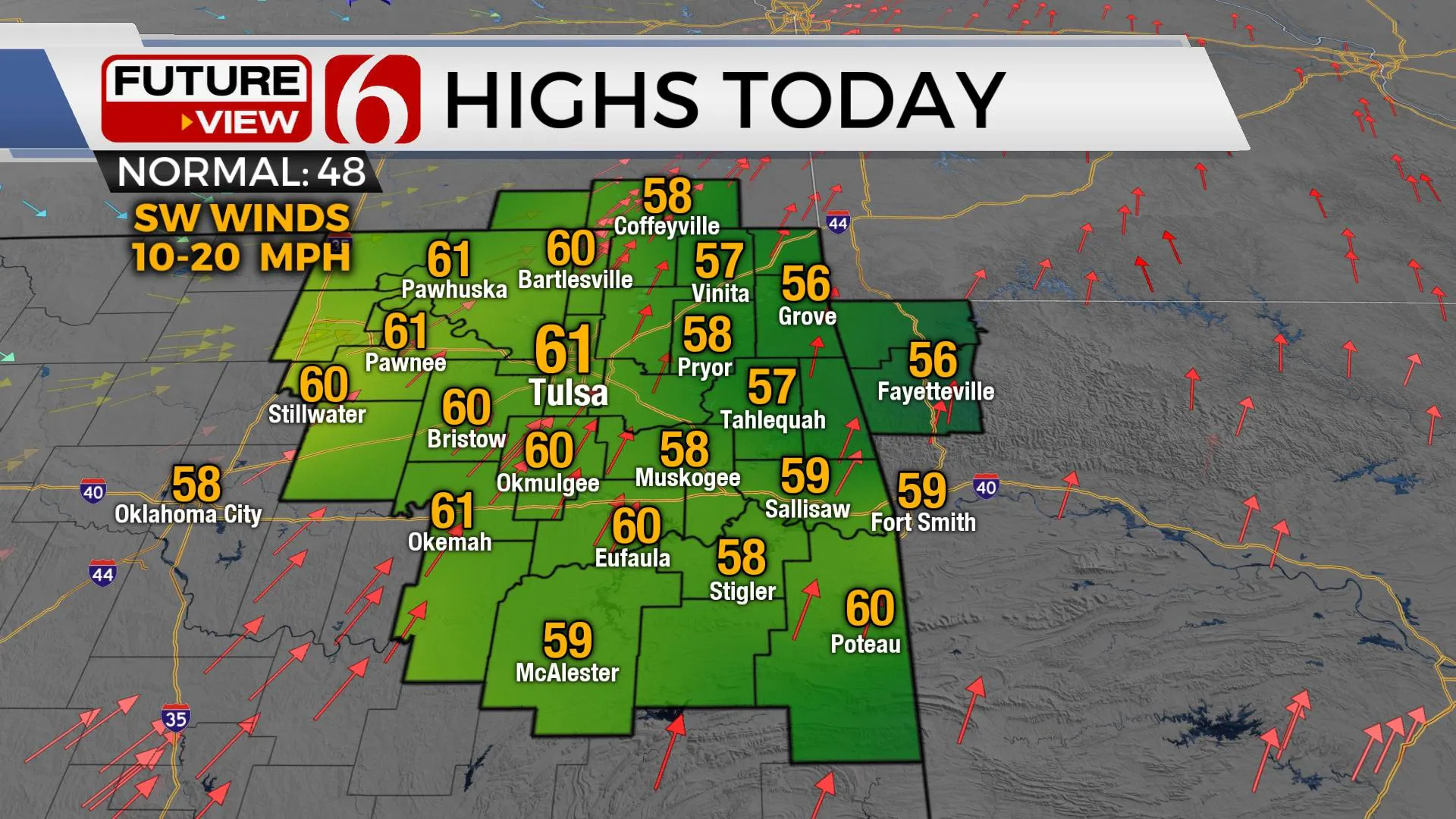
Welcome to the warmest day of the week. Afternoon highs will reach the upper 50s and a few lower 60s. Plenty of sunshine is expected with southwest winds nearing 10 to 20 mph. A pattern change brings chilly and windy weather back to the state soon. A few showers may be possible with a cold front Thursday, but the main impact will be gusty northwest winds behind the front Thursday and continuing into Friday.Wednesday, January 13th 2021, 6:38 am
Welcome to the warmest day of the week. Afternoon highs will reach the upper 50s and a few lower 60s. Plenty of sunshine is expected with southwest winds nearing 10 to 20 mph. A pattern change brings chilly and windy weather back to the state soon. A few showers may be possible with a cold front Thursday, but the main impact will be gusty northwest winds behind the front Thursday and continuing into Friday.

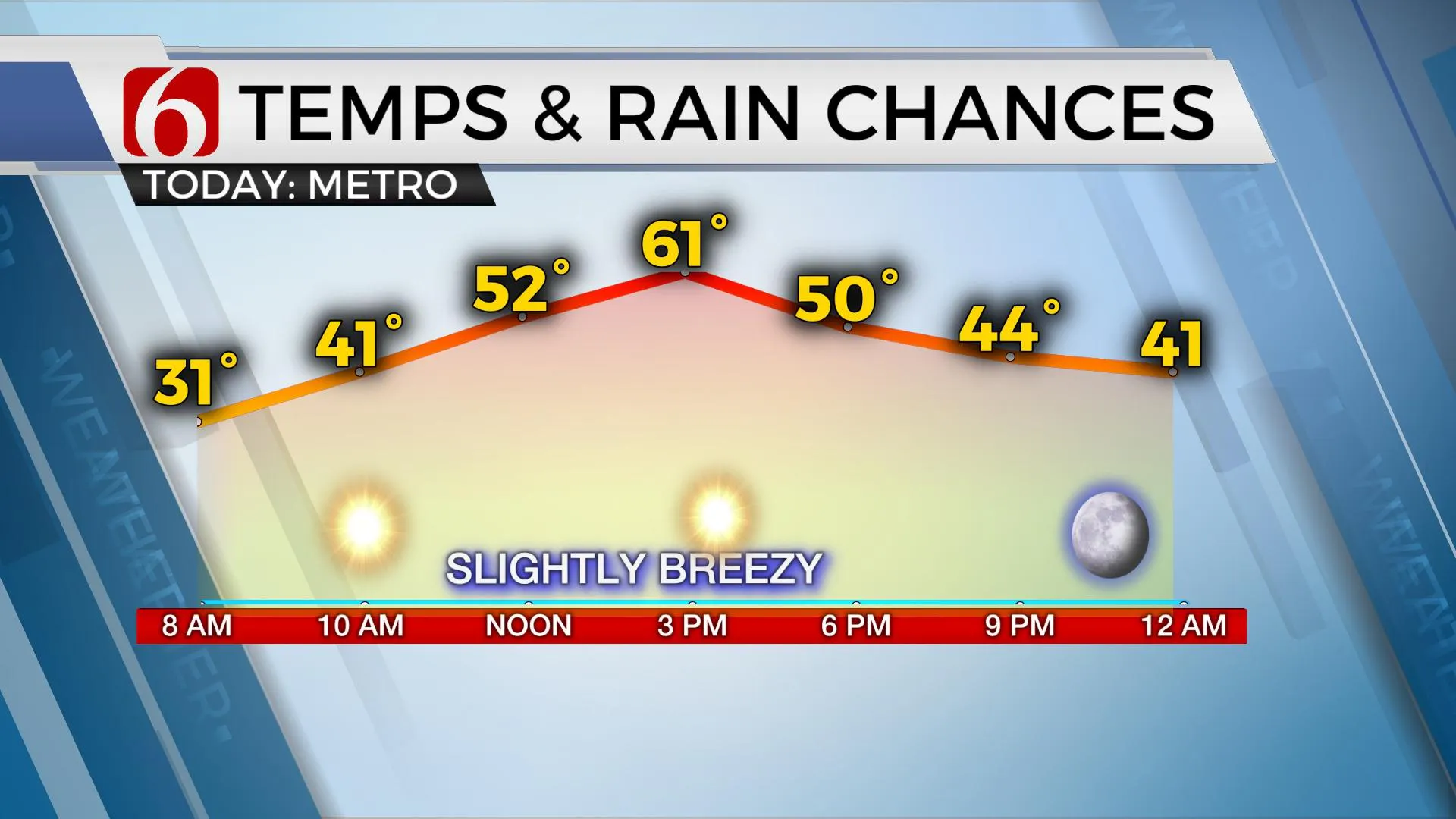
Temperatures will begin this morning in the upper 20s and lower 30s but will quickly climb into the 50s by noon and near 60s early afternoon ahead of the cold front scheduled to arrive Thursday morning. A strong upper-level low will develop across southern Canada and drop into the upper Midwest tonight while deepening across the Great Lakes this weekend. The resulting upper flow from the northwest will keep cold weather circulating down the northern and central plains into the Missouri Valley Friday through the weekend. Most of our area will be on the southern edge of this deeper and colder air mass but should experience another noticeable surge of colder weather Friday into part of the weekend. Another weak wave will near the state Saturday night, but will more than likely pass the area with little impact. A few sprinkles may be possible, but our chance will remain near or less than 10% for this update.

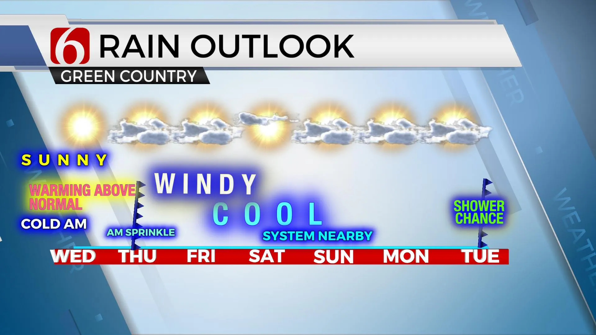
As the pattern changes, strong northwest winds will return Thursday afternoon and Friday. Winds may approach wind advisory criteria Thursday and Friday with speeds from 20 to 40 mph. Low humidity through the afternoon in the 20 to 30% range combined with dry soils and dead vegetation will lead to enhanced fire spread rates nearing 220 ft per minute. Wind chill values will also drop Friday into the 30s due to the strong northwest winds and afternoon highs only in the 40s.
Another system will be nearing the state Monday night into Tuesday bringing a mention for a few showers with another cold front.
January is usually the month favored for true arctic air intrusions. We’re seeing signs in some of the extended and ensemble data of a possible surge of arctic air during the next two weeks for the northern half of the nation. Stay tuned.

Thanks for reading the Wednesday morning weather discussion and blog.
Have a super great day!
Alan Crone
KOTV
If you would rather listen to the update, be sure and check out my daily mini-weather update podcast. Search for NewsOn6 and ‘Weather Out The Door’ on most podcast providers, including here on Spotify.
More Like This
January 13th, 2021
February 14th, 2022
January 26th, 2022
January 25th, 2022
Top Headlines
December 12th, 2024
December 12th, 2024
December 12th, 2024
December 12th, 2024


