Mild Weather Returns Across The State
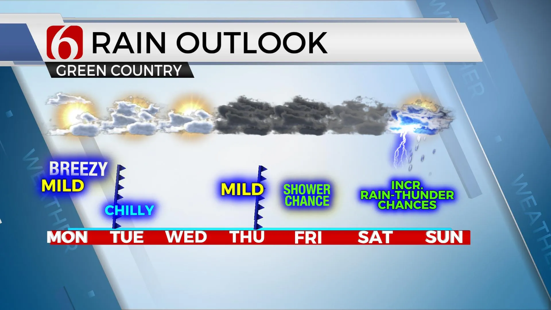
We're tracking two systems this week with a slight chance of showers tonight across far southern OK with higher chances arriving this weekend into next Monday morning for northeastern OK. Some showers may also be possible Wednesday and Thursday, but mostly across extreme southern OK and north TX. The pattern continues to support a surge of arctic air invading at least the northern sections of the nation early next week.Monday, January 18th 2021, 5:46 am
We're tracking two systems this week with a slight chance of showers tonight across far southern OK with higher chances arriving this weekend into next Monday morning for northeastern OK. Some showers may also be possible Wednesday and Thursday, but mostly across extreme southern OK and north TX. The pattern continues to support a surge of arctic air invading at least the northern sections of the nation early next week.

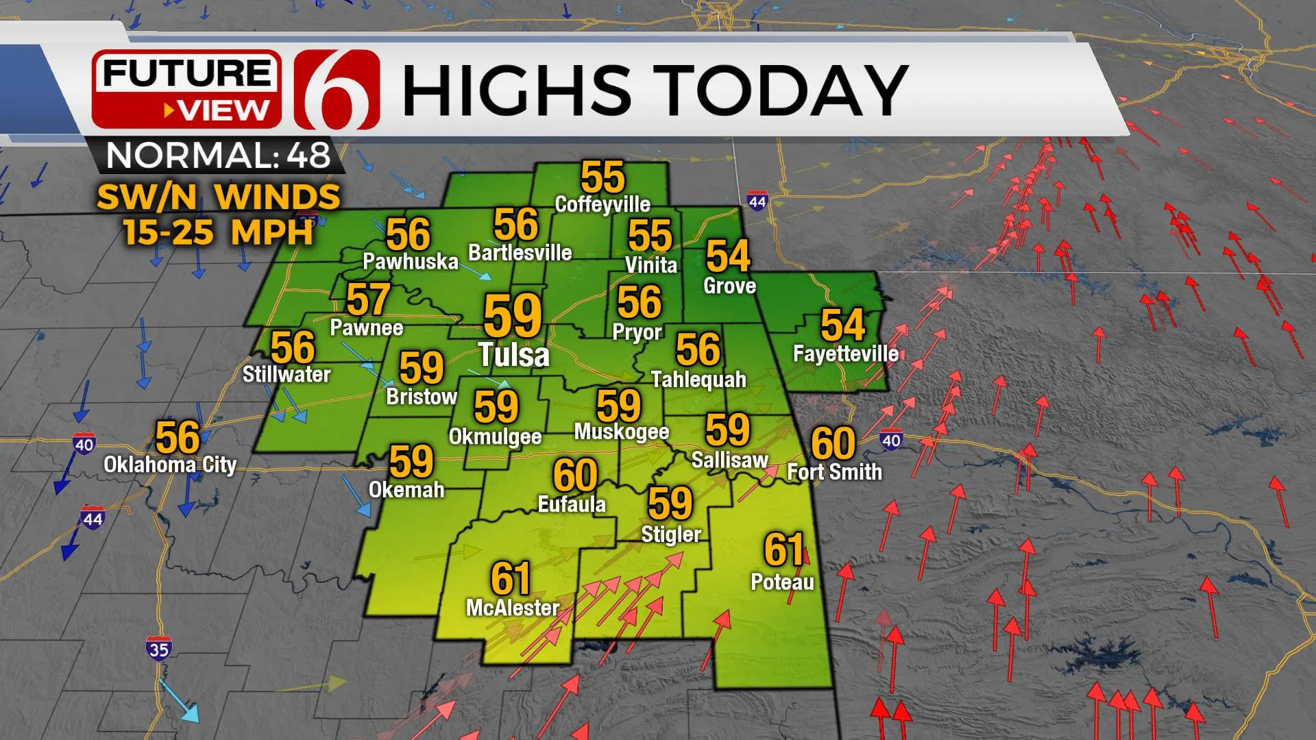
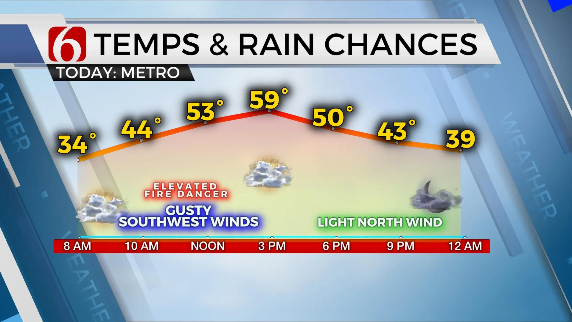
Mild weather returns today across the state with highs reaching the upper 50s and lower 60s before the first cold front moves across the area later this afternoon and evening. We will experience a cool-down tomorrow with temps starting in the mid-30s and ending with highs in the mid to upper 40s. Wednesday highs will reach the mid-50s with Thursday in the upper 50s near 60 before another system nears Thursday evening into Friday morning. Our forecast currently keeps most of the area above freezing Friday morning with some shower chances near or south. This will mostly be rain, but some snow mix will be possible across northern OK, if it happens at all. The weekend features lows in the 30s and highs in the lower to mid-50s with increasing moisture and thunder chances Sunday into early Monday.

The progressive upper air pattern will continue for the next few weeks. A strong upper-level system will drop down the west coast and become cut-off from the main flow later today. This strong wave will eject from the desert southwest into the southern plains Wednesday evening into Thursday but is also expected to weaken as it occurs. Regardless, enough moisture will be present to increase rain chances for some Thursday evening into Friday, including a low chance for the Tulsa metro. EURO is a little more south compared to the more north and generous data in the GFS.
This weekend, a long-wave trough will reload across the western U.S. and make steady progress eastward allowing southerly surface flow and rapidly returning moisture Sunday into early Monday ahead of the main system. Enough moisture and instability would be present for thunderstorms, including at least a low mention of a few strong storms based on the pattern for Sunday evening into early Monday.

Thanks for reading the Monday morning weather discussion and blog.
Have a super great day!
Alan Crone
KOTV
If you listen to podcasts, search for NewsOn6 and "Weather Out The Door." You’ll find it on most podcast providers, including Here on Spotify.
More Like This
January 18th, 2021
February 14th, 2022
January 26th, 2022
January 25th, 2022
Top Headlines
December 15th, 2024
December 15th, 2024
December 15th, 2024
December 15th, 2024


