Strong System Moves Across The State Early Monday Morning
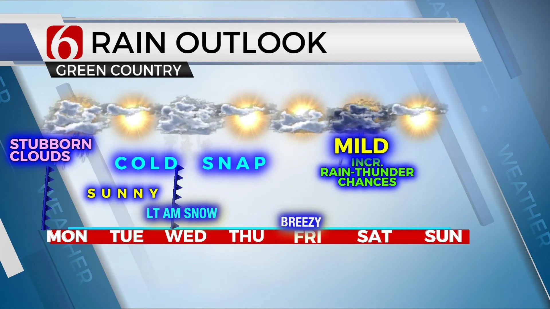
The upper airflow will bring three distinct systems across the plains over the next seven days, including one early this morning followed by another system Wednesday morning and the last for this forecast period Saturday. All these systems will require some form of precipitation probabilities including of course thunderstorm activity ending early this morning. The Wednesday morning system could bring some light snow or flurries to part of northeastern OK and the third system currently supports mMonday, January 25th 2021, 6:01 am
The upper airflow will bring three distinct systems across the plains over the next seven days, including one early this morning followed by another system Wednesday morning and the last for this forecast period Saturday. All these systems will require some form of precipitation probabilities including of course thunderstorm activity ending early this morning. The Wednesday morning system could bring some light snow or flurries to part of northeastern OK and the third system currently supports more rain and thunder opportunities Saturday.

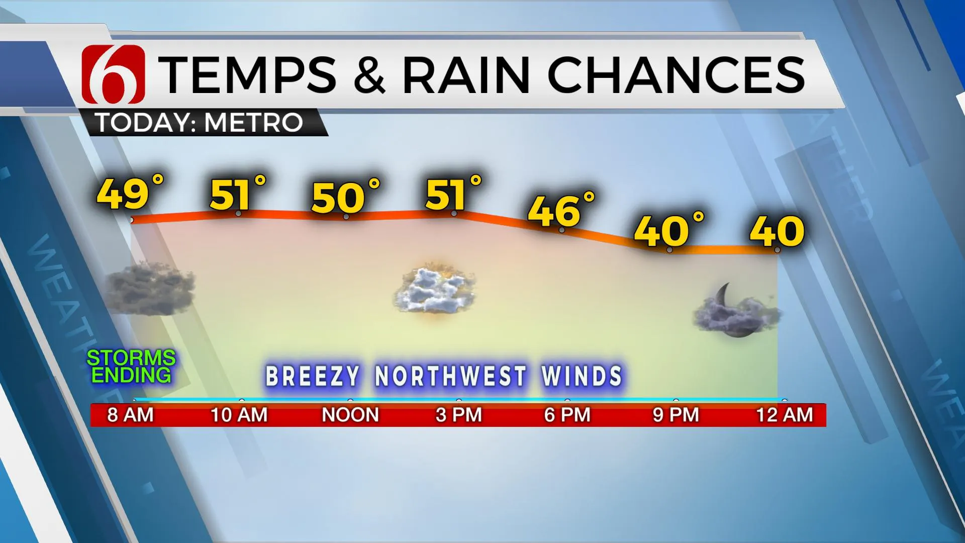
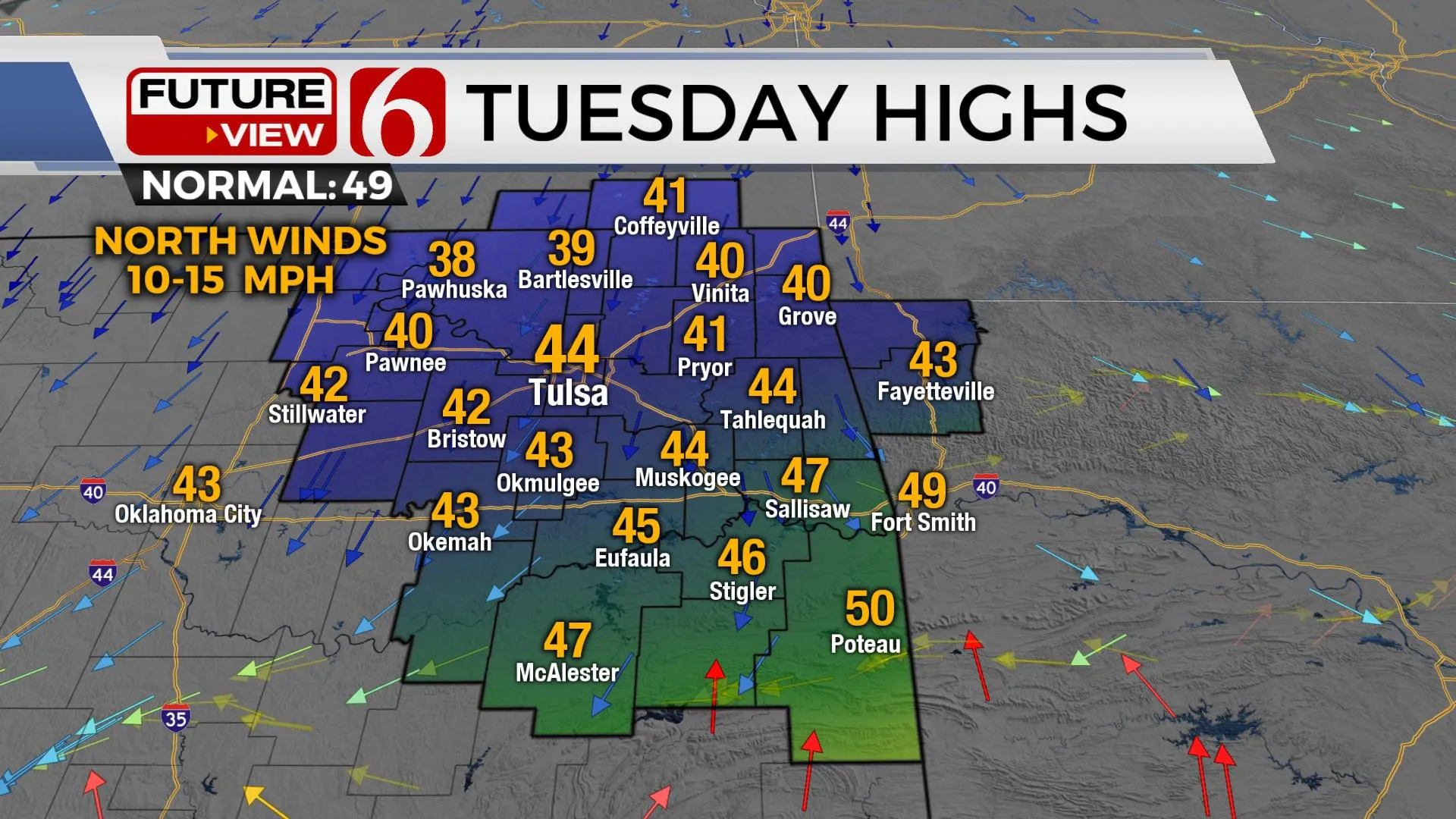
A strong system is moving across the state early this morning with rain and thunder near and east for the next few hours. A few strong to severe storms will remain possible early this morning, mostly across extreme southeastern OK and northeast Texas where low-level moisture and instability remain highest as the upper-level support continues to lift the atmosphere. Locations near and south of the I-40 corridor and east of Highway 69 may be in a short window for a low chance of severe storms for the next few hours. This system will be exiting our immediate area quickly this morning with temps in northern OK staying in the upper 40s and lower 50s and reaching the upper 50s across southeastern OK for most of the afternoon. Colder weather arrives tonight and sticks around for the middle of the workweek. The sunshine returns Tuesday with lows in the 20s and highs only in the lower 40s before the next fast-moving clipper brushes northeastern OK Wednesday morning.

Late Tuesday evening into Wednesday morning a fast-moving system will bring a chance for some light snow or flurries across part of eastern OK and northwestern Arkansas. This system may be moisture-starved but could produce some light precipitation for a short period Wednesday morning. Higher elevations of northwestern Arkansas may receive some minor accumulation. Wednesday morning lows will start in the upper 20s and highs will remain only in the upper 30s with mostly cloudy skies. Thursday also features the return of sunshine but a cold start with lows in the lower 20s and highs in the mid-40s. As the weekend system approaches, south winds will bring highs into the 50s Friday and into the lower 60s Saturday with additional thunder chances Saturday afternoon and evening. Sunday's highs will reach the mid-50s with the return of sunshine.

Thanks for reading the Monday morning weather discussion and blog.
Have a super great day!
Alan Crone
KOTV
Check out my daily weather briefing-podcast. Search for NewsOn6 ‘Weather Out The Door’ on most podcast providers, including Here on Spotify.
More Like This
January 25th, 2021
February 14th, 2022
January 26th, 2022
January 25th, 2022
Top Headlines
December 15th, 2024
December 15th, 2024
December 15th, 2024
December 15th, 2024


