Gusty Southwest Winds, Highs In The Upper 50s, Lower 60s
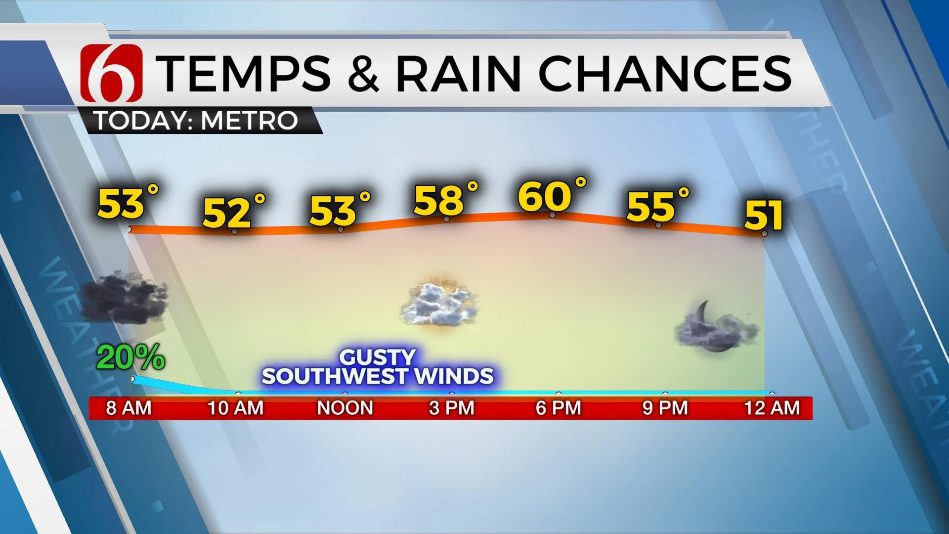
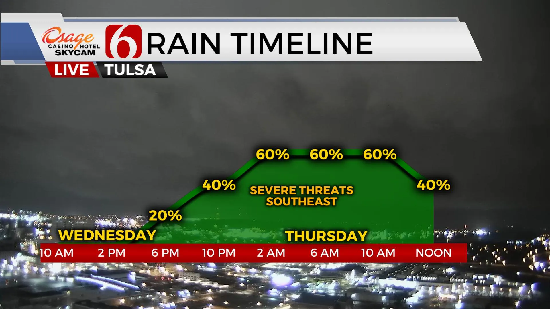
Southwest winds will remain gusty today as our overnight storm system is exiting the area. Clouds may linger for a while and keep temps into the 50s this morning, but later this afternoon, partial clearing should allow highs into the upper 50s or lower 60s. After a small respite, we’ll track additional rain and storm chances Wednesday evening into Thursday morning through midday.Tuesday, March 23rd 2021, 9:13 am
TULSA, Okla. -
Southwest winds will remain gusty today as our overnight storm system is exiting the area. Clouds may linger for a while and keep temps into the 50s this morning, but later this afternoon, partial clearing should allow highs into the upper 50s or lower 60s. After a small respite, we’ll track additional rain and storm chances Wednesday evening into Thursday morning through midday.

The upper-level flow remains active. The strong upper level low responsible for the active overnight storms is now lifting northeast and will quickly take our early morning showers out of the region. Another stout-looking short-wave is diving southward across the Pacific Northwest this morning and will reach the southern plains Wednesday evening before rounding the base Thursday morning. One additional, weaker disturbance arrives Friday evening into early Saturday morning.

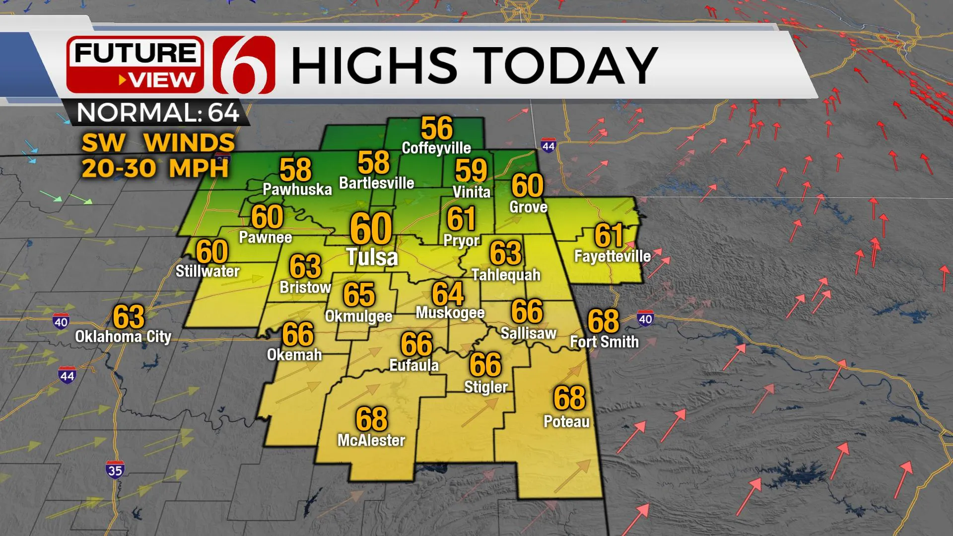
The upper low is ejecting to our northeast this morning and any scattered showers and storms will quickly vacate the region. Morning clouds will also begin exiting and thinning later this afternoon but these clouds may be slow to clear. Southwest winds from 15 to 30 mph will be possible today as highs reach the mid-50s to near 60 around northern OK and the metro, upper 60s across southeastern OK. Our next storm system rapidly drops into the pains Wednesday evening into Thursday, but most of the forcing and deeper moisture will be positioned across southeastern OK into Texas. Severe weather threats will mostly remain across far southeastern OK and to our southeast with this incoming system late Wednesday evening.

Once this disturbance clears our vicinity Thursday afternoon, another fast clipper wave drops south out of the Rockies Friday night bringing a small chance for a few storms into the area late Friday evening. This system currently appears to be mostly moisture-starved, but I’ll continue to keep at least a low pop for Friday evening into early Saturday morning. As of now, our weekend looks good. Saturday morning starts with a low chance for a departing shower with lows in the 50s. Afternoon highs will be reaching lower 70s with decreasing clouds, sunshine, and north winds around 10 to 20 mph. Sunday morning features lows in the 40s and highs reaching the mid-60s with mostly sunny sky and north winds near 10 to 20 mph before another disturbance approaches Monday evening with additional storm chances.
Thanks for reading the Tuesday morning weather discussion and blog.
Have a super great day!
Alan Crone
KOTV
If you’re into podcasts, check out my daily weather update below. Search for NewsOn6 and ‘Weather Out The Door’ on most podcast providers, including Apple, Stitcher, Tune-In and down below on Spotify.

More Like This
March 23rd, 2021
February 14th, 2022
January 26th, 2022
January 25th, 2022
Top Headlines
December 14th, 2024
December 14th, 2024
December 14th, 2024
December 14th, 2024


