Light Winds, Highs In The Upper 50s
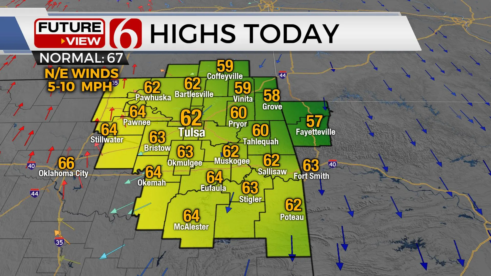
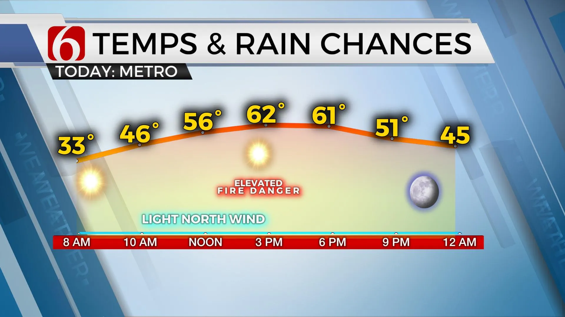
The freeze watch-warning is underway through the early morning hours with most locations near and north of the metro experiencing some minor freezing temps. Readings should climb above freezing between the 8 a.m.-9 a.m. hour with sunshine, light winds and highs reaching the upper 50s to lower 60s for most of northeastern OK. A surface ridge of high pressure currently nearby will migrate eastward later today and tonight. We’ll have light north winds this morning and light east winds later tonightThursday, April 1st 2021, 6:09 am
The freeze watch-warning is underway through the early morning hours with most locations near and north of the metro experiencing some minor freezing temps. Readings should climb above freezing between the 8 a.m.-9 a.m. hour with sunshine, light winds and highs reaching the upper 50s to lower 60s for most of northeastern OK. A surface ridge of high pressure currently nearby will migrate eastward later today and tonight. We’ll have light north winds this morning and light east winds later tonight mostly in the 10-mph range. A welcome relief for a lot of folks. Later tonight into early Friday morning, a few spots will once again drop near or below freezing for a short period and our friends at the National Weather Service will issue another freeze watch for these locations mostly north and east of the metro from Friday 2 a.m. to 9 a.m. Tulsa county will not be included in the freeze watch for later tonight.

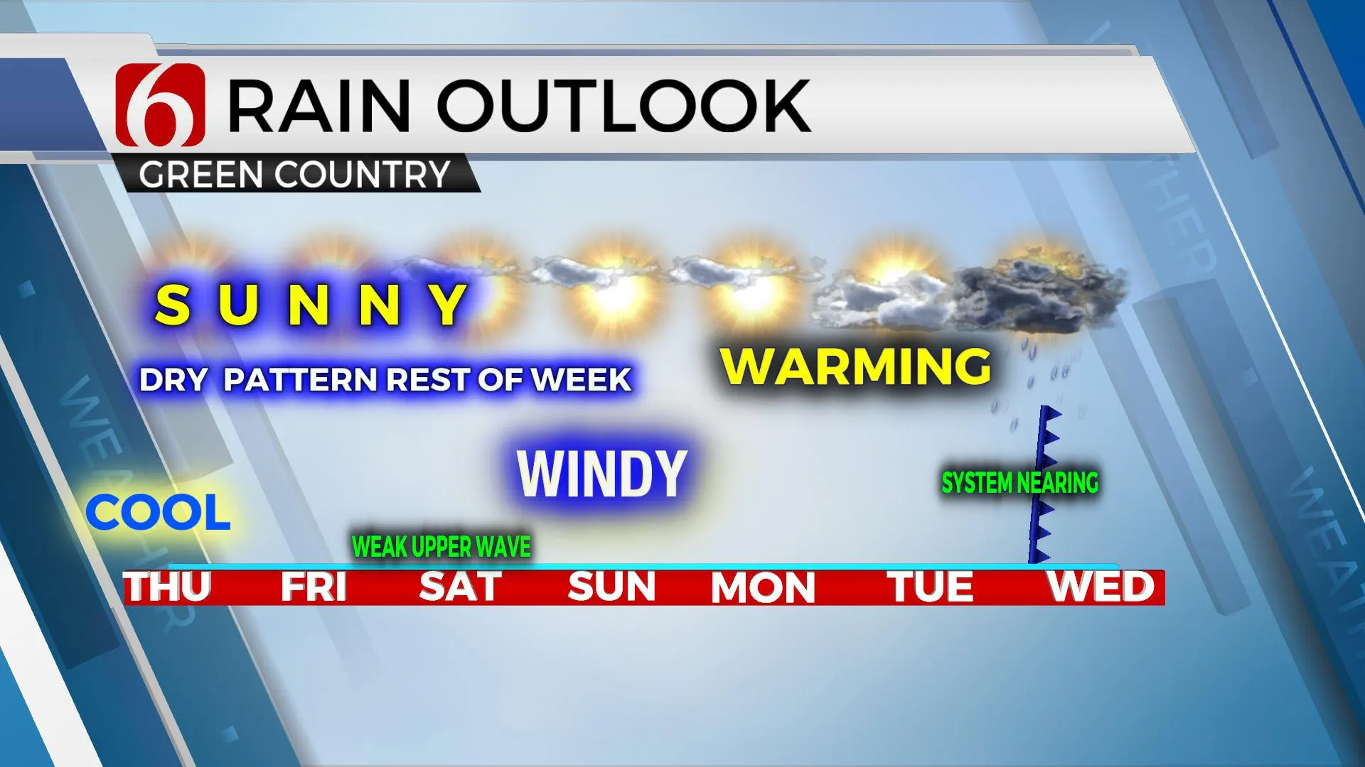
The extremely dry air in place today will continue to support fire spread, but the fire danger issues will remain manageable due to the light wind. But light wind may also keep some smoke plumes and fire aroma rather noticeable in a few spots. Gusty south winds return Friday through the weekend with speeds nearing 20 to 30 mph. The first day of southerly flow is usually dry, and the fire danger issues for Friday may be reaching Red Flag warning criteria again across our part of the state. The low-level flow will bring eventually bring moisture through the state with dew points reaching the upper 50s and lower 60s Sunday into early next week. Our next larger-looking upper-level system nears the central plains Tuesday and Wednesday of next week, yet a small wave takes the scenic southern route across Texas Friday night into Saturday. At this point, our weekend continues to look good other than the increasing south winds.

Temps Friday afternoon will reach the mid to upper 60s with sunshine and should top-out in the lower 70s Saturday and upper 70s Sunday. Most data support highs nearing the lower 80s early next week and I have increased the daytime highs slightly for these periods.

The main upper-level pattern next week doesn’t necessarily remind me of early spring as the main upper-level cyclone takes a mostly northern route. Yet the forcing with this system will overspread the southern Kansas and northern OK region Tuesday night into Wednesday as a weak surface boundary should also be moving southward into the state. More than adequate low-level moisture will be in place for storm development, but stronger dynamics could remain slightly northeast. Regardless, thunderstorm chances will return for the middle of next week, including the mention of strong to severe storms for Tuesday evening into part of Wednesday.
Thanks for reading the Thursday morning weather discussion and blog.
Have a super great day!
Alan Crone
KOTV
If you’re into podcasts, check out my daily weather update below. Search for NewsOn6 and ‘Weather Out The Door’ on most podcast providers, including Apple, Stitcher, Tune-In and down below on Spotify.

More Like This
April 1st, 2021
February 14th, 2022
January 26th, 2022
January 25th, 2022
Top Headlines
December 14th, 2024
December 14th, 2024
December 14th, 2024


