Gusty South Winds, Warming Trend Slowly Begins
After a chilly start, a warming trend slowly begins today and continues into early next week before our next chance of storms Tuesday evening into Wednesday. Gusty south winds return today and through the weekend with highs reaching the mid to upper 70s Easter Sunday.Friday, April 2nd 2021, 5:06 am
After a chilly start, a warming trend slowly begins today and continues into early next week before our next chance of storms Tuesday evening into Wednesday. Gusty south winds return today and through the weekend with highs reaching the mid to upper 70s Easter Sunday.

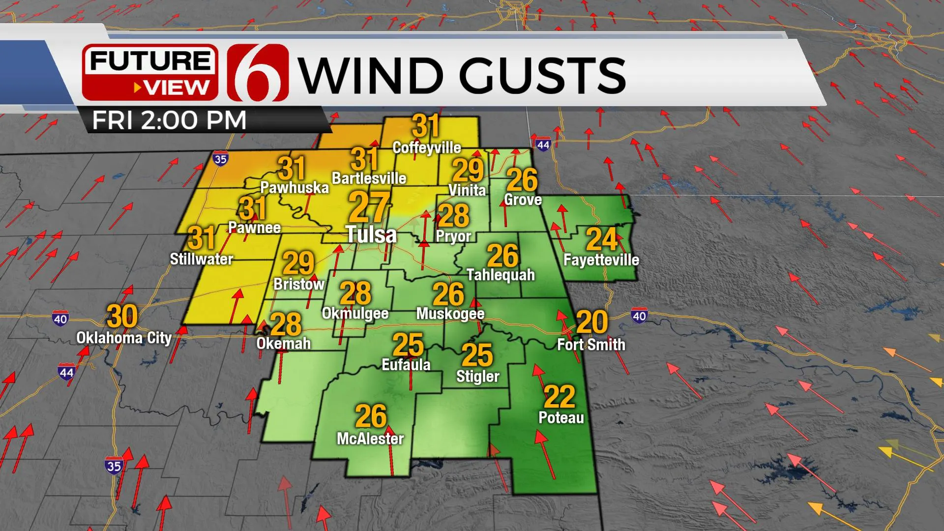
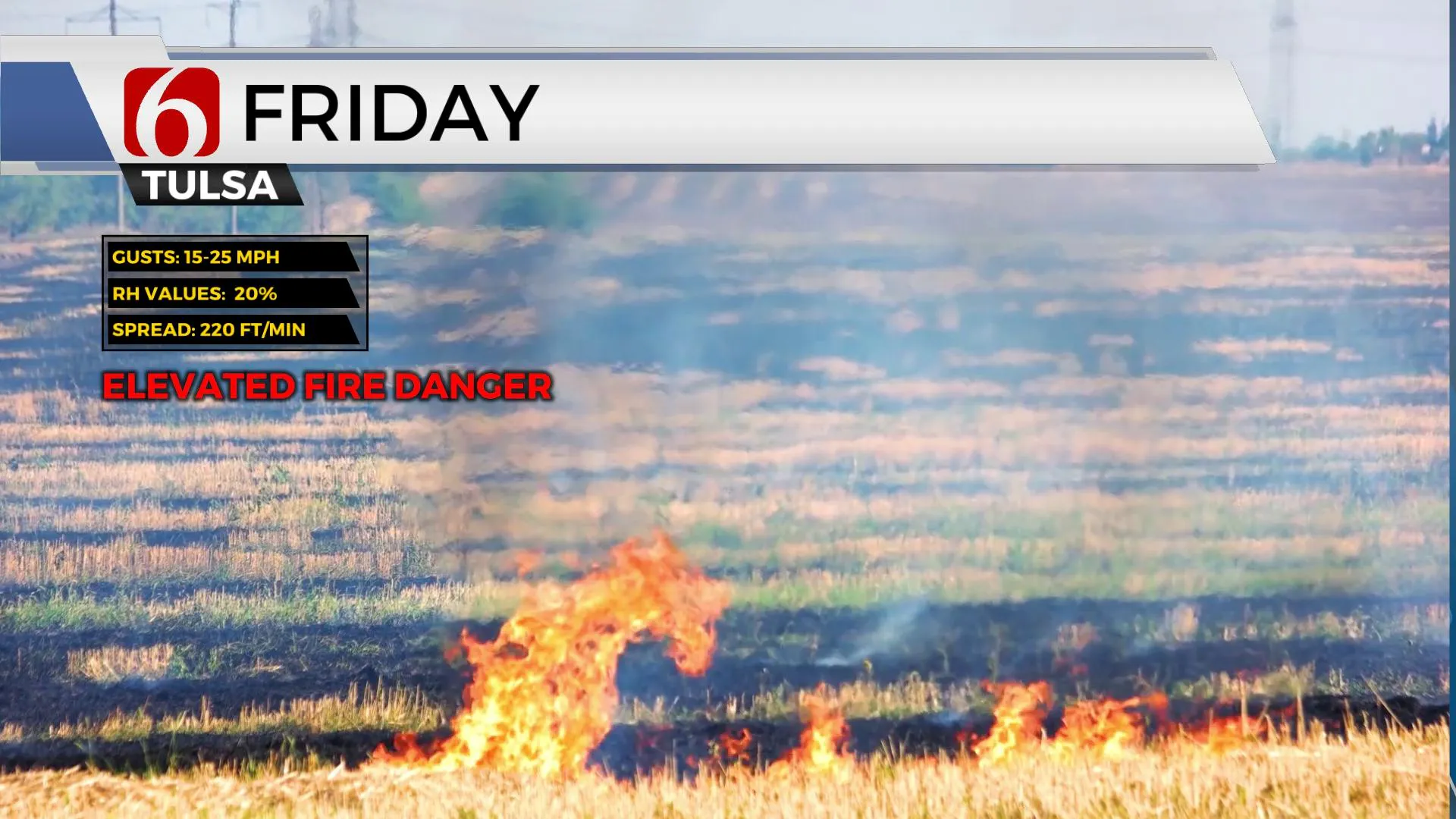
Our only issue in the short term will be the return of strong south winds today and the return of another high fire danger afternoon across the state. Red Flag warning criteria will be met for the northwestern third of the state, but across most of Eastern OK, top-end wind speeds will stay slightly below the threshold yet humidity values will be very low. Regardless, please use caution. Burning is discouraged today and into the weekend. The gusty south winds will eventually bring low-level moisture back from the Gulf before our next storm system arrives early next week with a chance for a few thunderstorms. A small wave takes the southern route across Texas later tonight into Saturday but should only bring a few clouds near our area later this afternoon and evening. Our weekend continues to look good other than the increasing south winds.

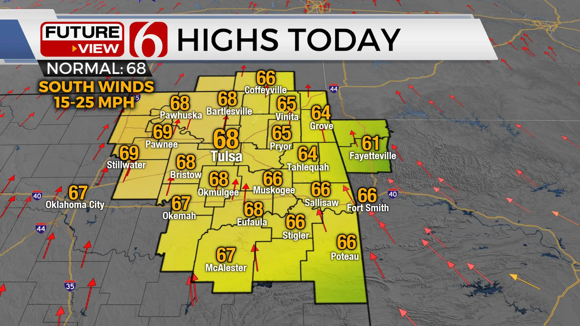
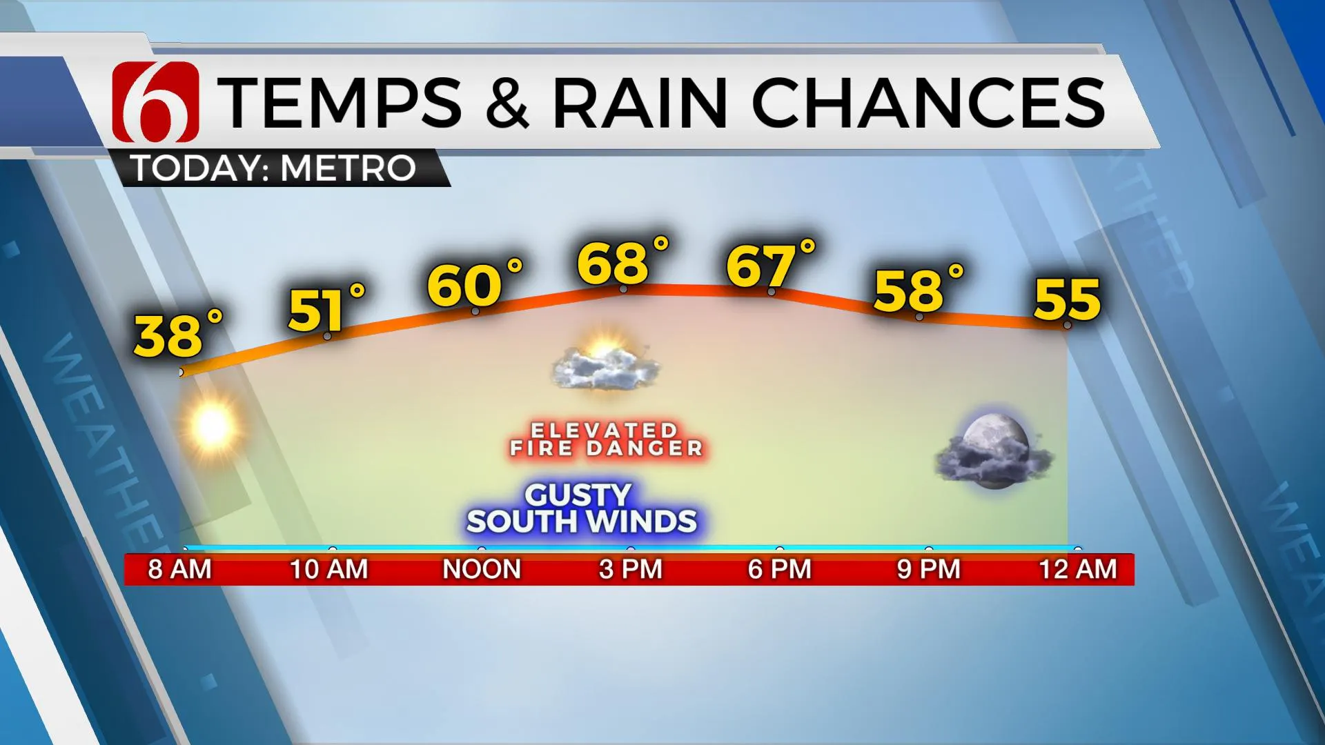
Temps this afternoon will reach the mid to upper 60s with a sunshine-cloud mix and should top-out in the lower 70s Saturday and upper 70s Sunday. Most data support highs nearing the upper 70s and lower 80s early next week and I continue to keep a few lower 80s Tuesday into Wednesday for afternoon highs.

Our next system nears Tuesday night into Wednesday. The forcing with this system will overspread the southern Kansas and northern OK region Tuesday night as a weak surface boundary should also be moving southward into the state. More than adequate low-level moisture will be in place for storm development but may quickly be shunted eastward with this system. Regardless, thunderstorm chances will return, including the mention of strong to severe storms for Tuesday evening into part of Wednesday. The remainder of late next week currently looks dry and slightly cooler compared to our early-week warm-up. Most data support a closed upper-level low traversing to our southeast and this would place northeastern Oklahoma under a cool and dry northwest flow.

Thanks for reading the Friday morning weather discussion and blog.
Have a super great day!
Alan Crone
KOTV
If you’re into podcasts, check out my daily weather update below. Search for NewsOn6 and ‘Weather Out The Door’ on most podcast providers, including Apple, Stitcher, Tune-In and down below on Spotify.
More Like This
April 2nd, 2021
February 14th, 2022
January 26th, 2022
January 25th, 2022
Top Headlines
December 14th, 2024
December 14th, 2024
December 14th, 2024


