Early Morning Temperatures In The 40s, Storm Chances Return Friday
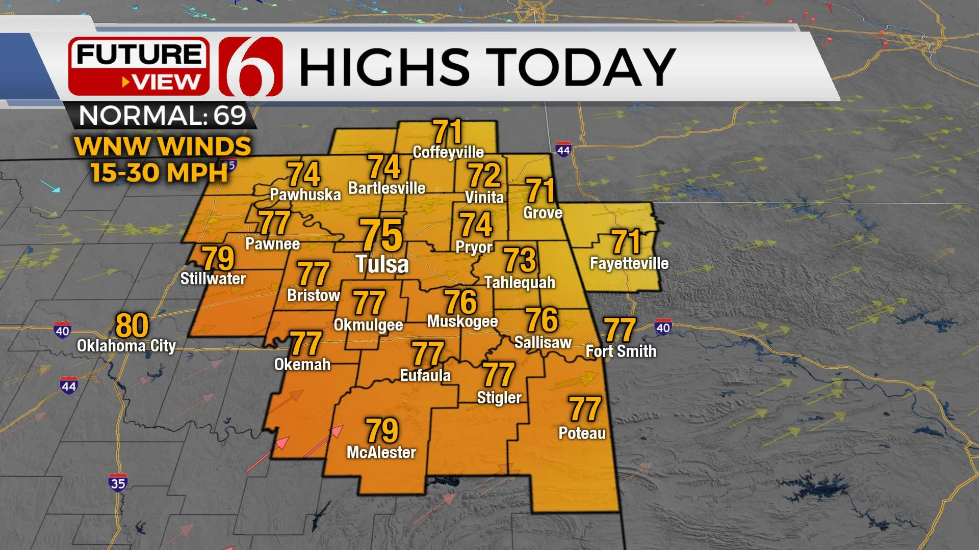
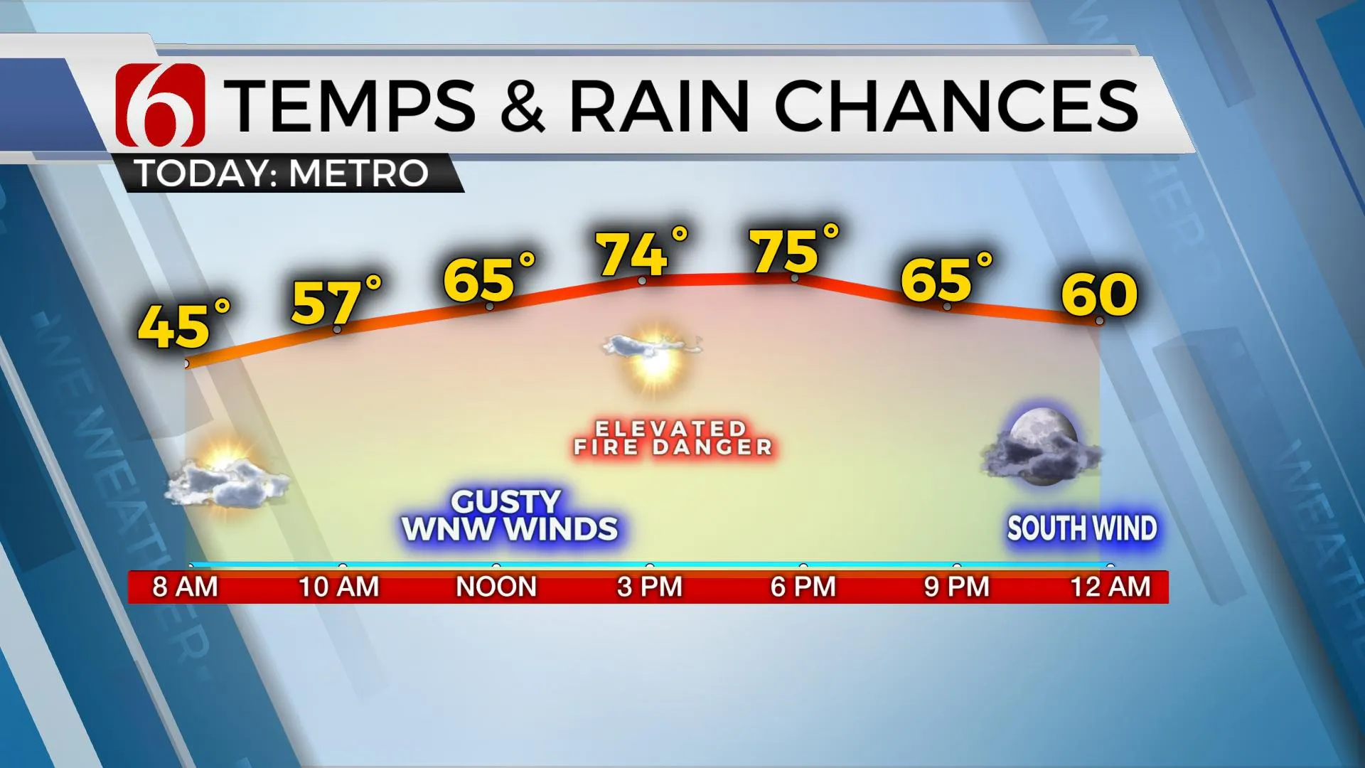
The main upper-level cyclone responsible for yesterday’s cold front will quickly exit the region this morning and move into the Mid-Missouri Valley region. A few early morning wrap-around clouds will exit, and we’ll be in good shape for the day. Temps this morning will start in the 40s and reach the mid-70s for afternoon highs along with sunshine and west winds from 15 to 30 mph. Dry air will remain across northern OK and southern Kansas for the afternoon and fire spread rates will increase withThursday, April 8th 2021, 9:43 am
The main upper-level cyclone responsible for yesterday’s cold front will quickly exit the region this morning and move into the Mid-Missouri Valley region. A few early morning wrap-around clouds will exit, and we’ll be in good shape for the day. Temps this morning will start in the 40s and reach the mid-70s for afternoon highs along with sunshine and west winds from 15 to 30 mph. Dry air will remain across northern OK and southern Kansas for the afternoon and fire spread rates will increase with afternoon humidity values between 20 and 30%. But our next strong upper-level low will quickly drop out of the Rockies into the central plains with south winds increasing later tonight into early Friday morning. Storm chances return for some locations tomorrow.

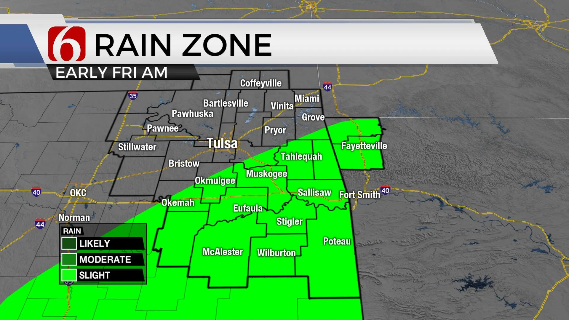
This next upper-level low will drop out of the northern intermountain region and move across the central high plains Friday afternoon and evening. As this occurs, our pressure will quickly fall Thursday evening into early Friday morning, and this will quickly bring low-level moisture back into the southern half of the state by tomorrow morning. A few showers and storms will develop early, pre-dawn Friday across southeastern OK as moisture returns in this area. These are not expected to be severe, but some small hail may occur. Friday morning south winds will increase, and moisture will continue moving northwest, nearing the metro by early afternoon as a surface cold front arrives near the I-44 corridor and the surface low begins moving eastward along the Red River Valley.

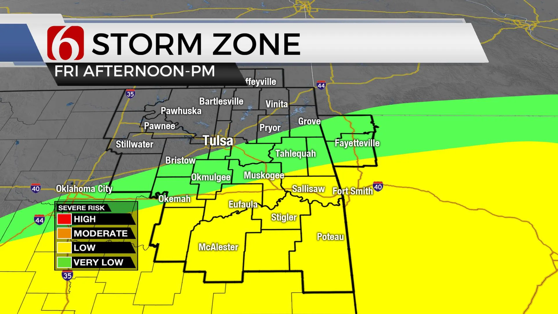
Thunderstorms are likely to develop Friday afternoon and early evening in two areas: along the advancing cold front and along the dry line positioned south from the surface low. The rapid return of Gulf moisture into this system combined with favorable heating Friday afternoon should result in increasing convective and potential energy, surface instability and adequate shear for severe weather, especially across far southern OK where moisture and lift will be maximized. The metro may once again be on the start-line for storm development along the cold front tomorrow afternoon. We’ll keep a 50% chance for storms at this point but may draw this back slightly in subsequent updates since the higher chances may occur slightly south.

The timing of this system should exit our immediate area Friday between 10 p.m. to midnight allowing for a wonderful weekend. The only concern will be the main upper-level low. This feature may be close enough Saturday to keep some warp around clouds across far northeastern OK for Saturday afternoon. Otherwise, we seem to be looking good with Saturday highs in the upper 60s and Sundays into the upper 70s or lower 80s before, yet another system quickly invades the state early Monday. Low-level moisture should not make a big comeback ahead of this Monday morning front and we’ll currently include only low storm chances for this early week system. The upper air pattern will change some next week and this allows cooler weather and possibly wet weather for the middle of the week. More on this scenario will be posted tomorrow.

Thanks for reading the Thursday morning weather discussion and blog.
Have a super great day!
Alan Crone
KOTV
If you’re into podcasts, check out my daily weather update below. Search for NewsOn6 and ‘Weather Out The Door’ on most podcast providers, including Apple, Stitcher, Tune-In and down below on Spotify.

More Like This
February 14th, 2022
January 26th, 2022
January 25th, 2022
Top Headlines
December 15th, 2024
December 15th, 2024
December 15th, 2024
December 15th, 2024


