Early Morning Showers, Cool Weather Remains For The Rest Of The Day
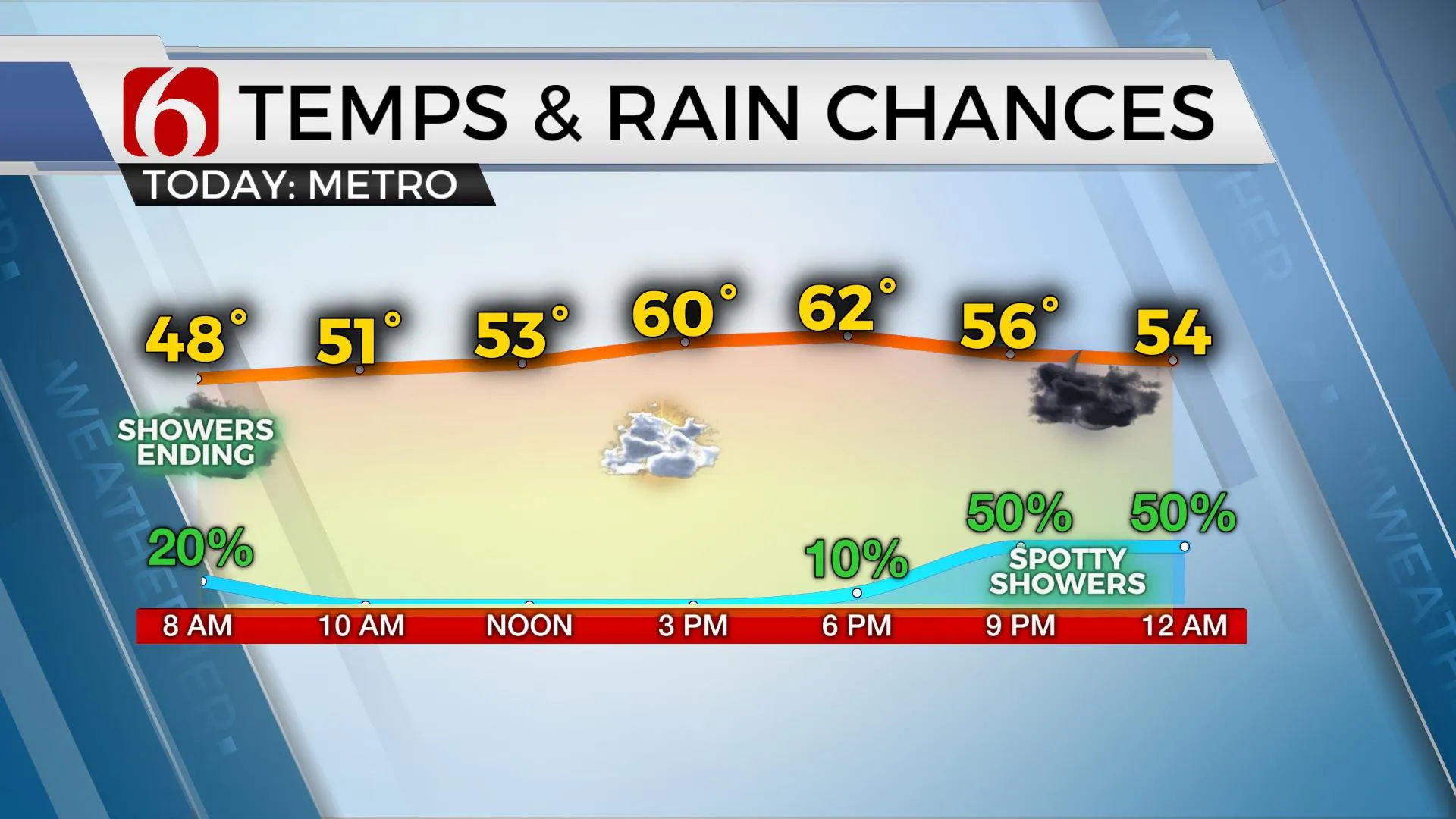
The morning showers will quickly exit the area with mostly cloudy and cool weather remaining for the day before another wave nears the region later tonight. Most of the region will start with morning temps in the upper 40s and lower 50s. Highs this afternoon should be on the cool side of guidance with many locations staying in the upper 50s to lower 60s. We’re tracking two more rounds of possible showers and storms before the entire system finally exits our immediate area.Wednesday, April 14th 2021, 7:06 am
TULSA, Okla. -
The morning showers will quickly exit the area with mostly cloudy and cool weather remaining for the day before another wave nears the region later tonight. Most of the region will start with morning temps in the upper 40s and lower 50s. Highs this afternoon should be on the cool side of guidance with many locations staying in the upper 50s to lower 60s. We’re tracking two more rounds of possible showers and storms before the entire system finally exits our immediate area.

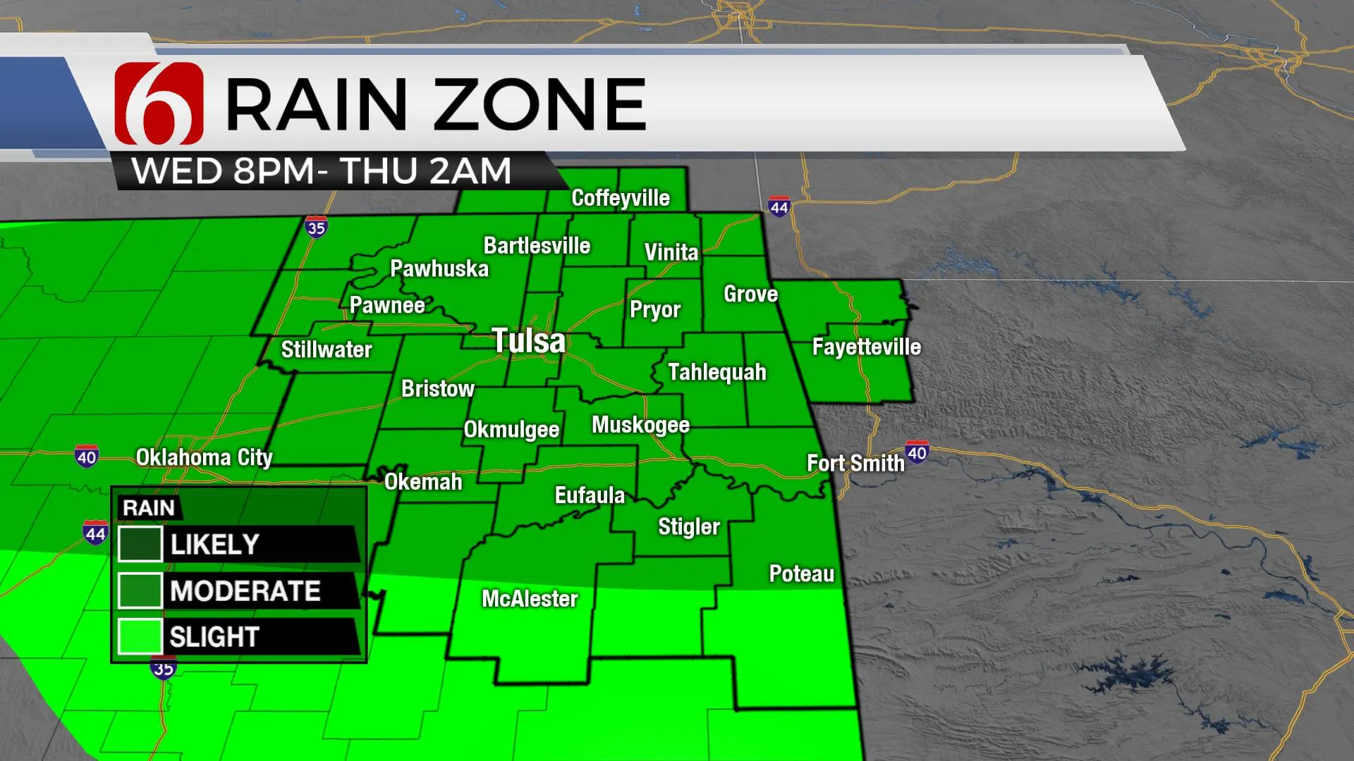
My only change from the previous forecast is to increase the chances with the next wave nearing the area later tonight and exiting around 2 a.m. Thursday. The rest of the forecast remains mostly intact. The main upper-level system, currently to our west, will eject eastward soon and bring the last round of showers or thunder across the area Thursday evening into Friday. There remain some differences regarding the strength of the wave and this may have some minor influence on where stronger storms may develop, but for most of our area, this will not be a major concern. Any strong to severe storm activity Friday should be confined to either the Red River Valley or north TX southward into central Texas. As the main upper-level trough exits the region late Friday night into early Sturdy morning, a few lingering showers may be present early Saturday morning across far northeastern OK or southeastern kanas, but the chances remain too low to include any significant chance for this update. Cooler, almost cold for April standards will arrive Friday into part of Saturday before the air mass modifies Sunday into Monday. Yet another system should arrive early next week reinforcing the drier air mass in the lower levels of the atmosphere. This would once again keep any severe weather threats well removed from most of the state for almost all net week. A highly unusual pattern for mid to late April in Oklahoma.

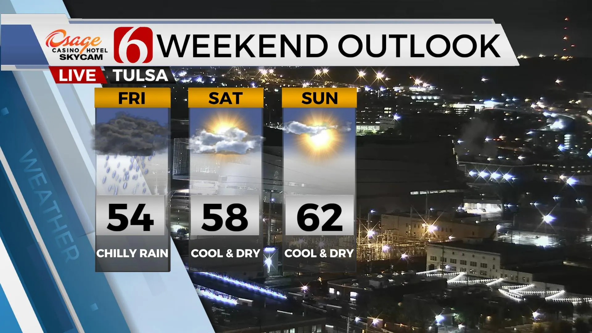
The main upper-level pattern hasn’t changed too much from the previous, but it will be transitioning some by the end of the week and into the weekend. A closed low remains over the Great Lakes region with another trough positioned across the western U.S this morning. The upper air flow between these features remains mostly from the west to east and continues bringing several disturbances across the state. Another arrives later this afternoon before the main western trough weakens as it moves near the central plains Friday into Saturday. This should bring us chilly yet dry weather this weekend with morning lows in the 40s and highs in the upper 50s to lower 60s. Sunday evening into Monday morning will allow for clear skies, dry air and light winds. This will drop temps into the upper 30s for lows with highs reaching the upper 60s to lower 70s before the next strong front rolls across the area late Monday night into Tuesday with another cool-down Tuesday with highs in the 50s.

Thanks for reading the Wednesday morning weather discussion and blog.
Have a super great day!
Alan Crone
KOTV
If you’re into podcasts, check out my daily weather update below. Search for NewsOn6 and ‘Weather Out The Door’ on most podcast providers, including Apple, Stitcher, Tune-In and down below on Spotify.

More Like This
April 14th, 2021
February 14th, 2022
January 26th, 2022
January 25th, 2022
Top Headlines
December 14th, 2024
December 14th, 2024
December 14th, 2024


