Chilly Morning Temperatures, Storm Chances Move In
Chilly morning temperatures are expected and weekend storm chances move inThursday, May 13th 2021, 7:50 am
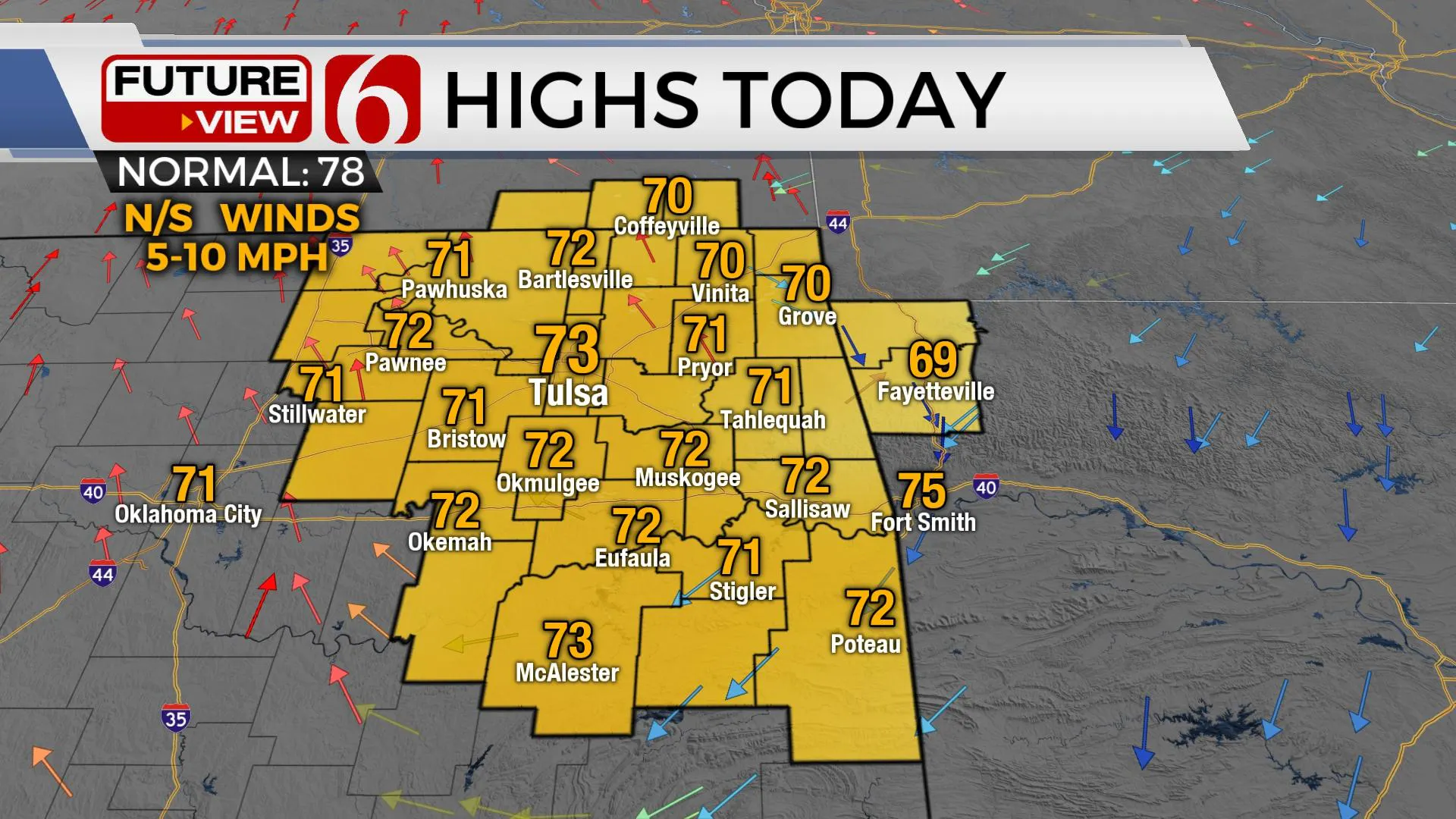
Another chilly morning is underway with many locations in the 40s. But later today we’ll see more sunshine, southeast winds returning later today around 10 mph, and highs reaching the lower 70s. Even warmer weather is expected Friday into the weekend with daytime highs topping out in the upper 70s to lower 80s. But the pattern change that brings seasonal temperatures back to the state will also bring more thunderstorm chances, including the mention for a few strong to severe storms, and some heavy pockets of moderate to heavy rainfall for some locations.
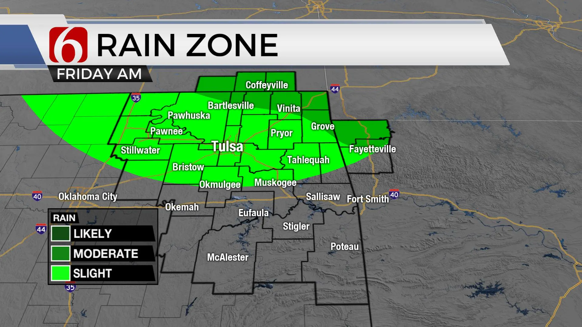
The upper air flow is currently from the northwest. Later today, storms will develop across central Kansas and drop southeastward into far southern Kansas and potentially into far northeastern OK late tonight into Friday morning. Most model data is not very bullish on a large complex of storms, but I will keep a low chance for a few showers or storms brushing the northeastern sections early Friday morning. This chance should remain north of the Tulsa metro. Friday afternoon looks good for our part of the state with highs in the mid to upper 70s with a few clouds and breezy southeast winds.
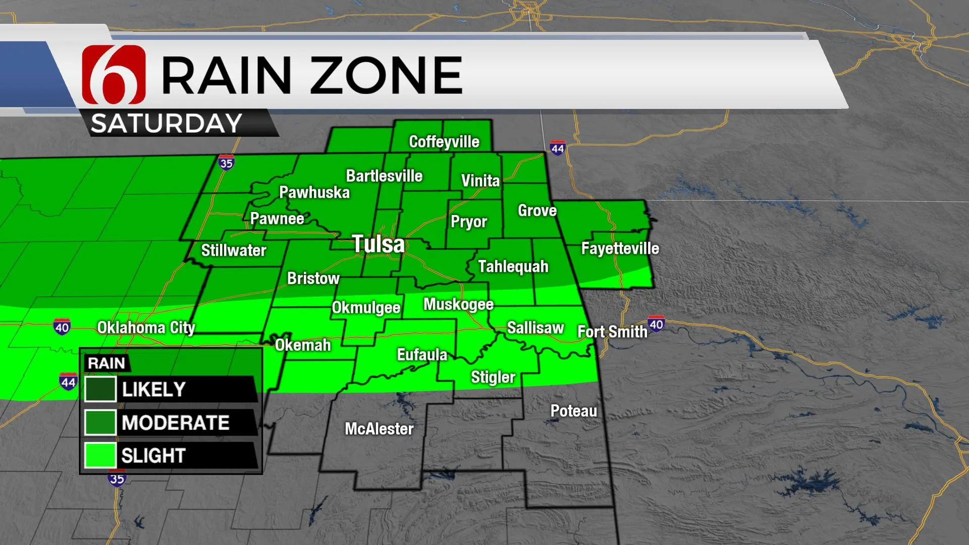
Saturday the flow will be from the west to east for a small window during the morning hours before transitioning to a southwesterly flow Sunday into early next week. Friday evening, another complex of storms will develop across the high plains of Texas and move eastward, near and north of the highway 412 corridor into pre-dawn Saturday. This system may also provide us with additional storm chances through midday as the decaying complex moves east. I have increased the Saturday chances because of this scenario, mostly along and north of the highway 412 region. This will include the Tulsa metro.
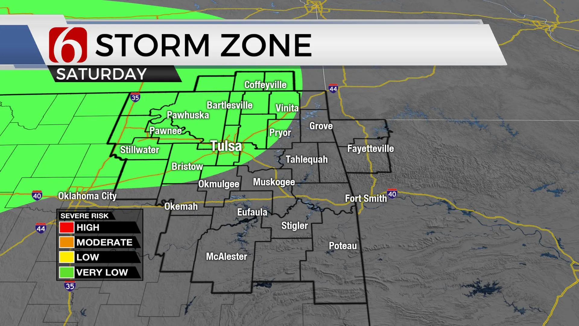
Late Saturday evening, a residual boundary will be near northern OK and southern Kansas as additional disturbances move back across the state. A few storms may develop late Saturday into early Sunday and could become strong to severe.
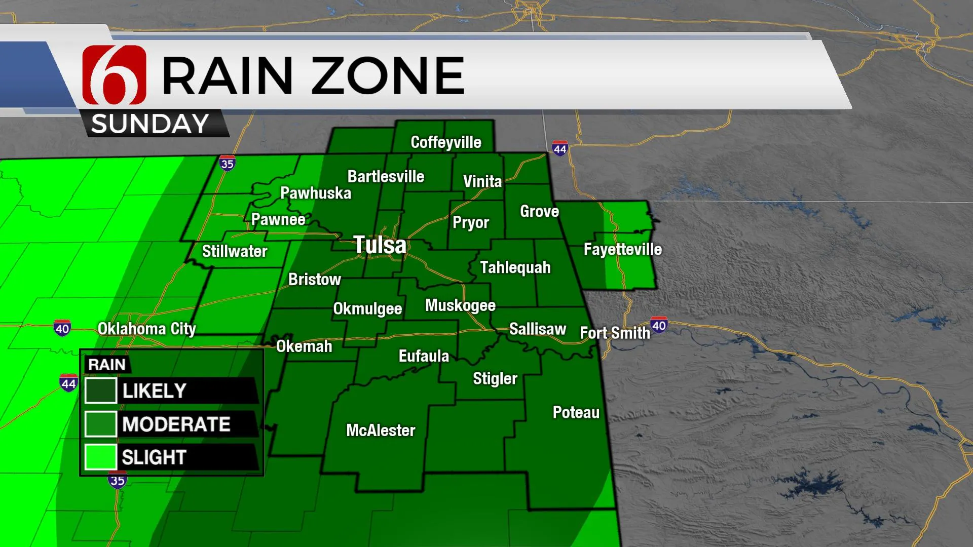
Sunday into next week the next upper trough will establish across the western U.S and slowly move ENE while sending small disturbances around the basal region across Oklahoma. The result will be scattered thunderstorms Sunday afternoon and evening, and even more late Sunday night into Monday. A few of these could be strong to severe, but our main issue may eventually transition to locally heavy rainfall. This pattern may persist for several days early next week and will probably result in flooding issues from central to eastern OK.
Thanks for reading the Thursday morning weather discussion and blog.
Have a super great day!
Alan Crone
KOTV
If you’re into podcasts, check out my daily weather update below. Search for NewsOn6 and ‘Weather Out The Door’ on most podcast providers, including Apple, Stitcher, Tune-In and below on Spotify.

More Like This
May 13th, 2021
February 14th, 2022
January 26th, 2022
January 25th, 2022
Top Headlines
December 15th, 2024
December 15th, 2024
December 15th, 2024
December 15th, 2024


