Cool, Cloudy Tuesday, Shower Chances Decrease Throughout The Day
Cool cloudy temperatures stick around today in to tomorrow. Rain Chances begin to decrease throughout the day.Tuesday, June 1st 2021, 6:06 am
TULSA, Oklahoma -
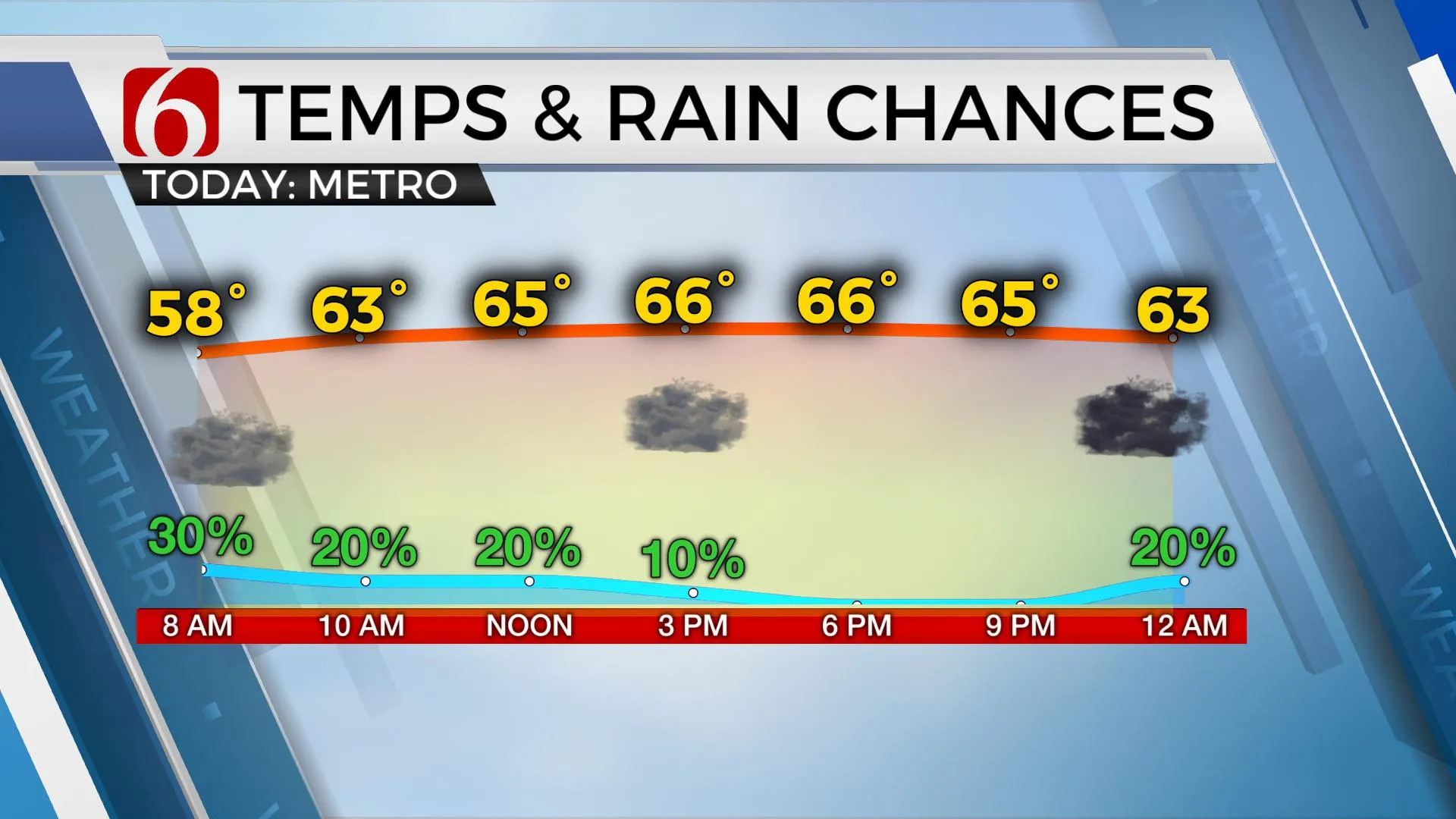
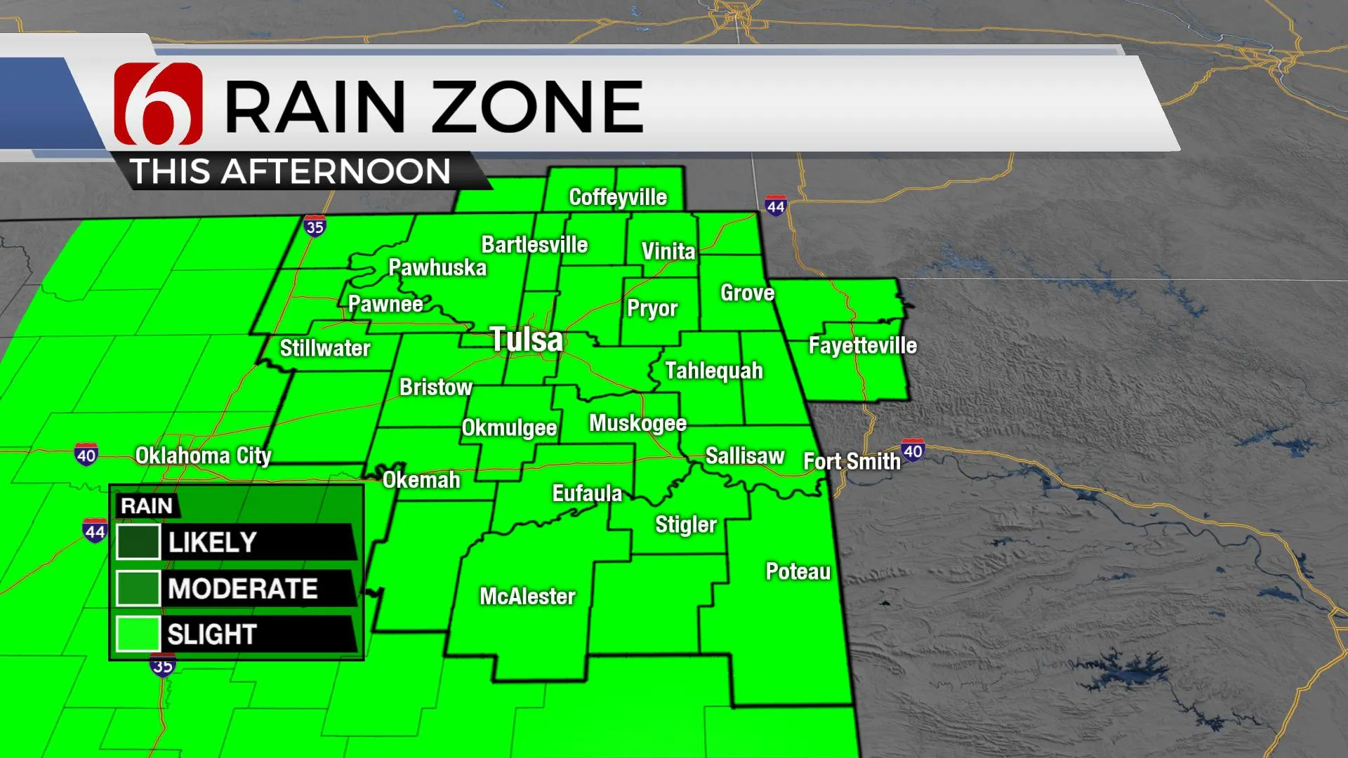
Shower chances decrease through the day, but cool and cloudy conditions remain both today and tomorrow as the active weather pattern remains.

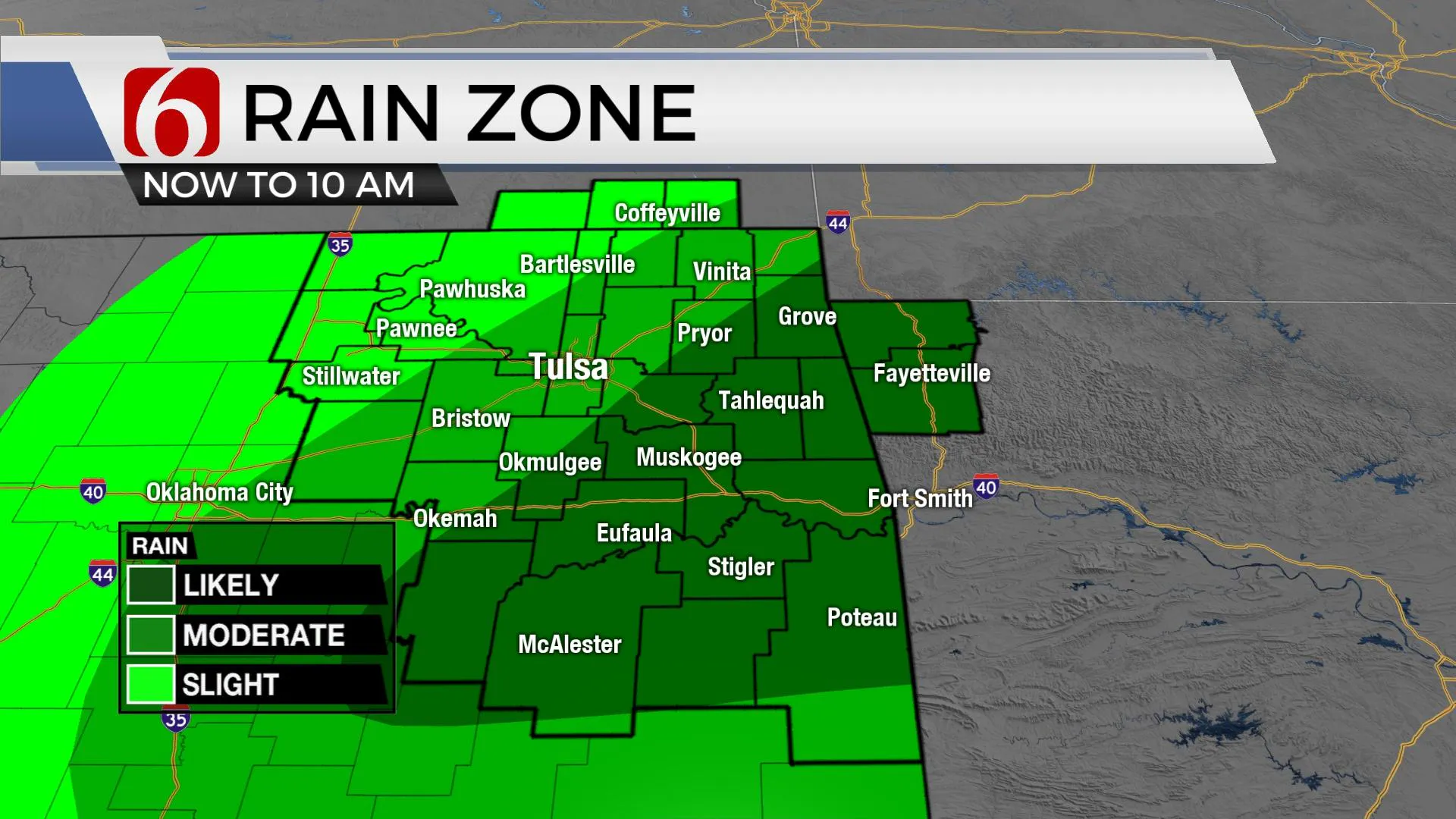
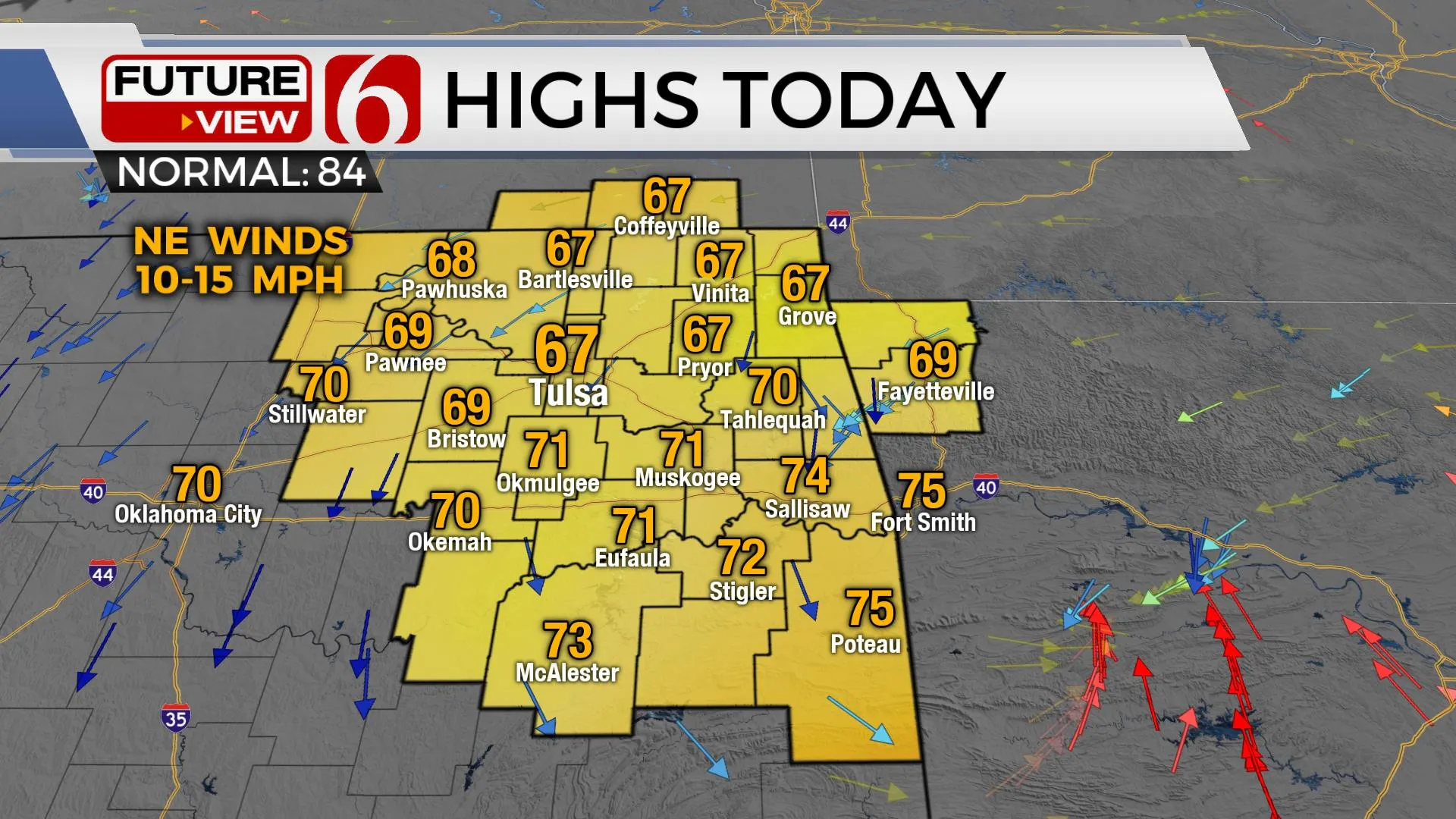
A flood watch remains for the next few hours across northeastern OK with some additional rain near and southeast of the I-44 corridor, but rain chances will quickly diminish this morning with a few spotty showers remaining trough the day. Highs this afternoon will remain below the seasonal average with many locations staying in the upper 60s and a few spots reaching the lower 70s. Clouds could attempt to thin out some later this afternoon, but I’ll keep us mostly cloudy for the day with winds from the north wind at 10 to 20 mph. The upper pattern will briefly transition to a northwest flow for the next few days before reverting from the southwest this weekend into early next week with additional rain and thunder chances returning to Oklahoma.

Pockets of moderate to heavy rainfall continue this morning in a narrow region and could pose flooding issues in low-lying areas across east-central Oklahoma. Local streams, creeks and rivers may also begin to slowly rise later this afternoon as water makes its way into several local basins, but widespread flooding is not expected.

Wednesday into Thursday, a brief northwest upper airflow brushes the region and may provide us with a few shower or storm chances, but this flow appears rather weak. Low-level moisture will be increasing and would support some heavy downpours, but no appreciable forcing mechanism can be identified at this point for the next few days, so our chances remain relatively low. By this weekend into early next week, several items of interest will near the state with a modest increase in rain and thunder chances.
A southern stream upper trough, partially closed, should near the state this weekend from the south with slowly increasing rain and thunder chances. Severe threats will remain low due to a rather weak upper air low and low surface instability.
Early next week, a strong midlevel trough ejects out of the Rockies into the central plains state, but most of the forcing should remain slightly removed to our north. This may still bring some active weather, including thunder threats into the state early next week as some data loop this feature southward later next week while approaching the mid-Missouri Valley.

Temps will remain cool today and Wednesday but should gradually climb to seasonal averages later this week with lows in the lower 60s and highs in the lower 80s this weekend. Some typical early June muggy weather will be likely early next week.
Thanks for reading the Tuesday morning weather discussion and blog.
Have a super great day!
Alan Crone
KOTV
If you’re into podcasts, check out my daily weather update below. Search for NewsOn6 and ‘Weather Out The Door’ on most podcast providers, including Apple, Stitcher, Tune-In and down below on Spotify.

More Like This
February 14th, 2022
January 26th, 2022
January 25th, 2022
Top Headlines
December 13th, 2024
December 13th, 2024
December 13th, 2024


