A Few Spotty Showers, Highs In The Upper 70s
Some spotty showers and storms may are possible today. Cool temperatures stick around.Wednesday, June 2nd 2021, 7:14 am
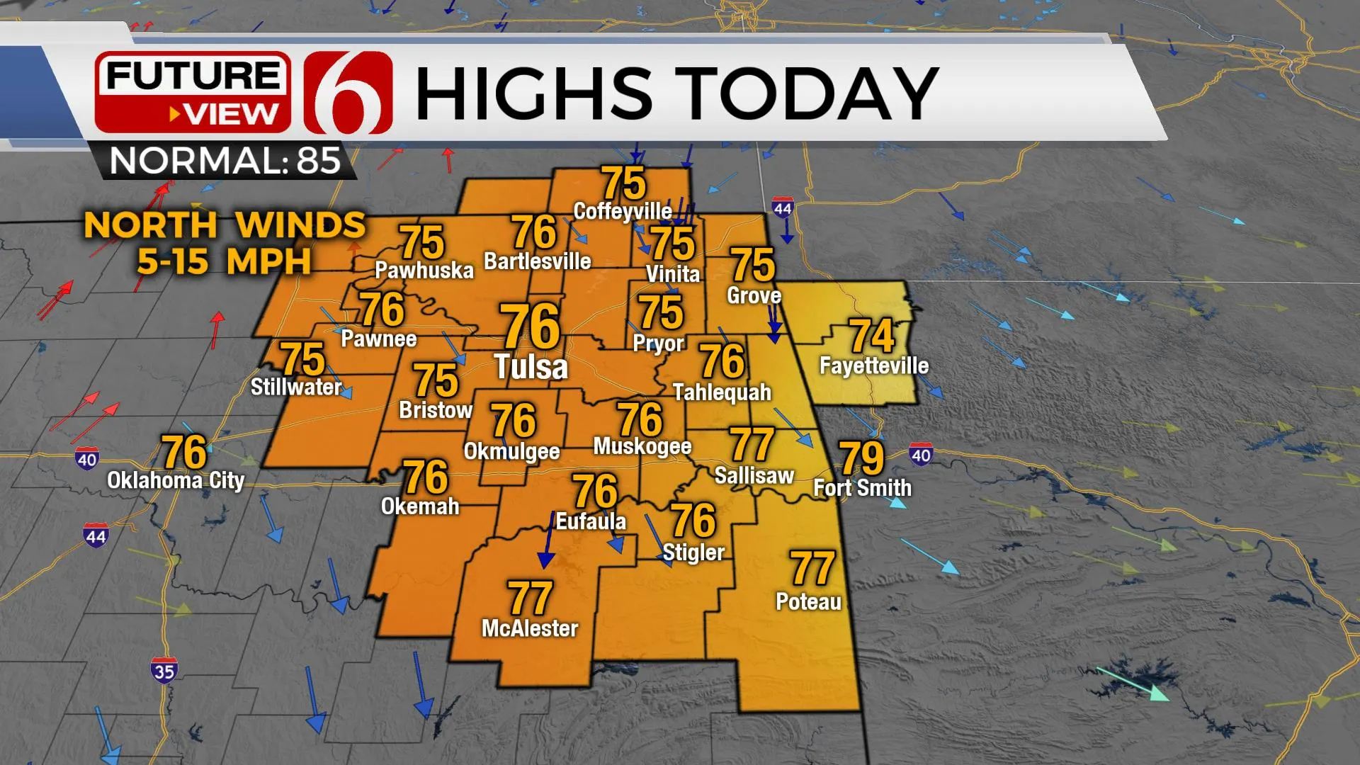
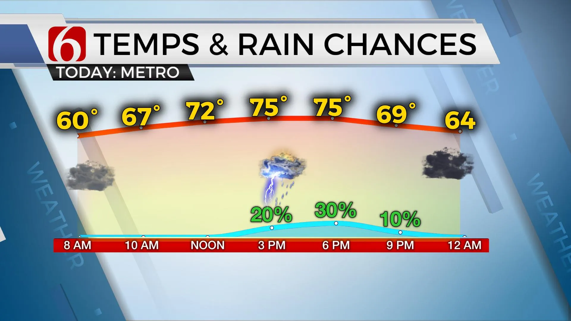
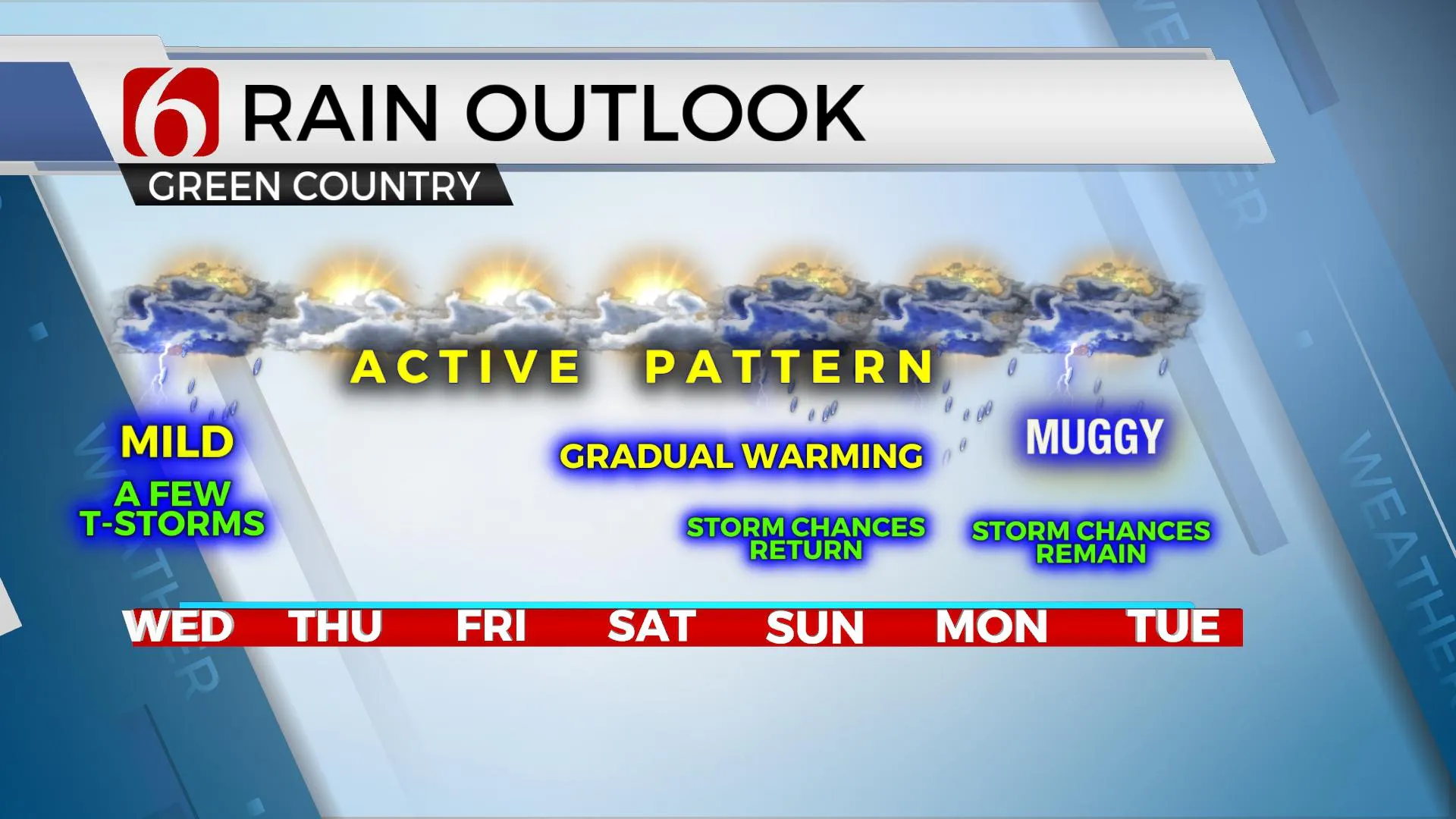
We’re in the northwest flow pattern for the next few days with plenty of low-level moisture across Eastern OK and the surrounding region. This will result in a few spotty showers or storms later this afternoon with much lower chances Thursday and Friday. Temps will continue to be cool, but today’s readings should reach the mid to upper 70s with north winds and cloudy. We’re gradually warming into the lower 80s Friday through the weekend with another weak upper-level system nearing that should bring a few additional showers or storms into the area.

Some mid-level ridging is to our west and the upper airflow is currently from the northwest both today and tomorrow. While we don’t see any major signals for showers or storms, this pattern doesn’t need much to generate some precipitation and I will keep mentions in the forecast for the next few days with scattered storms a possibility later this afternoon near the metro into the evening commute.

Friday into the weekend the upper airflow changes again and will bring a southerly to southwesterly flow across the southern and central plains. A weak, quasi-closed low will develop across the Permian Basin Friday and drift northeast into north TX Saturday and near Eastern OK Sunday. As this feature nears the state, additional scattered showers and storms will occur. The question remains as to the exact location and the expected coverage of precipitation. I will keep low mentions Saturday with highs reaching the lower or mid-80s with slightly higher chances Sunday as the main feature should be nearing but still slightly south. Data this morning will keep this feature positioned near Eastern OK and Western AR for a few days early next week and this means chances for scattered showers and storms will remain through these periods. The upper air flow will remain very weak but low-level moisture is expected to be rather high. This sets the stage for some slow-moving, high output storms during this period of the forecast that may produce locally heavy downpours. Severe threats will be limited.

Later next week, the pattern attempts to become more June-like with a mid-level ridge develop across the western part of the state and extending northward into the Rockies. This positioning is a little unusual for early June and the data may change. Temps under this feature will move into the 90s across western OK and the 80s to the east. This will be a weak, or dirty ridge that may feature some daily storm chances with increasing low-level moisture and a few minor impulses near the region for the end of next week.
Thanks for reading the Wednesday morning weather discussion and blog.
Have a super great day!
Alan Crone
KOTV
If you’re into podcasts, check out my daily weather update below. Search for NewsOn6 and ‘Weather Out The Door’ on most podcast providers, including Apple, Stitcher, Tune-In and down below on Spotify.

More Like This
June 2nd, 2021
February 14th, 2022
January 26th, 2022
January 25th, 2022
Top Headlines
December 14th, 2024
December 14th, 2024
December 14th, 2024
December 14th, 2024


