A Steamy Afternoon Before Storm Chances Arrive Friday Night
Warm and muggy conditions continue on Friday, storm chances move in toward the evening hours.Friday, June 11th 2021, 10:18 am
TULSA, Oklahoma -
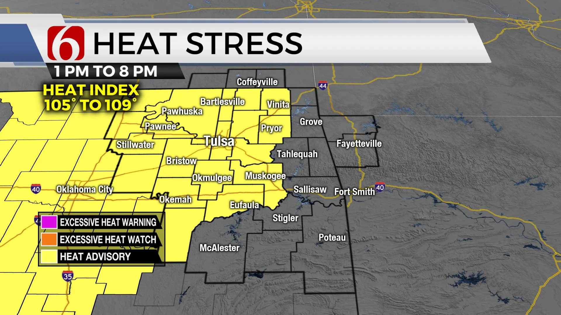
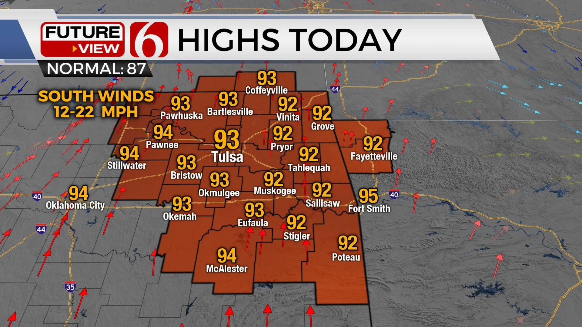
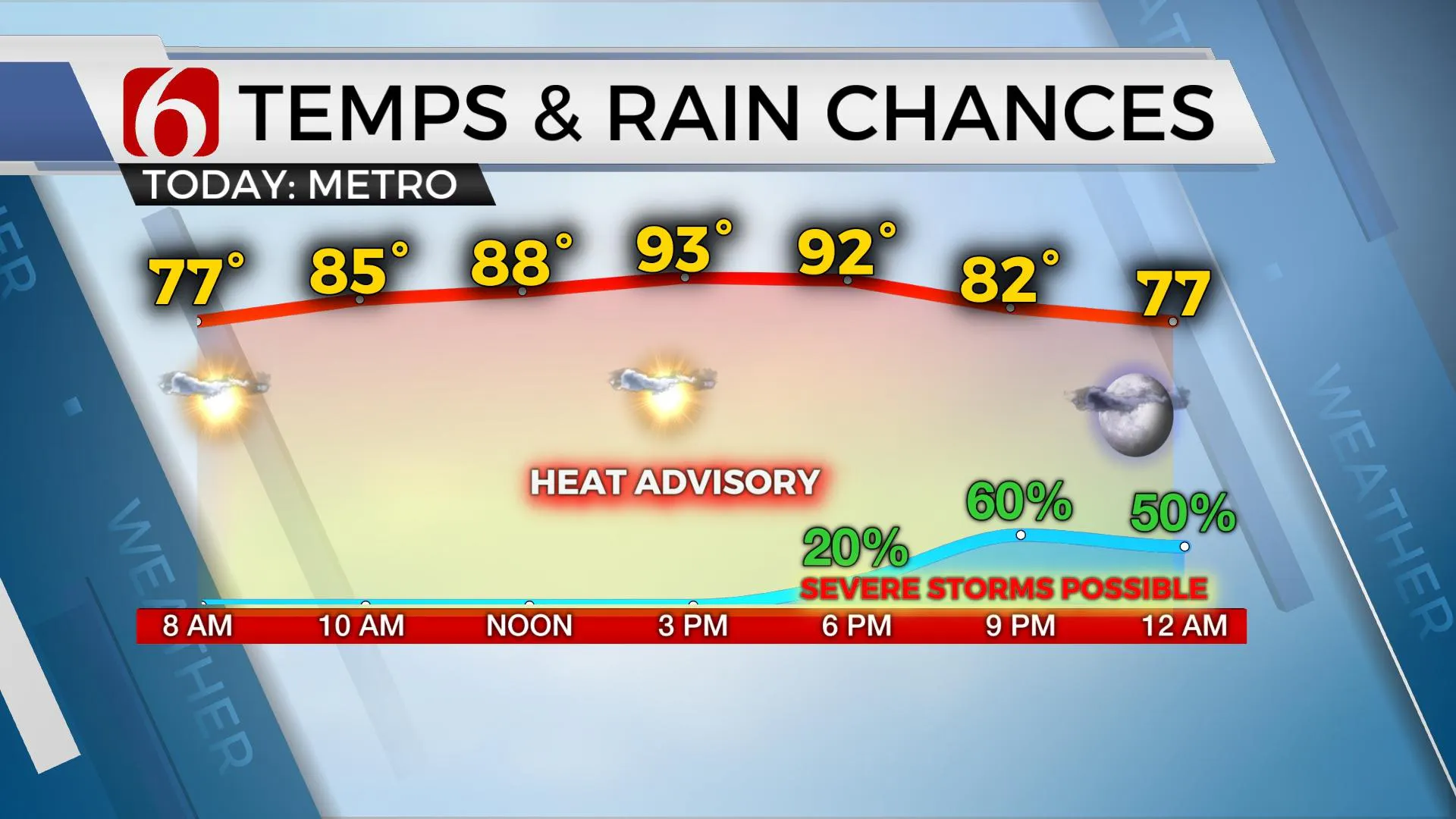
Another day of a very tropical airmass for most of the region and this means another heat advisory will be posted for many of the same areas included yesterday with heat index values nearing 103 to 107. Afternoon highs will reach the lower 90s again this afternoon with south winds near 12 to 22 mph before a weak front nears the area late Friday night into early Saturday morning. A small complex of storms may approach southeastern Kansas and northern OK later tonight and may survive the trip into part of northern OK late this evening. A midlevel ridge of high pressure should continue to be near and southwest which may eventually limit the southward progression of most of this complex, but a reasonable mix of model guides support part of this system arriving this evening with a chance for some severe storms producing damaging wind gusts. The atmosphere ahead of this system will be characterized by increasing surface instability and convective potential energy. This type of pre-frontal zone is common in a very warm and humid airmass and would support damaging winds and some hail in stronger cores, which will be more preventive along the OK-KS state line region. Despite the presence of the boundary moving across part of the area Saturday morning, no airmass change is initially expected. Tropical dewpoints in the 70s will pool along both sides of the front keeping the uncomfortable conditions for most of the weekend. It is possible that another heat advisory may be required for part of the state Saturday. Some minor cooling of local dew points will be possible Sunday across part of northern OK and more noticeably early next week across more of the region.

Temps will remain above the seasonal average with lows in the 70s and highs in the upper 80s and lower 90s this weekend. The pattern may briefly change early next week allowing a disturbance moving southward into the state with a few storms, but the overall pattern of warm and muggy weather will remain until the middle to end of next week when some drier air and slightly cooler daytime highs arrive Wednesday through Friday.

A mid-level ridge of high pressure remains in control for most of the area today and is centered across west Texas into the high plains of Texas and OK. The northeastern extent of the ridge reaches far northern OK and southern Kansas. Its this far northern area where a storm complex will enter later this evening. This system is already up and running this morning well northward, along the I-70 corridor, but will tend to propagate southeast later this afternoon with a damaging wind threat across at least east-central to southeastern Kansas. Most of this complex should weaken once it draws closer to the ridge and conditions become less favorable for storm maintenance as the system moves south of the metro later tonight. A general timeline would increase southeastern Kansas from 5 p.m. to 7 p.m., northern OK from 7 p.m. to 10 p.m. and any residual storms nearing the I-40 corridor between 10 p.m. and midnight. A few leftover showers can’t be ruled out early Saturday morning, but the probability remains low.

Thanks for reading the Friday morning weather discussion and blog.
Have a super great day!
Alan Crone
KOTV
If you’re into podcasts, check out my daily weather update below. Search for NewsOn6 and ‘Weather Out The Door’ on most podcast providers, including Apple, Stitcher, Tune-In and down below on Spotify.

More Like This
June 11th, 2021
February 14th, 2022
January 26th, 2022
January 25th, 2022
Top Headlines
December 15th, 2024
December 15th, 2024
December 15th, 2024
December 15th, 2024


