Above Normal Temperatures Again Today
A mid-level ridge of high pressure remains the dominant feature but will still allow a weakness in the flow for part of far northern OK and western Arkansas during the next few days.Tuesday, June 15th 2021, 4:29 am
TULSA, Oklahoma -
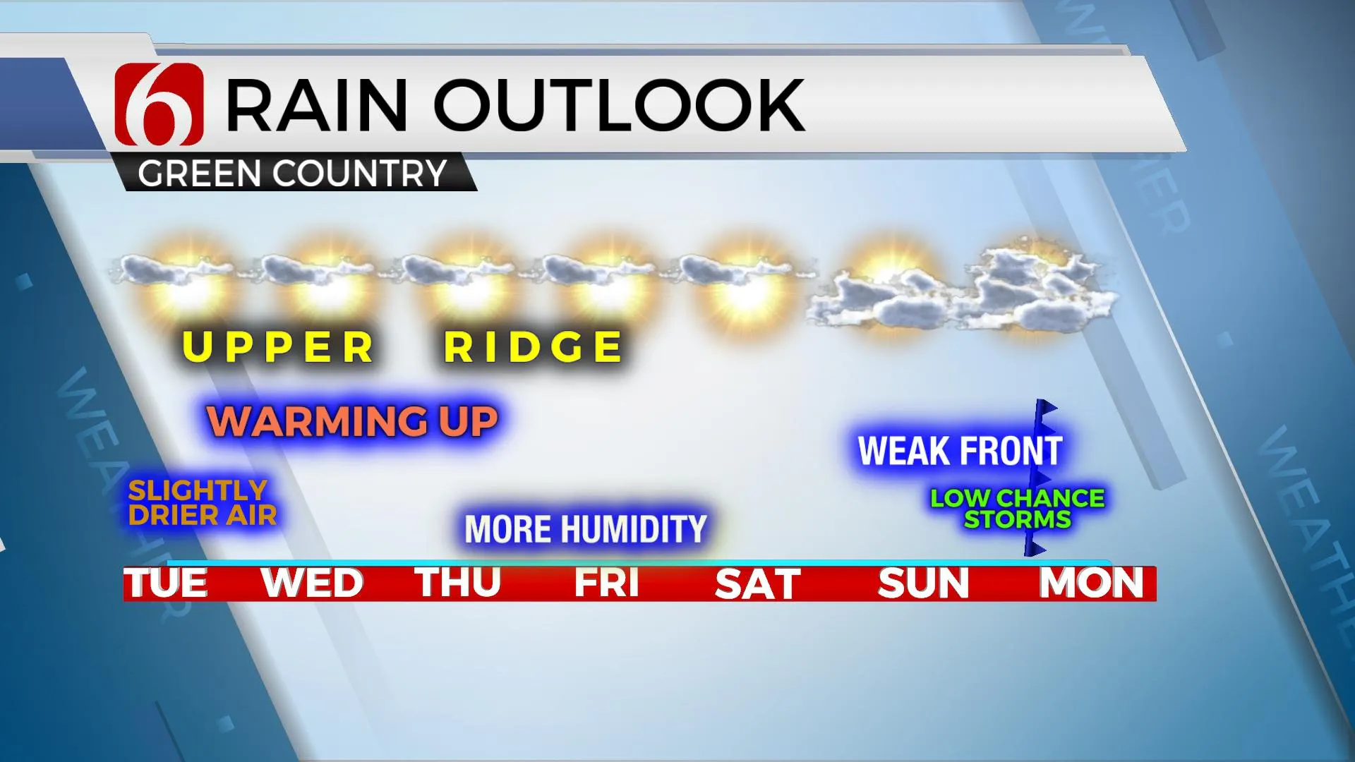
A mid-level ridge of high pressure remains the dominant feature but will still allow a weakness in the flow for part of far northern OK and western Arkansas during the next few days. This means we’ll watch for any isolated showers or storms bubbling up on the periphery of the ridge. As of this morning, the probability of any storms in the short term remain very low. This weekend the upper air pattern will support some changes allowing for a few disturbances approaching from the north and a weak boundary nearing the state. These features will bring a low mention for a few storms, more so as the boundary gets a shove southward late Sunday night into Monday morning.
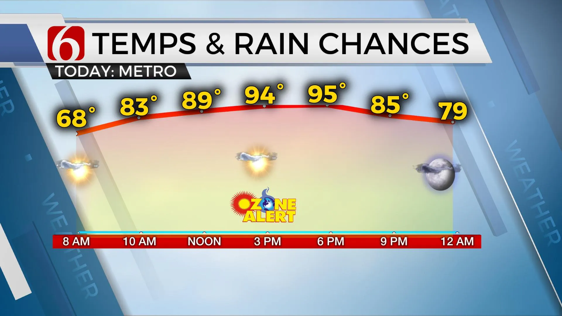
Slightly drier air continues to provide some benefits with the morning lows and the afternoon heat index. Morning lows will stay in the mid to upper 60s this morning with afternoon highs reaching the lower to mid-90s. But the expectation of dew points in the 60s will keep our heat index values only a few degrees higher than actual surface temps during the afternoon. Compared to last week's 105 to 109, this will feel different, yet afternoon temps will be a degree or two higher than late last week. You’ll still need to prepare for the warm, toasty conditions and stay hydrated for outdoor activities. Unfortunately, most data support some lower 70 dewpoints returning tomorrow into the 2nd half of the week. This will take the heat index into the 100 to 104 range but should remain below heat advisory criteria through the end of the week.
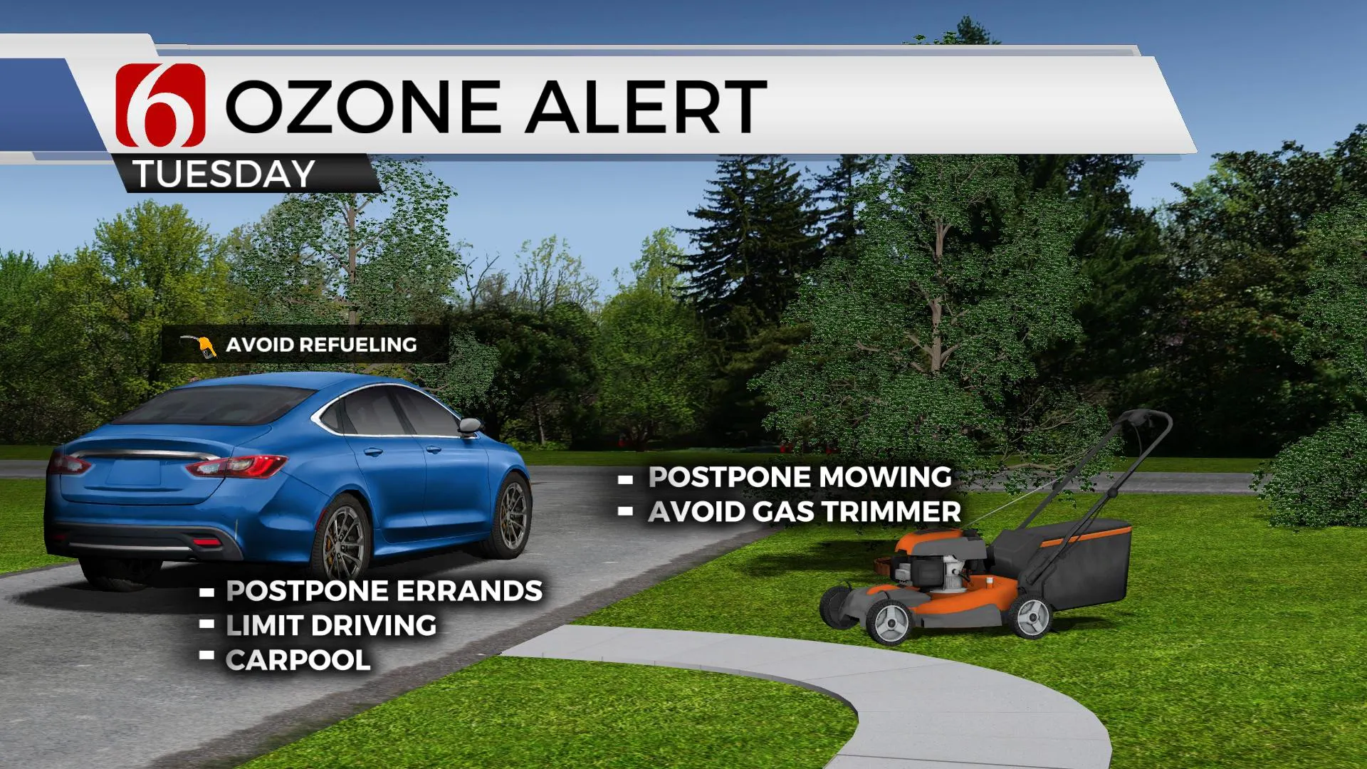
The presence of the midlevel ridge, light wind and abundant sunshine will more than likely lead to some surface ozone this afternoon and our first ozone alert of the season will be issued for the Tulsa metro this afternoon.
Later this week, the ridge begins to change shape and retrogrades as a pair of short waves move across the northern high plains. The first one is rather weak and will drive the surface front southward into the central plains this weekend. It appears the front should stay north of our area with little impact. The 2nd system is stronger and should bring the front southward into the state Sunday night into early Monday with at least a few storm chances near the boundary. The operational data bring this boundary across the area with very little precip output, but we’ll keep a low mention for this update. The boundary should move southward Monday morning, but stall across southern OK before retreating northward Tuesday of next week with a few showers and storms.
Thanks for reading the Tuesday morning weather discussion and blog.
Have a super great day!
Alan Crone
KOTV
If you’re into podcasts, check out my daily weather update below. Search for NewsOn6 and ‘Weather Out The Door’ on most podcast providers, including Apple, Stitcher, Tune-In and down below on Spotify.

More Like This
June 15th, 2021
November 30th, 2022
November 1st, 2022
August 26th, 2022
Top Headlines
December 12th, 2024
December 12th, 2024
December 12th, 2024
December 12th, 2024


