Scattered Storms & Weekend Relief
It is another hot day, but a few showers and storms are possible.Friday, August 13th 2021, 4:46 am
TULSA, Oklahoma -
A weak boundary is approaching the state bringing mentions for storms and some not as hot and less humid weather into the weekend resulting in below normal temperatures into early next week. My experience tells me to disregard a cold front in August moving too far into the state. But this summer has not been normal, and it does appear this boundary will have some influence on our weather this weekend.

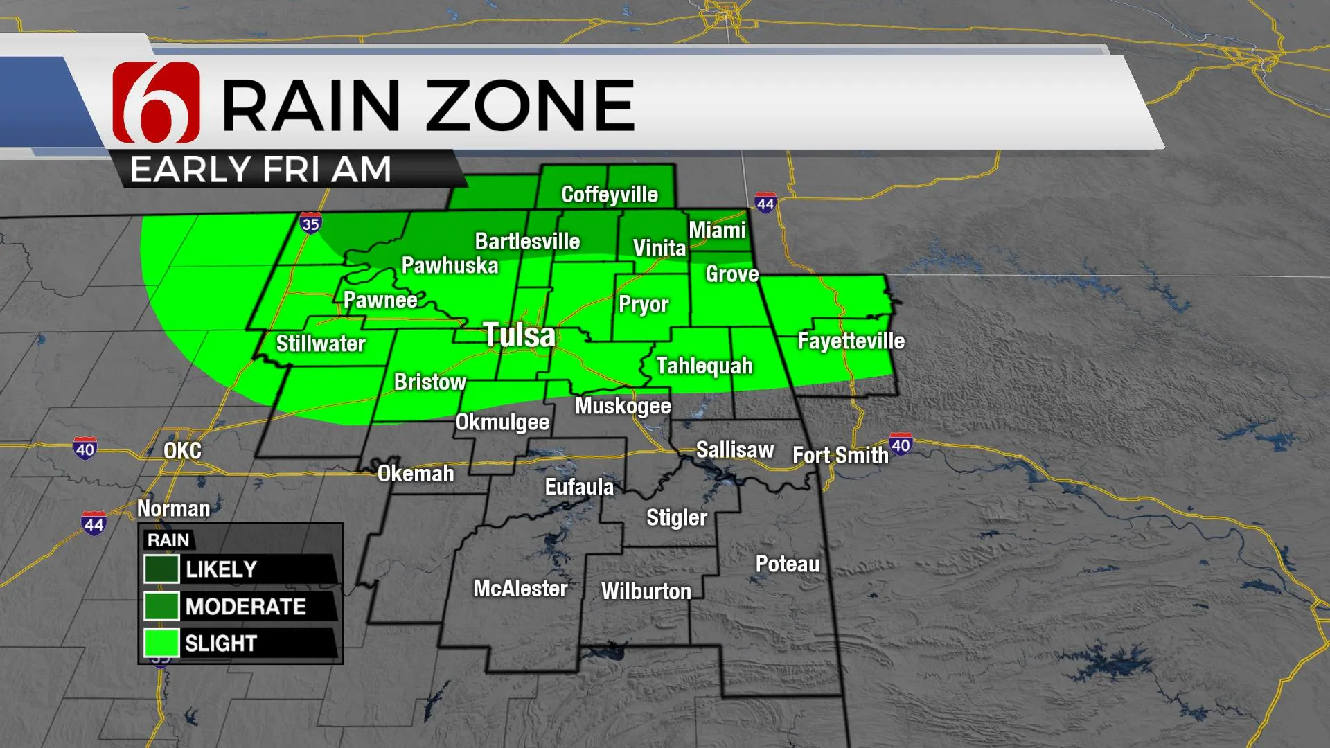
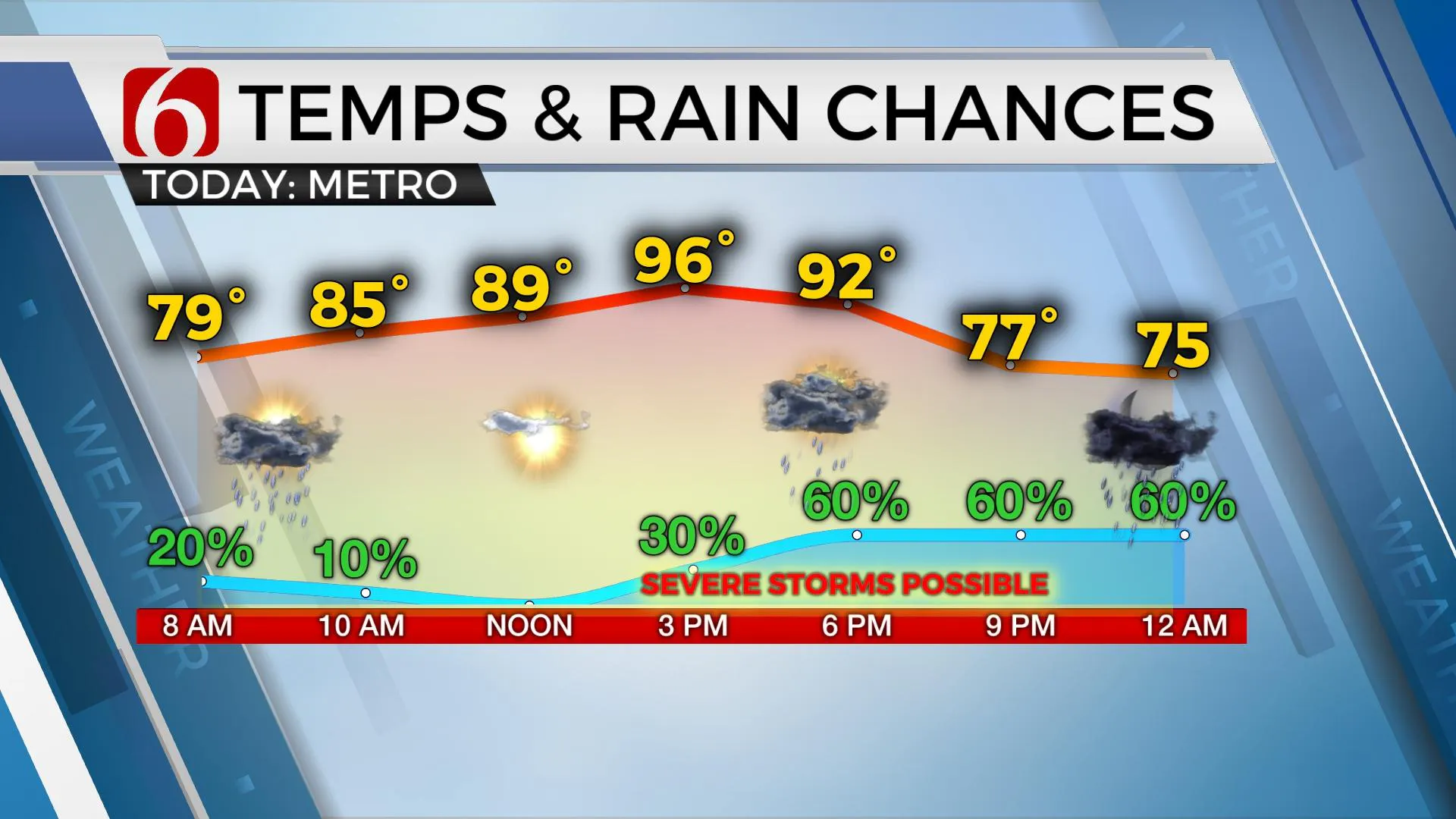
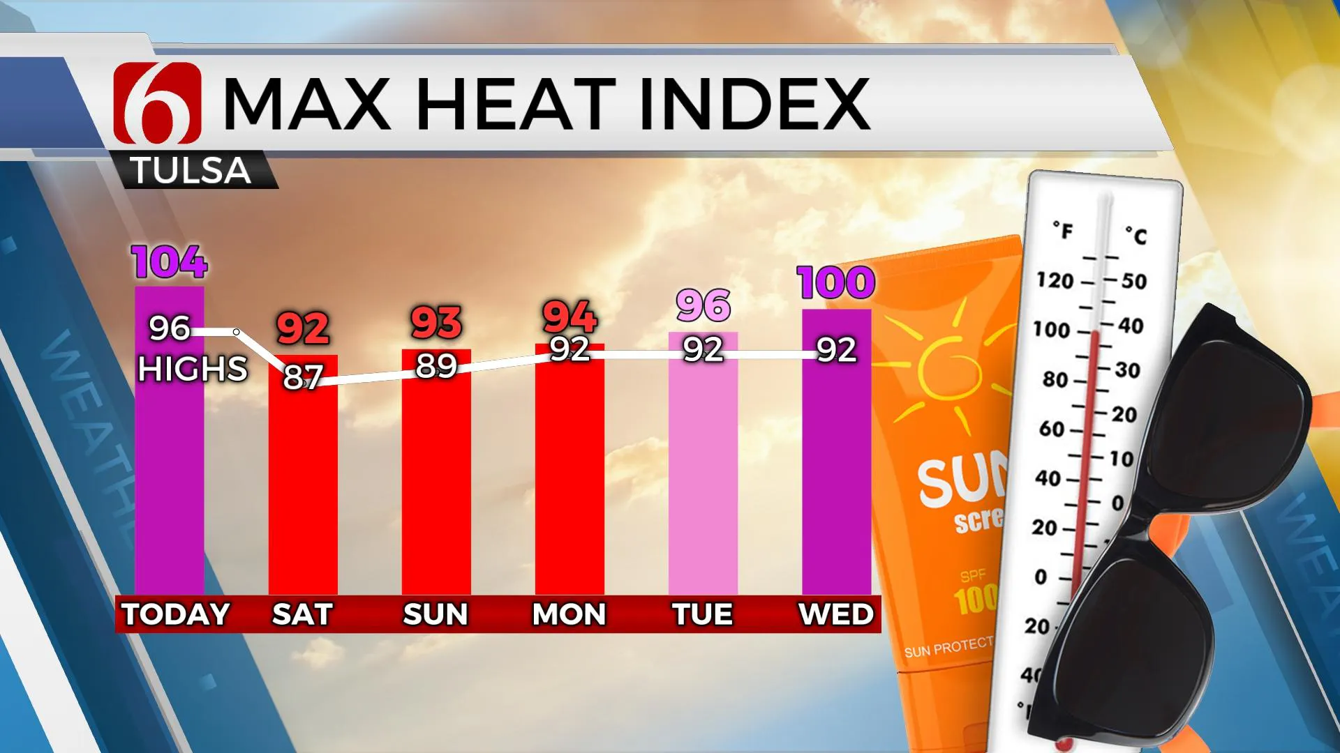
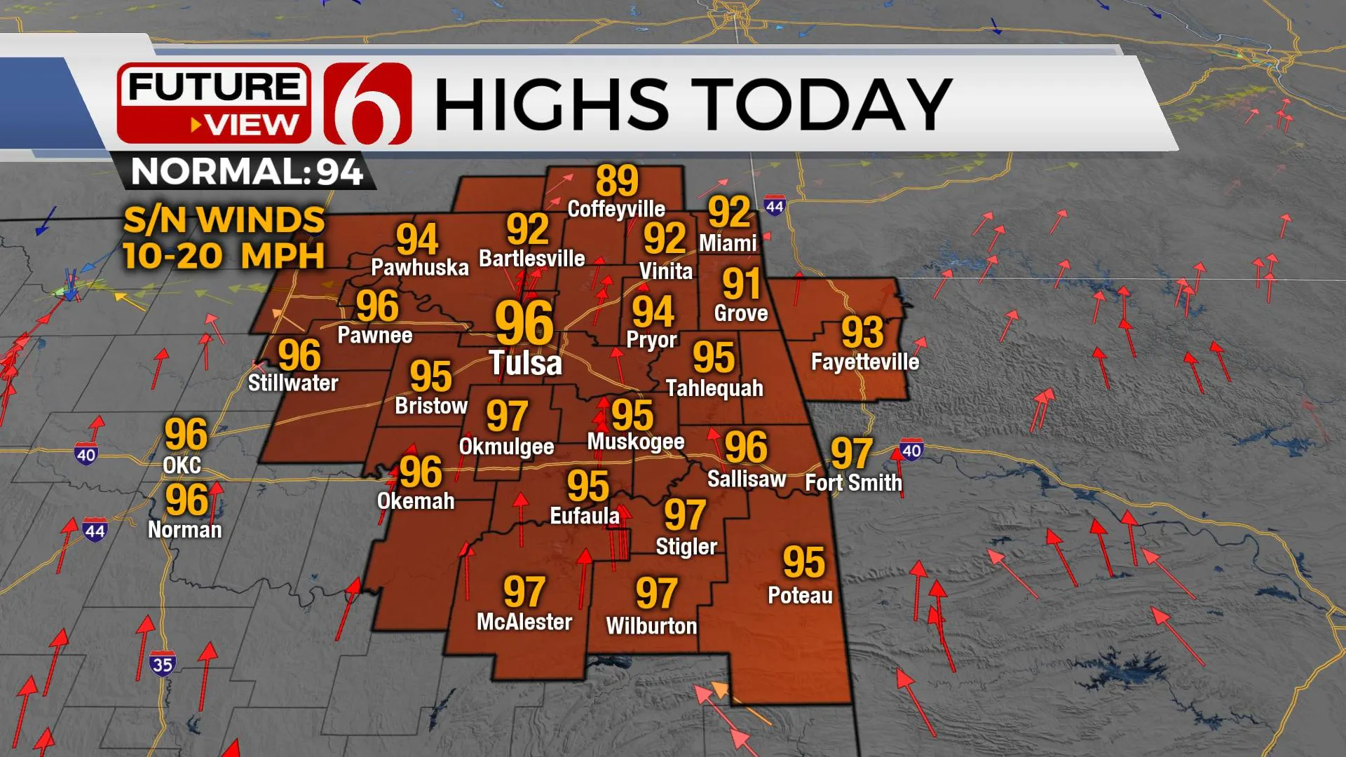
The hard part today is distinguishing between how much influence outflows and the real cold front will have on temps and moisture regarding potential heat advisory issues. These boundaries will also play a role in thunderstorm development over the next few days. The first boundary (outflow) should be entering northern OK this morning to midday and could spark off a few scattered showers and storms, more so along the OK-Kansas state line region, but we’ll have a slight chance in the metro, even this morning. The eventual stopping spot of this outflow should also allow low-level moisture to gather and pool near and south. It's these areas that could still experience heat index values around 105 to 108 this afternoon before some scattered storms develop and provide localized relief. At this point (330am) it appears locations near I-40 south and east of highway 69 may see another heat advisory today. The Tulsa metro and northern OK will still have a heat index this afternoon, but we may be right on the bubble for an advisory.

The real front should arrive later this afternoon into the evening triggering a few more scattered storms by this afternoon into tonight. A few storms will be capable of damaging downbursts of winds, some locally heavy rainfall and maybe some hail in spots. Some data has been suggesting a weak disturbance moving across the boundary later tonight that could fire up a small cluster of storms near and behind the front through early Saturday morning, but I’ll keep higher chances slightly south of the metro for Saturday morning. As of this post, I'm sticking with highs in the upper 80s Saturday afternoon with a few additional scattered storms tomorrow afternoon, mostly across southeastern OK.

Sunday the boundary will be south of our immediate area but also should be quickly weakening and becoming diffuse. East to southeast surface winds should return through the day with highs in the upper 80s or lower 90s. The data is all over the map regarding Sunday night into Monday but we're keeping some rain and thunder mentions during these periods and will continue with at least low chances early next week with lows in the lower 70s and highs in the lower 90s.

Tropical Fred continues to struggle this morning but still has time to increase back to storm status as it approaches Florida this weekend. Another strong-looking disturbance will follow in a few days, and the launching site of many potential tropical systems this time of year, coastal Africa is primed with numerous disturbances and storms ready to enter the basin. This corridor could become very active very quickly.
Thanks for reading the Friday morning weather discussion and blog.
Have a super great day!
Alan Crone
KOTV
If you’re into podcasts, check out my daily weather update below. Search for NewsOn6 and ‘Weather Out The Door’ on most podcast providers, including Apple, Stitcher, Tune-In and down below on Spotify.

More Like This
August 13th, 2021
February 14th, 2022
January 26th, 2022
January 25th, 2022
Top Headlines
December 14th, 2024
December 14th, 2024
December 14th, 2024


