A Pleasant Stretch Of Weather Ahead
Sunny skies and a pleasant, warm afternoon on Monday.Monday, October 4th 2021, 4:40 am
TULSA, Oklahoma -
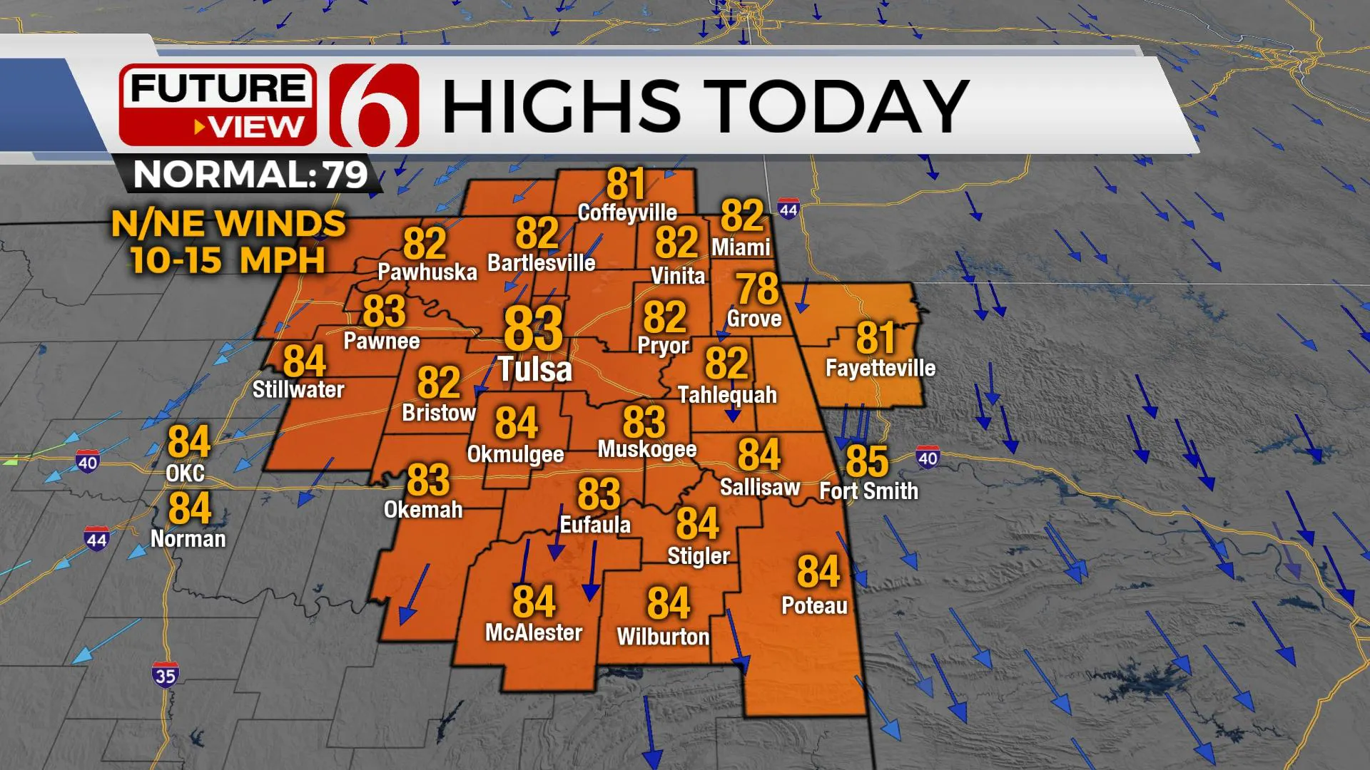
Some patchy fog is possible for the early portion of the morning across part of Eastern OK and western Arkansas due to local dew points in the upper 50s and lower 60s combining with light wind and the presence of abundant moisture from Saturday mornings rainfall. After the early morning fog, pleasant weather is likely again today with afternoon highs reaching the lower or even mid-80s with north winds and a reinforcing shot of dry air by the afternoon. Most of the week will remain void from any impactful weather events despite the nearby location of a closed upper level low to our east. This feature will lift northeast by Thursday with a developing southwest upper flow arriving for the weekend and increasing temps well above seasonal averages. We may take another run at a 90-degree afternoon high temp for part of the upcoming weekend before a more typical active upper airflow brings several systems into the nation the week of Oct 11th.

A broad area of low pressure is located to our northeast this morning and is diving southward today. This disturbance dives southward on the backside of the near cut-off low already positioned to our east across part of Arkansas and Louisiana. This broad low brings more influence of showers near and east of the low for the next few days. A few showers may wrap around the northwest side of the low Wednesday and briefly impact far northeastern OK and northwestern Arkansas for a few hours of light showers, but the probability remains very low. By the middle of the week, another deepening trough across the western U.S. will kick our cut-off low back into the flow and help to accelerate this system away from the region.

As we move into the weekend, a series of disturbances will round the base of the main western U.S. trough and provide active weather across the intermountain region and the central to northern high plains into early next week. At least one, possibly two powerful surface lows are expected to develop during this period. This should bring gusty south winds into the state Friday through the weekend with increasing heat and fire danger issues. Low-level moisture will be slow to return but should be nearing the state Sunday as a storm system influences our weather with storm rain and storm chances Sunday evening into early Monday morning. This will bring more active weather beginning of the week of Oct 11th as several systems are expected to bring active weather ranging from snow in the Rockies to severe weather threats across the central plains states.
Thanks for reading the Monday morning weather discussion and blog.
Have a super great day!
Alan Crone
KOTV
If you’re into podcasts, check out my daily weather update below. Search for NewsOn6 and ‘Weather Out The Door’ on most podcast providers, including Spotify, Stitcher, Tune-In and down below on Apple.

More Like This
October 4th, 2021
February 14th, 2022
January 26th, 2022
January 25th, 2022
Top Headlines
December 14th, 2024
December 14th, 2024
December 14th, 2024


