Nearing Record Highs Later This Week
Once again, we’ll start with some patchy dense fog across part of southern Oklahoma this morning with some locations near or below freezing.Wednesday, December 22nd 2021, 9:24 am
TULSA, Oklahoma -
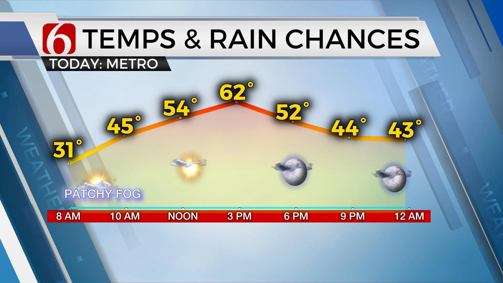
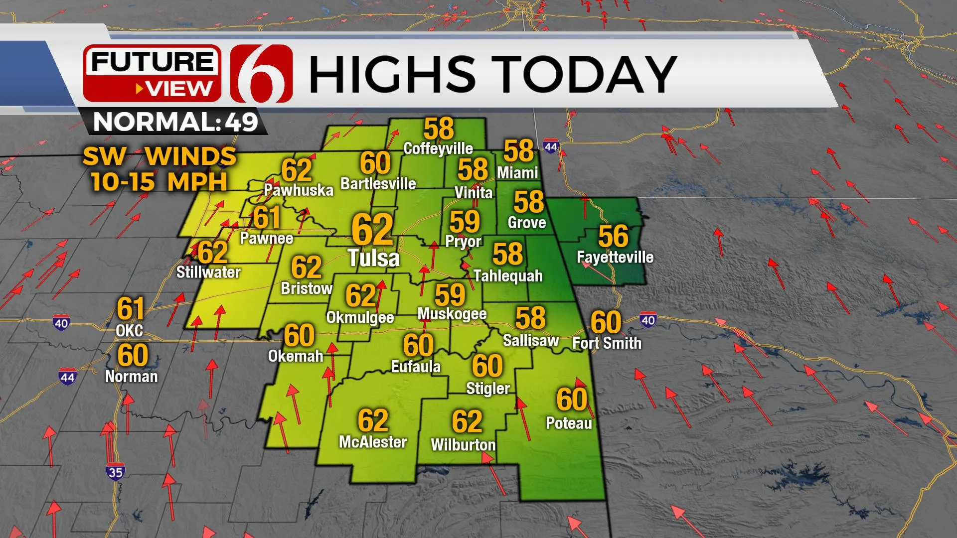
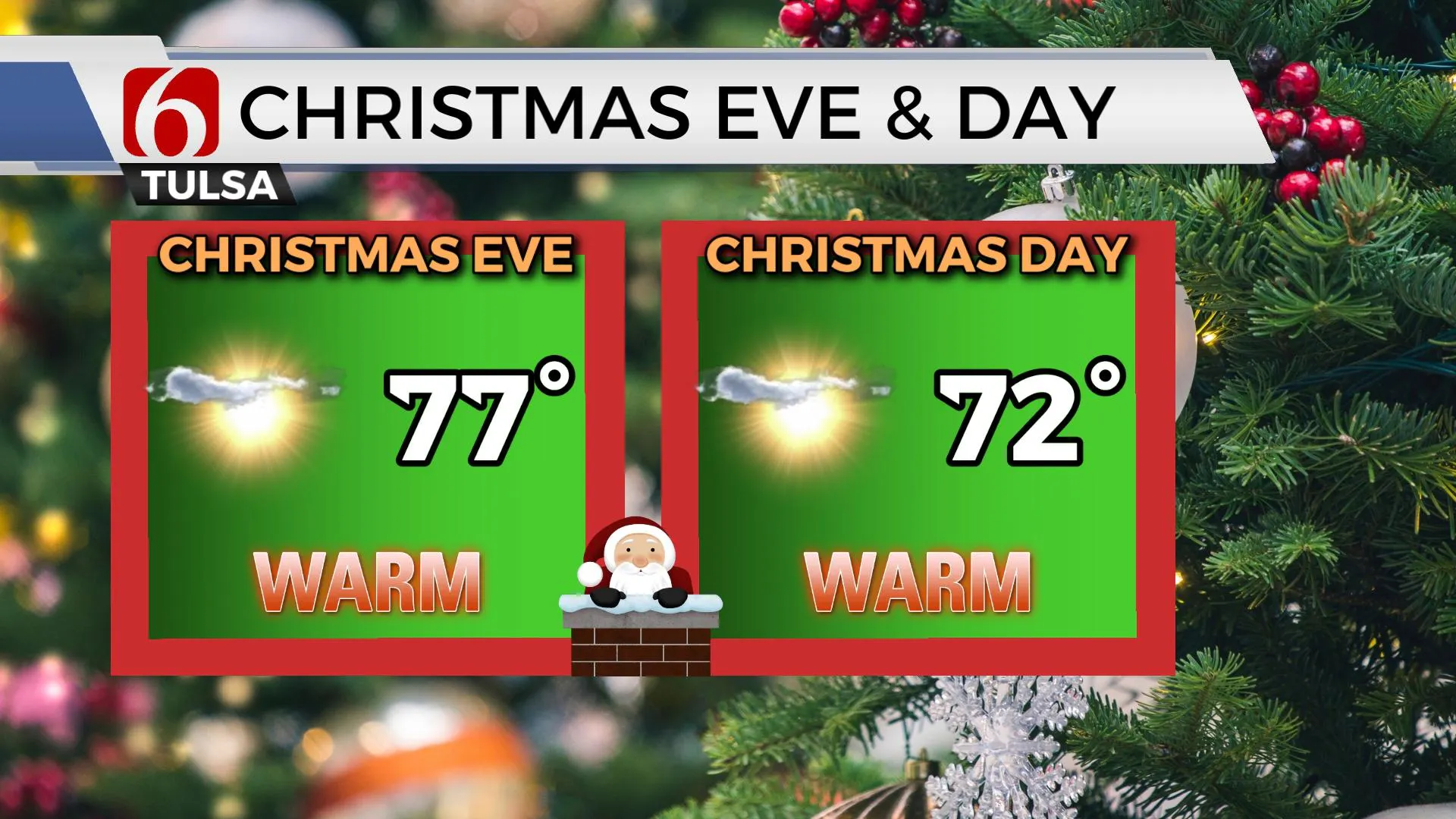
Once again, we’ll start with some patchy dense fog across part of southern Oklahoma this morning with some locations near or below freezing. While not expecting widespread issues, one or two slick spots will be possible on elevated surfaces such as bridges or overpasses through the early morning hours can’t be ruled out. This is an extremely low probability. Later today we’ll experience the continued warming trend with afternoon highs reaching upper 50s east and lower 60s near Tulsa westward. The trend of above normal readings will continue through the end of the week with upper 60s Thursday and into the mid to upper 70s Christmas Eve. A weak front enters the area Saturday but will have minor impacts for Christmas Day. We’ve adjusted the afternoon highs upward with many locations reaching the lower 70s near and south of the metro. A few spots along the OK-Kansas state line region may drop into the 60s with north winds by Christmas afternoon. The warming trend will remain for early next week before the polar jet begins migrating more southward and the southern stream continues to offer storm systems near the plains.

A strong short wave should move across the central plains this weekend with a series of surface lows developing and scooting across the state. The first of these will arrive Sunday evening bringing a slight chance for a shower or storm across far northeastern OK and southeastern Kansas. We’ll keep low chances along the state line region from Sunday late exiting early Monday morning.
The second low arrives Tuesday. Low-level moisture will be pooling across the far southeastern OK region and it's these areas that will support a mention for a few storms Tuesday into Wednesday. Temps throughout this period will remain above seasonal averages.

By the middle to end of next week, most data also suggest a surge of arctic air across part of Canada into the northern U.S. with the potential for colder weather to move southward into the plains by the start of the New Year. While much of this cold air mass stays north, the pattern and climatology suggest the potential for some of this to sneak down into the central plains.

Thanks for reading the Wednesday morning weather discussion and blog.
Have a super great day!
Alan Crone
KOTV
If you’re into podcasts, check out my daily weather update below. Search for NewsOn6 and ‘Weather Out The Door’ on most podcast providers, including Apple, Stitcher, Tune-In and down below on Spotify.

More Like This
December 22nd, 2021
February 14th, 2022
January 26th, 2022
January 25th, 2022
Top Headlines
December 11th, 2024
December 11th, 2024
December 11th, 2024


