A Warm, Windy Christmas Eve
The calendar and weather pattern will not match today as strong southwesterly winds combined with mid-level warming will bring unseasonably warm weather, near-record highs across part of the area.Friday, December 24th 2021, 8:28 am
TULSA, Oklahoma -
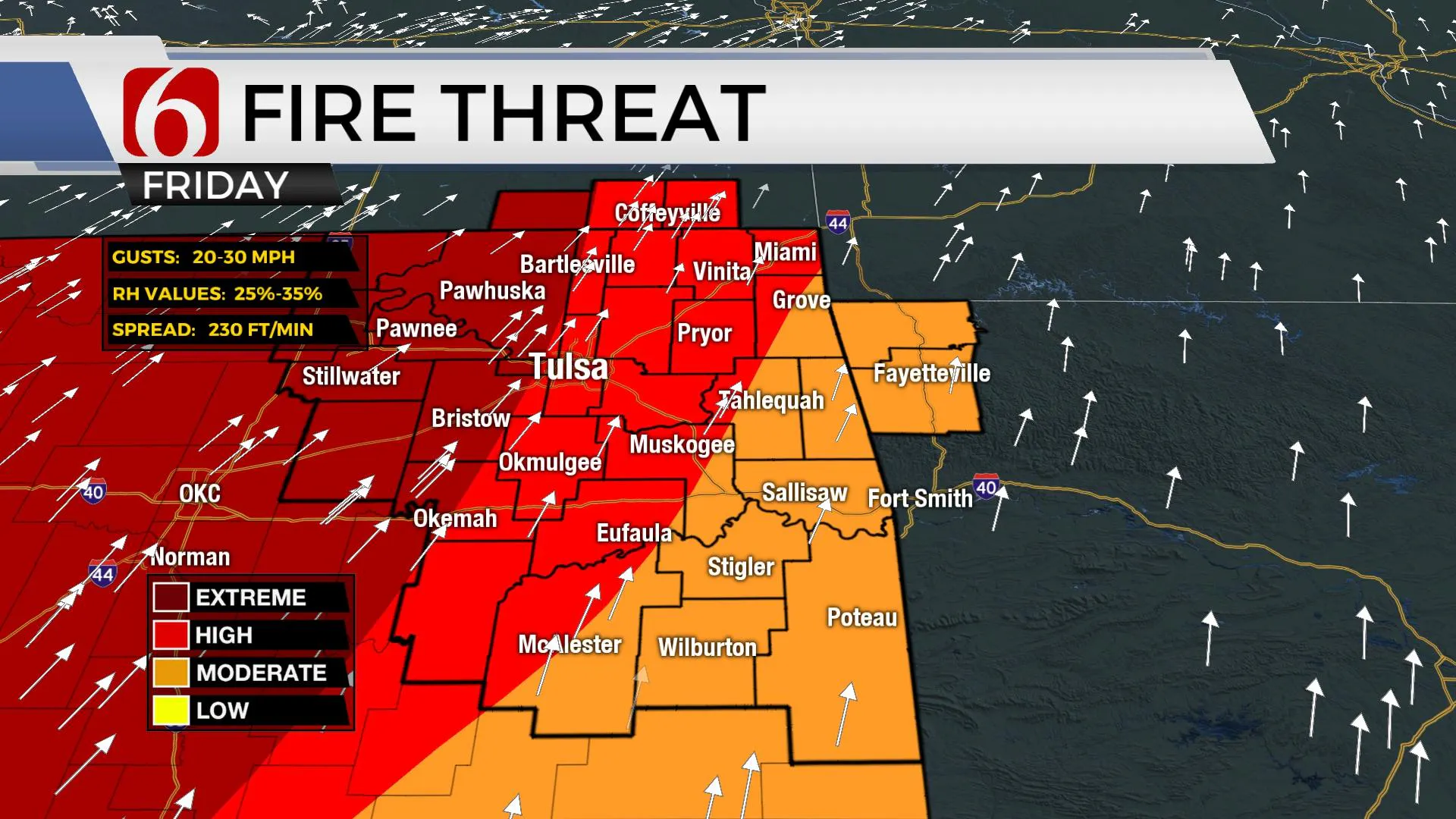
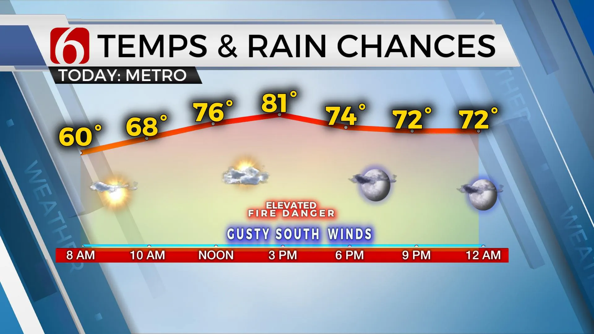
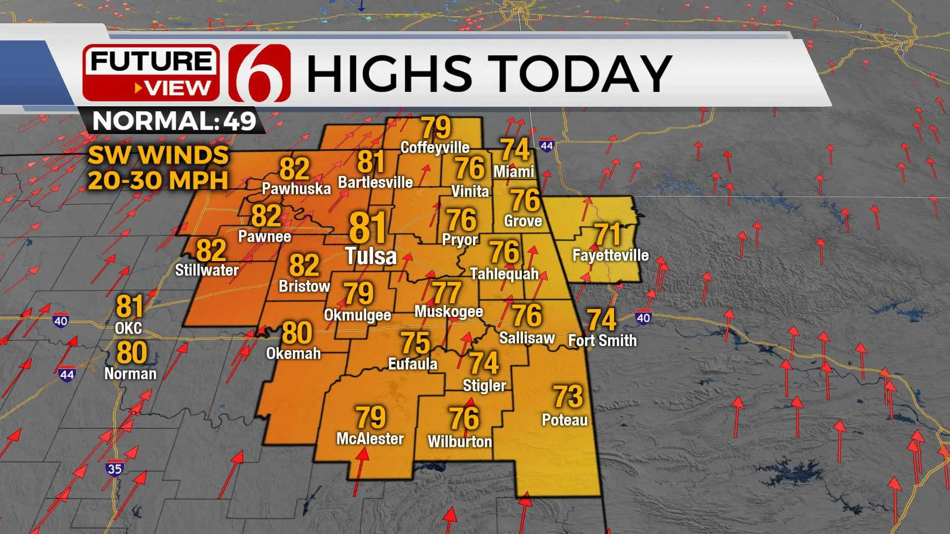
Welcome to Christmas Eve! The calendar and weather pattern will not match today as strong southwesterly winds combined with mid-level warming will bring unseasonably warm weather, near-record highs across part of the area. Highs this afternoon are still scheduled to reach the mid-70s east to the lower 80s from Tulsa west, with mid to upper 80s likely across far southwestern OK this afternoon. A dry line will likely become notable from near the Tulsa metro with locations westward capable of humidity values near or below 30% for the bulk of the afternoon.

These environmental conditions will bring a rapid-fire spread rate across the western and central OK to the Tulsa metro. Please refrain from outdoor burning today. A weak cold front enters the area early Christmas Day and moves southward into southern OK. This will bring north winds and highs in the upper 60s and lower 70s for the afternoon. This boundary will return northward late Sunday as the next in a series of upper-level waves will move across the central plains. Gusty south winds will quickly return Sunday with afternoon highs once again reaching the mid to upper 70s as a strong surface area of low pressure moves from the central plains into the upper Midwest. Most of the impact with this system stays away from our area, but there may be one or two showers east of Independence across far southeastern Kansas into southwestern Missouri. As this low ejects, another front moves across the area Monday morning with afternoon highs staying the upper 60s along with north winds.

Another stronger wave moves into the plains Monday into early Tuesday and effectively brings the Monday front northward as a warm front Tuesday morning. As this occurs, low-level moisture will begin moving northward and a few showers or storms will be possible. By Tuesday night into early Wednesday morning, artic air positioned across the northern half of the nation will surge southward, and the leading edge of colder air will arrive sometime Wednesday across our immediate area. This will bring temps back down to near and below the seasonal average. Any showers or storms will be confined to far southeastern OK Wednesday morning as this strong front moves across the state. Colder weather is likely to remain through the News Years Holiday weekend.

Thanks for reading the Friday morning weather discussion and blog.
Have a super great day!
Alan Crone
KOTV
If you’re into podcasts, check out my daily weather update below. Search for NewsOn6 and ‘Weather Out The Door’ on most podcast providers, including Apple, Stitcher, Tune-In and down below on Spotify.

More Like This
December 24th, 2021
February 14th, 2022
January 26th, 2022
January 25th, 2022
Top Headlines
December 15th, 2024
December 15th, 2024
December 15th, 2024
December 15th, 2024


