Weekend Warm-Up On The Way For Green Country
It's been a chilly week, but that long-awaited weekend warmth is almost here!Friday, January 28th 2022, 10:03 am
TULSA, Oklahoma -
It's been a chilly week, but that long-awaited weekend warmth is almost here!
Before that warm-up, jacket weather will stick with us for one more day. Highs will climb back to the upper 40s this afternoon from Tulsa to the south with a brisk northwest breeze. Temperatures will stay a bit chillier in extreme northeastern Oklahoma where additional clouds will hold highs in the lower 40s.
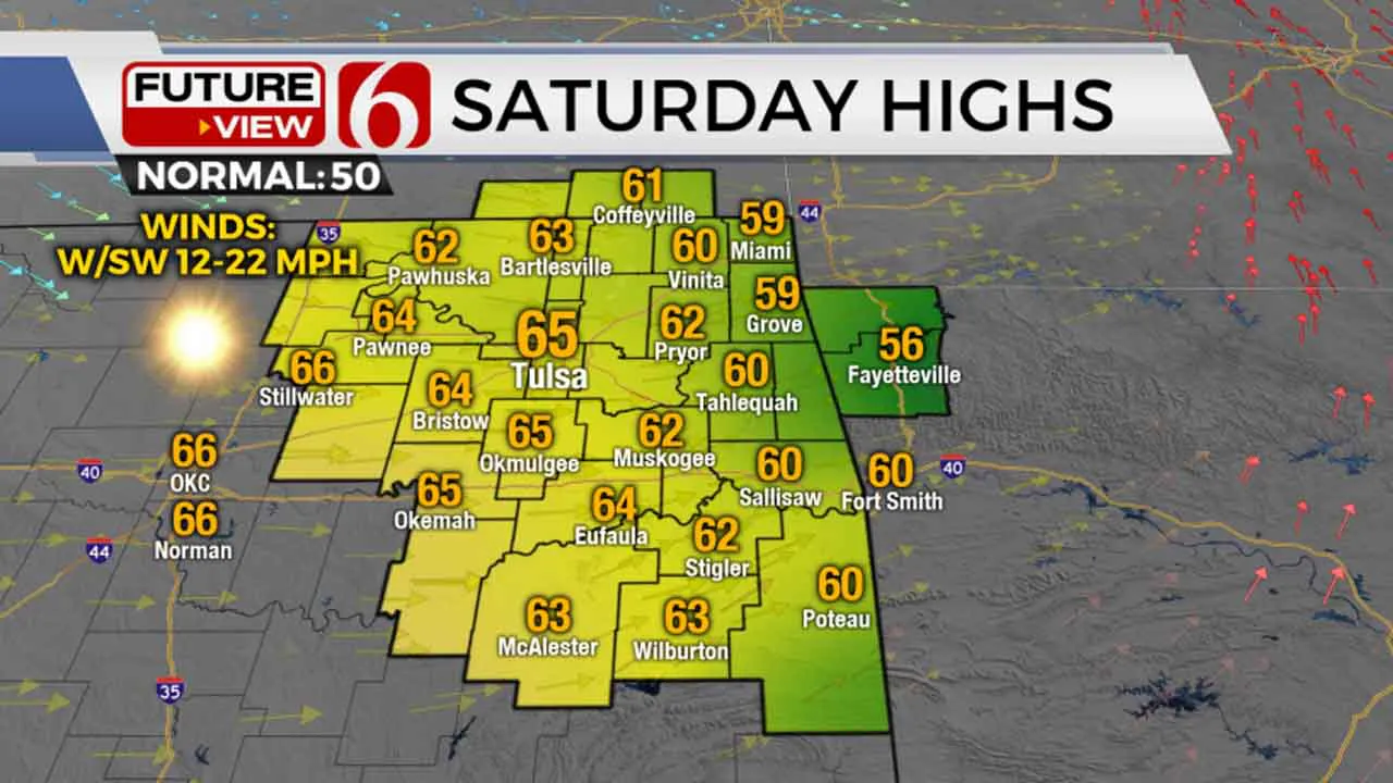
We've been saying it all week: Make outdoor plans for the weekend! A return to a southwest breeze Saturday will usher in a major warm-up. We'll soar into the lower to mid-60s Saturday afternoon with plenty of sunshine. The only drawback will be the return of elevated fire danger Saturday with those southwest winds gusting over 20 miles per hour.

Sunday will be just a hair cooler but still beautiful with sunshine, lighter northeast winds, and highs in the upper 50s. South winds kick back in Monday, and that'll kick our highs back into the 60s once again to start off the week.
As we head into the beginning of February next week, the weather pattern is going to take another very cold turn. A strong surge of Arctic air takes aim at the Southern Plains by the middle of the week, with an extended stretch of sub-freezing temperatures returning. Some wintry precipitation looks to be in the cards as well from Wednesday into Thursday, although there are still a lot of moving parts to sort out. Continue to check back over the next several days for updates!
I hope you have a great Friday, Green Country! You can follow me on Twitter @StephenNehrenz as well as my Facebook page Meteorologist Stephen Nehrenz to stay up to date with the very latest.
More Like This
January 28th, 2022
June 21st, 2023
June 19th, 2023
June 13th, 2023
Top Headlines
December 15th, 2024
December 15th, 2024
December 14th, 2024


