Shower Chances Ending
A few scattered showers remain possible on Thursday morning before the heat and humidity return to Green Country.Wednesday, August 10th 2022, 6:00 am
TULSA, Oklahoma -
A few scattered showers remain possible on Thursday morning before the heat and humidity return to Green Country.
Here are the details from News On 6 Meteorologist Alan Crone:

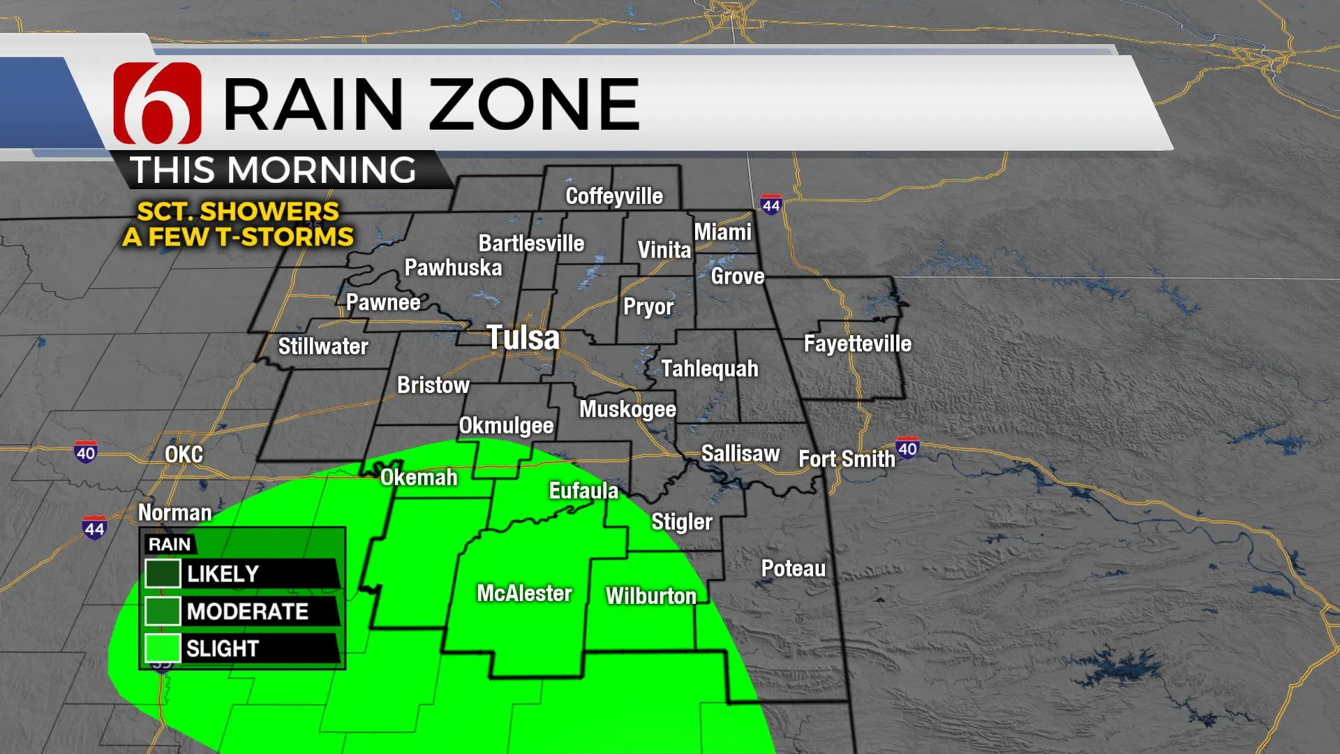
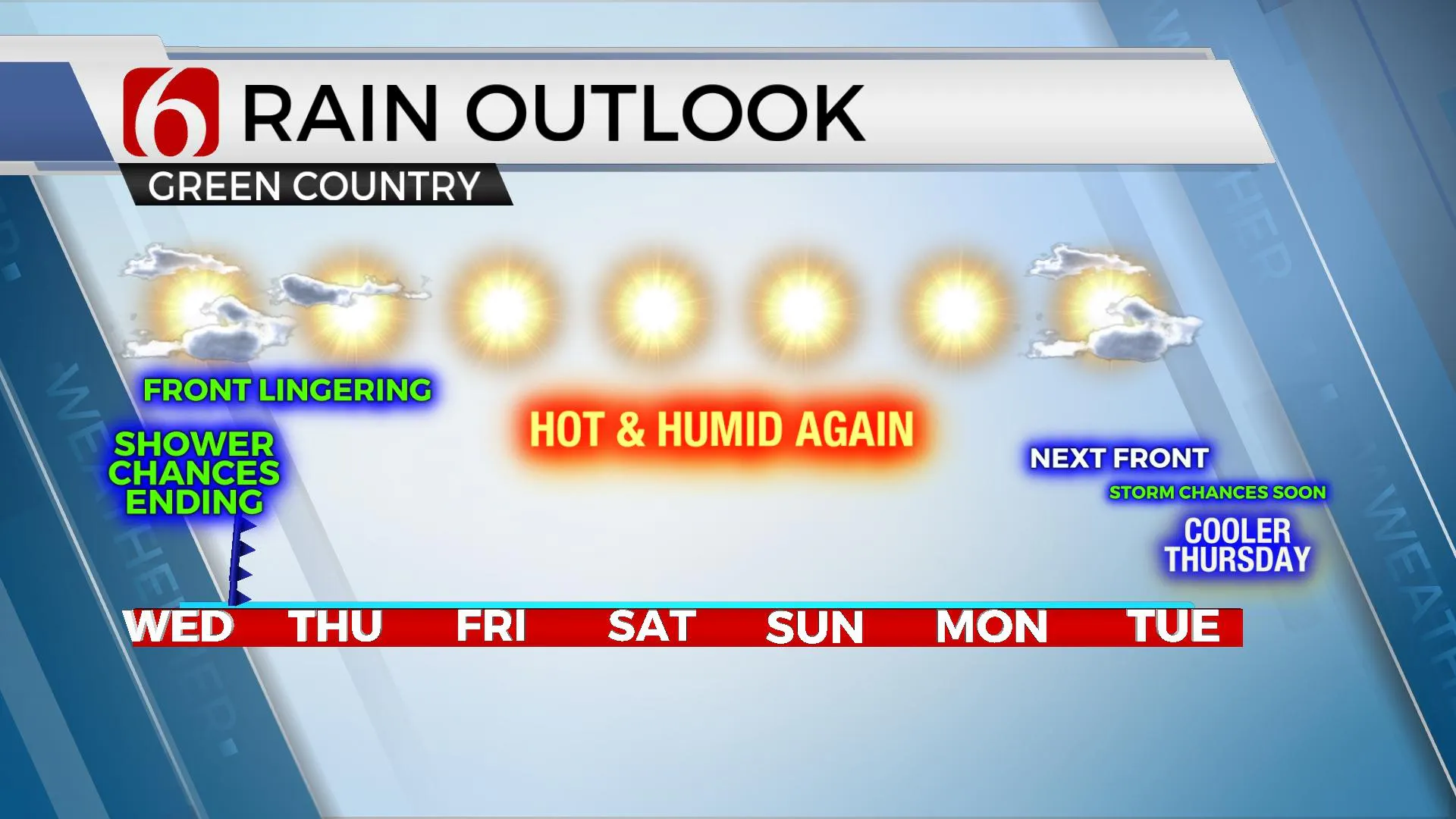
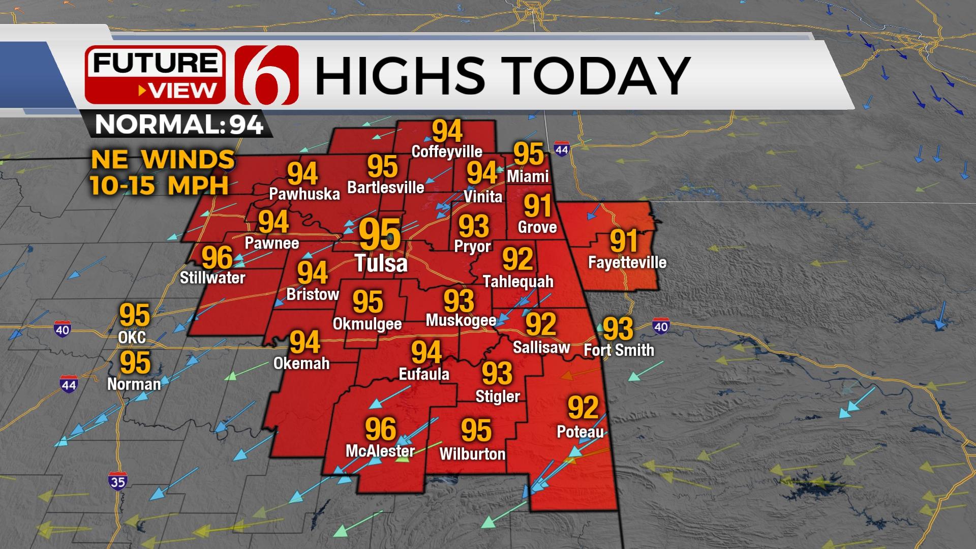
A few leftover scattered showers and storms will remain for the early morning hours, mostly along and south of I-40, before transiting into the Red River Valley. Locally heavy downpours will remain possible in those very few areas that receive activity this morning. By afternoon, the more favorable locations for additional storm development will remain across the Red River Valley into northern TX, but a few stray storms will be possible along highway 270 in southeastern OK. As the weak front move south this morning, slightly drier air filters into far northern OK midday to afternoon with deeper moisture along I-40 southward. We'll have some minor relief across the northern areas today, but afternoon highs will still be in the 90s with northeast winds near 10 to 15 mph. The winds return from the south later tonight into Thursday with any additional storms remaining across extreme southern OK both Thursday and Friday. Most of our area of concern will remain dry, starting today.

The center of the mid-level ridge is located across the Rockies today and expands eastward during the remainder of the forecast period bringing more heat and humidity into the state later in the weekend. Afternoon highs will eventually return into the mid-90s Friday and upper 90s near 100 this weekend. Recent rainfall will keep temps down slightly from where they could reach with this pattern, but heat index values will also increase, possibly reaching heat advisory criteria early next week. The positioning of the ridge will remain favorable for some additional storm chances by the middle of next week when another cold front attempts to move south into Oklahoma either Tuesday or Wednesday with more storm chances and a notable reduction in temperature.

The Atlantic hurricane season has been quiet but may soon awaken from its slumber. Conditions seem to be more favorable for tropical development soon. I’ll have more about this tomorrow.
Thanks for reading the Wednesday morning weather discussion and blog. And thanks for listening to the morning podcast update.
Have a super great day!
Alan Crone
KOTV
If you’re into podcasts, check out my daily weather update. Search for NewsOn6 and ‘Weather Out The Door’ on most podcast providers, including Spotify, Stitcher and Tune-In, or Click Here to listen on Apple Podcasts
More Like This
August 10th, 2022
June 21st, 2023
June 19th, 2023
June 13th, 2023
Top Headlines
December 15th, 2024
December 15th, 2024
December 14th, 2024


