Rising Temperatures For The Weekend
A hot weekend is ahead as the intense summer heat continues across Green Country.Friday, August 12th 2022, 5:44 am
TULSA, Okla. -
A hot weekend is ahead as the intense summer heat continues across Green Country.
Here are the details from News On 6 Meteorologist Alan Crone:

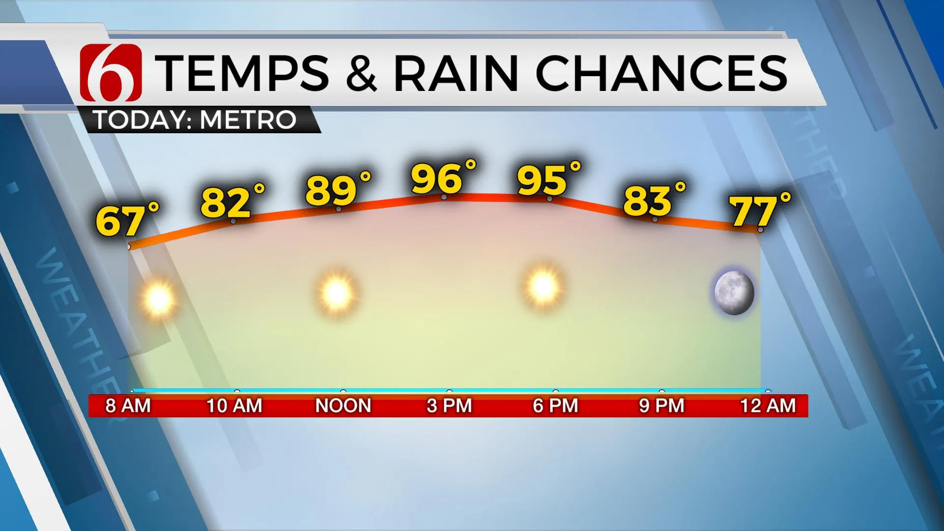
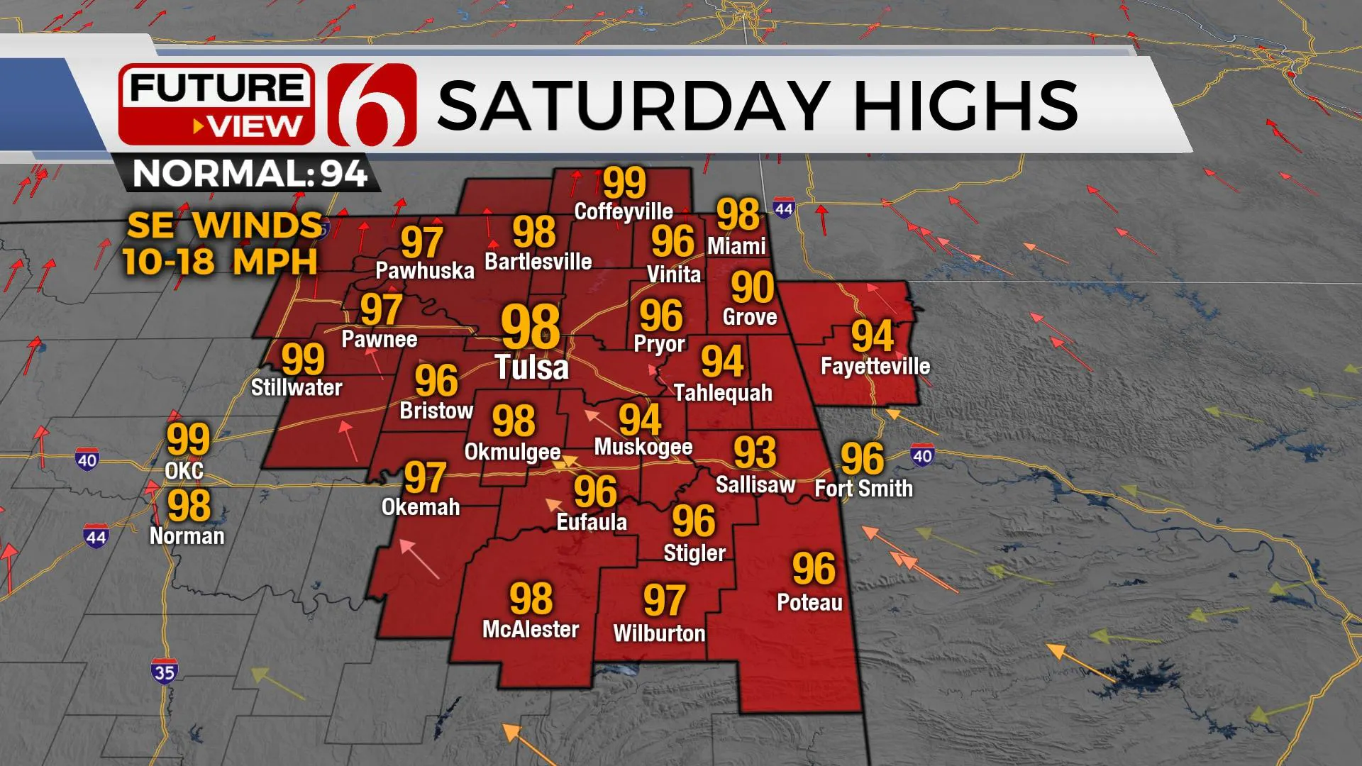
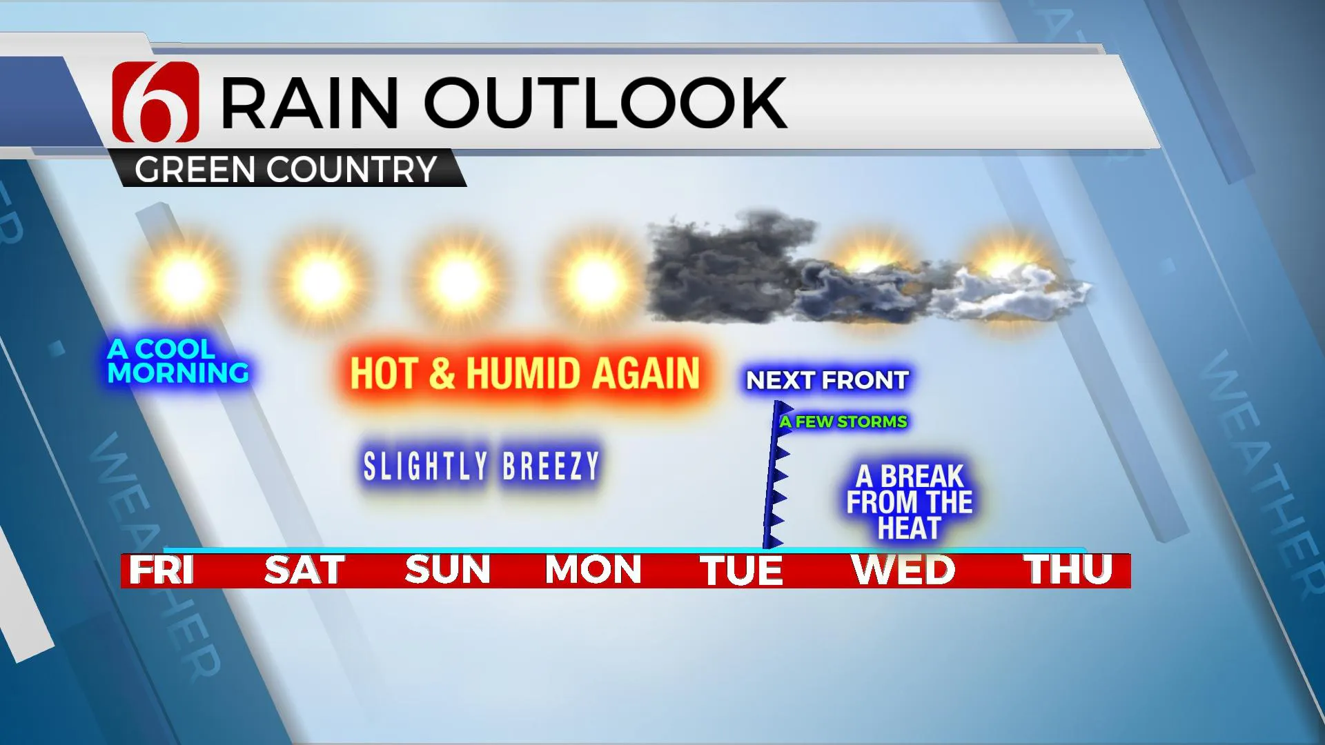
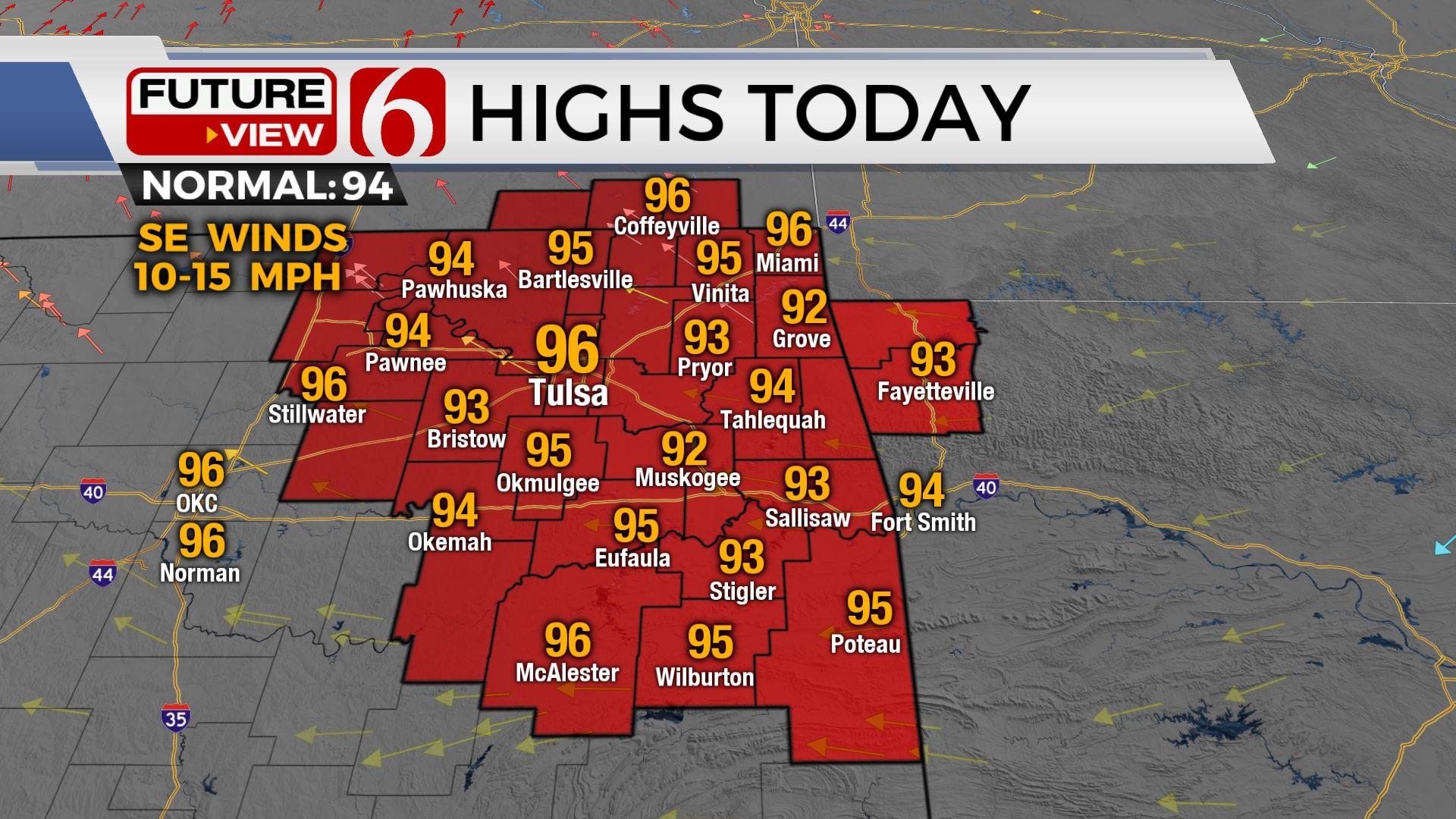
Dry low-level air has allowed morning temps in the 60s north and lower 70s south this morning. A very few locations may briefly drop to 59 right before sunrise before temps quickly rise into the mid and upper 90s by afternoon. Southeast winds return later today from 10 to 15 mph with full sunshine. The weekend will support a return of hot weather with Saturday afternoon highs in the upper 90s and triple digits likely Sunday through Tuesday before the next front enters the area bringing storm chances and some reduction in temps for the middle of next week.

The pattern early next week features an unseasonably strong upper air trough across Hudson Bay Canada and the mid-level ridge southwest of the state. The flow brings a cool Canadian air mass into the northeastern U.S. for several days next week. The leading edge of this front enters Oklahoma either Tuesday or Wednesday with storm chances and some slightly cooler weather for Wednesday and Thursday. The more significant cool-down will remain well northeast, but we’ll anticipate highs dropping into the 80s Wednesday and near 90 Thursday as the front remains near the area.

Slightly breezy southwest surface winds are likely to slowly develop Sunday. Despite recent rainfall and some increasing humidity values, fire spread rates will increase. Numerous counties continue with burn bans.
Thanks for reading the Friday morning weather discussion and blog.
Have a super great day!
Alan Crone
KOTV
If you’re into podcasts, check out my daily weather update. Search for NewsOn6 and ‘Weather Out The Door’ on most podcast providers, including Spotify, Stitcher and Tune-In, or Click Here to listen on Apple Podcasts.
More Like This
August 12th, 2022
June 21st, 2023
June 19th, 2023
June 13th, 2023
Top Headlines
December 15th, 2024
December 15th, 2024
December 14th, 2024


