A Hard Freeze Tonight Before Another Big Weekend Warm-Up
The plains states, including Oklahoma will be on the backside of the trough with a persistent northerly flow today and tomorrow before changing later this week.Tuesday, October 18th 2022, 5:44 am
TULSA, Okla. -
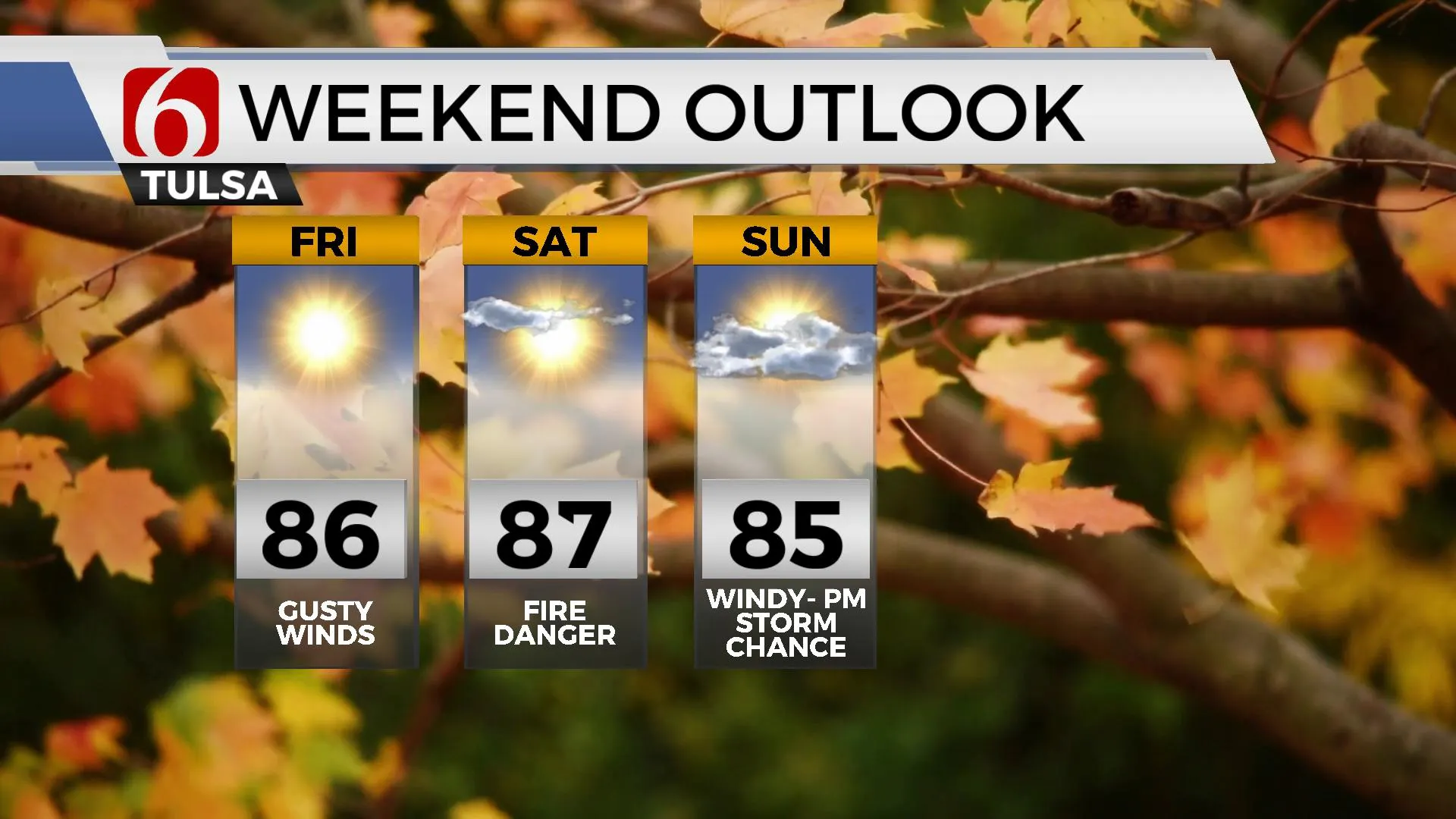
The upper air pattern continues with a deep, broad upper trough across the Great Lakes and a ridge positioned across the pacific northwest. The plains states, including Oklahoma will be on the backside of the trough with a persistent northerly flow today and tomorrow before changing later this week. A chilly Canadian ridge of high pressure is dropping southward and will be nearing northeastern Oklahoma this afternoon and tonight. This will bring the coldest air of the early fall season before quickly moderating Thursday. A pattern change occurs this weekend as the Great Lakes trough moves east and a new trough arrives across the pacific northwest. This brings much warmer weather into the southern plains with weekend highs reaching the mid-80s. Strong southwest winds are likely Saturday and especially Sunday. Fire danger spread rates will once again increase across the state with increasing fire danger threats before our next storm system brings storm chances into the area late Sunday night into early next week. The period directly before low level moisture arrives will correspond with gusty winds and unseasonably warm weather. The continuing drought and combination of vegetation becoming dormant will support the potential for a very high fire danger.
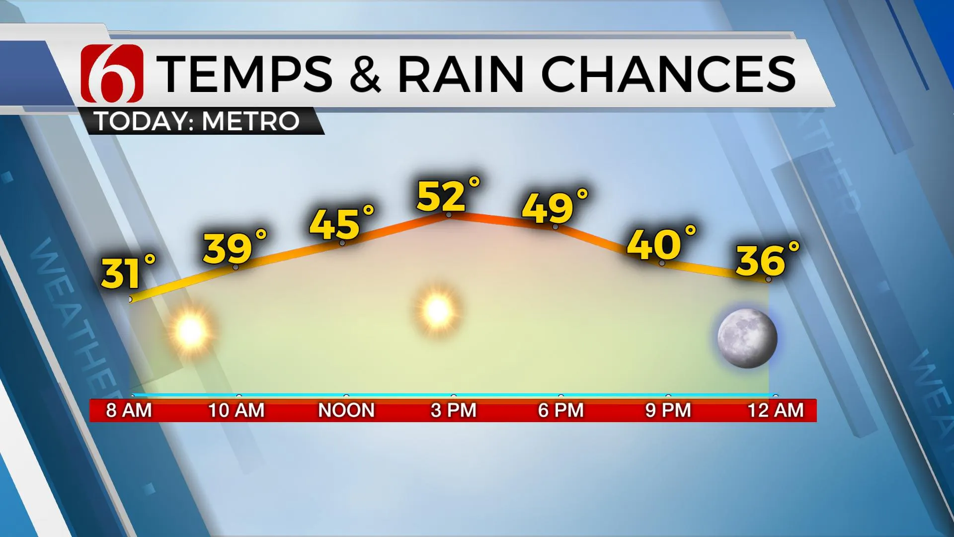
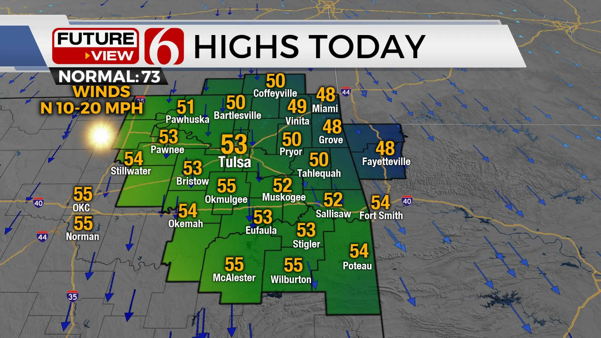
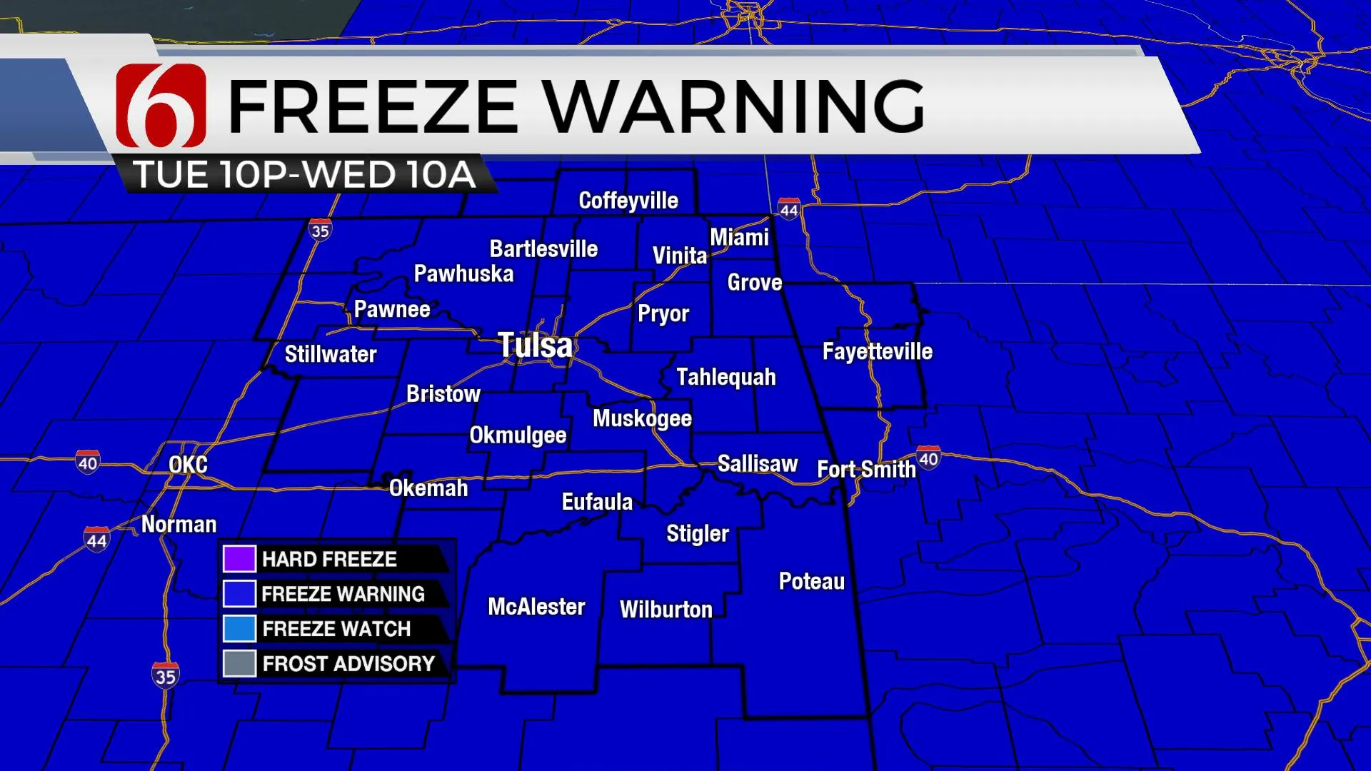
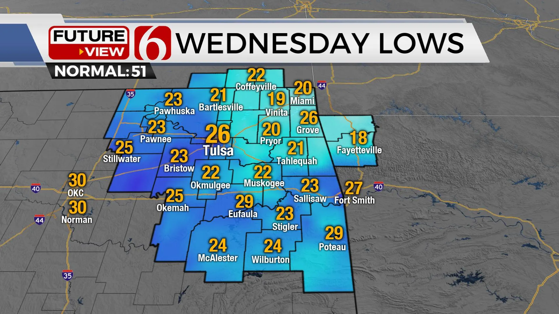
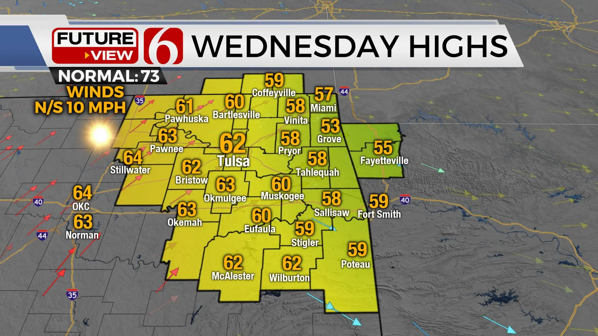
Temperatures this morning will drop into the upper 20s and lower 30s for most of the area. Colder air aloft impacts northeastern Oklahoma today and will support daytime highs in the lower 50s north and mid 50s south along with breezy north winds from 10 to 20 mph. We’ll experience some minor wind chills this afternoon. As the ridge drops south, much colder weather is likely. Extremely dry low-level air arrives this afternoon and will allow for a hard and killing freeze areawide overnight into Wednesday morning across the eastern third of the state. This will effectively end the growing season. Wednesday afternoon highs will rebound into the lower 60s with sunshine and light winds. Thursday afternoon highs should reach the mid-70s with southwest winds at 10 to 15 mph. Unseasonably warm and windy weather arrives this weekend with daytime highs in the mid-80s. Wind advisories are possible Saturday but likely by Sunday afternoon.
The next system should arrive Sunday late into early next week. The question remains on the quality and depth of moisture return ahead of the system. For now, we’ll continue with a 30% chance Sunday late into a 40% probability Monday. Strong dynamic energy is likely to be nearby early next week.
Thanks for reading the Tuesday morning weather discussion and blog.
More Like This
October 18th, 2022
December 15th, 2024
December 15th, 2024
December 15th, 2024
Top Headlines
December 15th, 2024
December 15th, 2024
December 15th, 2024
December 15th, 2024


