Weekend Warmup To Summerlike Temps
Oklahoma Weather Forecast: Bookmark this page and refresh it often for the latest forecast and daily updates.Thursday, May 16th 2024, 10:34 pm
TULSA, Okla. -
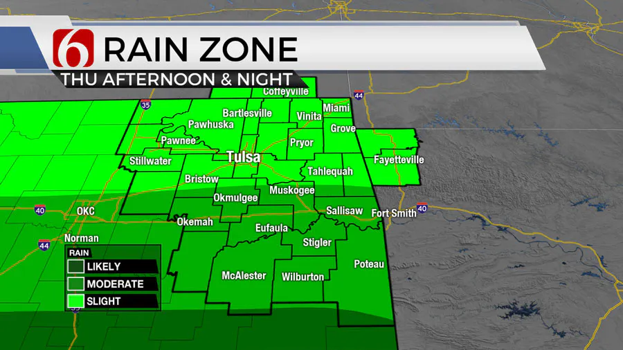
A weak boundary moving south should provide a focus for new development later Thursday and early evening, primarily along and south of I-40, where localized heavy rainfall could occur.
While a few strong thunderstorms may produce wind and hail, severe threats are likely to be more pronounced southward in Texas, or eastward in Arkansas.

The primary upper-level trough, driving this active weather, remains close by Thursday morning and is expected to move away from the region by Friday midday.

There are some discrepancies in data regarding the precise location of another round of showers and storms on Friday morning, but chances remain good for the early hours until the driving forces dissipate into the afternoon and evening.
What will the weather be like this weekend in Oklahoma?
The weekend will see a shift to early summer-like conditions as the subtropical mid-level ridge extends from southern Texas into Oklahoma. Southerly winds between 15 to 25 mph will bring increased low-level moisture to the area. Afternoon temperatures are set to reach the upper 80s, with heat index values possibly in the lower 90s.

From Sunday into the early part of next week, the upper atmospheric pattern is likely to foster more severe weather threats across the central and southern plains. A large upper trough will sit over the southwestern United States, with strong upper air flow from the southwest to northwest over the region. This setup, coupled with sufficient moisture and rising surface instability, could lead to severe weather events.
A weak surface boundary is expected to develop and maybe stationary across southern or central Kansas Monday into early next week. A complex of storms will be possible Sunday night into Monday morning near this boundary positioned across the far northern edge of the subtropical ridge. This should create a favorable track for a complex of storms across southern Kansas.
Some of this complex may slip into northeastern OK late Sunday into early Monday morning. Otherwise, we'll be including a probability for thunderstorms Tuesday afternoon and evening as a surface boundary moves into Oklahoma coupled with the strong upper-level trough nearby. As we grow closer to next week, adjustments will be made regarding specific chances and threats.
Outages Across Oklahoma:
Northeast Oklahoma has various power companies and electric co-operatives, many with overlapping areas of coverage. Below is a link to various outage maps.
Indian Electric Cooperative (IEC) Outage Map
Oklahoma Association of Electric Cooperatives Outage Map - (Note Several Smaller Co-ops Included)
The Alan Crone morning weather podcast link from Spotify:
https://open.spotify.com/episode/5j0ovActG8BZCOTqZQzrfU
The Alan Crone morning weather podcast link from Apple:
https://podcasts.apple.com/us/podcast/weather-out-the-door/id1499556141?i=1000646589555
Follow the News On 6 Meteorologists on Facebook!

More Like This
May 16th, 2024
May 16th, 2024
May 16th, 2024
May 16th, 2024
Top Headlines
May 16th, 2024
May 16th, 2024


