Cold Front Expected Thursday In Oklahoma
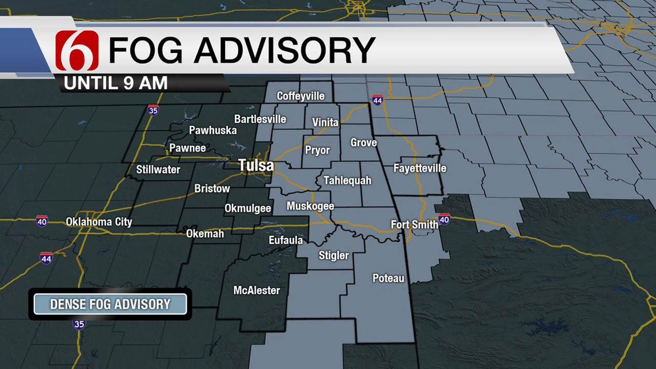
<p>Dense fog is underway this morning in a few locations near and east of the metro. Temps are near and slightly below freezing and may result in a few slick spots on elevated surfaces, more so to the east of the metro. </p>Tuesday, January 9th 2018, 3:51 am
Dense fog is underway this morning in a few locations near and east of the metro. Temps are near and slightly below freezing and may result in a few slick spots on elevated surfaces, more so to the east of the metro. Please use caution again this morning while driving during the early morning hours. Our weather will quickly respond with a warming trend (if the low clouds don’t ruin the day) as afternoon highs move back into the lower and mid-50s today and possibly into the lower 60s Wednesday with windy conditions before another sharp cold front moves across the area Thursday morning.
Temps will fall Thursday morning from the 50s into the lower 30s by the afternoon along with northwest winds at 20 to 35 mph along with a slight chance of light snow showers across part of northeast Oklahoma and southeast Kansas. Another surge of arctic air will arrive late Friday night into Saturday morning bringing frigid weather back to the region that may last into next week with some moderation. The temp forecast today is challenging due to the wide variation of model output dealing with the potential for fog-stratus through the morning hours. Operational data goes from 58 to 44 regarding suggestions for afternoon highs in the metro today. The main reasoning for the next few days has not changed too much from yesterday morning’s discussion.
The split flow upper air pattern will bring another mid-level low from the Pacific westward across the southwestern U.S. and into Oklahoma Wednesday night into Thursday. The exact positioning of this feature continues to flip around quite a bit in the last few days with some runs more northward and opening and other runs more closed and across the state. As the system approaches, we may see a few showers or even thunderstorms attempt to develop across northwestern Oklahoma late Wednesday night and move ENE brushing far northeast Oklahoma and southeast Kansas around 11 pm to midnight. Thursday morning the front surges southward bringing the falling temps and strong northwest winds to the region. The main upper level system ( now ejecting into central Kansas) may still have enough mid-level moisture to produce some scattered snow showers from southeastern Kansas into far northeastern Oklahoma for a small window of time Thursday midday to afternoon as the base of the long wave trough moves over the region. No significant accumulation would occur in our area under this scenario with any impactful precip located across central Kansas. Cold air would remain Friday into the weekend with another front moving across eastern Oklahoma Saturday morning that may produce a few flurries. Next week’s operational data is not consistent at this point but chilly weather should remain for a few days.
Thanks for reading the Tuesday morning weather discussion and blog.
More Like This
January 9th, 2018
September 29th, 2024
September 17th, 2024
Top Headlines
December 12th, 2024
December 12th, 2024
December 11th, 2024
December 11th, 2024


