

Flooding Possible As Rain Moves Into Northeast Oklahoma
<p>We’re now in the beginning phase of a storm system that will bring thunderstorms back to the state along with heavy rainfall threats and the potential for strong to severe thunderstorm activity. </p>Thursday, April 20th 2017, 4:08 am


We’re now in the beginning phase of a storm system that will bring thunderstorms back to the state along with heavy rainfall threats and the potential for strong to severe thunderstorm activity.
The first part of this two-day system begins this morning with a few showers and storms moving across northeastern OK this morning and across east-central and southeastern Oklahoma later today. This activity is not expected to be severe. The better chance for heavy rainfall and some severe weather threats will arrive Friday as the main upper level system draws closer to the state.
Weather Alerts
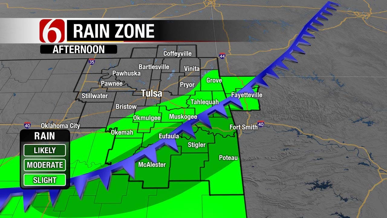
A flood watch is underway for a large portion of central and northeastern Oklahoma from Thursday night through Friday evening. This means the possibility of heavy rainfall that may lead to some flash flooding issues in some locations along with run-off that could lead to some stream-creek-river issues for a few locations. Model solutions support from 2 to near 5 inches of rainfall across the watch area before the system exits early Saturday morning. Locations south of the watch may still receive thunderstorms including some locally heavy rainfall along with severe weather threats but will not result in flooding issues. As the system exits the state early Saturday morning strong northwest winds will bring much cooler air to the region. Daytime highs Saturday may stay in the mid-50s.
The front is entering northern Oklahoma this morning and should move to far southeastern Oklahoma before stalling this afternoon or evening. After the early morning showers and storms, a few additional storms will be possible this afternoon and evening along the boundary. Later tonight into Friday morning a disturbance will move from the southwestern U.S. into the state with thunderstorms developing and moving ENE early Friday morning. The surface front will remain to our south tomorrow morning. This means thunderstorms may be elevated and could produce sporadic pockets of hail along with heavy rainfall that may require some flood warnings to be issued.
This first wave will pass the area early Friday morning. A 2nd wave may quickly follow with additional storms moving across the same areas producing more heavy rainfall. Again we expect the front to remain south of the metro but could be positioned along the I-40 area. Locations along and south of this boundary may see some severe storms, but locations across far southeastern Oklahoma may be under the influence of a CAP or warmer air aloft that will suppress thunderstorm activity.
Stay Connected With The News On 6
Finally, a surface low will move along the front into central and northeastern Oklahoma by late Friday afternoon. This process may act to bring the front northward to near or slightly south of the Tulsa metro by 2 pm to 6 pm or so. It’s during this period through the evening hours that will have the best chance for severe weather including all modes along and east of the advancing system. Current indications would place southeastern and east-central OK in a more favorable position for severe storms but the metro may still have the potential if the boundary can retreat this far north. We’re planning on the boundary staying south of the metro but it may be close.
Late Friday night the surface low will eject across northeastern Oklahoma taking the severe weather threats eastward with the frontal passage. The upper level system will be swinging across southeastern Kansas late Friday night into Saturday morning with much colder air spilling southward into the state.
While a few showers may remain Saturday morning across the area, the main impact will be the chilly air spreading southeast. Strong northwest winds from 15 to 25 mph will be likely with temps starting the 50s then falling into the 40s by mid morning and attempting to rebound back into the lower or mid 50s by the afternoon. Sunday morning a surface ridge of high pressure will center near eastern Oklahoma allowing sunny and cool weather with morning lows in the lower 40s and highs in the upper 60s or lower 70s. The next upper system will near the state by the middle to end of next week and we’ll rinse and repeat the cycle. Springtime in Oklahoma.
Thanks for reading the Thursday morning weather discussion and blog.
Have a super great day!
Alan Crone

Get The Daily Update!
Be among the first to get breaking news, weather, and general news updates from News on 6 delivered right to your inbox!
More Like This

April 20th, 2017

September 29th, 2024

September 17th, 2024

Top Headlines

December 15th, 2024

December 15th, 2024

December 15th, 2024

December 15th, 2024