

Warm, Sunny And Windy Conditions With Storm Chances Late
<p>South winds continue to howl today ahead of the next system that will bring storm chances to parts of Green Country over the next 24 hours. </p>Sunday, April 9th 2017, 9:01 am


Bad Hair Day Alert! South winds continue to howl today ahead of the next system that will bring storm chances to parts of Green Country over the next 24 hours.
Those pesky south winds won’t be dying down today, with gusts to 35 miles per hour or even higher once again expected throughout our Sunday. Hang on to your hats! Clouds will also be on the increase, with partly to mostly cloudy skies filling in as the day progresses.
Despite the increase in clouds it still looks like a relatively warm Sunday, with highs ranging from the upper 70s in cloudier areas to lower 80s where we have a bit more sunshine. The daylight hours look primarily dry across eastern Oklahoma, but storm chances will be starting to show up by the end of the day.
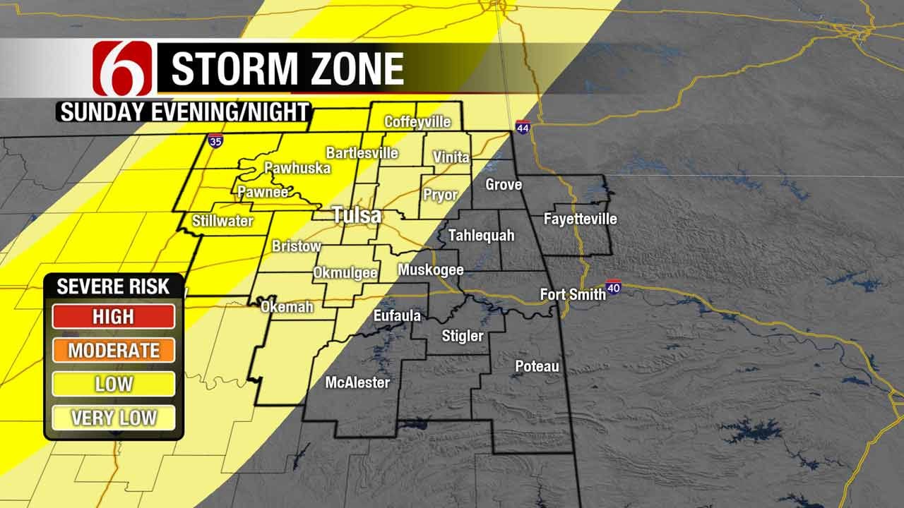
A dryline will take shape across western Oklahoma by the late afternoon hours, and there is a slight chance that one or two storms could develop across central and northern Oklahoma by early evening and move into areas west of Tulsa. However, the “cap” in the atmosphere is strong today, meaning storms could struggle to develop and there is a chance that we’ll see very few, if any, storms in the late afternoon to early evening time frame. Nevertheless, IF a storm can develop it would likely become severe with large hail and damaging winds possible, so we’ll be watching it closely!
A better chance of scattered storms arrives later tonight as a weak cold front moves into northeastern Oklahoma. Storms should develop along this front around or after midnight across far northeastern Oklahoma, moving south overnight into Monday morning. A few of these storms could be strong to marginally severe, with hail and strong winds again the primary threats.
The best chance of showers and storms will shift into southeastern Oklahoma during the day Monday, with a few areas of locally heavy rain possible south of I-40 as that weak front stalls out. Behind that front across northeast Oklahoma, we should be getting the week off to quite the pleasant start with highs in the 70s and, thankfully, MUCH lighter winds!
Areas of clouds and mild temperatures look to hang around for much of the upcoming week as we remain in somewhat of an unsettled weather pattern. Rain chances do look to increase again sometime late Wednesday into Thursday with our next storm system. And there are also signs that showers and storms could be hanging around into Easter weekend as well, so we’ll watch that closely!

Get The Daily Update!
Be among the first to get breaking news, weather, and general news updates from News on 6 delivered right to your inbox!
More Like This
April 9th, 2017

September 29th, 2024

September 17th, 2024

Top Headlines

December 14th, 2024

December 14th, 2024

December 14th, 2024

December 14th, 2024