

Warm And Windy Day Across Oklahoma
<p>The winds will be cranking up from the south again today in advance of a strong storm system that will bring a chance of storms into eastern Oklahoma tomorrow morning through afternoon. </p>Thursday, March 23rd 2017, 4:03 am


The winds will be cranking up from the south again today in advance of a strong storm system that will bring a chance of storms into eastern Oklahoma tomorrow morning through afternoon.
The fire danger will be increasing today due to the influence of the south winds in the range of 20 to 35 mph. A wind advisory may be required for locations across western and maybe central Oklahoma. Highs today will be in the upper 70's and lower 80's with partly to mostly sunny conditions. A small area of showers or a pocket of drizzle may occur this morning for an hour or two across far northern Oklahoma and southern Kansas, but this appears highly unlikely.
Stay Connected With The News On 6
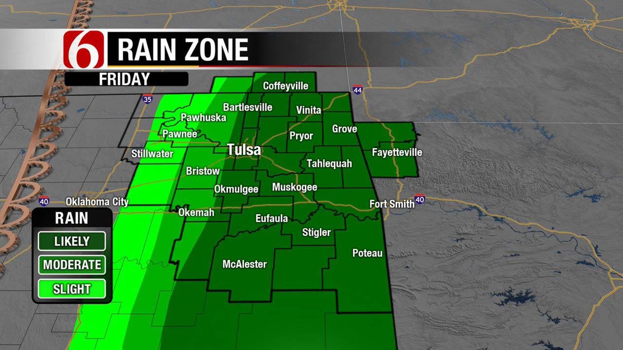
It looks like an early start time for the Friday event, and this may mitigate the overall severe weather threats downward for the metro, with a better chance of severe storms across far southeastern Oklahoma and extreme eastern sections of the state. We won’t know for sure until it begins to unfold, but the overall speed of the system and the progressive nature of the upper level system may shove the dry line rapidly eastward Friday morning to midday with storms developing quickly. The dynamic energy with this system remains quite high but the lack of surface instability and the overall shallow nature of the moisture will keep the severe threats on the low side. Some damaging wind reports and a few hailers would be possible. The better location for heavy rainfall may also be across the far southeastern and extreme eastern Oklahoma areas. One could make a decent case for lowering the probabilities for the Tulsa metro, but at this point, I’ll wait for a few more hours before making that decision. The progressive nature of the system may be too fast for a solid line of activity until it passes the metro early tomorrow morning. The upper level low will brush far NE Oklahoma and SE Kansas pre-dawn Saturday morning with a few storms, but the overall coverage is expected to remain low. At this point, my time line for tomorrow will be from 7 am to 10 am for the start time around the metro, and then from 10 am to 5 pm across eastern Oklahoma. The convective line may be exiting eastern Oklahoma around 3 pm to 5 pm, or even earlier, but the upper level core may trigger a few more scattered storms across NE Oklahoma late Friday afternoon or early evening.
The next system will quickly follow Sunday night into Monday with a surface low developing across southeastern Colorado Sunday morning and quickly dropping southeast into Oklahoma during the afternoon and evening hours. Southeast winds will return as a quasi-warm front will surge back into south central Oklahoma by the late evening hours. The wind profile, at least in the data, would be more favorable for tornadic storms Sunday night into pre-dawn Monday to our southwest, and the potential for increasing moisture across south central to southeastern OK also appears more likely during this period. This system will exit our area sometime Monday morning and we’ll be in the clear for another few days before the next strong storm system nears the state Wednesday or Thursday of next week. The springtime storm pattern has arrived.
Thanks for reading the Thursday morning weather discussion and blog.
Have a super great day!
Alan Crone

Get The Daily Update!
Be among the first to get breaking news, weather, and general news updates from News on 6 delivered right to your inbox!
More Like This
March 23rd, 2017

September 29th, 2024

September 17th, 2024

Top Headlines

December 15th, 2024

December 15th, 2024

December 15th, 2024

December 15th, 2024