Chilly Start, Rain Returning To Northeastern Oklahoma
Mostly cloudy and chilly weather remains today and tomorrow with increasing rain chances again for part of the area today and more so into Wednesday.Tuesday, February 11th 2020, 8:48 am
Mostly cloudy and chilly weather remains today and tomorrow with increasing rain chances again for part of the area today and more so into Wednesday. No severe weather will occur in our area, but severe storms are likely over the next few days across the southeastern U.S. with winter weather just north of the state line into the Midwest and northeastern states. The pattern will bring even colder weather Wednesday night late into Thursday before moderating quickly into the weekend with warmer weather and mostly pleasant conditions.

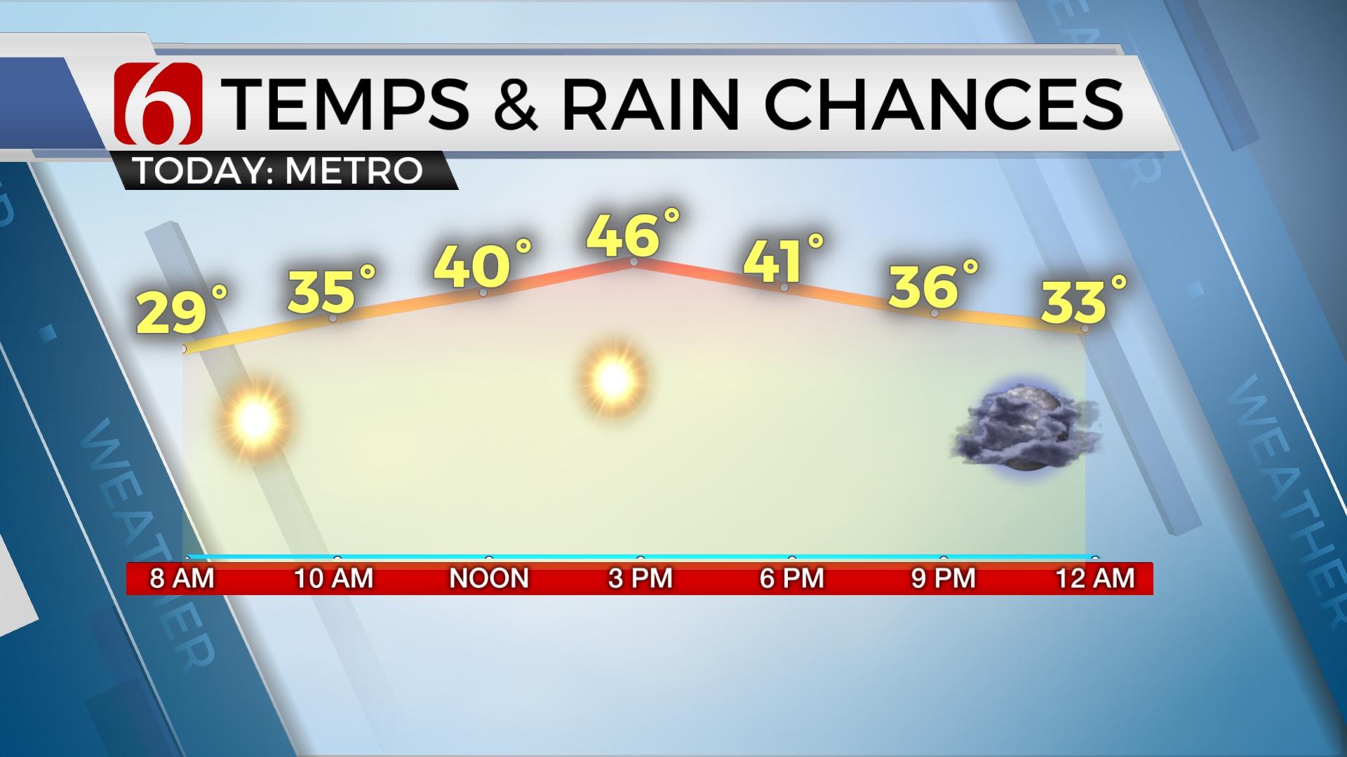
The first wave associated with our main upper level system ejected across the area late last night and is moving northeast away from the state this morning. We've been tracking some light showers across part of the area earlier this morning, with a small area of light wintry mix across northwestern Arkansas. This will quickly end. Other than a few showers today across the Red River Valley, we're in a holding pattern waiting for the main wave to near the area later tonight and Wednesday bringing a much higher chance for showers across the area. We could see a few spotty showers near the metro by midday, but the odds will continue remaining low other than southern sections. Much higher chances arrive late tonight into Wednesday through most of the morning to early afternoon. The far northeastern sections of the rain shield may contain some rain to snow mix Wednesday morning, but with no travel impacts or significant accumulations should occur in our immediate area of concern. Locations to our northwest, possibly across Kay county into northwestern Osage county and points north into southcentral or eastern Kansas may experience some light snowfall tomorrow morning with a dusting on grassy areas, but this should remain away from most of the Northeastern OK vicinity. Temperatures today and tomorrow will not vary much with highs in the lower to mid-40s. As the main storm system ejects away from the area later Wednesday afternoon and evening, the precipitation will end, and much colder weather will quickly arrive for about 36 hours.

A surface ridge of high pressure will build into the state Wednesday night into Thursday morning bringing temperatures down into the lower 20s near the metro for morning lows with afternoon highs only reaching the mid-30s north and lower 40s south Thursday afternoon. Friday morning starts cold with lows in the upper teens and lower 20s but will see a return of south winds and quickly moderating temperatures with Friday afternoon reaching the upper 40s with mostly sunny conditions. Warming weather is likely into the weekend with above normal readings through Sunday. Saturday afternoon highs will reach the mid to upper 50s with Sunday back into the mid-60s along with breezy south winds. A weak upper disturbance is scheduled to brush the region Sunday, but any shower activity should be confined to far southeastern OK either late Saturday night or early Sunday morning with minor impacts.

Another system nears the region early next week with rain and thunder chances Monday, followed by more cold weather for the middle of next week.
Thanks for reading the Tuesday morning weather discussion and blog.
Have a super great day!
Alan Crone
More Like This
February 11th, 2020
November 30th, 2022
November 1st, 2022
August 26th, 2022
Top Headlines
December 12th, 2024
December 12th, 2024
December 12th, 2024
December 12th, 2024


