Warmer Temperatures, Severe Storm Chances Return To Green Country
Warmer Temperatures, Severe Storm Chances Return To Green CountryWednesday, May 13th 2020, 6:44 am
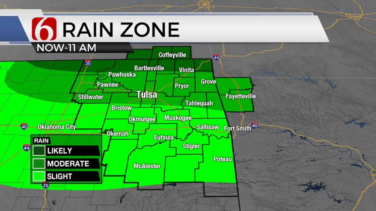
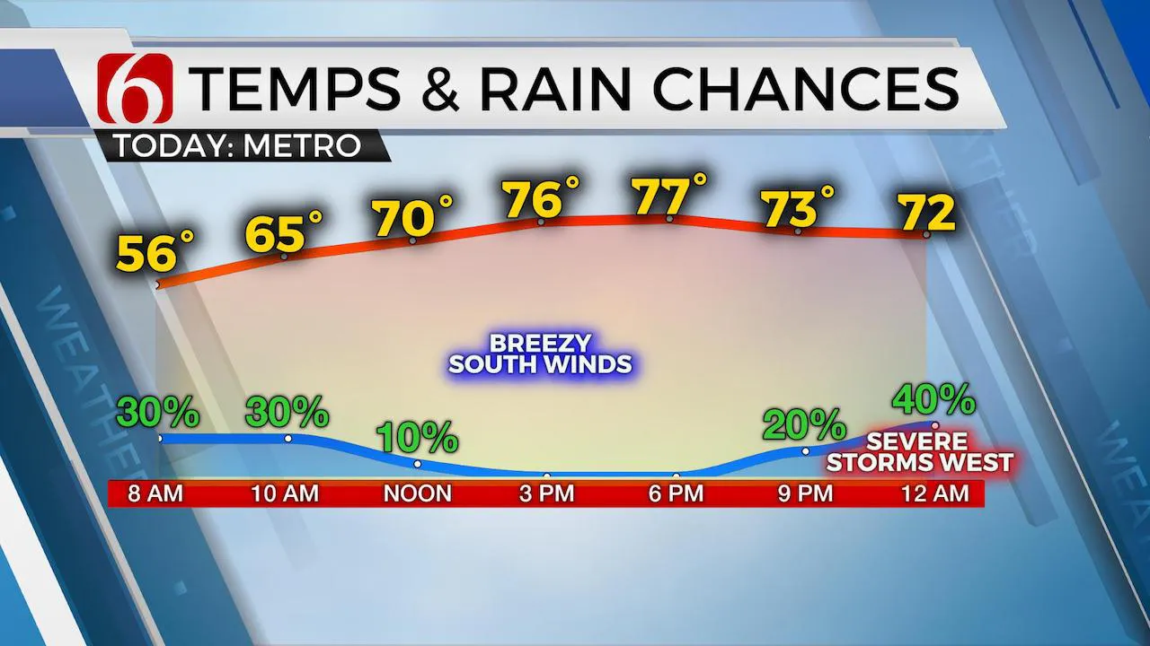
The pattern is changing. This morning, warm and moist air is slowly returning from the south into central and northern OK as a quasi-warm front is lifting northward. A weak mid-level disturbance is also located across northwestern OK moving east. Locations to the north of this boundary and east of the disturbance may experience drizzle and a few showers and storms, including a low probability of a few strong storms, mostly in the form of small hail. The model output data is not suggesting high probabilities for these types of storms, but we know this pattern can produce a few hailers. The actual probabilities remain near 30% through the early morning hours, roughly along and north of highway 412. Once this boundary lifts into southeastern Kansas by midmorning, a layer of warm air aloft ( the CAP) is expected to keep us dry and warm for the majority of the afternoon. Temps this morning may start in the 50s but quickly move into the 60s by noon and into the mid-70s along with gusty south winds from 15 to 30 mph by afternoon. We should see some sunshine in the cloud mix by afternoon for portions of eastern OK as we dry out for a few hours. Storms are likely to develop along a dry line across far western OK later tonight and move eastward bringing threats for strong to severe storms across central OK by late evening and possibly into portions of eastern OK tonight through early Thursday morning. The data this morning is not very robust with these storms holding together all the way into eastern OK later tonight. I have lowered the pops for the metro into the 30-40% range. Higher probabilities for severe storms will remain slightly west of the metro this evening and near and south of -40 between the 9pm to 3am hours. Our main threats will be hail along with damaging downbursts of wind. Again, most of these storms should be weakening as they approach the eastern third of the state overnight.

I do think we’ll need another higher chance of storms in the forecast for late Thursday night into Friday morning as a storm complex moves from southeastern Kansas into parts of northeastern OK. There will be some severe weather threats with this time period. Additionally, heavy rainfall will also be possible and may add to already swollen streams and creeks in these areas. Friday night into Saturday additional showers and storms will also be likely, yet specific timing and locations can’t be resolved with any confidence at this moment. We’ll continue with a broad-brush approach, including 60% chances for the Friday into the Saturday midday and evening. Severe weather probabilities must also remain through this entire period. Sunday we may get a break after the early morning hours. At least the chilly weather we experienced Sunday through yesterday is now gone. We’re moving back into a typical May upper air pattern that will bring warm and humid weather back to the plains. We may even experience above normal and humid conditions for most of next week.
The upper air pattern is showing signs of slowly shifting the stronger belt of westerlies aloft northward. This process usually begins in late May and early June but could possibly be beginning earlier this season. It’s hard to know if these signals are anomalous or if it’s the beginning of an early pattern shift. Typically, when this happens, mid-level ridging near and south of the state becomes more prevalent leading to increasing heat and humidity and lower organized storm chances as stronger upper level flow moves slightly northward. We’re not there yet, but the next week or so will keep us mostly warm and humid with additional storm chances later next week.
Thanks for reading the Wednesday morning weather discussion and blog.
Have a super great day!
Alan Crone
More Like This
August 8th, 2023
July 4th, 2023
May 8th, 2023
Top Headlines
December 15th, 2024
December 15th, 2024
December 15th, 2024
December 15th, 2024


