

Warm Weather Heats Up For Northeast Oklahoma
Warm Weather Heats Up For Northeast OklahomaThursday, June 11th 2020, 9:50 am

The heat will increase going into next week, as dry weather and low humidity will continue to govern our weather for the next few days.
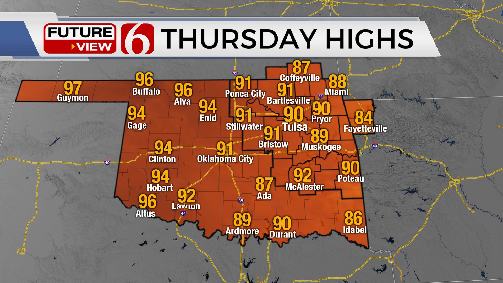
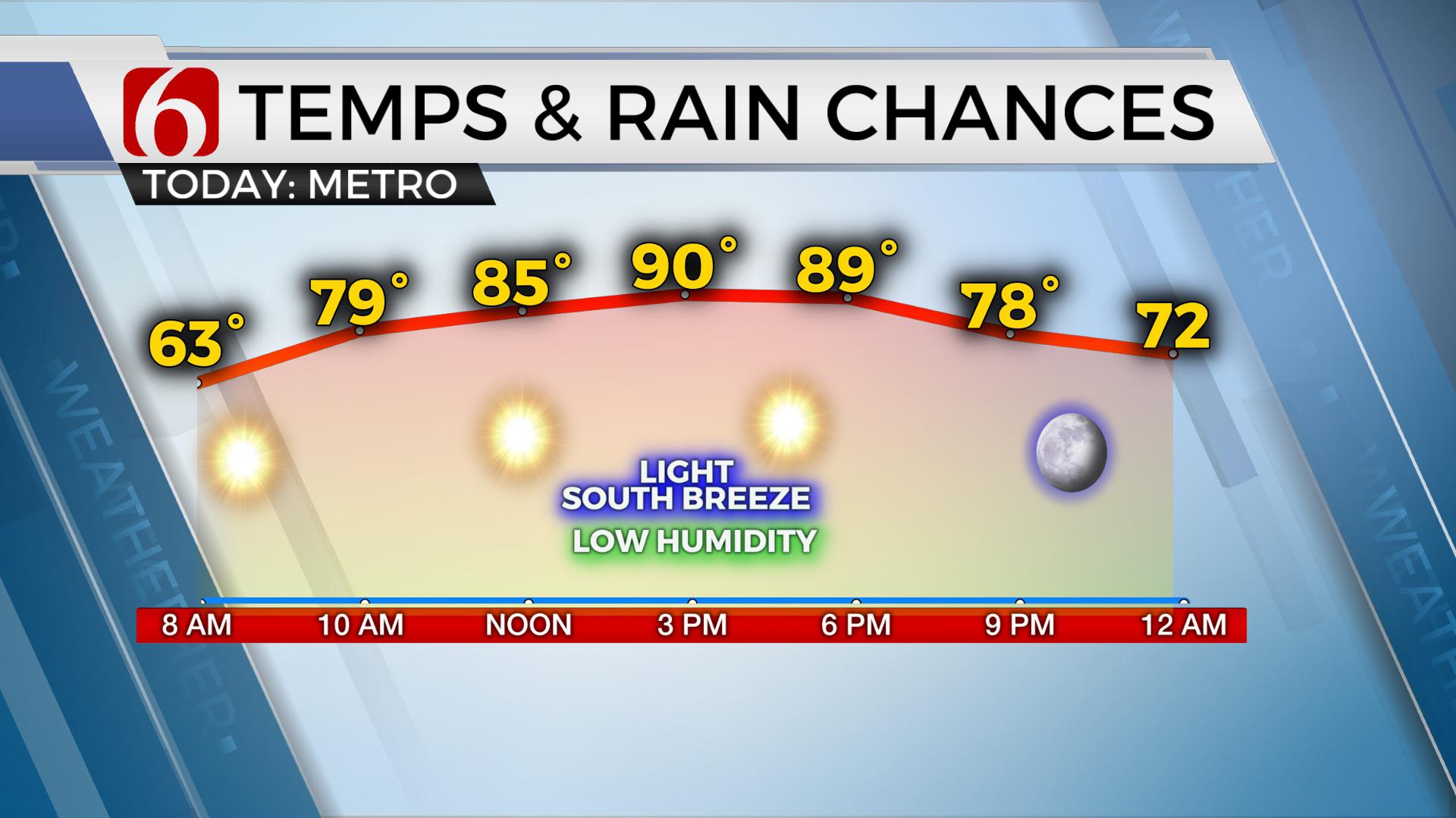
Temperatures will start this morning in the mid-50's across east central Oklahoma with the Metro in the upper 50's. Afternoon highs will reach the upper 80's and a few lower 90's, but a low moisture content will continue with dew point temps staying in the 50's through the day. This pattern is not expected to change much over the next few days, even though slightly warmer weather will arrive for the weekend. We’re not expecting to add any major heat index values into the forecast for the weekend. Morning lows will start in the upper 60's to lower 70's with afternoon highs reaching the lower to mid-90's. Stronger westerlies have lifted northward with a summer-like ridge of high pressure once again building near the state.
While the ridge will be the dominate player across most of the region, some data has differences regarding the strength of the ridge. This would allow a small complex of storms to develop and move into northwestern Oklahoma and southwestern Kansas later this afternoon and evening. While this activity will remain to our west, some clouds could arrive later tonight into Friday morning.
This ridge of high pressure should continue to dominate the northern OK region this weekend but may still allow for a weak boundary to back-door its way across part of the state Saturday evening into Sunday morning. This early summer pattern should persist through most, it not all next week before the ridge retros southwestward allowing another weak northwest flow to brush far northeast Oklahoma and northwest Arkansas the following weekend.
Trajectories across the southeast Texas Gulf Coast region continue to be mostly offshore which will keep deeper Gulf moisture confined away from the state for several days. Most data will not allow the deeper moisture to return until the second half of next week. Consequently, this is also when the ridge moves westward, this would allow a more normal June pattern for northeastern Oklahoma, including some chances for showers and storms, and increasing heat index values by next weekend.
Thanks for reading the Thursday morning weather discussion and blog.
Have a super great day!

Get The Daily Update!
Be among the first to get breaking news, weather, and general news updates from News on 6 delivered right to your inbox!
More Like This
June 11th, 2020

August 8th, 2023

July 4th, 2023

May 8th, 2023
Top Headlines

December 14th, 2024

December 14th, 2024

December 14th, 2024

December 14th, 2024