Hot And Muggy Wednesday Weather For Eastern Oklahoma
Hot And Muggy Wednesday Weather For Eastern OklahomaWednesday, June 17th 2020, 8:00 am
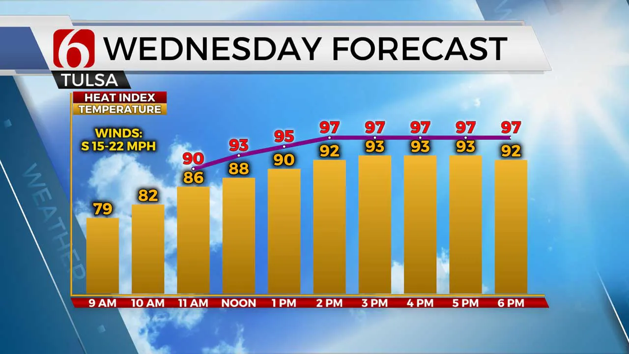
Humidity levels will be more noticeable and a little more uncomfortable for our Wednesday, as steady summer heat continues. Sticky conditions and higher dewpoints for the morning hours look to hang with us for the afternoon, instead of mixing out like they have most of the past several days. Highs will climb back into the lower 90s today with a gustier south wind, but when you tack on the humidity our heat index values will push into the mid to upper 90s.

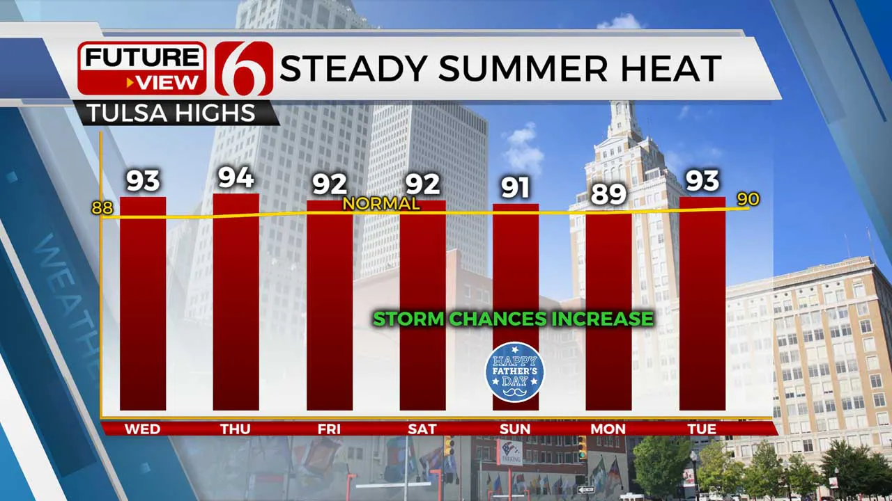
Once again, a couple of those very isolated “pop-up” showers will try to flare up during the heating of the day, mainly across southeastern Oklahoma. They will be pretty few and far between, and any activity will be falling apart after sunset. And Thursday? Yep, no surprise here: More summer heat and humidity. We’ll see those highs climb back into the lower to mid 90s Thursday afternoon, and this time around we don’t expect much in the way of isolated pop-up afternoon showers.

As we head toward the end of the week and into the weekend, our weather pattern becomes more unsettled as the upper level ridge that’s brought us mainly dry weather starts to break down. Some leftover morning storms may impact parts of Green Country on Friday and Saturday, with potentially a better chance of more organized storms by the end of the weekend. We’re starting to dry out very fast, so we could certainly use a drink of water! We’ll keep you updated.
I hope you have a great Wednesday, Green Country! You can follow me on Twitter @StephenNehrenz as well as my Facebook page Meteorologist Stephen Nehrenz to stay up to date with the very latest!
More Like This
June 17th, 2020
August 8th, 2023
July 4th, 2023
May 8th, 2023
Top Headlines
December 12th, 2024
December 12th, 2024
December 12th, 2024


