Few Monday Morning Showers Move Through Eastern Oklahoma
A weak disturbance will quickly move across the area this morning bringing a chance for a few showers and storms near or east of the metro.Monday, June 29th 2020, 6:52 am
TULSA, Okla. -
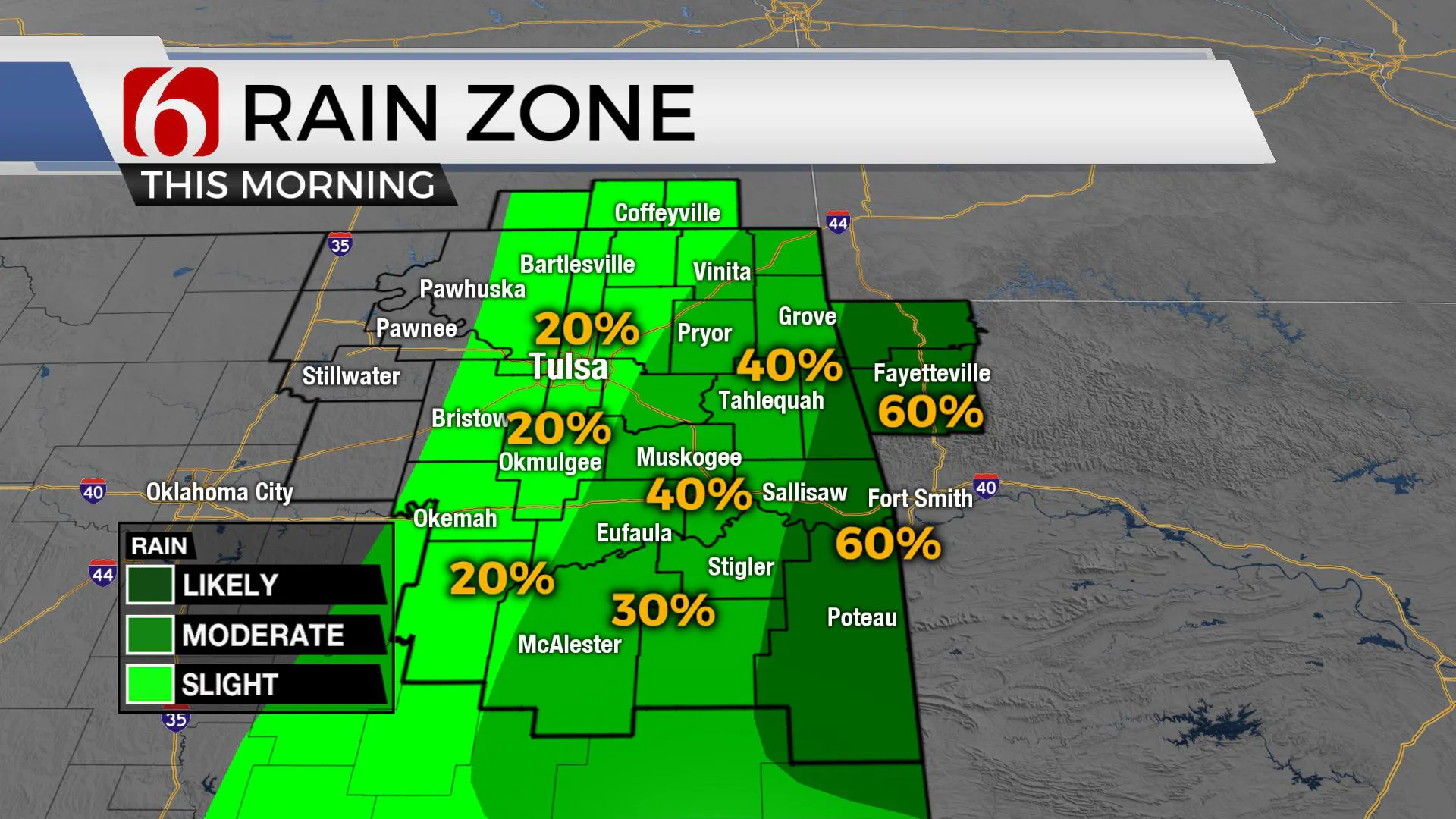
A weak disturbance will quickly move across the area this morning bringing a chance for a few showers and storms near or east of the metro.
One or two of these could support some pulse severe weather characteristics with a quick downburst of wind and some nickel hail, but the overall chance for storm activity remains low.

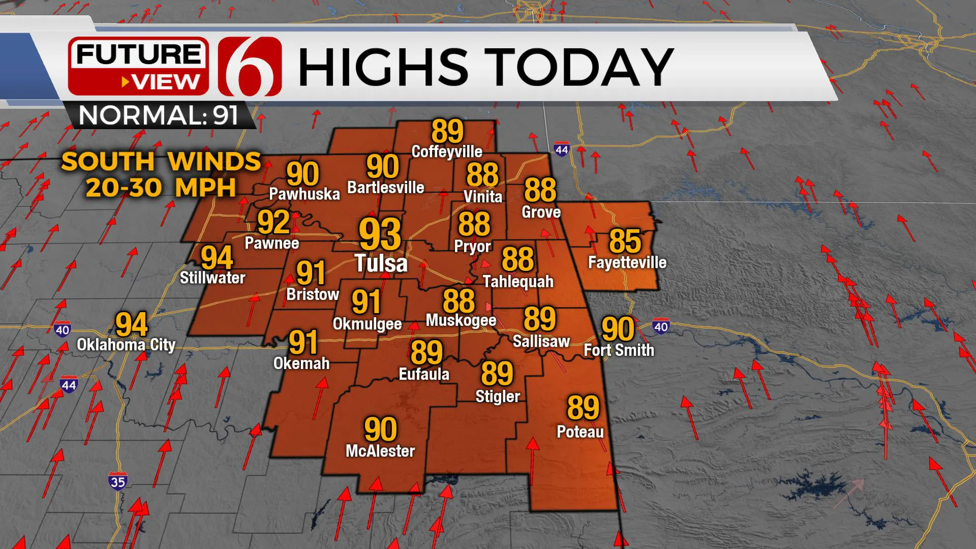
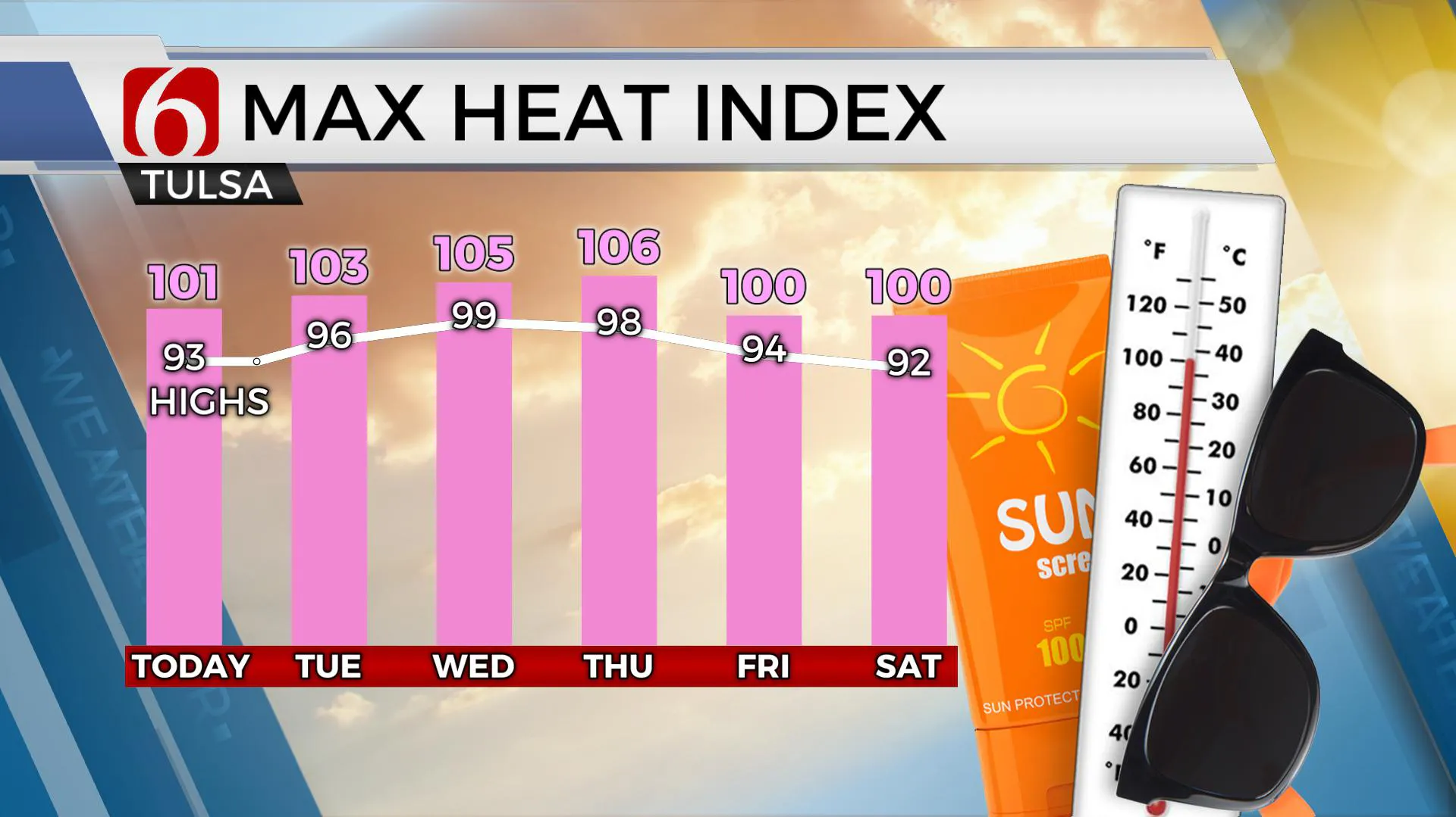
Otherwise windy and warm weather remains this afternoon with highs reaching the upper 80s to lower 90s and heat index values slightly over 100. A ridge of high pressure will arrive for the next few days bringing heat index values near or over 105 as actual surface temps rise to near the upper 90s. This ridge will retro westward Thursday as a weak back-door front arrives from the Missouri Valley bringing some minor relief and a slight chance for a few storms Thursday and Friday. The 4th of July weekend currently appears warm and muggy with morning lows in the lower to mid-70s and highs in the lower to mid-90s. Any storm chances this weekend currently appear isolated in nature.

The data his morning continue suggesting a few storms should develop as a disturbance ejects across the state. The exact location for storm initiation is tricky due to the presence of some capping inversions. Some hi-res data will keep storm activity mostly across extreme eastern OK into Arkansas while others crank-up a few near Tulsa early this morning. Because of this variance, we’ll need to broad-brush the chances from highway 75 east through noon.
The midlevel ridge will bring triple digit heat into the western half of the state for the next few days, but locations across eastern OK will remain in the mid to upper 90s, yet heat index values should rise to near or even above 105 Wednesday or Thursday requiring heat advisories for part of the area.

The ridge should weaken some with the center moving west Thursday allowing a weak surface boundary arriving from the Missouri Valley with a few storms and some minor relief. Highs Friday into the weekend will remain in the lower 90s but heat index values should be near or below 100.
Thanks for reading the Monday morning weather discussion and blog.
More Like This
June 29th, 2020
August 8th, 2023
July 4th, 2023
May 8th, 2023
Top Headlines
December 14th, 2024
December 14th, 2024
December 14th, 2024
December 14th, 2024


