Break From Heat For Tuesday
A few storms are located to the northwest of the metro this morning and will more than likely remain away from Tulsa for the next few hours.Tuesday, July 21st 2020, 6:41 am
TULSA, Okla. -
A few storms are located to the northwest of the metro this morning and will more than likely remain away from Tulsa for the next few hours.
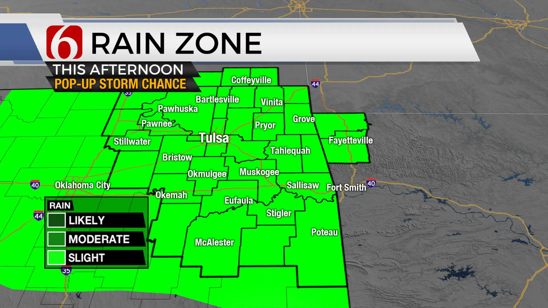
Later today, one or more outflow boundaries will be nearing highway 412 with a few additional storm chances arriving by midday to afternoon. We will include another slight chance for Tulsa and the surrounding region for the afternoon and early evening hours.
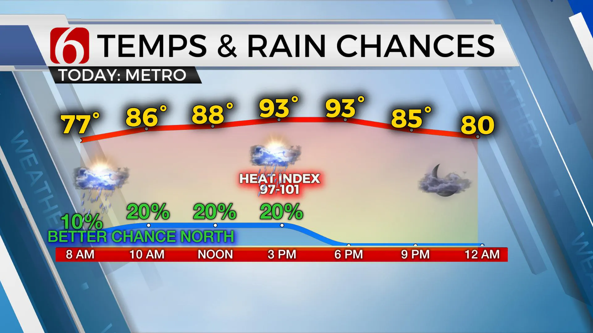
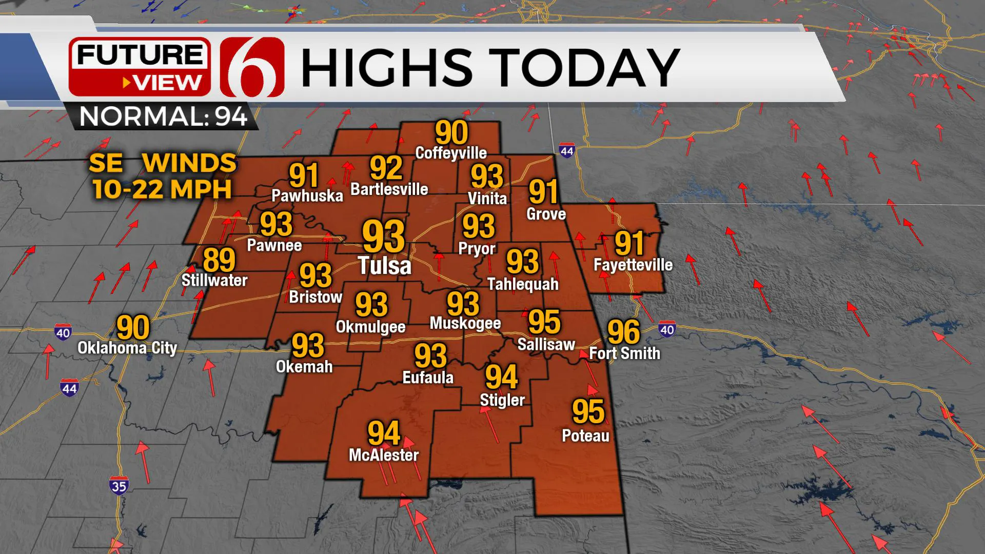
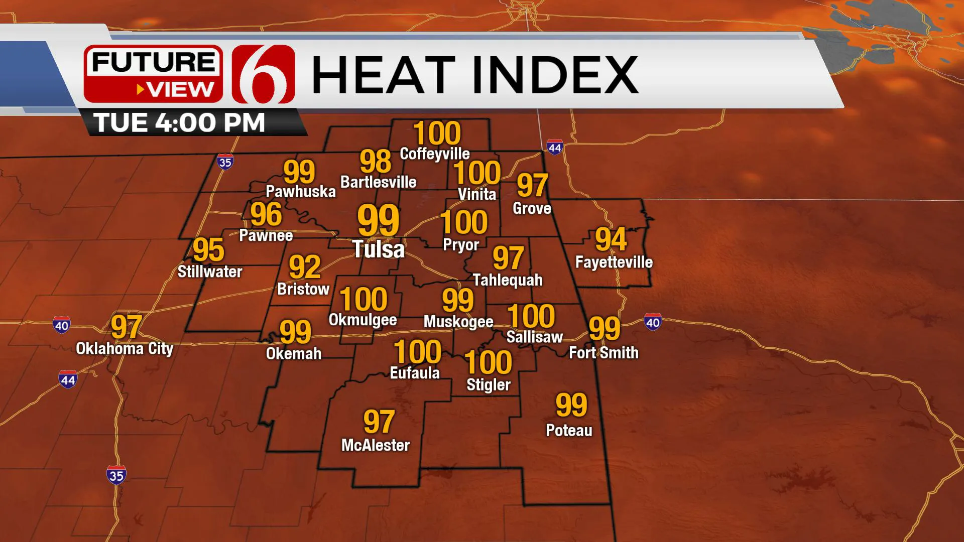
Most locations will remain dry across eastern OK, but this pattern should bring a few storms nearby for some locations. The additional cloud cover on occasion today will also keep the highs lower than the previous few days. Metro temps will top-out near 93 with a heat index only near 99 to 101. No heat advisory will be required today or for most of the week as these values are expected below the criteria of 105 or higher. Daytime highs and heat index will slowly increase by the 2nd half of the week and advisories will become more likely later this weekend into early next week.
A mid-level ridge of high pressure is located to our southeast this morning. While the ridge is strong enough to keep most of eastern Oklahoma dry, the northern periphery of the ridge will allow the chance for a few storms to persist near the OK-Kansas state line region for the next few hours before the outflow may provide some additional convection this afternoon.
Another flare-up is likely, again mostly northwest of the metro for later tonight. The ridge is expected to slowly expand northwest and strengthen some by the end of the week. Until this occurs, we’ll keep some low mentions in the forecast for a few showers or storms both Wednesday and Thursday as a weak easterly wave is ejecting across southwest Texas and into the Mexican Plateau.
While our chances Wednesday and Thursday will remain low, these probabilities will be increasing slightly across southeastern and east-central OK as deeper moisture arrives from the south. A few showers or storms will occur, but the confidence regarding exact location and coverage will remain low.
The ridge should be the dominate player this weekend with hot and dry conditions almost statewide, with the minor exception of a few afternoon storms across extreme east-central OK and Western Arkansas.
The ridge may not last for long. Data suggest this feature will weaken once again next week allowing a mid-level trough to dive across the central plains bringing a weak boundary near northern OK around Wednesday of next week. This would be highly unusual for late July.
Thanks for reading the Tuesday morning weather discussion and blog.
Have a super great day!
More Like This
July 21st, 2020
August 8th, 2023
July 4th, 2023
May 8th, 2023
Top Headlines
December 15th, 2024
December 15th, 2024
December 15th, 2024
December 15th, 2024


