Scattered Storm Chances Remain Thursday
Day four of some not as hot weather will be expected across eastern OK.Thursday, July 23rd 2020, 6:46 am
TULSA, Okla. -
Day four of some not as hot weather will be expected across eastern OK.
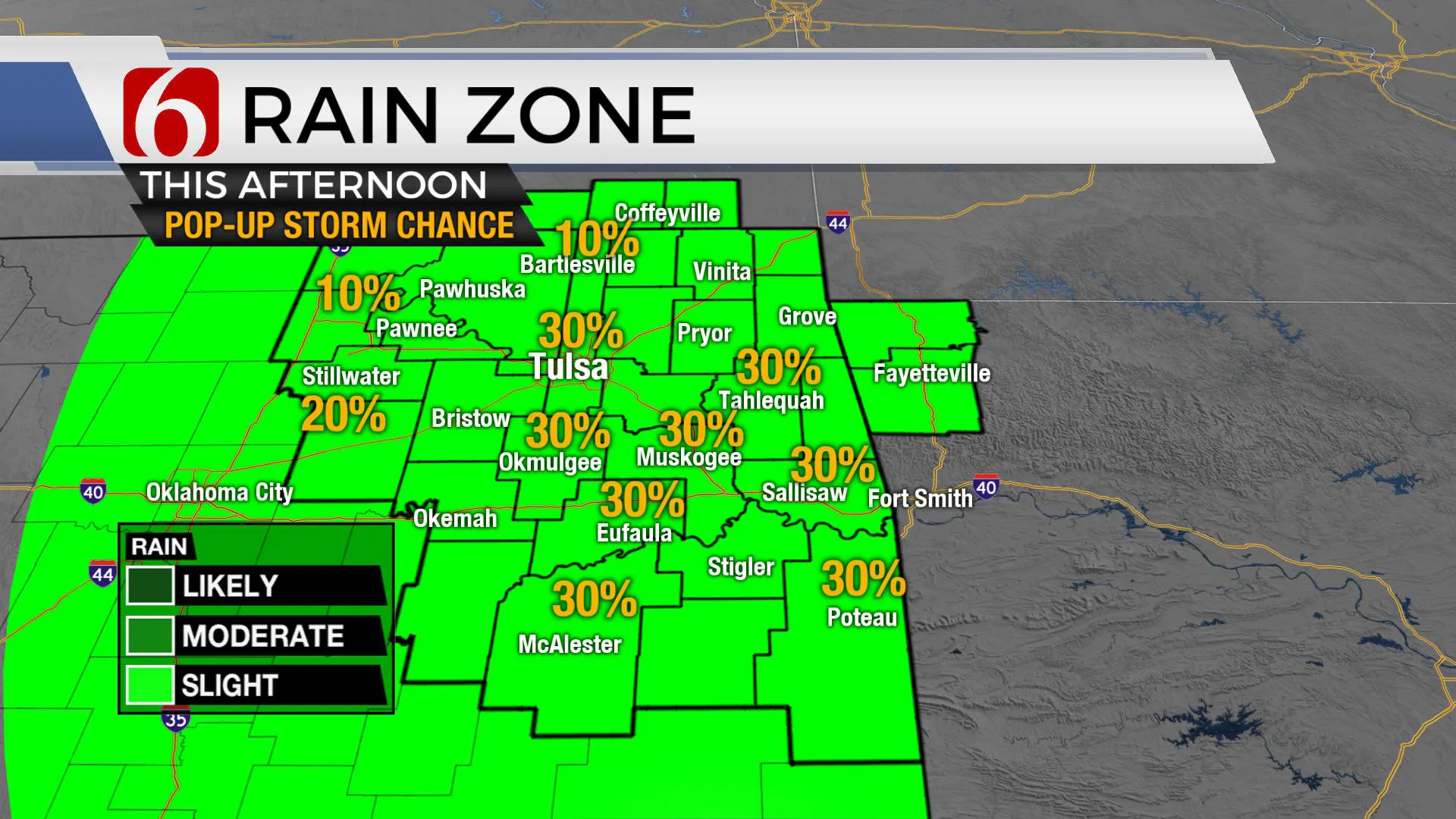
Just like the previous few days, scattered showers and storms will remain possible, including the potential for heavy rainfall with a few storms. Severe weather threats will also remain highly isolated and confined to a wet microburst in one or two cells.

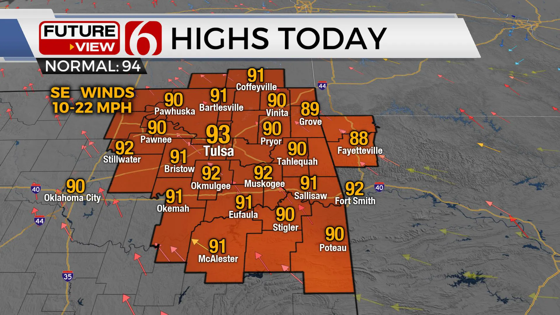
The overall threat is extremely low. Most locations will remain dry, but a few storms will occur. Highs this afternoon will range from the upper 80s to lower 90s with heat index values nearing 99 to 102. One more chance for a few showers or storms may be going early tomorrow morning along the I-35 corridor before the mid-level ridge of high pressure expands from the southeast taking the storm chances away for a few days and replacing it with increasing humidity for the weekend.
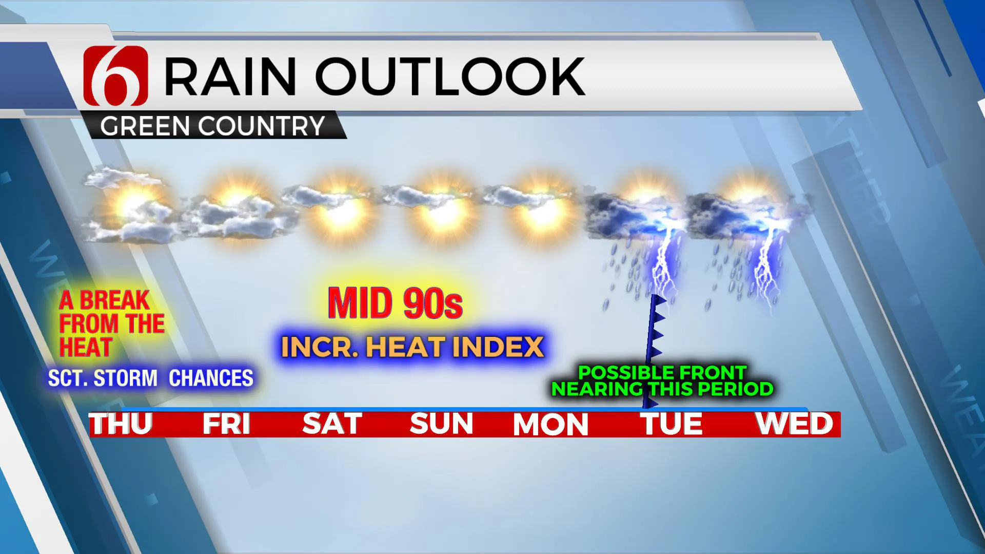
Highs this weekend should reach the lower to mid-90s along with heat index values from 104 to 109 in a few locations, more so Sunday. Heat advisories may return for part of eastern OK for part of the weekend. The only chance for any storm activity this weekend should remain near the OK-Arkansas state line region from the mid-afternoon to early evening period.

Most data support the mid-level ridge moving back to the west again early next week and allowing a surface front to approach northern OK Monday and again possibly Wednesday with another reduction in temps and more storm chances. The EURO powers this front south, across the entire State Monday afternoon and evening before stalling across north TX.
The GFS keeps this initial boundary north along the state line, moves it back into southern Kansas Tuesday, and then brings it south Wednesday before stalling around southern OK.Under normal circumstances, I would toss this data and keep with a persistent ridge nearby with hot and humid weather. But with most data taking the mean ridge west, there will be northwest flow aloft early next week and we’ll begin introducing a few storms with yet another reduction in heat. Not bad for late July.

We’ll be tracking three named tropical systems in the next few days, including soon to be TS Hanna in the Gulf of Mexico and already named Gonzalo in the Atlantic basin. Hanna will have impacts along the Texas coastal region Friday into part of the week. Gonzalo will become a hurricane soon and travel into the Caribbean this weekend.The third is a pacific basin storm, Hurricane Douglas, that may have some impacts on Hawaii in the next 5 days but either as a weakening hurricane or a tropical storm.
Thanks for reading the Thursday morning weather discussion and blog.
Have a super great day!
More Like This
July 23rd, 2020
August 8th, 2023
July 4th, 2023
May 8th, 2023
Top Headlines
December 14th, 2024
December 14th, 2024
December 14th, 2024
December 14th, 2024


