Pleasant Weather Continues For Green Country
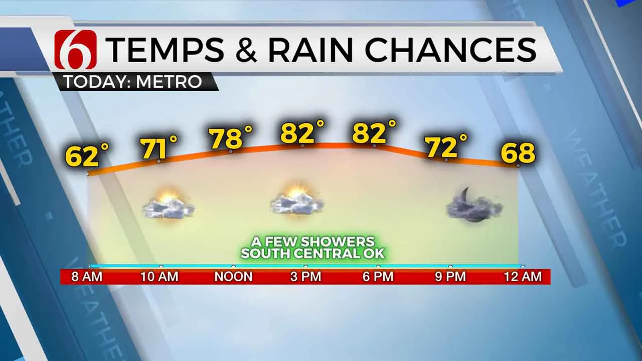
Pleasant and rather uneventful weather will be expected for most locations for the next few days, despite a low chance for a few passing showers for the next few days. Temperatures this morning will start in the lower 60s and rise into the lower 80s along with a sunshine-cloud mix.Tuesday, September 15th 2020, 4:43 am
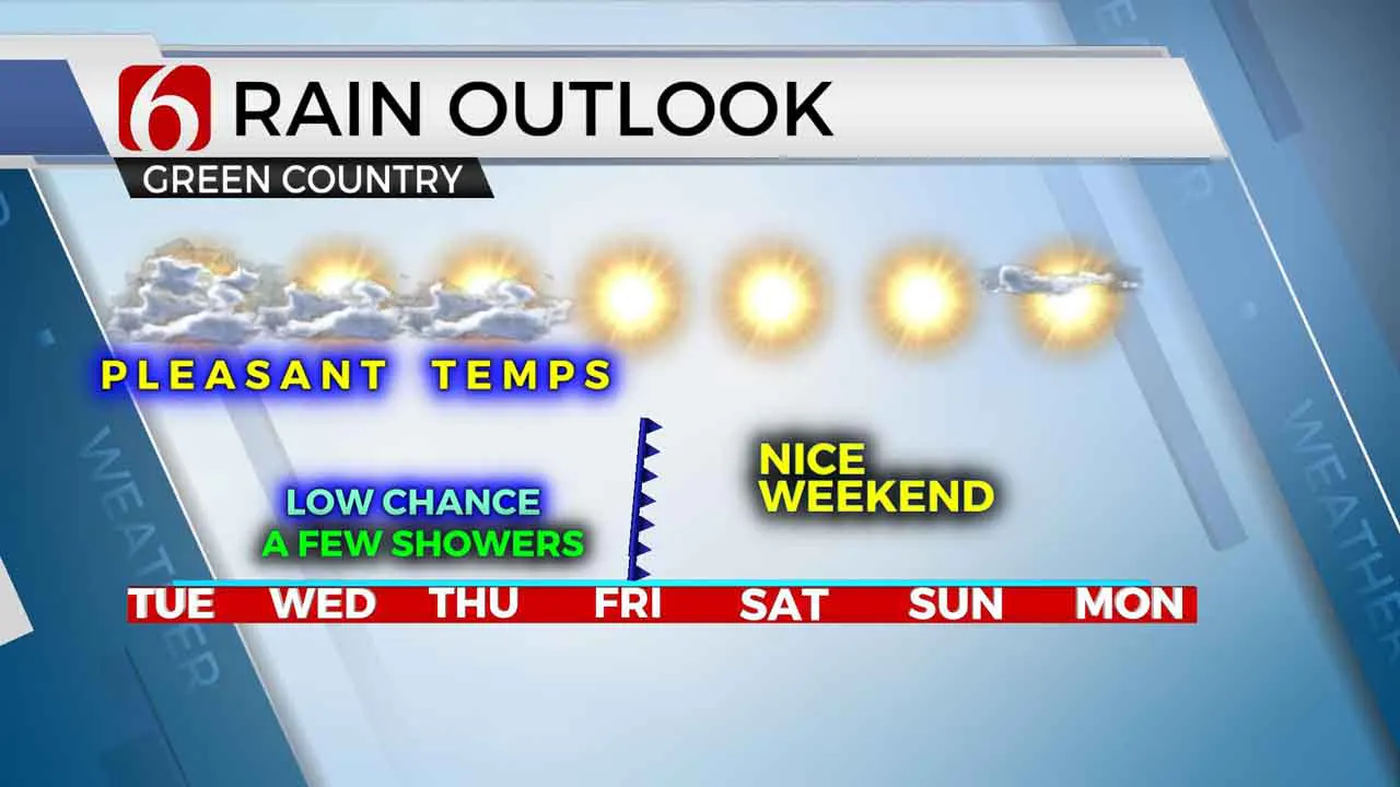
Pleasant and rather uneventful weather will be expected for most locations for the next few days, despite a low chance for a few passing showers for the next few days. Temperatures this morning will start in the lower 60s and rise into the lower 80s along with a sunshine-cloud mix. Smoke from the western U.S. wildfires may also continue spreading across part of the area occasionally for the next few days. A few spotty showers may develop today across south-central Oklahoma and could move east to northeast later tonight, but chances are extremely limited. A weak back-door front arrives Friday bringing a drier low level air-mass resulting in a wonderful pattern for the weekend with morning lows in the upper 50s and lower 60s followed by daytime highs in the lower 80s.

Hurricane Sally is crawling this morning into the southeastern Louisiana and southwestern Alabama coastal regions as a category one storm producing winds near 85 mph along with significant storm surge and life-threatening rainfall. Precipitation model forecasts include outputs nearing 15 to 25 inches of rain will result in historic totals for some locations. Due to the slow-moving nature of the system, flooding will remain a high risk for several days near the landfalling system. Additional tropical systems are also located in the Atlantic Basin and the active pattern will soon exhaust the available names for the 2020 season and activate the naming convention using the Greek Alphabet for remaining storms. This will be only the 2nd time in history to use the secondary list of names.

A weak disturbance will near region today through Thursday as low level moisture attempts to slowly move northeast into the eastern third of the state. A few showers or storms will remain possible, but many locations will remain dry. We’ll have a slight chance in the metro but again, we should remain dry. Thursday southeastern OK will have a better chance for a few showers or storms. A back-door front, arriving from the Missouri Valley region Friday, will bring drier air from the Midwest into the state and ending precipitation chances while ushering in what should be a five-star weather weekend.
Thanks for reading the Tuesday morning weather discussion and blog.
Have a super great day!
Alan Crone
More Like This
September 15th, 2020
August 8th, 2023
July 4th, 2023
May 8th, 2023
Top Headlines
December 15th, 2024
December 15th, 2024
December 15th, 2024
December 15th, 2024


