Thinning Clouds with Highs in the 70s
A very low chance will remain for a few leftover showers or mist for the next few hours but should quickly exit the area. Morning clouds will last into midday before thinning some from the northwest to southeast later this afternoon and evening.Wednesday, September 23rd 2020, 6:50 am
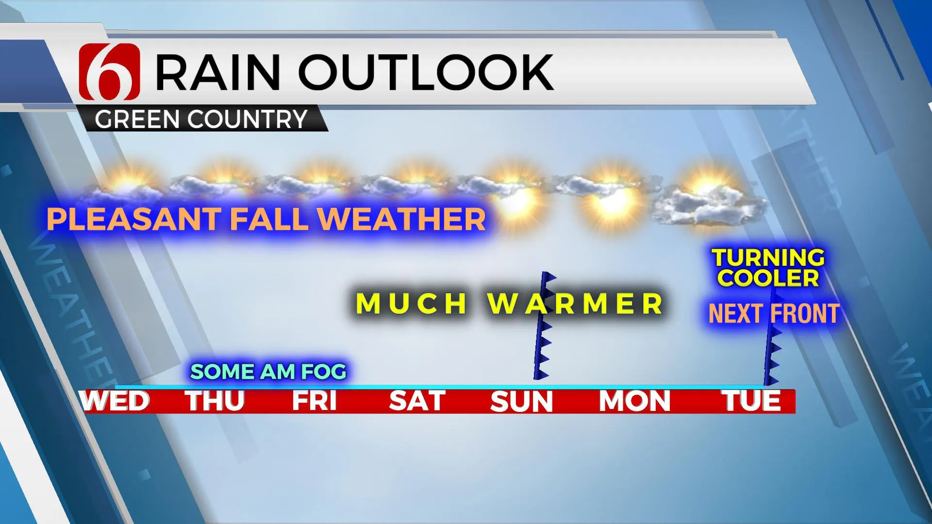
A very low chance will remain for a few leftover showers or mist for the next few hours but should quickly exit the area. Morning clouds will last into midday before thinning some from the northwest to southeast later this afternoon and evening. Temps now in the upper 50s and lower 60s will move into the lower to mid-70s this afternoon with a return of east winds around 10 mph. Pleasant yet warmer weather should arrive for the rest of the week with afternoon highs moving above the seasonal averages Thursday through Saturday before our next two fronts arrive Sunday morning and Tuesday morning. Low level moisture is not expected to support any major chance for showers or storms. The Sunday front more than likely becomes diffuse with little impact on the area. The Tuesday boundary should bring much drier air across the region with another cool-down, yet temperatures may spike into the upper 80s or lower 90s Sunday into Monday ahead of this system.
 Image Provided By: Alan Crone
The main upper air pattern has not changed much today compared to the previous few days but will be transitioning soon.
The main upper air flow is characterized by a strong northern jet positioned across the far northern sections of the nation extending into the upper Midwest and southern Canadian region. The stronger upper air flow will remain north of the state, but a weak upper disturbance is located across part of Missouri and should continue moving away from the southern plains later today as moisture from the old Beta system also transits eastward. A mid-level ridge of high pressure will extend westward across part of the state for the next few days helping to bring warmer air back to the region before we track the potential for some cooler weather arriving Tuesday into Wednesday of next week.
In summary, a few areas of mist or even a small shower or two will remain possible early this morning before thinning clouds arrive with some partly sunny conditions later today. Highs will reach the mid-70s near the metro. Thursday morning some fog may be possible for a few of the early hours.
Be sure and search for my NewsOn6 podcast “ Weather Out The Door”. It’s a quick and easy. It should be available on most podcast providers.
 Image Provided By: Alan Crone
Thanks for reading the Wednesday morning weather discussion and blog.
Have a super great day!
-Alan Crone, KOTV
More Like This
September 23rd, 2020
February 14th, 2022
January 26th, 2022
January 25th, 2022
Top Headlines
December 11th, 2024
December 11th, 2024
December 11th, 2024
December 11th, 2024


