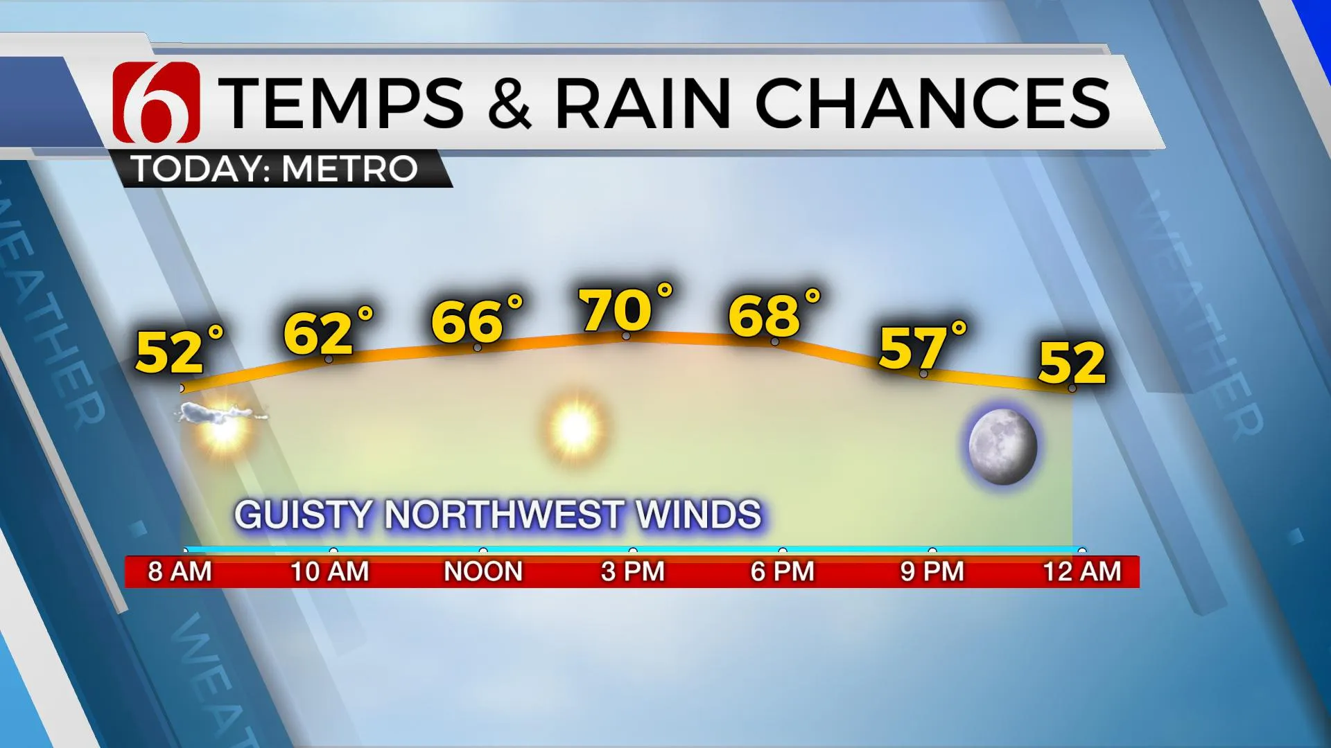
Gusty Northwest Winds With Highs In The Lower 70s
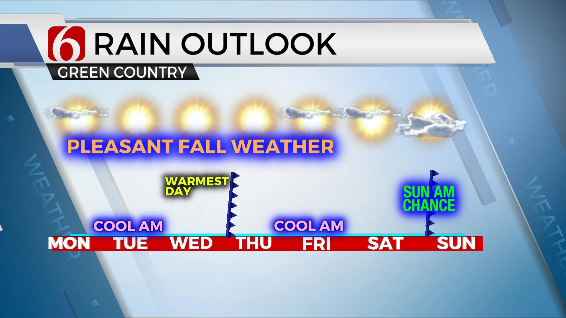
We're looking at a very pleasant stretch of fall like weather for most of the week with another cold front nearing Wednesday evening that will reinforce the cool and dry weather for the rest of the week.Monday, September 28th 2020, 6:04 am
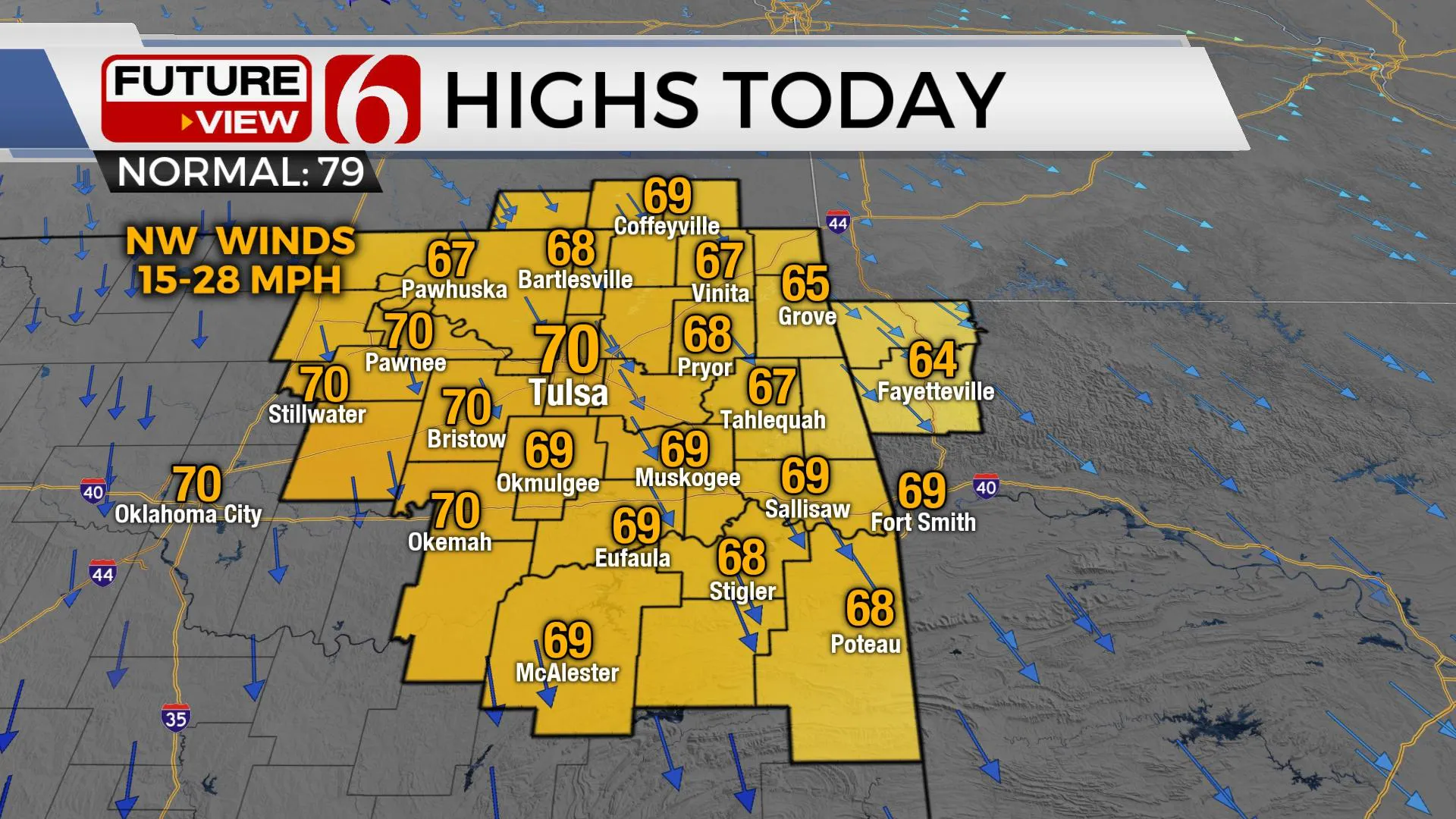
We're looking at a very pleasant stretch of fall like weather for most of the week with another cold front nearing Wednesday evening that will reinforce the cool and dry weather for the rest of the week. A small chance for a few storms will be required Sunday as a second front nears the state. Gusty northwest winds will remain later today along with mostly sunny sky and highs in the upper 60s near 70 this afternoon. Dry air will allow temps dropping into the mid and upper 40s Tuesday morning for most of eastern OK before we experience a minor yet noticeable warming trend with highs Tuesday remaining cool but Wednesday back into the lower 80s before the Wednesday front drops the temps again into the 40s for lows and highs in the upper 60s near 70 for the end of the week.
 Image Provided By: Alan Crone
The upper air flow is transitioning to a strong northwest flow. A long wave trough is moving southward across the middle of the nation this morning and will quickly pass the state later today. As this happens, clouds will clear, and sunshine should be the call for the day along with gusty northwest winds. Another strong looking upper trough will develop out of the base of the mean eastern U.S. trough and dive down the northern plains Wednesday. A surface front will follow Wednesday night bringing even drier low-level air into the state with dew points dropping into the 30s or lower 40s Thursday through Saturday morning setting the stage for some very pleasant weather for the end of the week. We're not expecting any precipitation with the midweek front but will need to mention some low-end pops for the weekend.
 Image Provided By: Alan Crone
At the surface, a ridge of high pressure will build across the plains states Thursday before quickly moving east Saturday as the next upper level disturbance approaches from the west. A surface low pressure area will develop across the Rockies with south winds returning across Oklahoma Friday into the weekend. This may be enough time to increase low level moisture Saturday as a cold front brushes northeastern OK Sunday morning. We’ll have a low chance for a few showers Saturday morning as moisture attempt the comeback and then a slightly better chances Saturday evening into Sunday morning as the surface boundary moves across northeastern sections of the state.
 Image Provided By: Alan Crone
Thanks for reading the Monday morning weather discussion and blog.
Have a super great day!
Alan Crone
KOTV
More Like This
September 28th, 2020
February 14th, 2022
January 26th, 2022
January 25th, 2022
Top Headlines
December 12th, 2024
December 12th, 2024
December 12th, 2024


