Back To Summerlike Weather With Winds Moving In
It’s back to summerlike weather today before another shot of fall returns overnight into Thursday. The rollercoaster pattern continues with some wild temperature swings for the next few days.Wednesday, October 14th 2020, 5:07 am
It’s back to summerlike weather today before another shot of fall returns overnight into Thursday. The rollercoaster pattern continues with some wild temperature swings for the next few days.

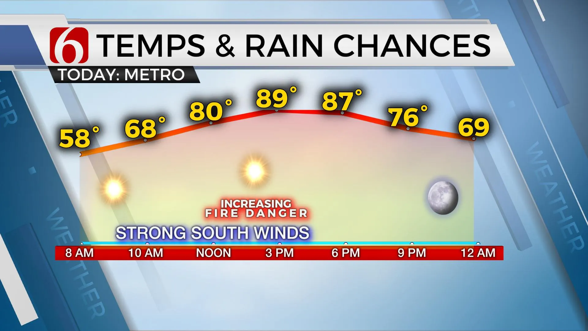
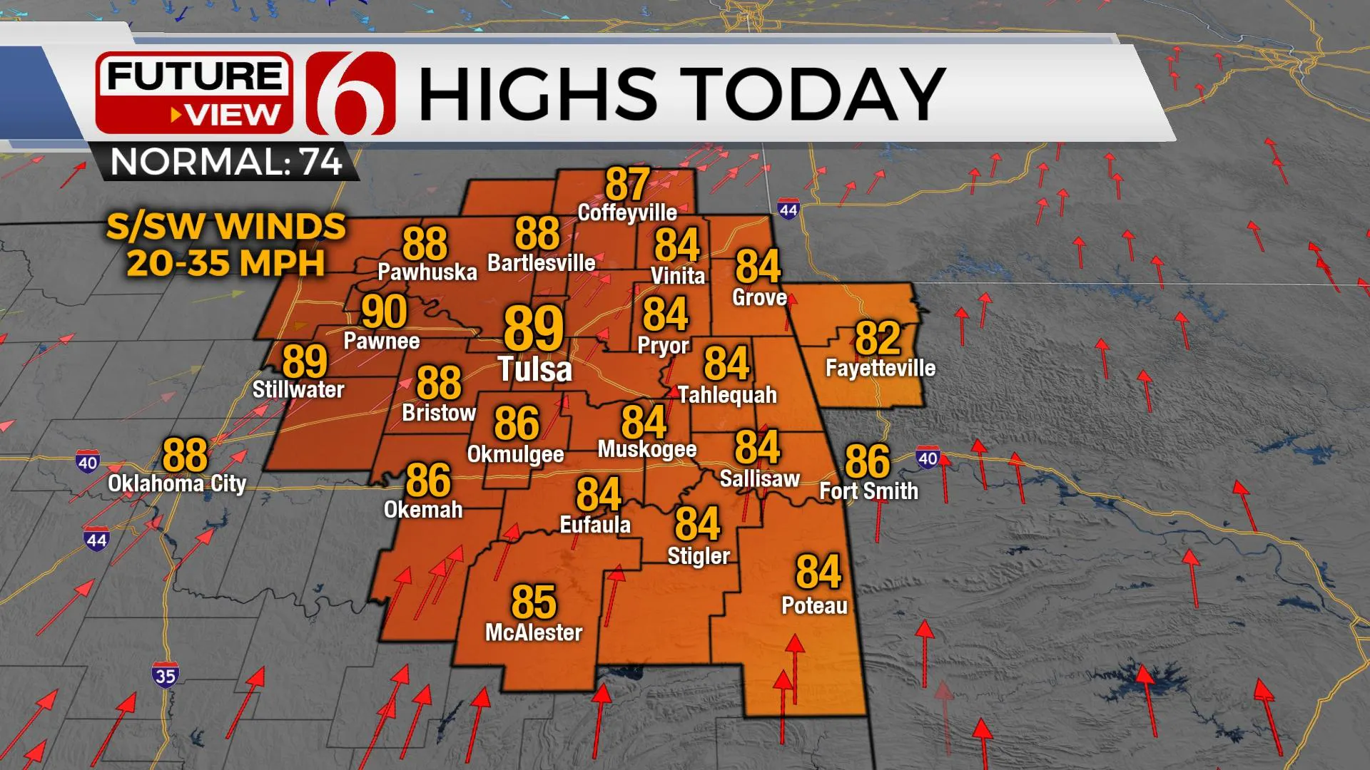
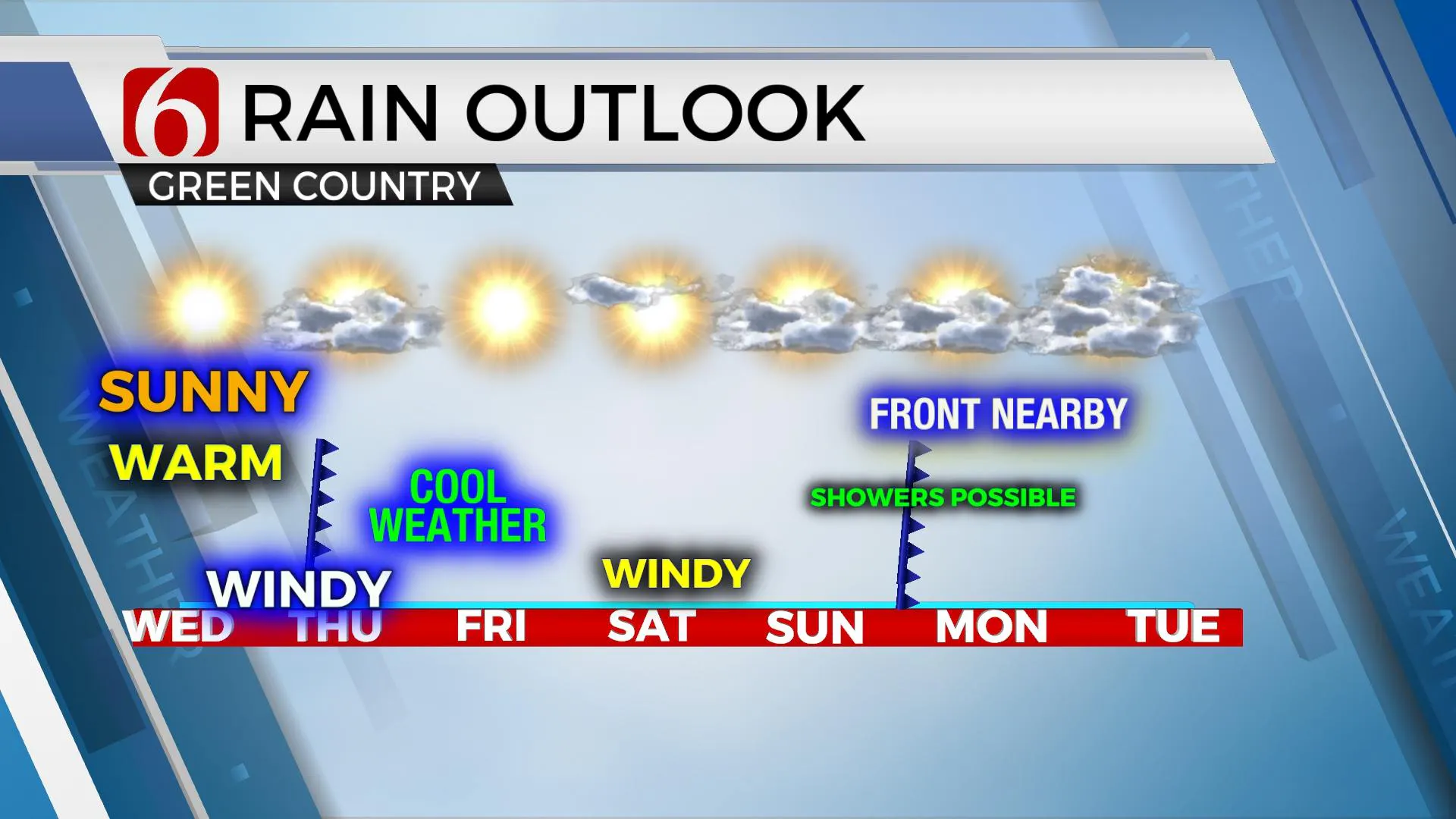
In the musical “Oklahoma” there’s a reason for the line” Where the wind comes sweeping down the plain”. And we’ll experience some of this later today through Thursday morning and maybe even stronger winds Saturday. We’re tracking two fronts over the next seven days that will bring increasing fire danger spreads and some chilly weather to the state. But before the first front arrives early pre-dawn Thursday, we’re back to summer today with highs reaching the lower to mid-80s for eastern OK and the upper 80s and lower 90s from the metro to the west. South to southwest winds will increase from 20 to 35 mph by the afternoon as the pressure falls across the Rockies in advance of our next upper level wave that shoves a strong cold front southward by early Thursday. As the boundary passes the area Thursday morning, gusty north winds return at 20 to 30 mph with chilly weather. There may be a very small window for some drizzle or a small shower or two, but the chance is extremely low and would not be a big inconvenience if it happens at all. Temps Thursday start in the 50s and remain in the mid to upper 60s with afternoon sunshine along with the strong and gusty north winds. Thursday night into Friday a surface ridge of high-pressure builds bringing clear sky and light winds allowing a cold Friday morning, possible in the mid-30s in the valleys and near 40 for the metro. We may even have some patchy frost in a few spots before highs Friday return into the upper 60s.

The weekend continues to offer another front arriving either Sunday or Monday that could bring a few showers or storms followed by another shot of chilly to cold weather. But the data continues to be highly inconsistent offering little confidence for early next week. Before this occurs, I continue to see signals for very strong southerly winds Saturday midday through afternoon and evening. The pressure gradient suggests we may have winds from 30 to near 40 mph. These strong winds combined with dry conditions and relatively low humidity would support increasing fire spread rates.

The data remain inconsistent, but we’ll bring this front across the area Sunday afternoon after hitting highs near 70. This boundary may retreat northward early Monday before moving south by evening. If this is the case, a few showers or storms may be possible. GFS data power the front southward Sunday bringing much colder air to the state compared to our European counterpart. Stay tuned, as changes are likely for this latter half of the forecast.
Thanks for reading the Wednesday morning weather discussion and blog.
Have a super great day!
Alan Crone
KOTV
If you’re into podcast, check out my daily “Weather Out The Door” on your podcast provider. Just search for NewsOn6 and load the latest updated file. Or you can find it on SoundCloud here.
More Like This
October 14th, 2020
February 14th, 2022
January 26th, 2022
January 25th, 2022
Top Headlines
April 25th, 2024
April 25th, 2024
April 25th, 2024


