Strong Winds With Highs In The Mid-70s
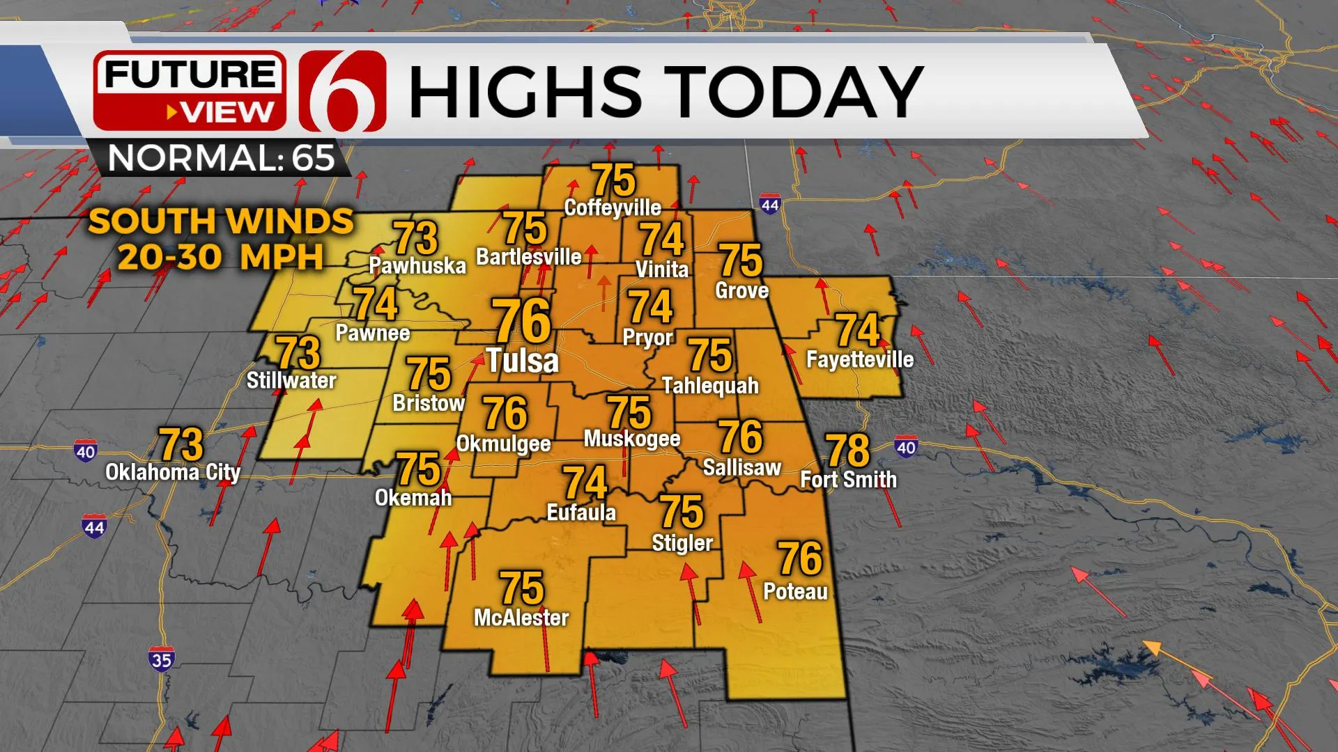
Mild weather is underway now, but strong south winds will increase low-level moisture today with highs reaching the mid-70s. A fast-moving storm system brings increasing thunderstorm chances into the area soon followed by a noticeable cool-down Tuesday into Wednesday.Monday, November 9th 2020, 5:07 am
Mild weather is underway now, but strong south winds will increase low-level moisture today with highs reaching the mid-70s. A fast-moving storm system brings increasing thunderstorm chances into the area soon followed by a noticeable cool-down Tuesday into Wednesday.

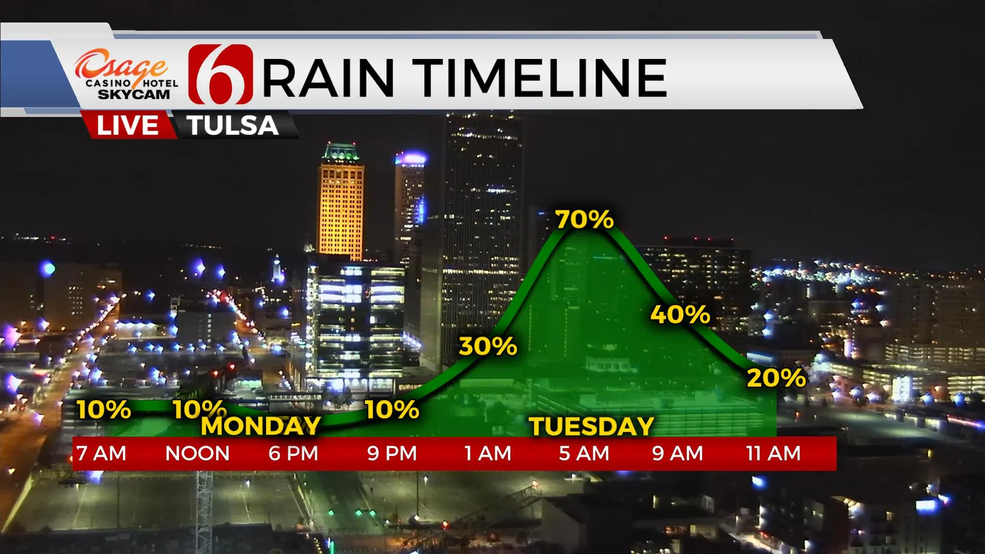
The cold front will arrive late tonight into early Tuesday morning with a narrow line of showers and storms along and ahead of the boundary. Enough deep-layer shear will exist for a few strong to severe thunderstorms during the pre-dawn hours of Tuesday, but the limited surface instability and convective energy should keep the threat low. A few heavy downpours will be expected but the progressive nature of the front should quickly sweep the precipitation east of the region around 10 a.m. Tuesday. Temps will start in the upper 60s early Tuesday morning and fall into the lower to mid-50s by midday with little afternoon recovery expected. Clouds will gradually clear Tuesday evening with a surface ridge of high pressure nearby allowing for Wednesday morning lows in the upper 30s and afternoon highs reaching the lower 60s with abundant sunshine. The upper air flow will remain active with several disturbances and storm systems moving across the central and southern plains for the next two weeks.
The first wave approaches Thursday into Friday and could trigger showers and thunder across northeastern Texas into southeastern OK. We'll be on the northern end of this fasting moving wave. As this wave exits, another stronger upper-level system quickly organizes to our west and brings another system across the plains Friday night into Saturday with a better chance of thunder. South winds will quickly bring robust low-level moisture back across the area with rain chances starting Friday and increasing through early Saturday morning to midday.
Most of the weekend, however, based on current timing appears good after early Saturday morning storm chances. Sunday also looks dry and mild.

Next week a prolonged period of south winds and warm weather will bring even higher moisture content into the plains ahead of a strong storm system set to arrive by the latter half of next week. We're getting ready to move into our normal secondary severe weather season for a few weeks before fall and winter will win-out.
The tropics continue to remain active. Eta could become stronger and possibly approach hurricane status off the west coast of Florida this week, while two more disturbances will be monitored for additional tropical development in the Atlantic basin.
Thanks for reading the Monday morning weather discussion and blog.
Have a super great day!
Alan Crone
KOTV
Check out my daily weather mini-podcast.
You’ll find it on most podcast providers, including Apple, Tune-In Radio, Spotify, Stitcher and here on SoundCloud.
More Like This
November 9th, 2020
February 14th, 2022
January 26th, 2022
January 25th, 2022
Top Headlines
December 14th, 2024
December 14th, 2024
December 14th, 2024
December 14th, 2024


