Strong Winds Sweep Across The State On Wednesday
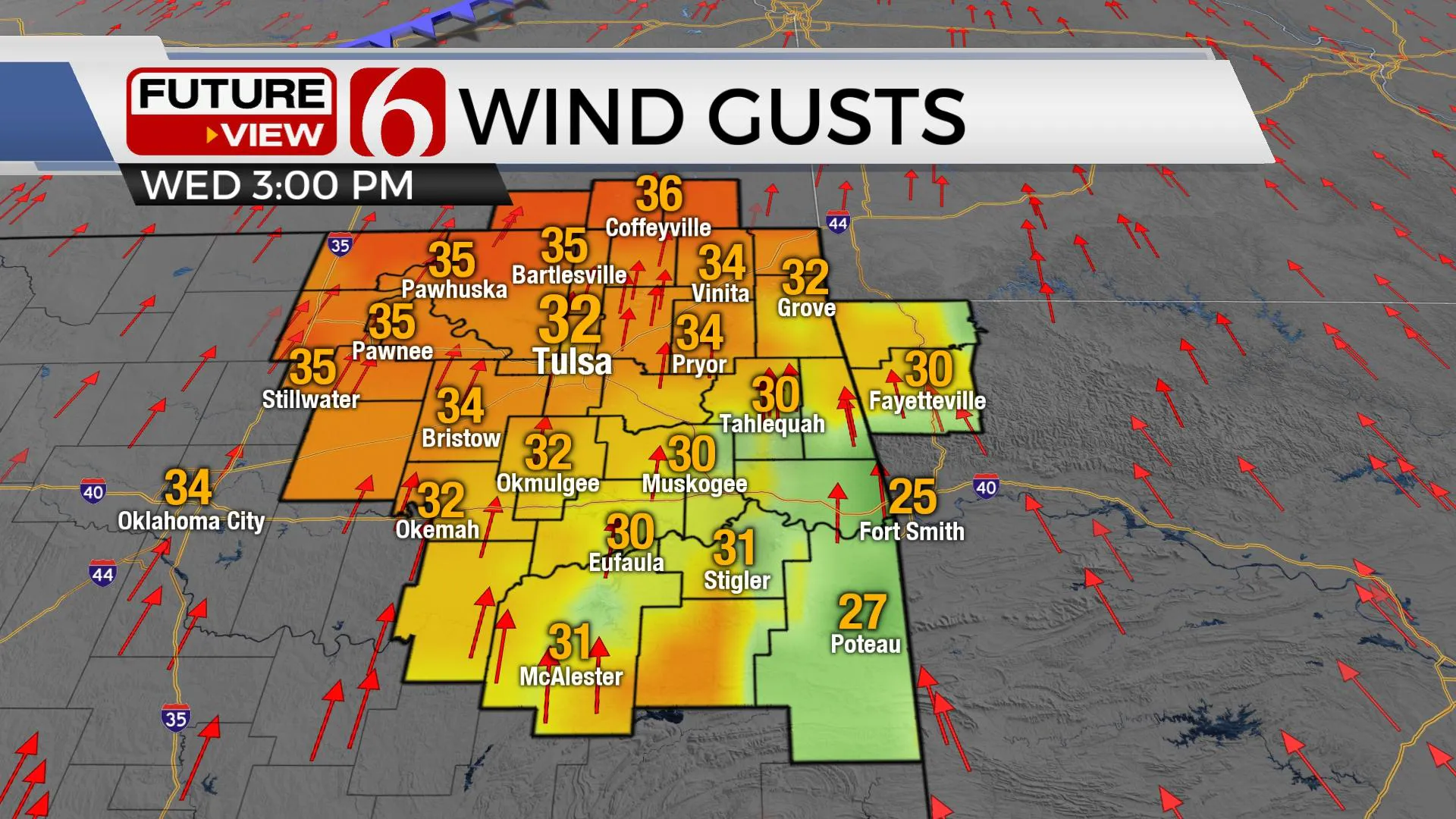
A surface area of low pressure developing to our north will ensure strong south winds developing today across the state with wind speeds from 20 to 35 mph possible along and northwest of I-44 by midday to afternoon.Wednesday, November 18th 2020, 6:14 am
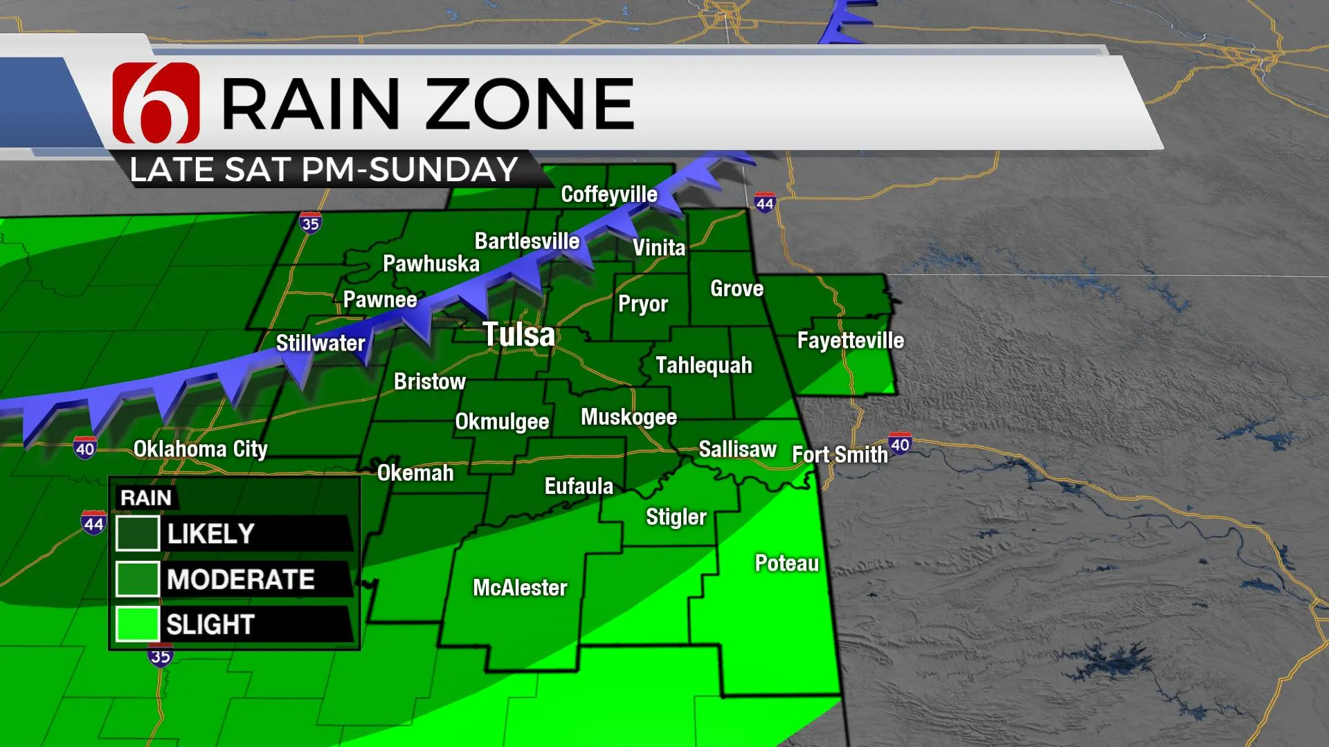
A surface area of low pressure developing to our north will ensure strong south winds developing today across the state with wind speeds from 20 to 35 mph possible along and northwest of I-44 by midday to afternoon. Humidity values are expected in the 20% to 30% range during the afternoon which would allow any wildfires to spread rapidly. Use caution both today and tomorrow as our fire danger issues will be increasing over the next few days. But these strong south winds will also eventually bring better low-level moisture from the Gulf of Mexico northward into the state later this week before a storm system brings a cold front into the region late Saturday night into Sunday morning. Severe weather threats currently appear low. The main timing for the front nears the metro early Sunday morning with temps in the 50s before the front moves into southeastern Oklahoma by midday with falling temps in the upper 40s for the day. Rain with some thunder will be likely early Sunday through midday.

The timing of the system hasn’t changed much but seems to be slowing down a hair compared to the previous few day's data. I’ll not make any major changes, but we may keep the rain chances longer Sunday morning before moving out of the metro region. Before the main system arrives, moisture will be transported northward across the area Friday night into Saturday and may result in a few spots of drizzle or a small shower or two during the day. This is a low probability for most of us but will be slightly higher for locations across southeastern Kansas Saturday morning to midday.

Next week should feature at least two distinct systems nearing the state, including late Monday night into Tuesday morning with some showers and then near or afternoon Thanksgiving. The data is not consistent regarding the middle to end of next week regarding the upper air pattern, but at least one system will be nearing Thursday or Friday. At this point, moisture may be limited.
Thanks for reading the Wednesday morning weather discussion and blog.
Have a super great day!
Alan Crone
KOTV
If you would rather listen, check out my daily “ Weather Out The Door” mini-podcast. You’ll find it on most podcast providers, including Spotify, Stitcher, Tune-In Radio, Apple Podcasts, and here on SoundCloud.
More Like This
November 18th, 2020
February 14th, 2022
January 26th, 2022
January 25th, 2022
Top Headlines
December 12th, 2024
December 12th, 2024
December 12th, 2024
December 12th, 2024


