Sunny, Pleasant Tuesday With Storm Chances Moving In Tonight
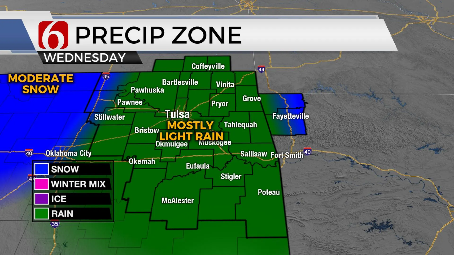
Another sunny and pleasant day is expected before a storm system nears the area later tonight bringing rain across eastern OK Wednesday and possibly changing to snow by late Wednesday night into Thursday morning for some locations across far northern OK.Tuesday, December 1st 2020, 6:04 am
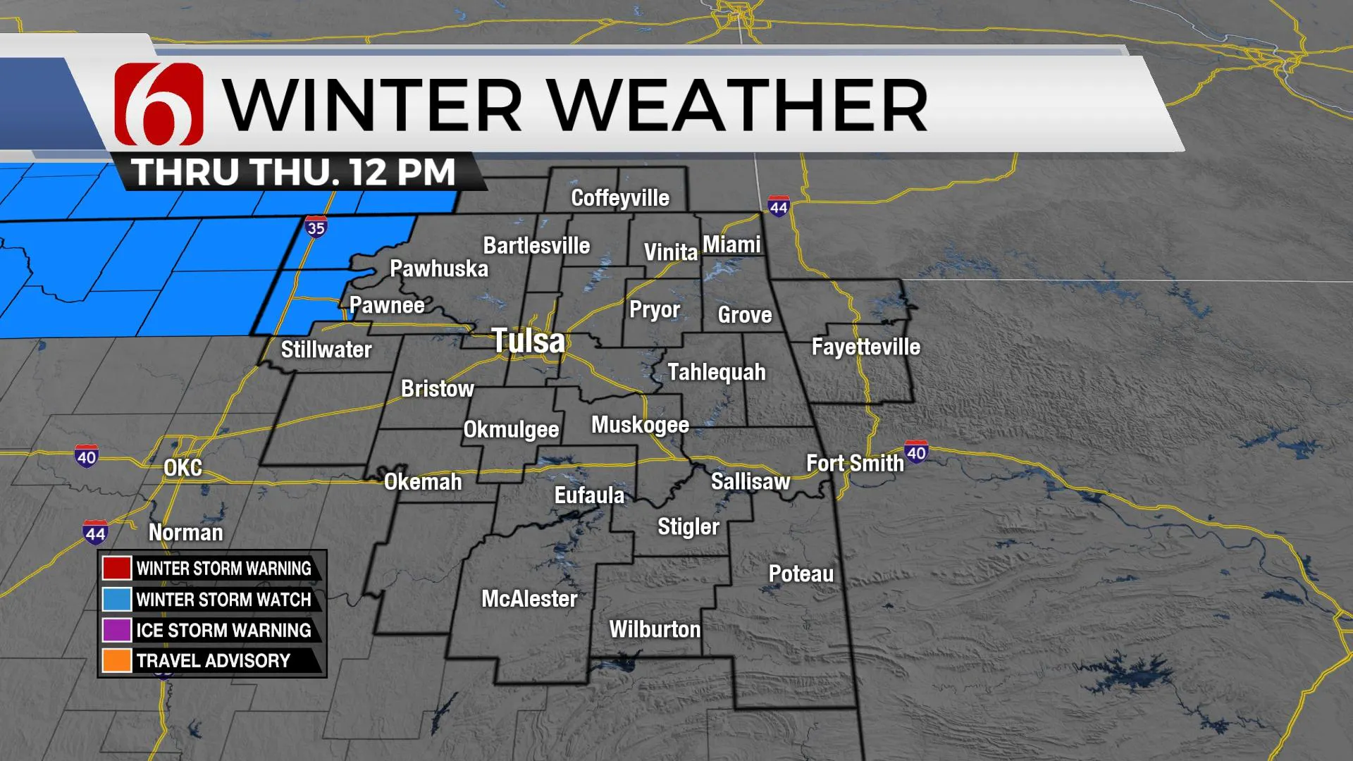
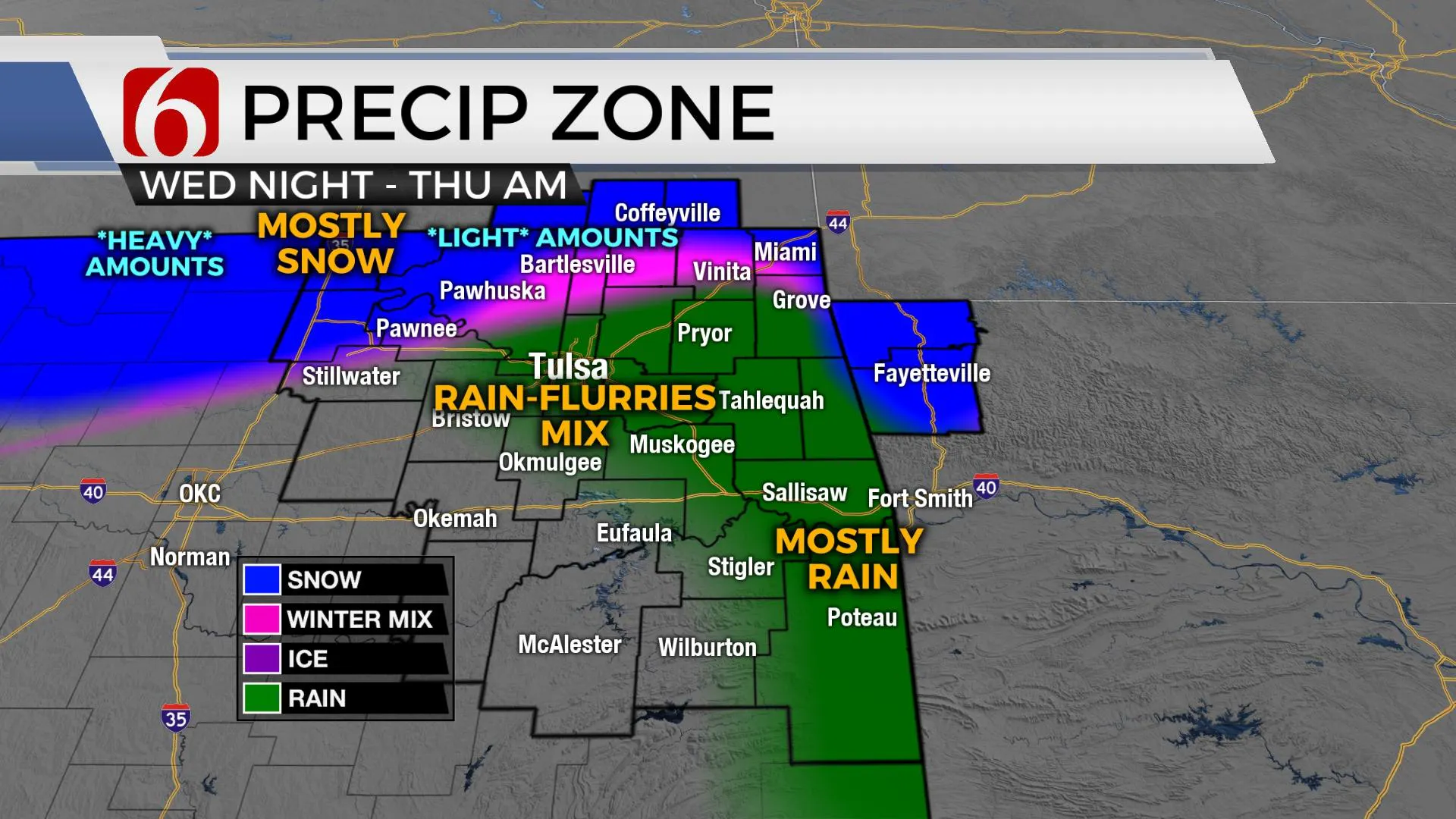
Another sunny and pleasant day is expected before a storm system nears the area later tonight bringing rain across eastern OK Wednesday and possibly changing to snow by late Wednesday night into Thursday morning for some locations across far northern OK. The best chance for accumulating snowfall with this system will remain north and northwest of the Tulsa metro where a winter storm watch is currently posted. These areas in the watch location could receive from 2 to 4 inches of wet snow with locally higher amounts across southcentral Kansas. The locations in the Winter Storm watch are approximately from Kay County in north-central OK north to Wichita Kansas west into southwestern Kansas and northwestern OK. Some rain with snow flurries or showers will be possible across the metro at times Thursday morning, but no accumulations are expected. Locations across far southern Kansas, part of Washington Co, part of Osage and Pawnee county may experience a slight dusting with this system. As with all winter systems, a change in the track of even 50 miles of some important features could change our forecast. This storm system will be exiting the area Thursday midday to afternoon with improving conditions Friday into the weekend.

The track of the main closed upper-level low is expected across northern OK Wednesday evening into Thursday with more than enough cold air aloft supporting column cooling to the surface. Most data support temps through the lowest 5000 feet of the atmosphere will be colder slightly to our west late Wednesday evening into Thursday morning with surface temps near freezing along or west of the I-35 region. If these features end up more west or southwest than anticipated, the accumulating snow forecast will shift more to the south and east than currently depicted.

After starting this morning in the 20s and lower 30s, highs today will reach the mid to upper 50s with abundant sunshine and breezy south winds. Wednesday lows start in the mid-30s and highs reach the mid-40s with rain developing before the main upper-level cold-core low draws near the region. Thursday morning temps will start in the lower 30s and finish with highs in the upper 30s to lower 40s. Some light rain may be mixed with flurries or light snow Thursday morning near the metro but no accumulations are currently expected in Tulsa. Friday appears cold with morning lows in the 20s and highs in the mid to upper 40s as sunshine returns across the area. This weekend features lows in the 30s and highs in the lower 50s as another weak system passes the area bringing north winds to the region Sunday.

Thanks for reading the Tuesday morning weather discussion and blog.
Have a super great day!
Alan Crone
KOTV
The morning weather update is now available as a mini-podcast. Search for ‘ Weather Out The Door’ on your podcast provider, such as Apple, Tune-In, Stitcher, SoundCloud and here on Spotify.
More Like This
December 1st, 2020
February 14th, 2022
January 26th, 2022
January 25th, 2022
Top Headlines
December 11th, 2024
December 11th, 2024
December 11th, 2024
December 11th, 2024


