Sunshine With Highs In The 60s
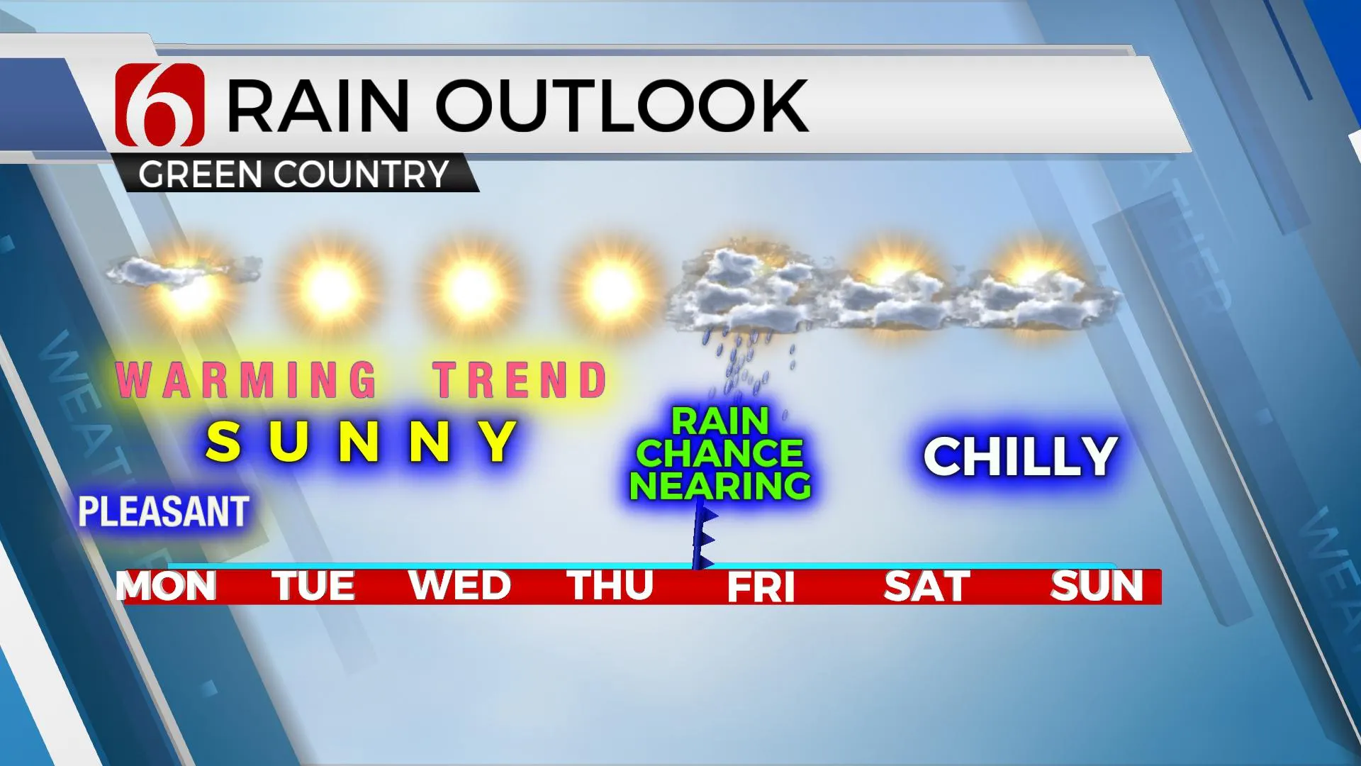
We are looking at generally uneventful weather for the next few days with plenty of sunshine and a warming trend. No precipitation will be expected until later this week, as we approach Thursday evening into early Friday when another series of upper-level systems will move across the state. Until then, the upper air flow combined with surface features will bring unseasonably warm weather into the state with highs reaching the upper 60s or lower 70s Wednesday into Thursday. No major cold air willMonday, December 7th 2020, 5:06 am
We are looking at generally uneventful weather for the next few days with plenty of sunshine and a warming trend. No precipitation will be expected until later this week, as we approach Thursday evening into early Friday when another series of upper-level systems will move across the state. Until then, the upper air flow combined with surface features will bring unseasonably warm weather into the state with highs reaching the upper 60s or lower 70s Wednesday into Thursday. No major cold air will be expected behind the departing system by this weekend, but a noticeable reduction in temperature will be likely since we will be expecting such above normal readings by the middle of this week.

We're on the western edge of the influence of a major trough located to our east. This feature will produce another surge of active weather across the Midwest and northeast in the next 24 to 36 hours. Oklahoma will remain on the western edge of this feature with a mid-level ridge of high pressure quickly expanding across the Mexican Plateau into the southern plains reaching into the central Rockies. This ridge will block any major system for the next few days before breaking down and moving east as the next upper trough loads across the western U.S.

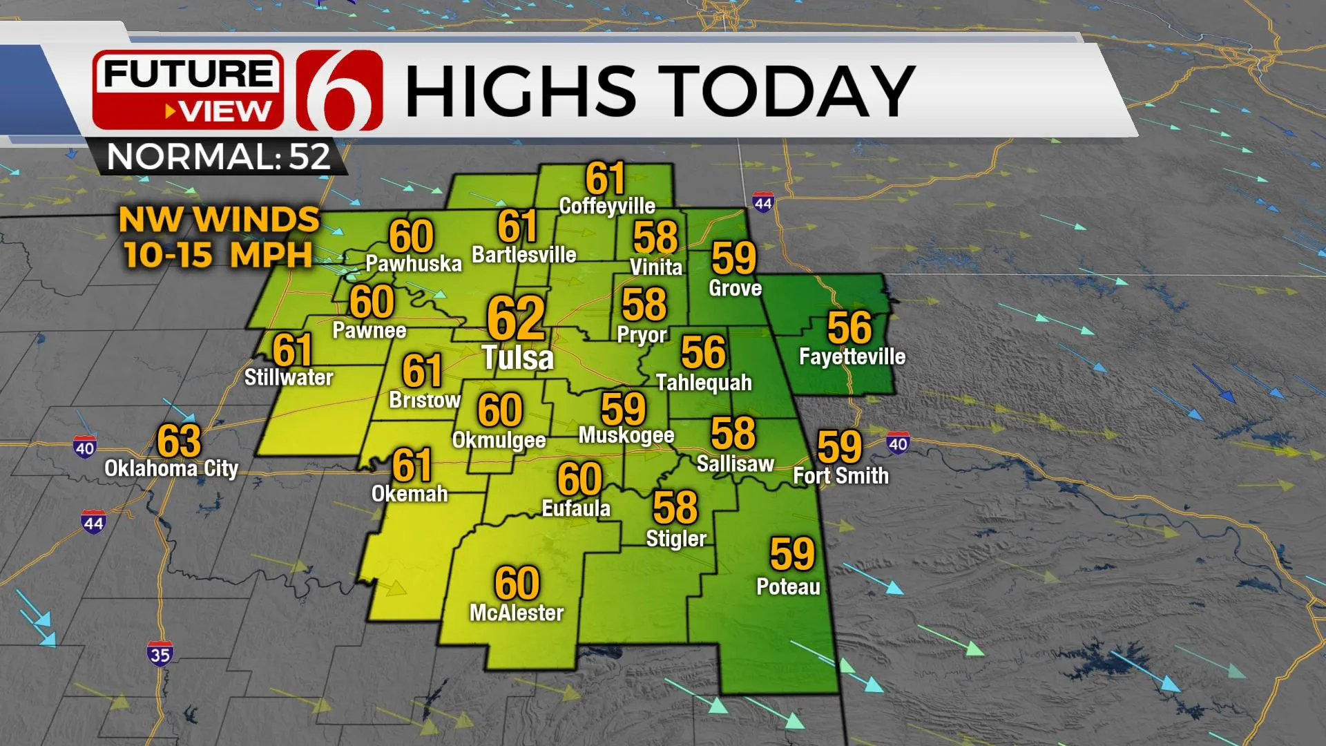
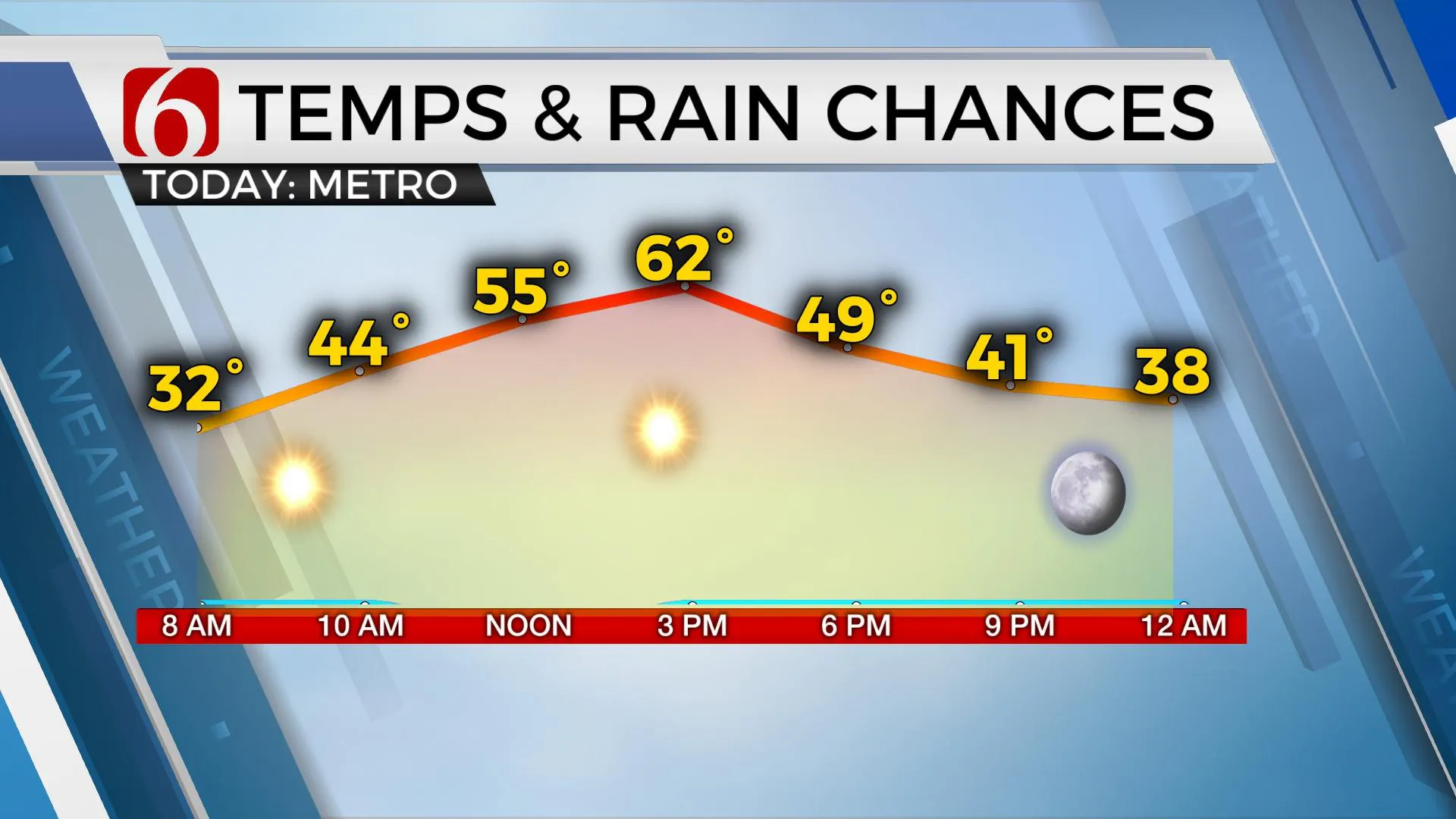
This morning will begin with lows in the 20s and 30s before reaching highs into the upper 50s and lower 60s along with west to northwest winds around 10 mph. After a chilly morning, we'll be looking at a very nice Monday afternoon. Tuesday through Thursday, south to southwest surface winds will return with lows moving into the 40s and highs reaching well above seasonal norms with upper 60s likely, and some lower 70s possibly both Wednesday and Thursday afternoon. The upper air pattern, currently from the north and northwest, will transition to a southwesterly flow pattern later this week bringing the first of a series of disturbances into the region. A surface low is expected to transit across northern OK late Thursday night into Friday morning with a chance for a few showers or rumbles of thunder. Following the frontal passage, temps will drop Friday and into the weekend representing near seasonal norms. Morning lows this weekend will start in the upper 20s and lower 30s with highs reaching the upper 40s and lower 50s. The pattern following into next week will remain active with upper-level waves moving across the plains frequently.

Thanks for reading the Monday morning weather discussion and blog,
Have a super great day!
Alan Crone
KOTV
Check out my ‘Weather Out The Door’ mini-podcast. Search for ‘NewsOn6’ on most providers, including Stitcher, Tune-In, SoundCloud and here on Spotify.
More Like This
December 7th, 2020
February 14th, 2022
January 26th, 2022
January 25th, 2022
Top Headlines
December 14th, 2024
December 14th, 2024
December 14th, 2024
December 14th, 2024


