Highs In The Mid-70s Before Winterlike Temperatures Return
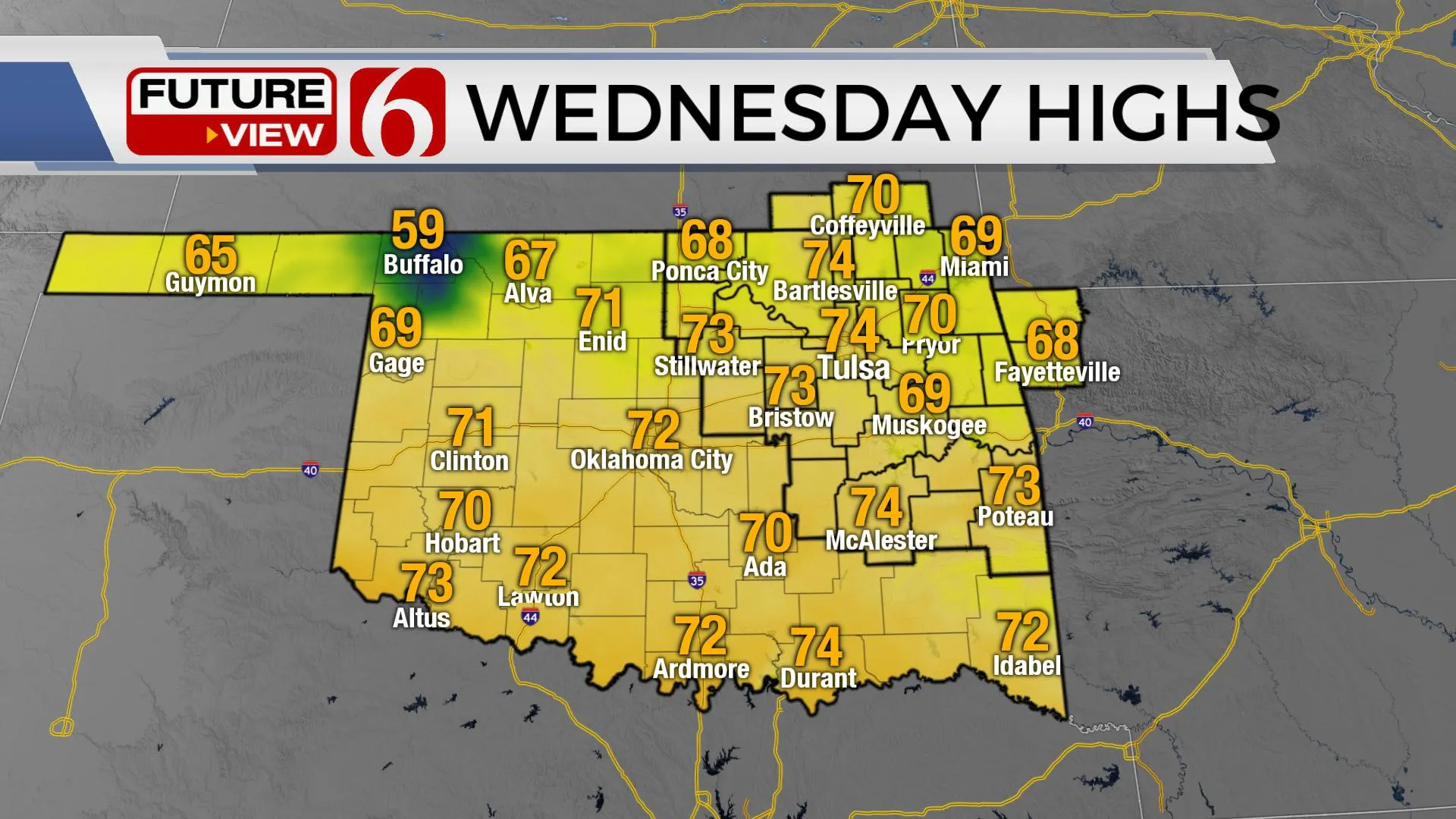
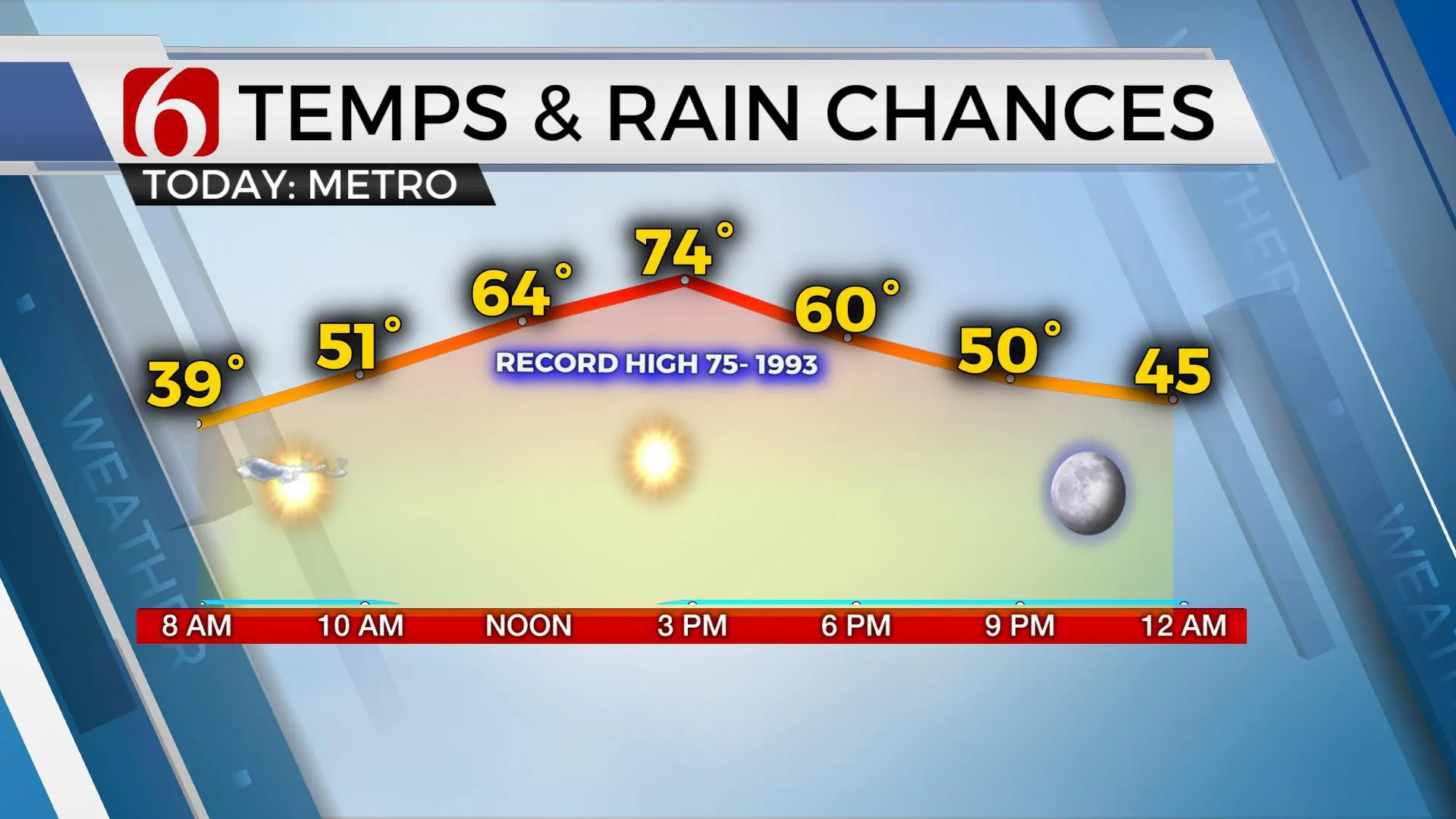
Day Three of super great weather is straight ahead with highs reaching the lower to mid-70s today and lower 70s tomorrow before the advertised changes kick-in Friday into the weekend with morning rain and a return of winterlike temps. Highs this weekend should stay in the lower 40s. If you enjoy the milder side of winter, enjoy the next few days before the pattern changes.Wednesday, December 9th 2020, 5:45 am
Day Three of super great weather is straight ahead with highs reaching the lower to mid-70s today and lower 70s tomorrow before the advertised changes kick-in Friday into the weekend with morning rain and a return of winterlike temps. Highs this weekend should stay in the lower 40s. If you enjoy the milder side of winter, enjoy the next few days before the pattern changes.

The mid-level ridge of high pressure remains in control of most of the area this morning but will slowly begin weakening and migrating east as our next upper-level system of interest moves closer to the area. A developing trough is forming across the western third of the nation, while a cut-off low currently near the Baja will eject ahead of this system and near the area by Thursday night into Friday morning. Before all of this occurs, pressure falls along the Lee of the Rockies will allow a return of south winds both today and tomorrow with increasing wind speeds Thursday from 15 to 22 mph. This also brings warmer temps into the region, thus the highs moving to near-record territory for some spots today. By Friday morning, a surface low will move across northern OK with the associated cold front moving across the area with a rain and some thunder nearby. Instability will be lacking. Most of the thunder will be confined to extreme southeastern OK or northeast TX. But the temps will take a tumble. I may eventually invert these numbers for Friday, with the highs in the 50s being reached early morning and temps dropping into the 40s by afternoon.

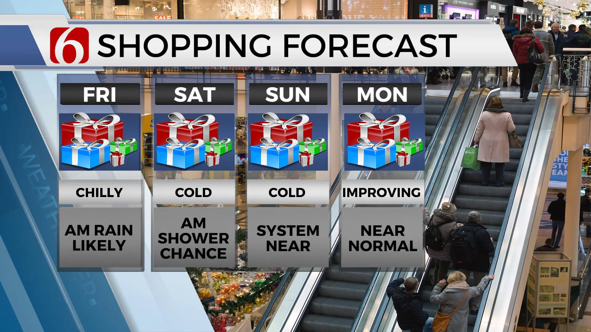
As the system moves east, colder weather will filter southward with temps taking a dive this weekend into the 40s for afternoon highs. Some data suggest another wave nearby could produce some precipitation Saturday morning near or north of the area. We have not added any big changes but will be introducing some low-end pops for Saturday morning due to this scenario near and north of the metro. Both EURO and GFS also bring a tail end trough-vort across the plains Sunday, but the GFS is closer to northern OK while the EURO remains more west. This may require us to add a low-end chance for a few snow showers Sunday midday, but this also currently remains a mostly a low-end chance for now until we get additional run to run consistency in the data.

The chilly weather will continue through the weekend before moderating to seasonal norms Monday into Tuesday before at least one, possibly two systems will arrive from the west with additional cold air intrusions possible.
Thanks for reading the Wednesday morning weather discussion and blog.
Have a super great day!
Alan Crone
KOTV
You can listen to the weather update. Check out my mini-weather podcast. Search for NewsOn6 ‘ Weather Out The Door ’ on most podcast providers, including here on Spotify.
More Like This
December 9th, 2020
February 14th, 2022
January 26th, 2022
January 25th, 2022
Top Headlines
December 14th, 2024
December 14th, 2024
December 14th, 2024


