Strong Cold Front Brings Blustery, Colder Weather Back To The State
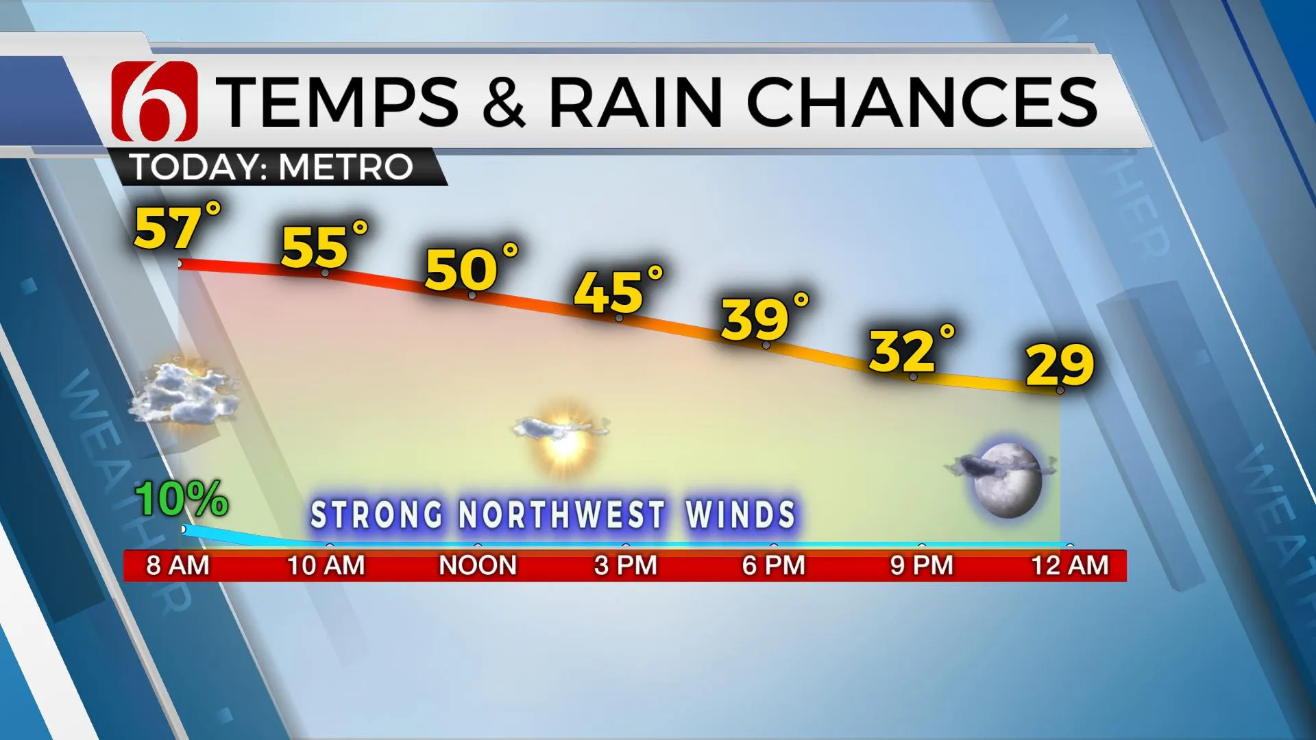
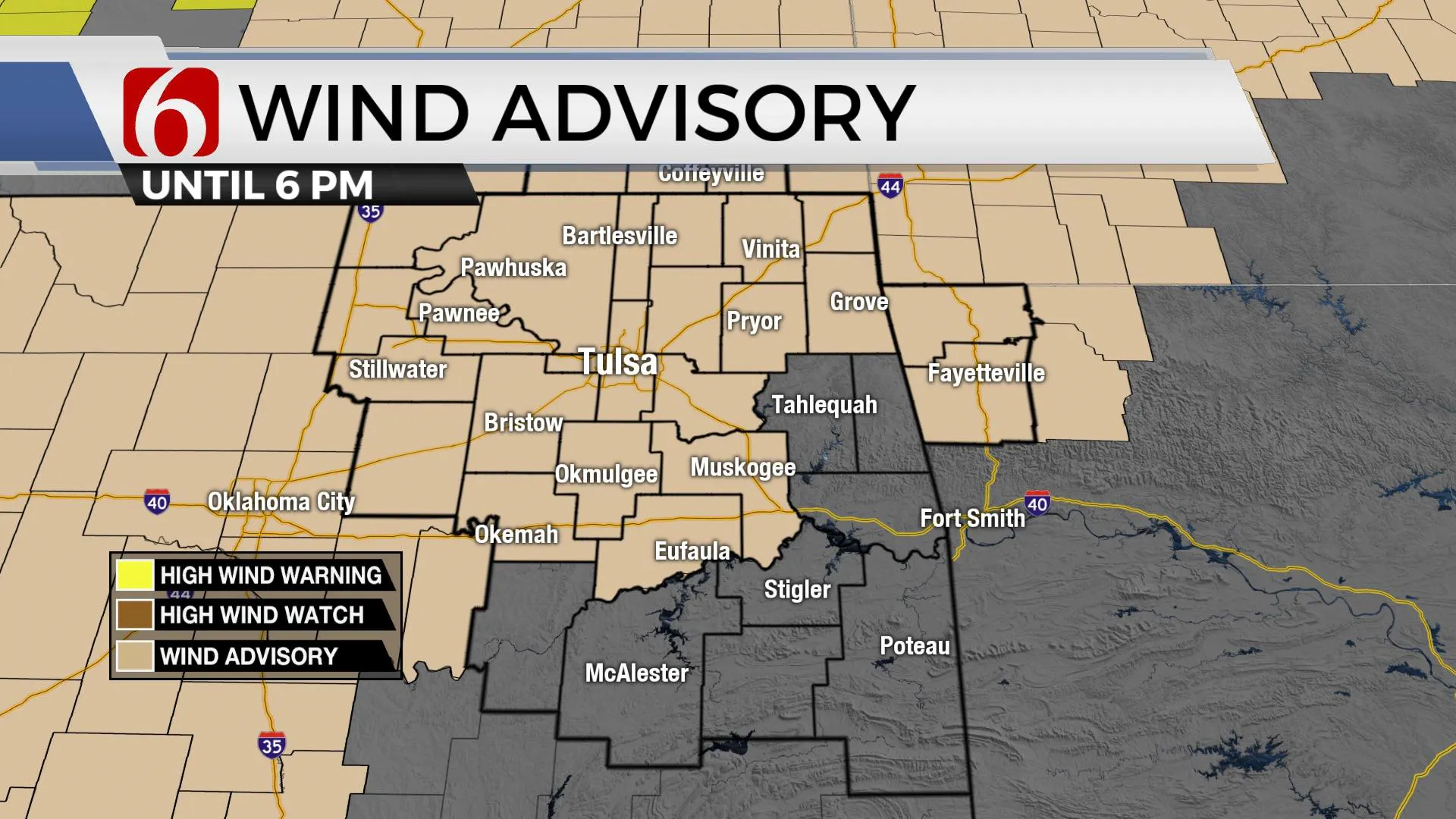
A strong cold front is plowing through the area this morning and will bring blustery and colder weather back to the state through the day. Temps this morning will stay in the mid-50s before dropping into the 40s this afternoon with strong northwest winds and eventually mostly sunny skies. These strong northwest winds will aWednesday, December 23rd 2020, 5:16 am
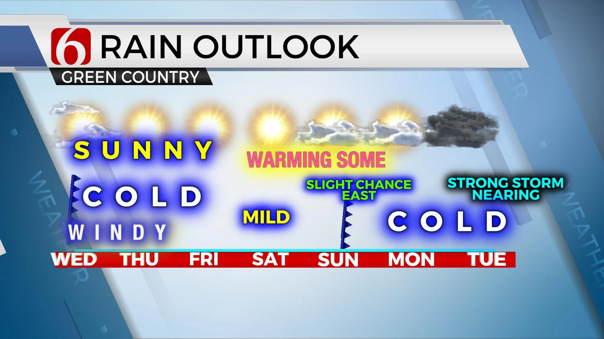
A strong cold front is plowing through the area this morning and will bring blustery and colder weather back to the state through the day. Temps this morning will stay in the mid-50s before dropping into the 40s this afternoon with strong northwest winds and eventually mostly sunny skies. These strong northwest winds will also contribute to another day of increasing fire spread rate issues. Burning is discouraged. This colder weather sticks around for most of the Christmas Holiday, but we’ll begin a mini-warm up with Christmas afternoon reaching near 50 and Saturday nearing the lower-60s before another fast system zips across the southern plains with a slight chance of a shower Sunday followed by more cold weather next week. I do anticipate another strong system for the middle of next week that could bring a possibility of some wintry impacts to the region, yet the data remain highly inconsistent with some important features.

A few showers may linger for the next hour or so across far Eastern OK but will quickly exit the area as a powerful upper-level trough rotates through the middle of the nation. Dry and colder air will quickly invade northern OK today. But this upper air system will bring blizzard conditions to part of the Midwest today and some snow into the northeastern U.S. Thursday evening into early Friday. Another developing system across the Pacific northwest into the northern intermountain region will also bring some scattered snow to the higher elevations. Most of the plains states will be void of precipitation for the Holiday but will remain quite cold. Gusty winds are likely to return to our area Thursday from the northwest at 15 to 30 mph with highs reaching the upper-30s to lower-40s Christmas Eve afternoon with mostly sunny skies. The winds should decrease quickly after sunset by Christmas Eve night and will bring very cold weather across northeastern OK through Christmas morning. Many locations will begin in the upper teens and lower-20s on Christmas Day before rising into the 40s at lunch and near 50 by afternoon. Winds should be from the south, but lighter in speeds Friday.

The weekend system also appears to be moisture-starved but I will keep a small placeholder pop for Sunday morning near and east of Tulsa. Temps will remain mild with highs mostly in the lower-60s for the weekend afternoon highs.

Next week could be interesting. Both EURO and GFS bring a strong system into the state, but the thermal properties and trajectory of the EURO would support another strong winter weather maker across the state, while the GFS counterpart is mostly liquid variety. But, based on the last two runs of the American model, some wintry mix would also be possible in a few areas as the system nears Tuesday with mostly a cold rain developing Wednesday. Stay tuned. We have a lot of work to do regarding the system for the end of 2020. As of this morning, I do not have any big mentions of winter weather for next week, but that is possible in subsequent forecast updates. It’s just too early to make that call.
Thanks for reading the Wednesday morning weather discussion and blog.
Have a super great day!
Alan Crone
KOTV
Check out my mini-podcast and weather update. Search for NewsOn6 ‘ Weather Out The Door ‘ on most podcast providers, including here on Spotify.
More Like This
December 23rd, 2020
February 14th, 2022
January 26th, 2022
January 25th, 2022
Top Headlines
December 10th, 2024
December 10th, 2024
December 10th, 2024
December 10th, 2024


