Cold Weather Returns To Northeastern Oklahoma
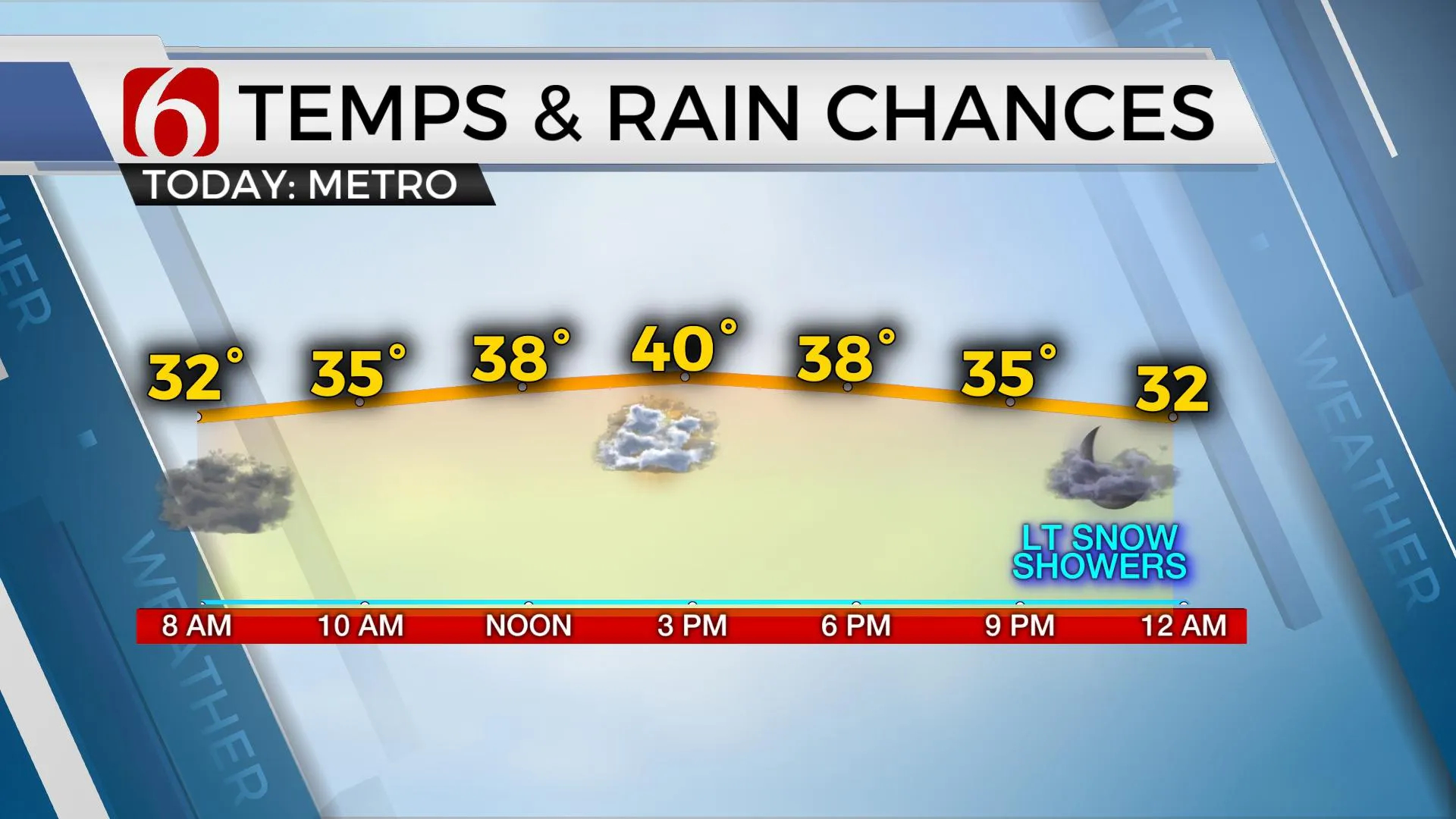
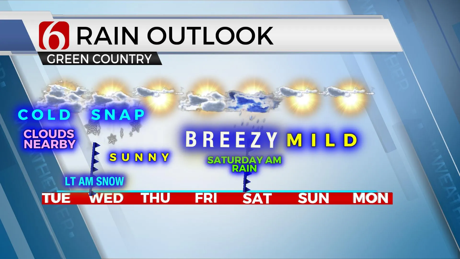
Cold weather has returned to northeastern Oklahoma and will remain for the next few days before moderating Friday into the weekend. We’re also tracking two more storm systems, including one arriving later tonight into Wednesday morning bringing a small window for a few rain and snow showers. The second system nears Saturday with rain and some thunder across the region for the morning hours. Severe storms are currently not expected with the weekend system. Temperatures this morning will start inTuesday, January 26th 2021, 8:38 am
Cold weather has returned to northeastern Oklahoma and will remain for the next few days before moderating Friday into the weekend. We’re also tracking two more storm systems, including one arriving later tonight into Wednesday morning bringing a small window for a few rain and snow showers. The second system nears Saturday with rain and some thunder across the region for the morning hours. Severe storms are currently not expected with the weekend system. Temperatures this morning will start in the upper 20s to lower 30s and will reach the upper 30s to lower 40s north and upper 40s in southeastern Oklahoma. The wave approaching the area tonight will bring some snow flurries or showers across part of northeastern OK tomorrow morning, but no significant accumulation will be expected for most of the area. The higher elevations of far east-central OK into northwestern Arkansas may get a minor dusting. A small area of far northern OK and southeastern Kansas could also see a minor dusting. The cold weather will remain Wednesday with morning lows in the upper 20s and highs only reaching the upper 30s. More sunshine returns by tomorrow afternoon into Thursday with lows in the 20s and highs reaching the mid to upper 40s Thursday afternoon.

The upper air flow will remain quite active for the next few weeks. This is an extension of the pattern that set-up about a month ago and continues to remain active into the foreseeable future. A moderately strong upper-level wave will scoot across the state late tonight into Wednesday, but the lower and mid-levels of the atmosphere appear rather dry. Regardless, we’ll need to keep a mention for some light flurries or a mix across part of the area as the wave ejects nearby early Wednesday morning. Another strong-looking trough is already diving down the West Coast and will eject across the southwestern U.S. later this week and bring rain and thunder chances for the first half of the weekend, and mostly for early Saturday morning. Current data support this system remaining too warm for any wintry impacts. As this system nears, gusty winds will return Friday and continue Saturday as the system exits the area. Our window for showers and storms will remain for Saturday morning with most of the weekend in good shape. This same active pattern will bring a strong system near the southern and central plains by the middle to end of next week.

Thanks for reading the Tuesday morning weather discussion and blog.
Have a super great day!
Alan Crone
KOTV
If you listen to podcasts, try out my daily weather update. Search for NewsOn6 and ‘Weather Out The Door’ on most podcast providers, including here on Spotify.
More Like This
January 26th, 2021
February 14th, 2022
January 26th, 2022
January 25th, 2022
Top Headlines
December 14th, 2024
December 14th, 2024
December 14th, 2024
December 14th, 2024


