Another Cold Day Likely
Another cold day is likely for northeastern OK ahead of our next storm system bringing gusty winds and rain into the area early Saturday morning.Thursday, January 28th 2021, 6:38 am
Another cold day is likely for northeastern OK ahead of our next storm system bringing gusty winds and rain into the area early Saturday morning.

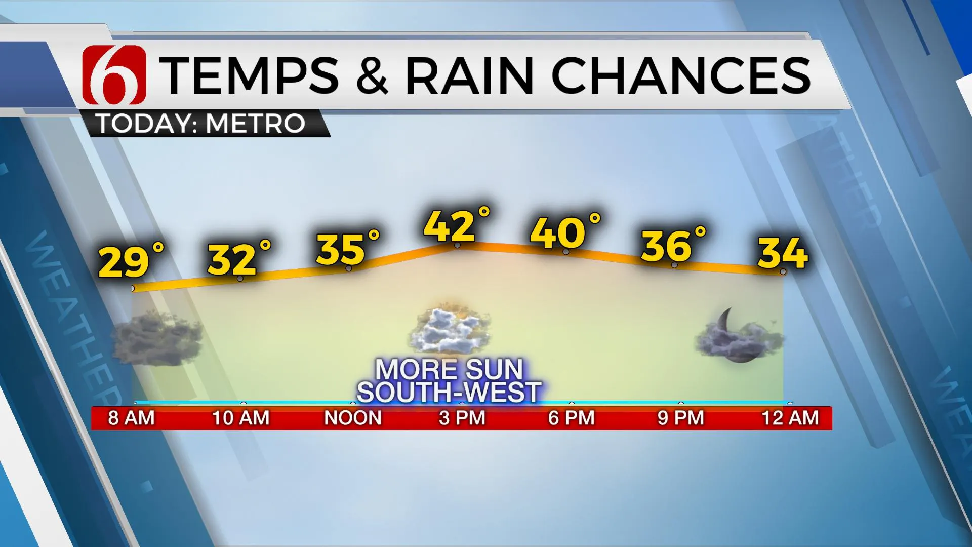
Low clouds have remained thick for most of the area overnight with most locations starting this morning in the upper 20s and lower 30s. More westward, the sky cleared, and temps are in the teens and lower 20s. The temperature forecast continues to be problematic due to the shallow nature of the cold air and the question of how long the low clouds will stick around today. This could keep part of the area again in the upper 30s and lower 40s with other locations southwest of the metro into the upper 40s and even lower 50s. I’ll stay on the low side near and east of the metro with highs in the lower 40s. Our next weather maker arrives Saturday with rain and some thunder. Another strong looking system will also near the southern plains for the middle to end of next week.

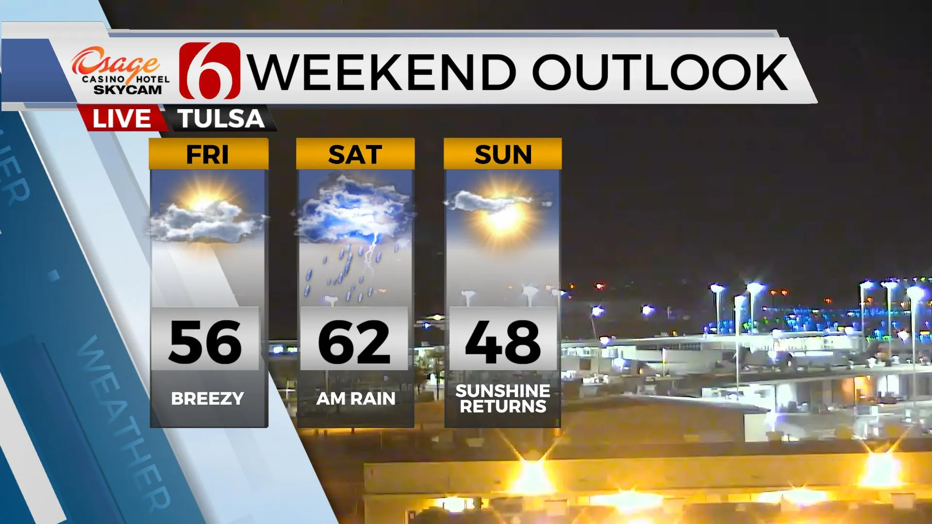
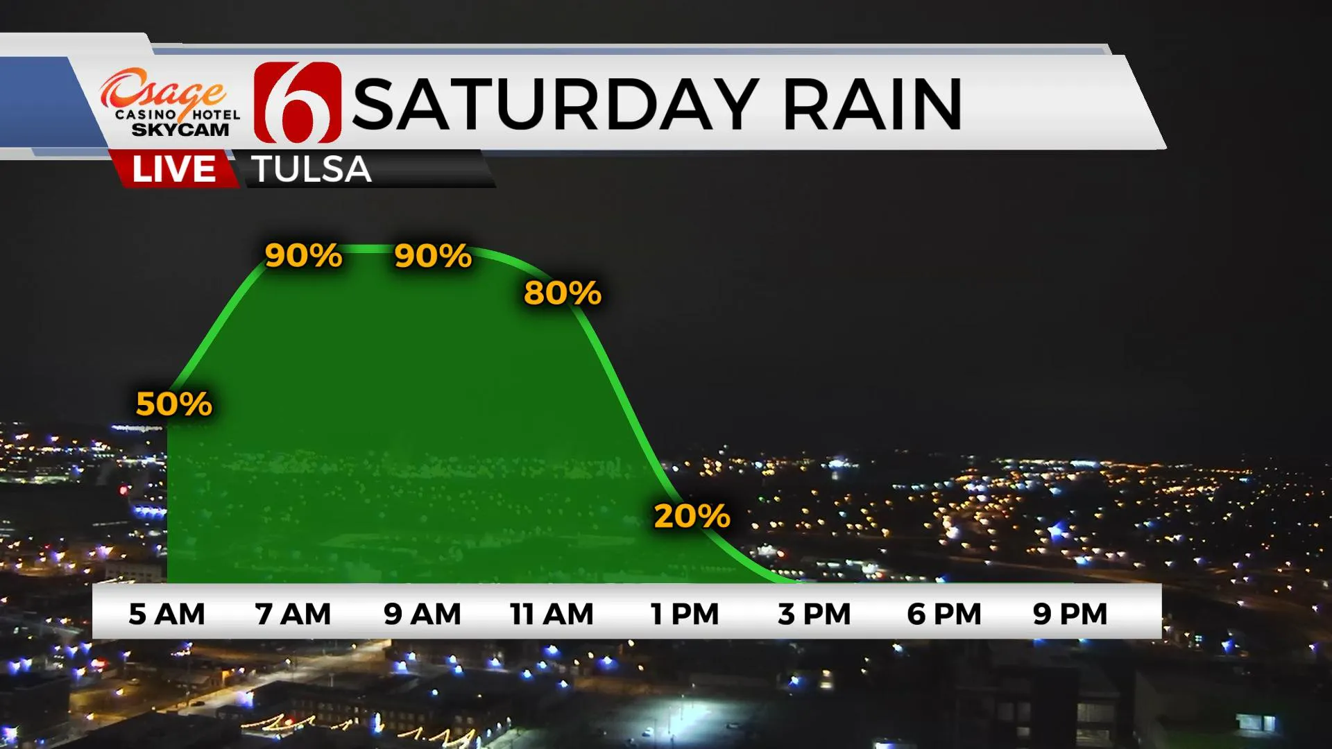
The next powerful upper-level system to impact our weather is currently across the western U.S and causing significant weather across the Sierra Nevada range again this morning. Blizzard warnings remain for the higher elevations through Friday morning with snow amounts from two to six feet in some locations along with winds gusting from 50 to 100 mph. Heavy, flooding rain is underway in the lower elevations with strong winds and mudslides in some locations across southern California. As this powerful upper-level low dives across the southwest and moves east, surface pressure will fall along the Rockies with gusty south winds developing Friday from 15 to 25 mph. A mid-level ridge of high pressure will temporarily bring us relatively mild temps Friday with highs in the upper 50s or lower 60s along with the partly cloudy sky. Showers and some thunder will be likely early Saturday morning as a strong surface low-pressure area ejects across southern Kansas and drags a cold front across the state. This is a very strong storm system and would normally be a severe weather maker for part of our area. But the lack of surface instability combined with deeper moisture remaining well south will keep the severe weather threats out the state. As this system exits, strong winds from the west and northwest will invade northeastern OK Saturday afternoon with decreasing clouds and highs reaching the upper 50s and lower 60s Saturday. Chilly weather returns Sunday with highs in the upper 40s and lower 50s. Another strong trough nears for the middle of next week with the possibility of showers and storms followed by more cold weather. Some data continues suggesting another cold snap will follow into next weekend.

Thanks for reading the Thursday morning weather discussion and blog.
Have a super great day!
Alan Crone
KOTV
Be sure and check out my daily podcast weather update Here on Spotify, and most other podcast providers.
More Like This
January 28th, 2021
February 14th, 2022
January 26th, 2022
January 25th, 2022
Top Headlines
December 15th, 2024
December 15th, 2024
December 15th, 2024
December 15th, 2024


