Blustery Weather Develops Thursday
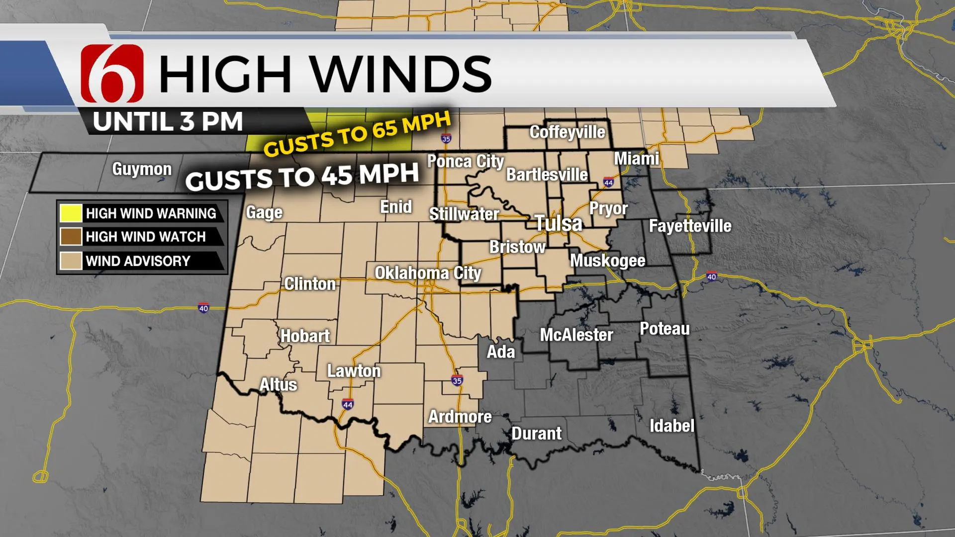
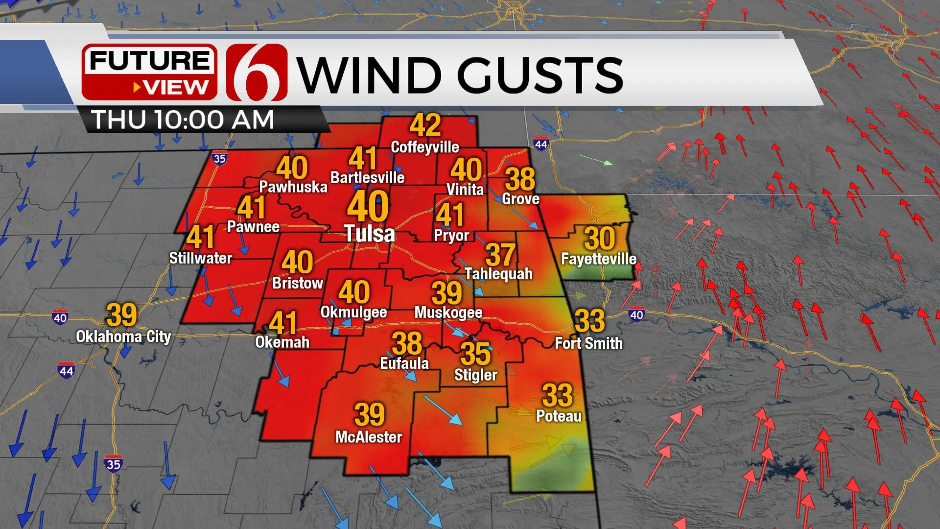
Blustery weather develops today as a strong cold front plows across the area. Wind advisories will remain until 3 p.m. with northwest winds gusting from 20 to 45 mph. Temps will rebound Friday with sunshine, lighter wind and pleasant conditions. The arrival of arctic air may not take hold for the entireThursday, February 4th 2021, 6:47 am
Blustery weather develops today as a strong cold front plows across the area. Wind advisories will remain until 3 p.m. with northwest winds gusting from 20 to 45 mph. Temps will rebound Friday with sunshine, lighter wind and pleasant conditions. The arrival of arctic air may not take hold for the entire area until Monday, yet the initial boundary could arrive late Saturday night into Sunday for extreme northern OK.

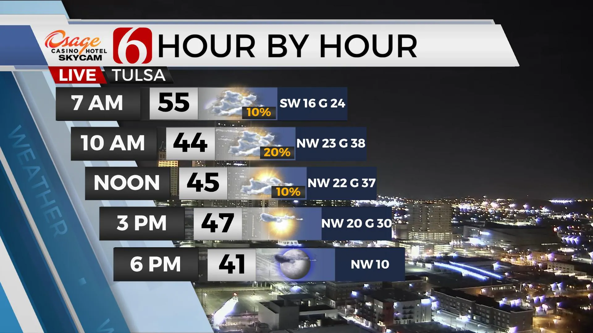
Mild temps will remain early this morning but will not last long as a strong cold front plows through the area around midday bringing gusty northwest winds, falling temperatures and a few sprinkles near the area. While most locations will remain dry, almost all of us will experience this initial cold air intrusion with temps dropping into the 40s this afternoon with wind chills in the 30s. But the main issue will be the strong northwest winds prevailing behind the front for the middle part of the day. Fire spread rates will be increasing quickly this morning through the day. Tomorrow, we should get a nice rebound after a cold Friday morning with afternoon highs reaching the mid-50s along with sunshine and southwest winds.

Our main issues continue to be the eventual return of arctic air for the weekend. The data is typically having a difficult time in resolving the arrival of the first surge of this airmass, but I’m inclined to bring this front through the area slightly faster than model data depictions. This means Saturday may reach the lower 50s around midday, but strong north winds and much colder air will arrive by evening, but only across far northern OK with a small window for light showers across far northeastern OK and some light snow or flurries in the mix for southeastern Kansas.

This airmass may prove difficult to survive the initial trip south into northern OK and most data depict the front becoming diffuse with south winds and temps moving back into the 50s Sunday afternoon, even for the Tulsa metro. This part of the forecast remains highly uncertain and additional changes are likely for Sunday and Monday, but I’ve continued to keep at least northern OK into the chilly air Sunday with highs in the upper 30s. South of I-40, temps could move into the 50s, and even the lower 60s along the Red River Valley. The 2nd and more significant surge of arctic air arrives Monday morning to midday bringing temps down into the upper 20s to lower 30s for afternoon highs and lows in the teens Tue through Thu. This pattern is also conducive for some wintry weather impacts across part of the state as shallow cold air remains while a disturbance approaches from the southwest. We’ll discuss more of these probabilities and scenarios tomorrow as hopefully data becomes more conclusive on the initial arrival of the arctic air.
Thanks for reading the Thursday morning weather discussion and blog.
Have a super great day!
Alan Crone
KOTV
Be sure and check out my daily weather podcast. Search for NewOn6 and ‘ Weather Out The Door’ on most podcast providers, including here on Spotify.
More Like This
February 4th, 2021
February 14th, 2022
January 26th, 2022
January 25th, 2022
Top Headlines
December 14th, 2024
December 14th, 2024
December 14th, 2024
December 14th, 2024


