Cold Temperatures Persist Ahead Of Weekend Winter Weather
The fetch of moisture from Lake Oologah continues to feed some light snow across part of the metro early this morning and some additional yet minor dustings to accumulations are possible in a very narrow region southwest of the Lake. The northeast wind has been perfectly aligned with the orientation of the lake. Water temperature is warmer than the surrounding air and light snow, lake effect snow has been the product. Other similar size lakes will also be able to produce some minor impacts to thFriday, February 12th 2021, 7:10 am
The fetch of moisture from Lake Oologah continues to feed some light snow across part of the metro early this morning and some additional yet minor dustings to accumulations are possible in a very narrow region southwest of the Lake. The northeast wind has been perfectly aligned with the orientation of the lake. Water temperature is warmer than the surrounding air and light snow, lake effect snow has been the product. Other similar size lakes will also be able to produce some minor impacts to the southwest of those bodies, including southwest of Lake Eufaula into the Pittsburg co and McAlester region. A minor change in wind direction from the current trajectory will probably shut this localized snow production down. While this is unusual for our area, it’s not uncommon to see this phenomenon at least once every few years or even annually during winter when conditions are perfect.
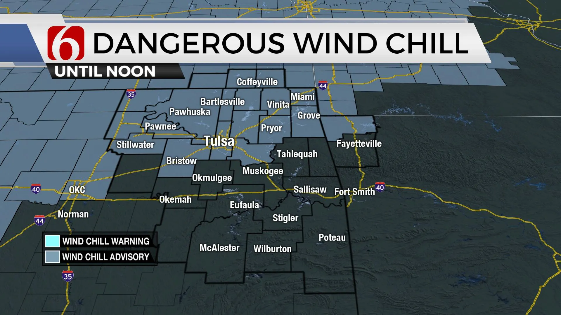
While we have a second surge of cold arctic air arriving today and continuing into the foreseeable future, I’ll keep most of the discussion this morning focused on the potential for snow, possibly impactful for the region Sunday into Monday morning. Another wave is also likely to arrive Tuesday night into Wednesday morning that will also bring some accumulating snowfall to part of northeastern or eastern OK.
Before the main upper low arrives near the state, a weaker wave will approach the area later tonight producing some light snow across southeastern Kansas into northeastern OK by evening. No major accumulations are expected, but a minor dusting will remain possible with higher chances located west of our immediate area. Unfortunately, the air currently remains shallow across far southeastern OK where another mix of light drizzle or showers may occur resulting in a small window for freezing precip once again. A short-term advisory may be issued for this time period, but any travel impacts would be across or south of the I-40 corridor, mostly into the southeastern OK region due to this potential for light freezing precip. Once this wave exits the area early Saturday morning, the rest of the day will feature dry but bitterly cold weather with highs staying in the teens along with dangerously low wind chills.
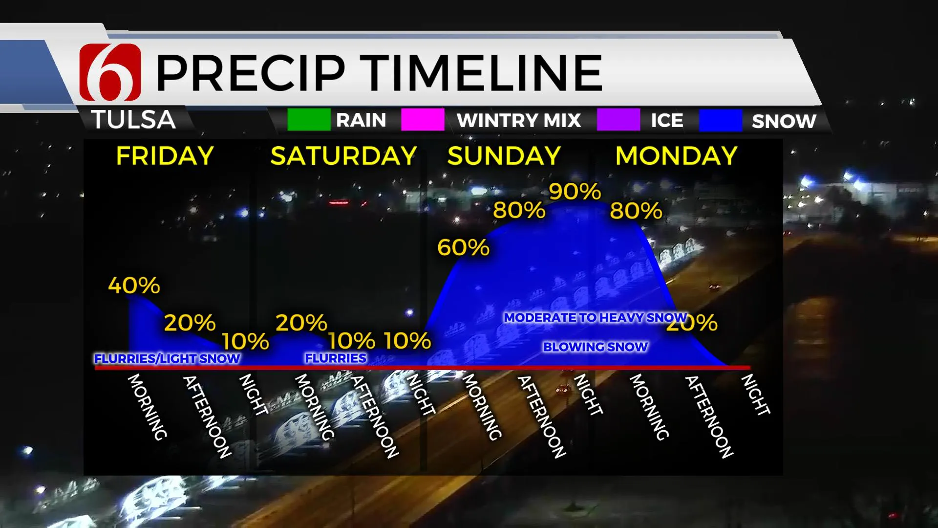
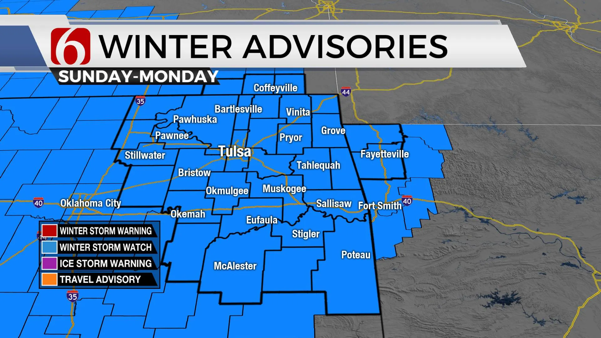
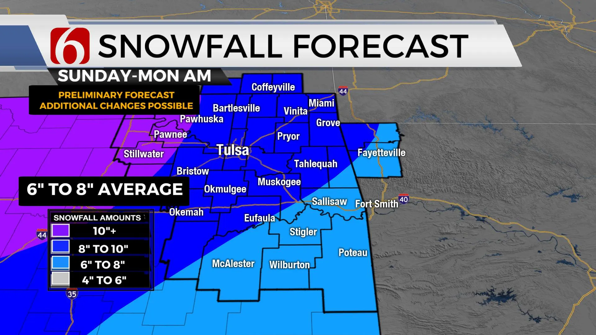
Saturday evening snow will develop across far northwestern OK as the main upper low nears the vicinity. By early Sunday morning, a lead wave ahead of the main low should allow for some snow bands to move into northcentral and northeastern OK with moderate snowfall rates. This initial wave could produce some accumulations from one to near four inches through the morning to midday Sunday. There may or may not be a break midday as this lead wave exits the area. By Sunday afternoon and early evening, the main upper-level low is nearing the north Texas region as moderate to heavy snow production begins across western OK and moves eastward through the evening. Northeast winds from 15 to 30 mph will be possible creating blowing snow and near blizzard conditions in the moderate to heavy snow bands. By Sunday evening into pre-dawn Monday, the main forcing should arrive across Eastern OK bringing the highest chance of impactful snowfall with this current system. The current configuration of most data supports the snow exiting our immediate Eastern OK region by midmorning to noon Monday. Snow ratios with arctic air are typically much different compared to continental air masses and will play a vital role in determining the exact amount of snowfall this system can produce. A conservative estimate between 15 to 1 ratio seems plausible with locally higher ratios from 20 to 1 likely at times. The forecast also hinges on the exact amount of available precipitation for the system. Model data suggests anywhere from .30 to .50 of precip will be possible, which seems high in this environment. This may result in some snow totals from six to 10 inches across Eastern OK, with locally higher amounts in a few spots. All of this is contingent on the exact track of the upper-level system and the positioning of a surface low across part of Texas. Any change in these features even by 50 miles south will have some impacts on our forecast. Another system will arrive Tuesday night into Wednesday morning and should be capable of producing another two to four inches of snow, but mostly across northeastern OK and part of southeastern Kansas.
Now to the disclaimer:
The main system we're currently tracking is still mostly off the west coast this morning, many miles away from Eastern Oklahoma. Things can still change with this system.
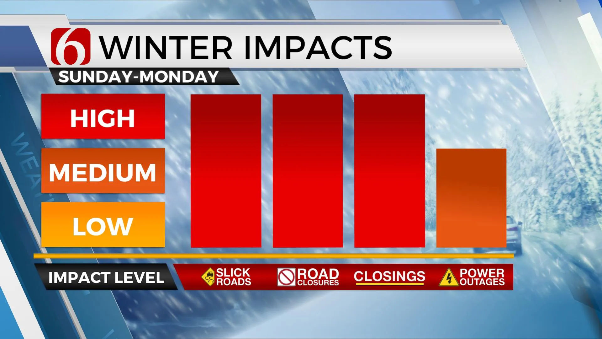
We’ve all experienced snow forecasts that ‘fizzled’. While this doesn’t appear to be the case in the data, it's always possible that some changes will occur in the forecast data that could change forecast accumulation projections. Minor changes to any of the factors I’ve written about can cause big changes in accumulation outputs. Other than a change in trajectory with the main upper level low, the presence of dry air that usually accompanies significant arctic air is of concern but should be quickly overcome with increasing moisture as the system nears the state.
The lingering effect of this long period of sub-freezing temperature will remain for all of next week before the pattern attempts to change allowing us to move into the mid-30s by next weekend.
Thanks for reading the Friday morning weather discussion and blog.
Have a great and safe day.
Alan Crone
KOTV
More Like This
February 12th, 2021
December 11th, 2024
December 11th, 2024
December 11th, 2024
Top Headlines
December 11th, 2024
December 11th, 2024
December 11th, 2024
December 11th, 2024


