Bitterly Cold Weather Today, Another Storm System Nearing
Bitterly cold weather is underway with yet another storm system nearing later this afternoon and evening. More accumulating snow is likely across a large part of the state. This cold weather will stick around for a while, but changes will occur soon.Tuesday, February 16th 2021, 10:27 am
Bitterly cold weather is underway with yet another storm system nearing later this afternoon and evening. More accumulating snow is likely across a large part of the state. This cold weather will stick around for a while, but changes will occur soon.

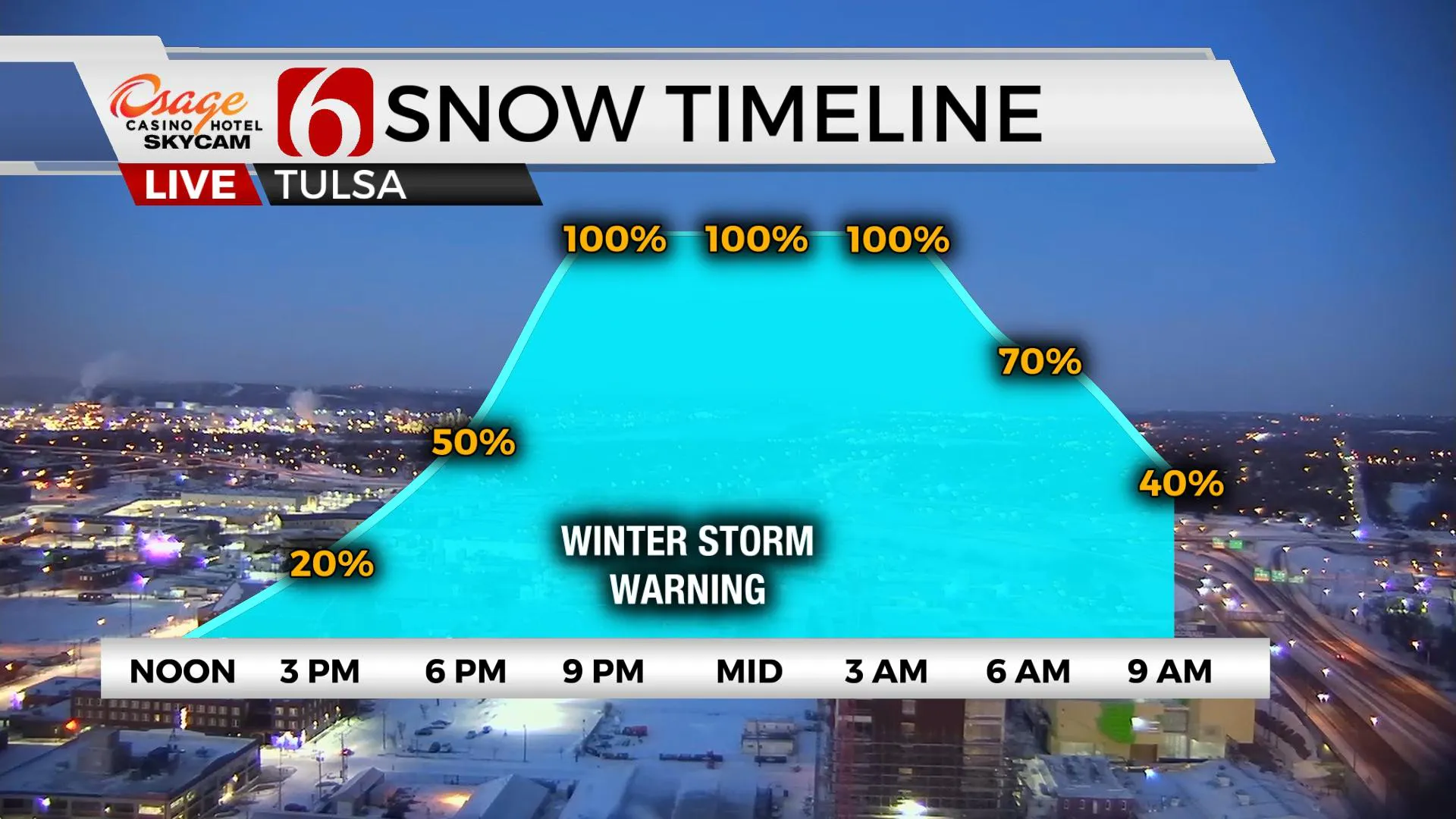
It may not seem like it, but the upper air pattern that has allowed this bitterly cold arctic air intrusion across the nation has already changed. We’ll continue to stay cold for the rest of the week, but the change in the upper air pattern will no doubt bring some welcome relief from the deep freeze with a minor warming trend this weekend and a very noticeable warm-up early next week. We’ll be approaching the upper 50s Monday and possibly the lower 60s by this time next week before another front moves across the area. We’re not finished with cold weather for the season, but we do see some relief into early next week. But not today. Another impactful winter storm will be arriving later this afternoon and evening with more snow accumulation over Eastern Oklahoma.

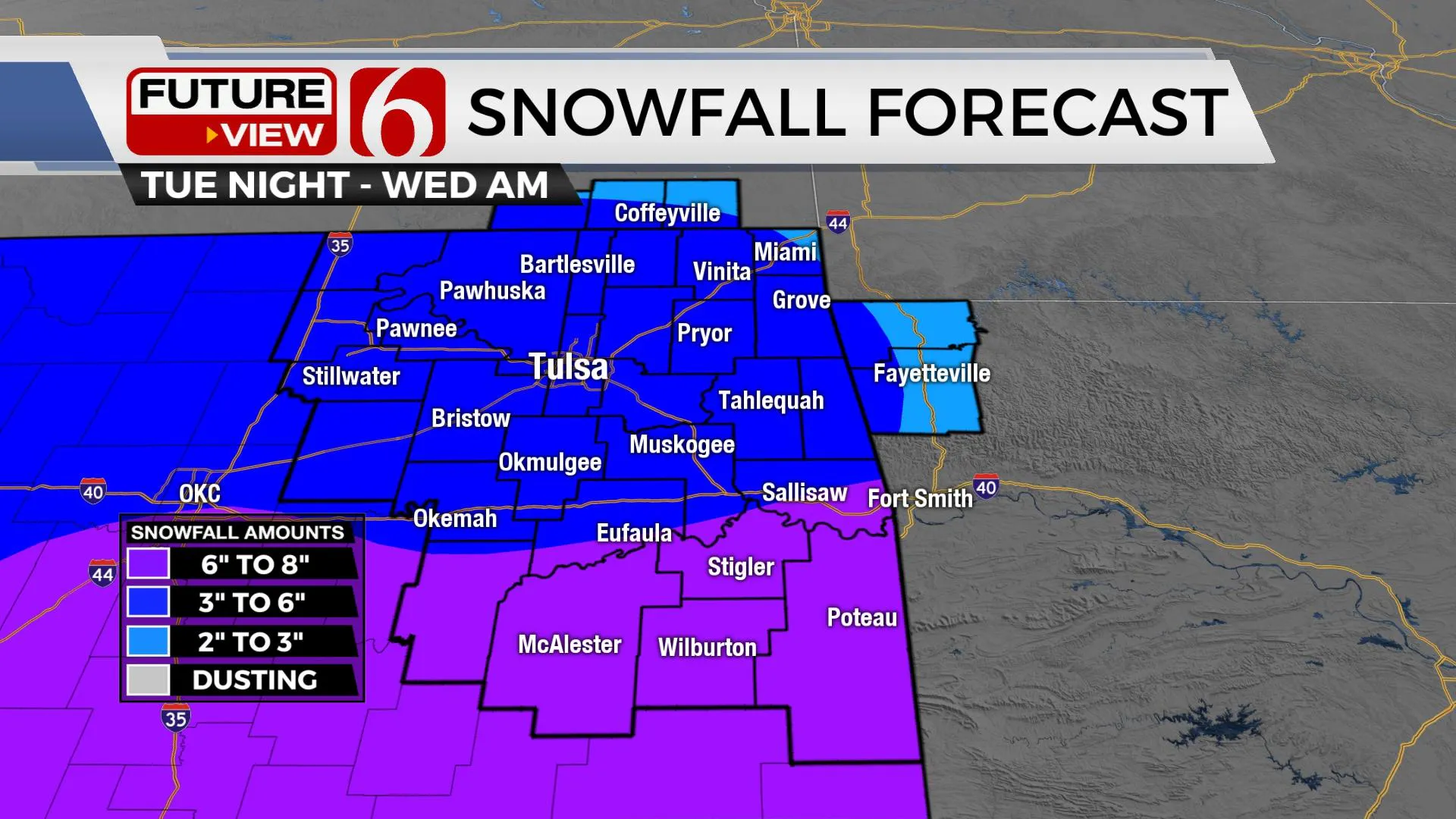
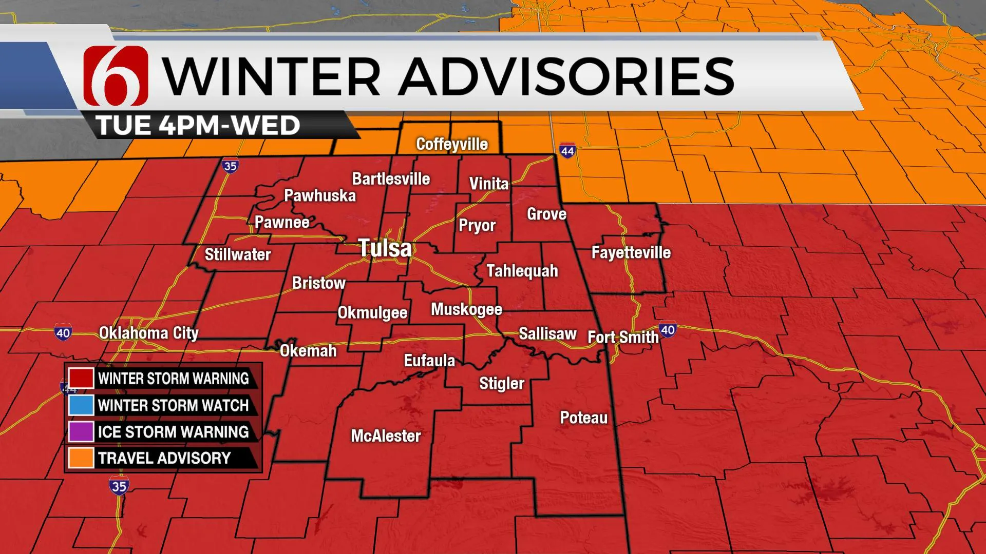
Our next system is queuing up this morning well to our west. Winter storm warnings will be underway for a large chunk of real estate of the state, including all of NE and SE OK. This system will be exiting our immediate area Wednesday morning to midday. My snowfall accumulation forecast hasn’t changed from yesterday with most locations receiving between 3 and 6 inches of snow near the metro along with locally higher totals. Locations near and south of the I-40 corridor may be in a more favorable position for higher totals, between 6 and 8 inches, including parts of Pittsburg, Latimer and Le Flore Counties. Winds should not be as strong as this past system, but wind speeds from 10 to 15 mph will be possible. This snow should be a little more on the ‘wet’ side and not as dry as the last system. Snowfall ratios will remain quite tricky with this system. Of course, it’s truly impossible to know the exact ratio until after the snow is produced. I need to stress that our accumulation forecast can still go through some changes later today as the system gets closer.

Another major issue currently underway is the potential for some all-time record lows underway across the state. The clouds cleared last night allowing for near perfect radiational cooling (max outbound solar insolation) and temps have plummeted due to the snow cover and extremely dry air in the planetary boundary layer. Our Tulsa all-time record low of -16 from January 22, 1930 is reachable this morning. Additionally, winds from 5 to 15 mph will create wind chill values between -15 and -30 across the region and our current wind chill warning remains.

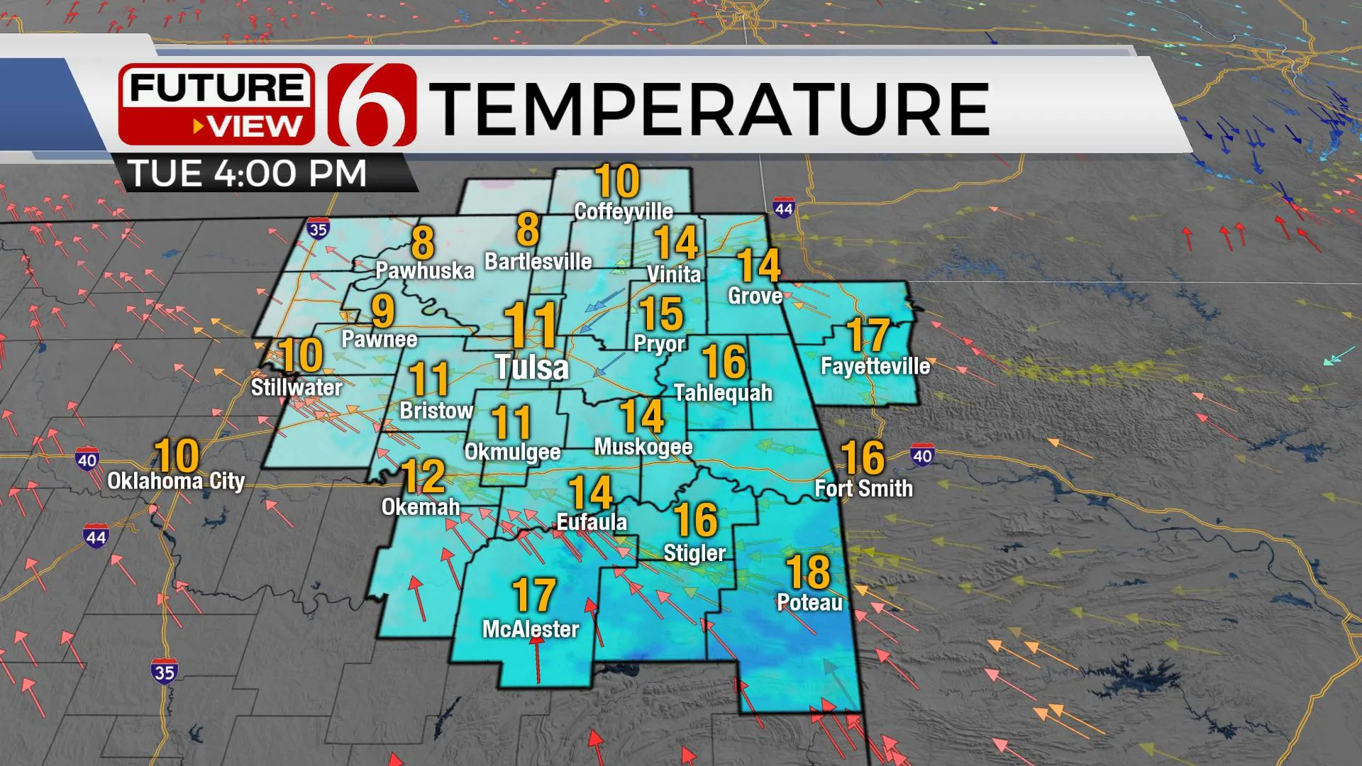
Highs today will be higher than yesterday but still bitterly cold with many locations topping out in the lower teens. More snowpack will remain for a few days before eroding and this also tends to keep temps colder than they normally would be, but we’re still planning for daytime highs near freezing Friday, the upper 30s Saturday and the mid-40s Sunday. A weak front crosses the area Sunday with a small chance for a shower or two, but nothing significant. Then we finally get some mild conditions early next week with upper 50s anticipated Monday and even the lower 60s next Tuesday.
Thanks for reading the Tuesday morning weather discussion and blog.
Prepare for additional snow later into the evening.
Have a super great and safe day.
Alan Crone
More Like This
February 16th, 2021
February 14th, 2022
January 26th, 2022
January 25th, 2022
Top Headlines
January 18th, 2025
January 18th, 2025
January 18th, 2025
January 18th, 2025


