Spring-Like Weather Sticks Around For A Second Day
Day two of this very pleasant preview of spring weather will bring unseasonably warm weather across the state with highs reaching the lower to mid-70s. The progressive pattern brings the first of several systems across the area pre-dawn Wednesday with a minor cool-down, yet this will be noticeable for the second half of the week. Two systems will near the southeastern OK and northeast Texas region soon with increasing rain and thunder opportunities with the second increasing probabilities for noTuesday, February 23rd 2021, 6:55 am
TULSA, Okla. -
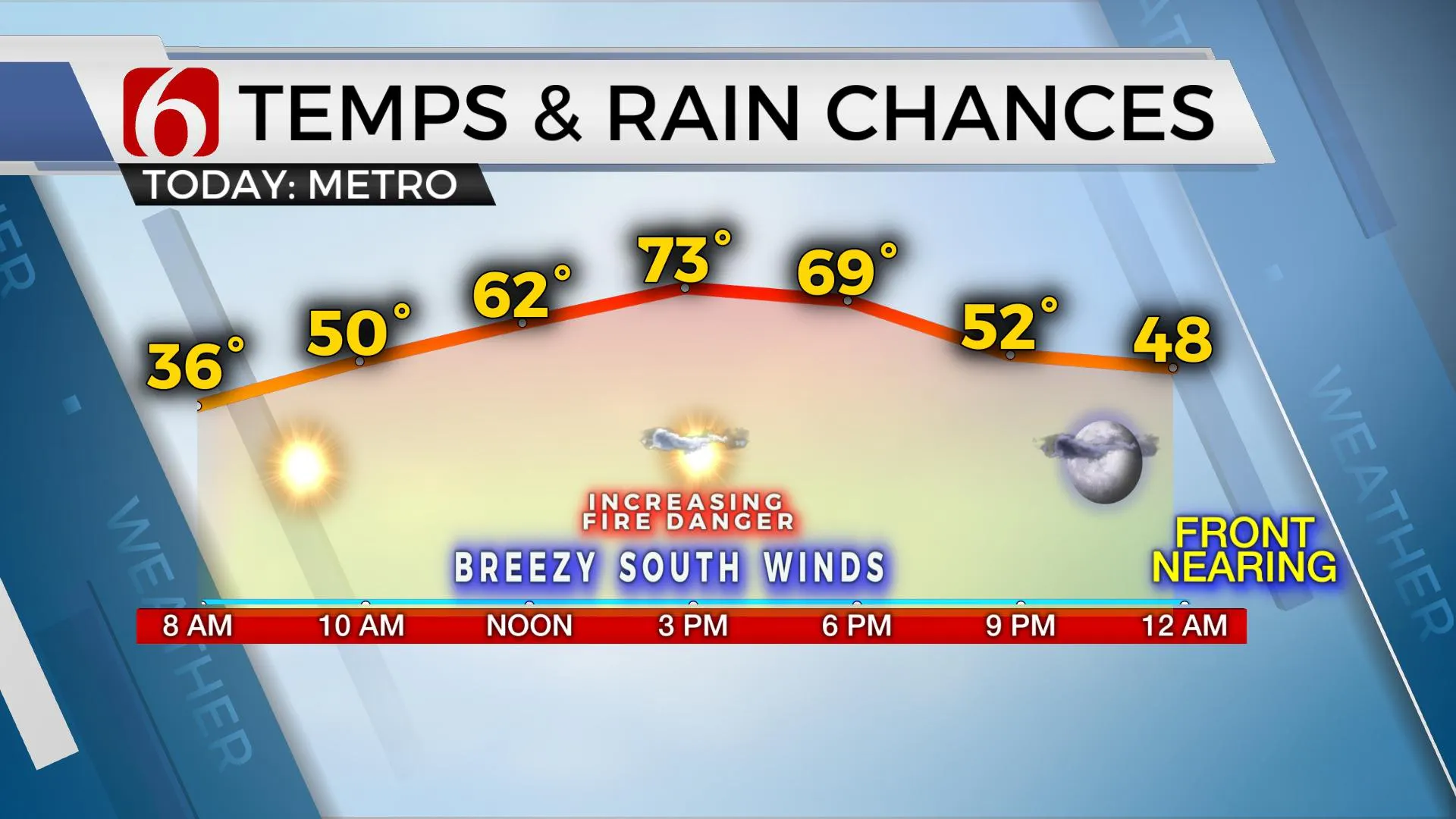
Day two of this very pleasant preview of spring weather will bring unseasonably warm weather across the state with highs reaching the lower to mid-70s. The progressive pattern brings the first of several systems across the area pre-dawn Wednesday with a minor cool-down, yet this will be noticeable for the second half of the week. Two systems will near the southeastern OK and northeast Texas region soon with increasing rain and thunder opportunities with the second increasing probabilities for northeastern OK.

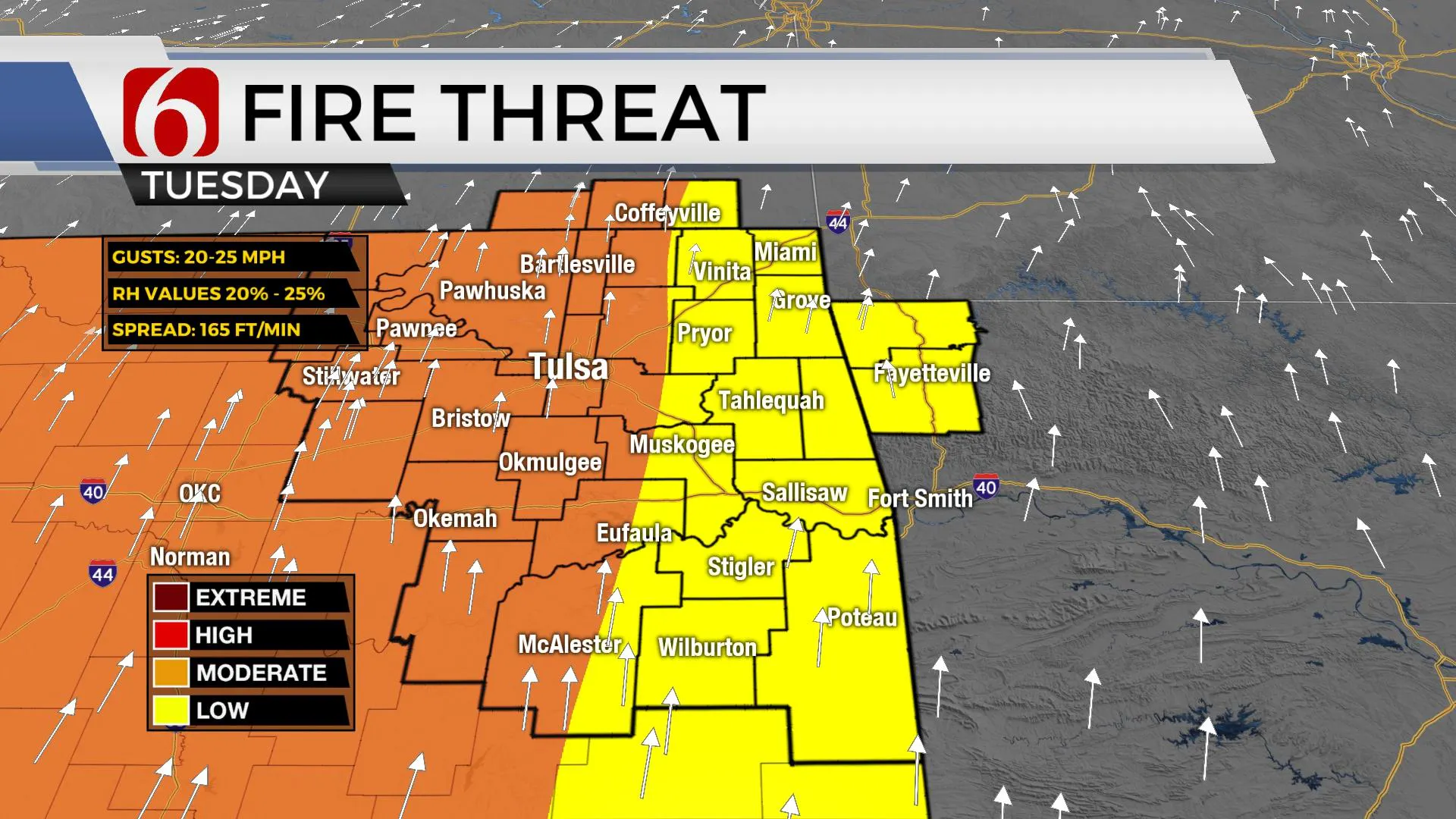
Last Tuesday we started anywhere from -10 to -19 across northeastern OK along with wind chill values from -19 to -28F. Temperatures this morning will begin in the mid-30s and should reach the lower 70s, even a few mid-70s across part of eastern OK for afternoon highs along with more sunshine and south winds from 10 to 25 mph. Afternoon humidity values may drop into the 20 to 30% range with increasing fire spread rates across the state. Despite the recent moisture and snowfall, the fire danger will be increasing today. The first of several storm systems will brush the area tonight into Wednesday morning with increasing rain chances into the 2nd half of the week and this weekend.
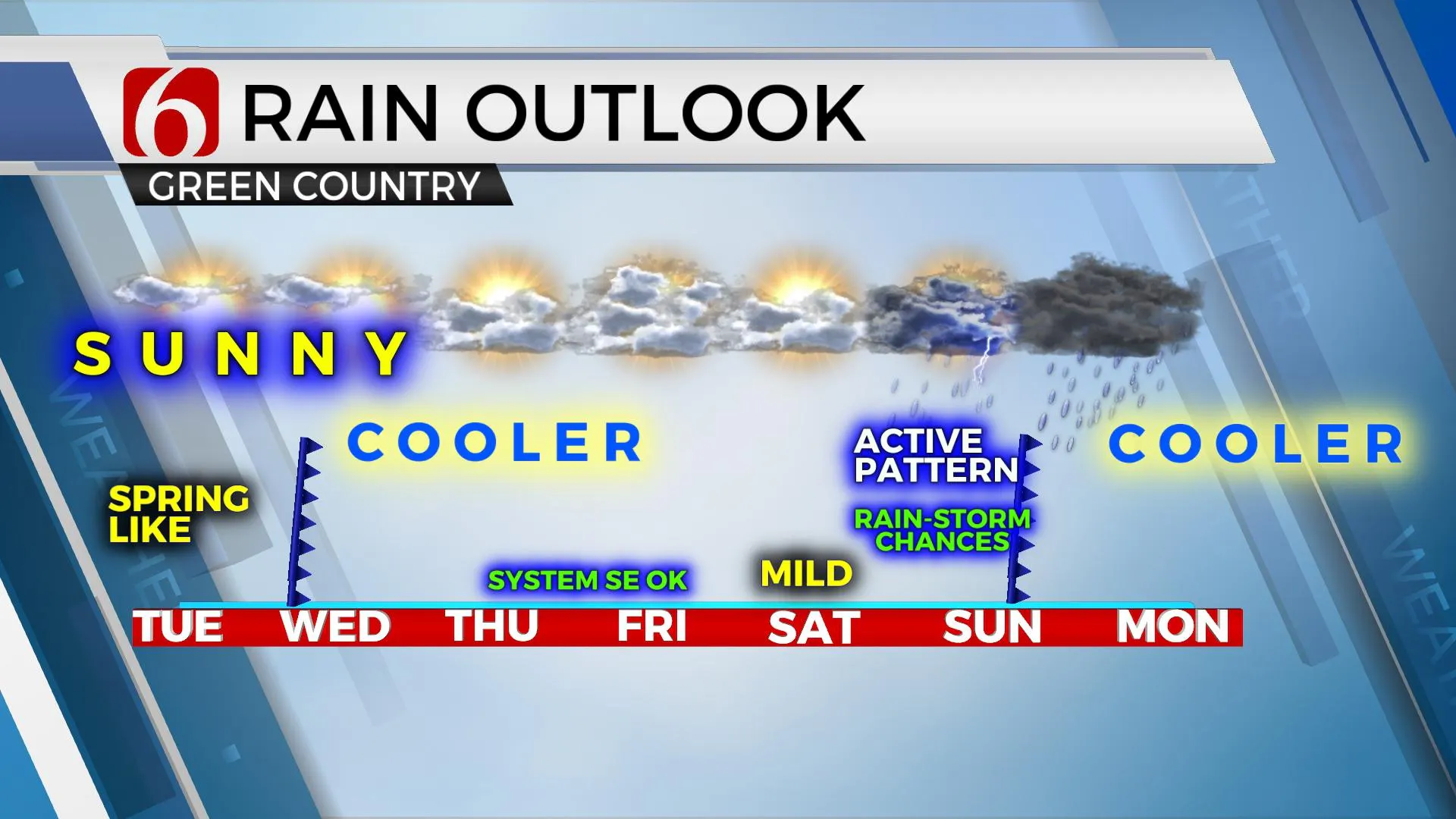
The main upper air flow is currently from the west to east. A small disturbance will pass the area to our north this morning and will help bring a front into the area later tonight through Wednesday morning. This boundary should enter and exit our area with a few clouds, but no measurable precipitation. Temps will start Wednesday morning in the lower 40s and rebound into the mid-50s by afternoon with north winds returning at 15 to 25 mph.

Thursday into the weekend the upper flow becomes more from the southwest and will bring several systems across the southern plains. The first once brushes southeastern OK and northeast Texas Thursday night into Friday with rain chances slightly better to our south. Another wave also nears this same area Saturday night into Sunday morning, but has now trended more northward compared to previous runs and I will be increasing rain and thunder chances for Eastern OK as we move into the second half of the weekend. Enough instability will be present for a mention of thunder with this system, but currently, any indications for a few strong to severe storms will remain across northeast Texas or even more southeast of the area.

While some colder air will be possible behind the Sunday system, I’ll continue to remain mostly in the camp of most ensemble data and will not make any big adjustments downward for this forecast cycle update, including the mention for additional precipitation chances Monday.
Thanks for reading the Tuesday morning weather discussion and blog.
Have a super great day!
Alan Crone
KOTV
More Like This
February 23rd, 2021
February 14th, 2022
January 26th, 2022
January 25th, 2022
Top Headlines
December 11th, 2024
December 11th, 2024
December 11th, 2024
December 11th, 2024


