Back To Chilly Weather To Close Out The Week
It’s back to chilly weather today into Friday as we track the first of several systems influencing the state over the next several days. Grab the jacket or even the coat, and some locations will need rain gear later this afternoon and evening.Thursday, February 25th 2021, 6:51 am
It’s back to chilly weather today into Friday as we track the first of several systems influencing the state over the next several days. Grab the jacket or even the coat, and some locations will need rain gear later this afternoon and evening.

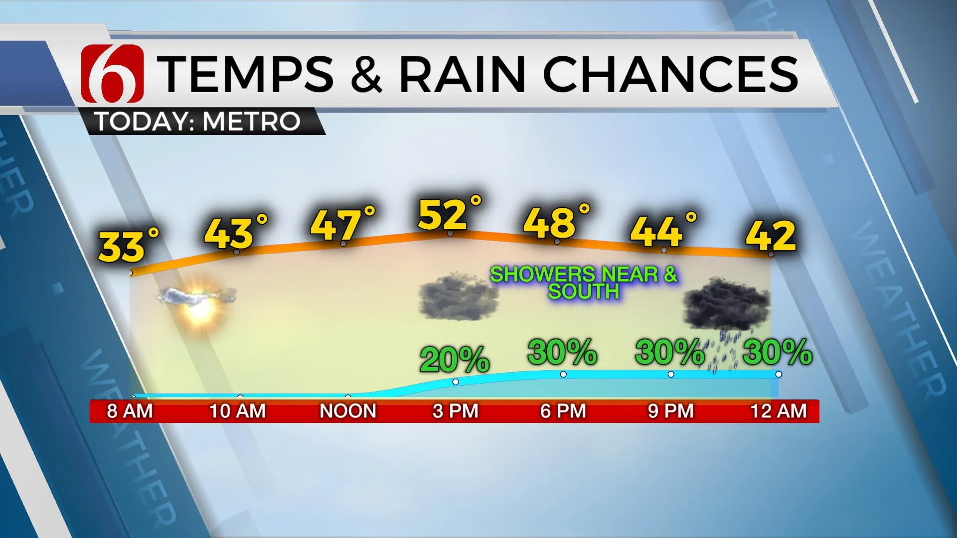
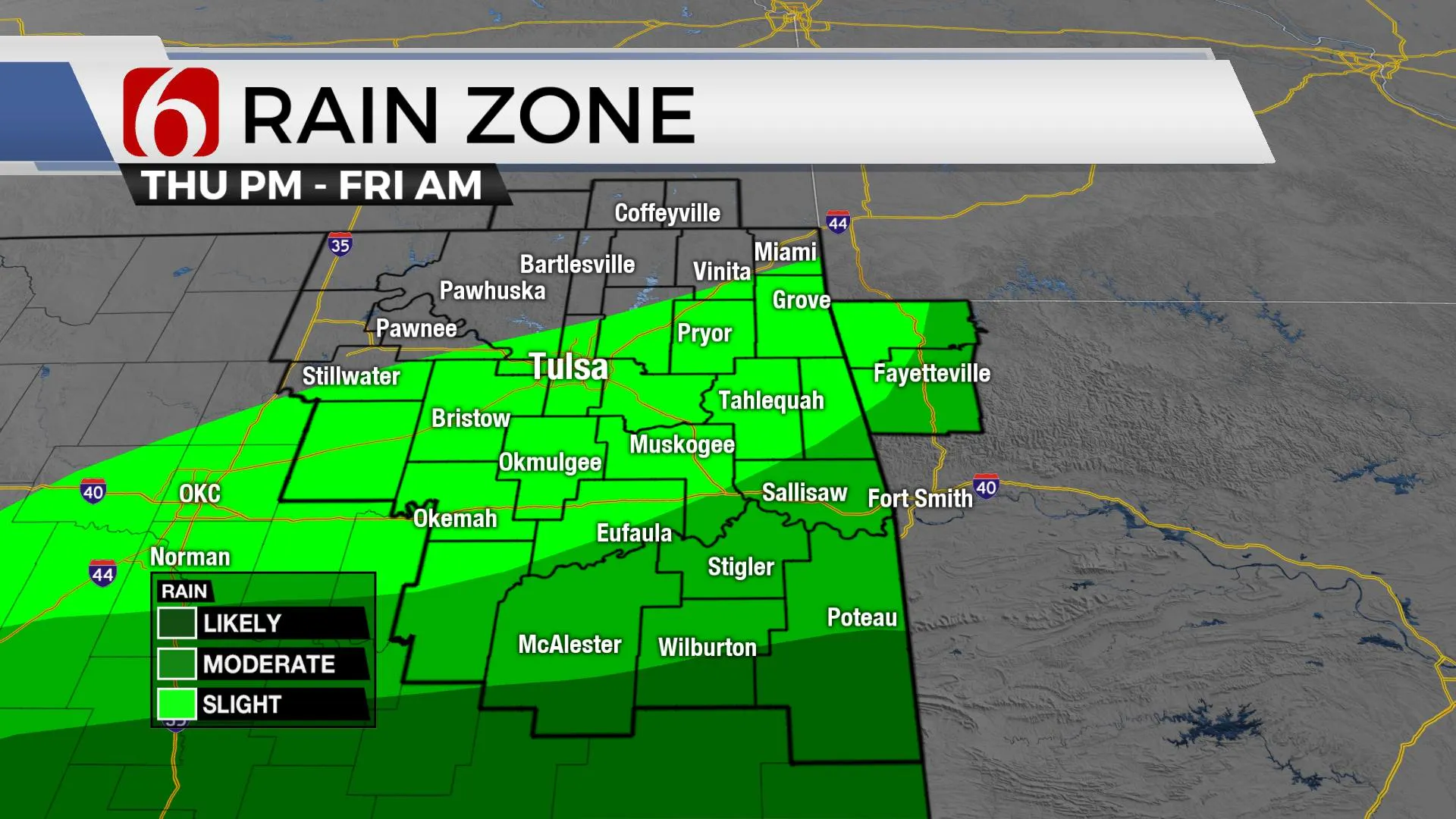
The next wave in our series of storm systems will arrive later tonight and exit the area early Friday morning to our east. I still think most of the precipitation with this system will fall across southeastern OK, but there will be a window for a few showers near the metro later this afternoon and tonight before exiting pre-dawn Friday. As the system exits, the air aloft will be cold enough for a rain to snow mix across northwestern Arkansas with no accumulation. This is contingent on precipitation making it this far north to begin with, and any winter mix would more than likely be confined to northwestern Arkansas. There will be enough instability for a few strong to near severe storms on the Red River Valley later tonight. Again, mostly southeast of our immediate area.

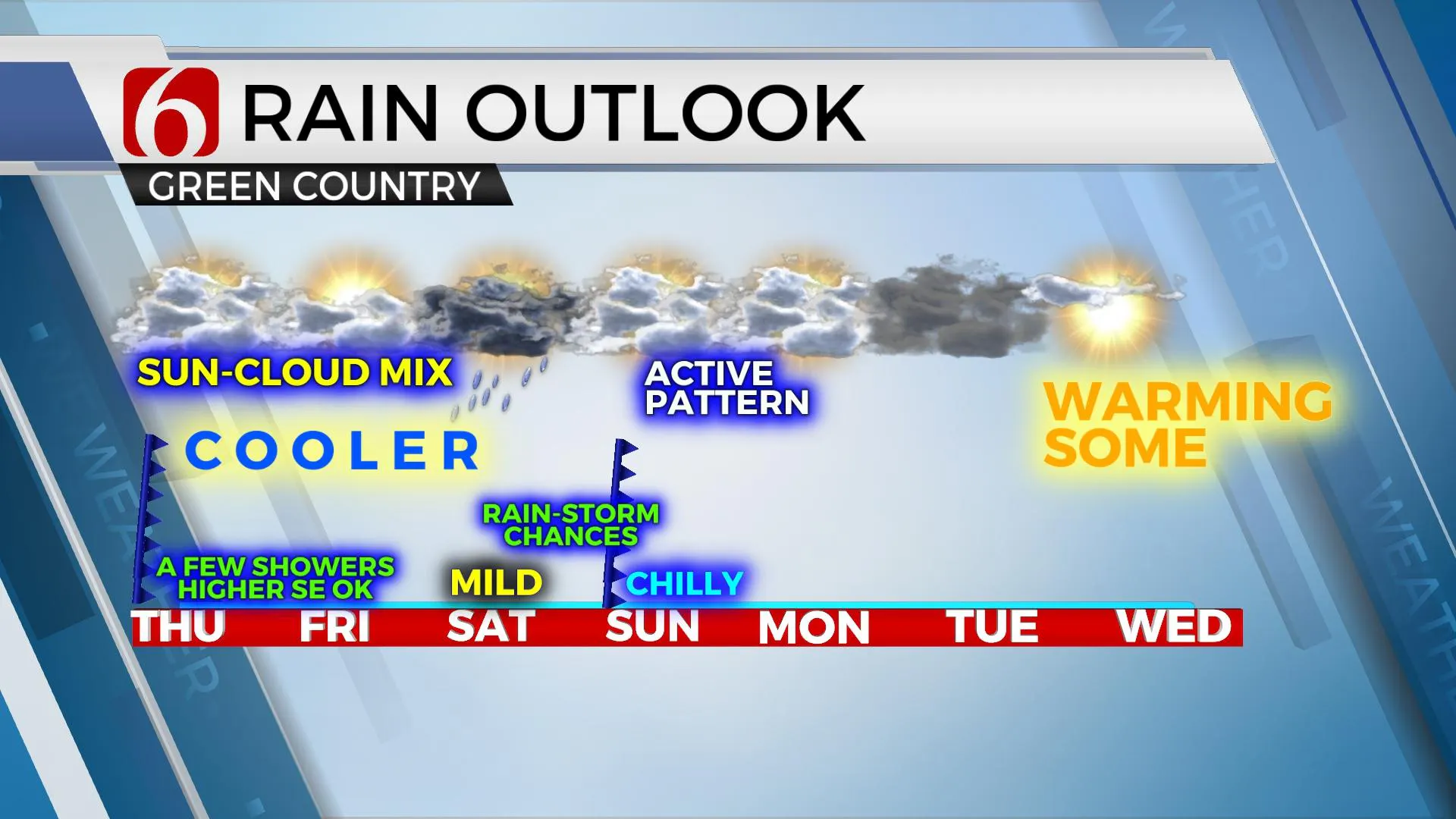
The next system remains our cut-off low mentioned here for the past few days. This low will remain west of the area this weekend but send some lift across the state Saturday evening into Sunday. A surface cold front will also approach Sunday and effectively shove most of the deeper moisture across northeastern Texas and extreme southeastern OK through the day. First, Saturday evening, scattered showers and storms will arrive across southern OK and move northeast. We’ll be in the running for a few of these near Tulsa before the cold front approaches from the north early Sunday morning. As the front moves south, temps will drop into the 40s Sunday afternoon with most of the deeper moisture shunted to far southeastern OK and northeast Texas. We’ll be in a holding pattern Monday before we discover what happens with the cut-off low to our west.
This low will get a kick eastward Monday but the run-to-run consistency remains poor. Until I have better confidence on exactly what happens and where it moves, I’ll keep a 30% chance for some showers Monday evening into early Tuesday, favoring mostly the GFS and its positioning.

The airflow early next week behind the departing system will bring us some mild and slightly warmer weather and we will be bringing the temps up a little from previous for early next week. Good news for a lot of folks.
Highs today, however, may only reach the upper 40s and lower 50s as it will be a race between the rising temps and the increasing clouds from the south. Once the clouds arrive, temps will level-off. I’ve got us at 52 for the metro with north winds near 10 to 15 mph.
Thanks for reading the Thursday morning weather discussion and blog.
Have a super great day!
Alan Crone
KOTV
If you’re into podcasts, check out my daily weather update below. Search for NewsOn6 and ‘Weather Out The Door’ on most podcast providers, including Apple, Stitcher, Tune-In and Spotify

More Like This
February 25th, 2021
February 14th, 2022
January 26th, 2022
January 25th, 2022
Top Headlines
December 14th, 2024
December 14th, 2024
December 14th, 2024
December 14th, 2024


